


.
Key Seven-Day Weather Information
If your app is not receiving notifications, please email me at beaudodsonweather@gmail.com
Wednesday, October 21st
I am at the National Weather Association annual meeting in Omaha, Nebraska. I’m learning quite a bit about new products coming out in the weather field. A lot of discussion on the future of AI. The future of our newest computer models. And so much more. I am enjoying the conference.
🍂 Beautiful autumn weather continues!
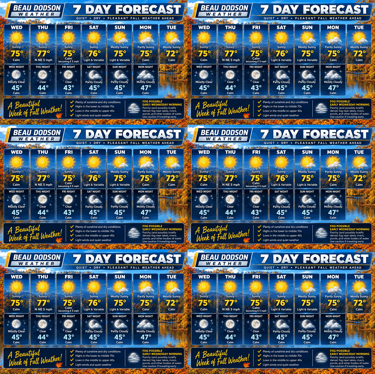
High pressure will keep our region dry and sunny for much of the next seven days. If you enjoy sunshine, comfortable afternoons, and cool nights, then you’re going to love this forecast!
🌡️ Temperatures: Afternoon highs will generally reach the middle to upper 70s, with overnight lows dipping into the middle to upper 40s. That’s near to slightly above normal for this time of year.
☀️ Sunshine: Plenty of sunshine is expected each day, with very little change in our weather through the weekend.
💨 Winds: Light northeast winds will continue through Friday before shifting to the south on Saturday. That may bring a slight warming trend.
🌫️ Morning Fog: Some patchy fog is possible near lakes, rivers, and other bodies of water early this morning. Be mindful of reduced visibility in those areas.
🌧️ Rain Chances: Our next opportunity for rain arrives Tuesday afternoon as a weak cold front moves into the region. Right now, the chance of a sprinkle or isolated shower is only around 15%. Most locations will likely remain dry.
🍁 Bottom line: We’re looking at a wonderful stretch of autumn weather! Sunshine, highs in the 70s, cool nights, and very little chance of rain.
Unfortunately, for those who need rainfall, there isn’t much relief in sight over the next seven days.
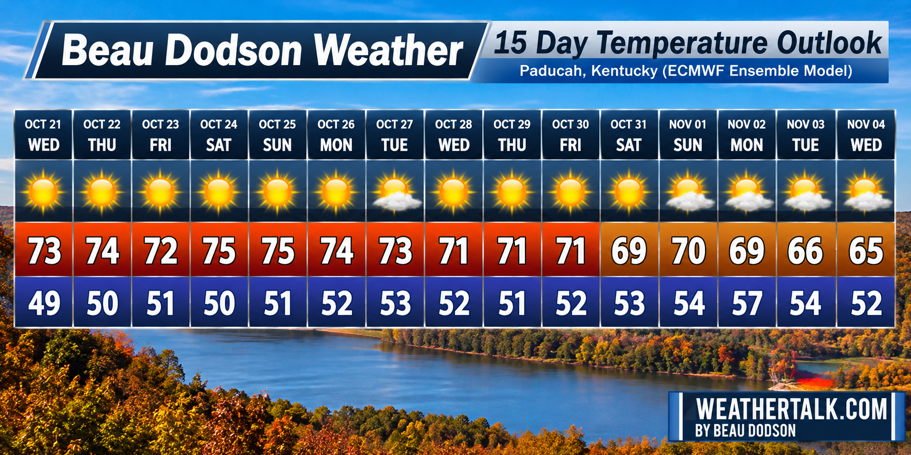
Let’s look at the EC ensembles. This is the average of 50+ model runs.
As you can see, autumn has arrived and settled into the region. The only question will be rain chances. Perhaps a couple of cold fronts over the next two weeks. For now, nothing stands out as significant.
I will be monitoring this for trends.
.
Radars and Lightning Data
.

🌪️ Seven-Day Outlook ⛈️
October 21st through the 29th
A severe thunderstorm is defined as a storm that produces 58 mph wind gusts and quarter-sized hail or larger.
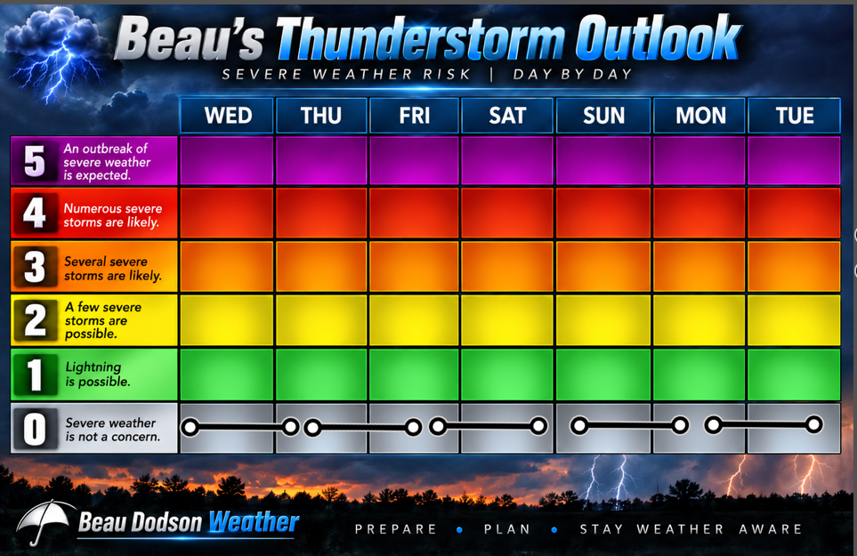
⛈️ Current severe thunderstorm risk: NO.
🌪️ Current tornado risk: NO.
🌪️ Current confidence level in the tornado forecast: CONFIDENCE IN THE FORECAST IS HIGH.
Here is my weekly thunderstorm concern meter.
.

Seven-Day Outlook
1. Is lightning in the forecast? NO.
2. Is flash flooding in the forecast? NO.
3. Will non-thunderstorm winds top 40 mph? NO.
4. Will the temperature rise above 90 degrees? NO.
5. Will temperatures fall below 32 degrees? NO.
6. Is the heat index forecast to rise above 100 degrees? NO.
7. Is the heat index forecast to rise above 110 degrees? NO.
8. Will the wind chill forecast fall below 10 degrees? NO.
.

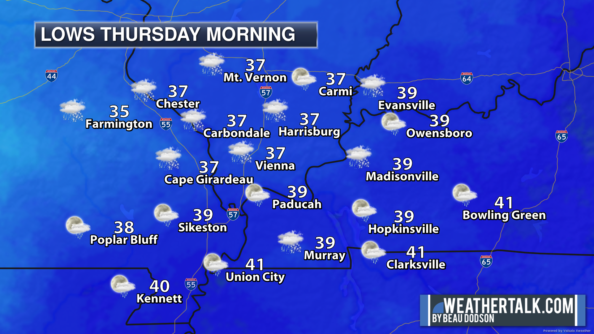
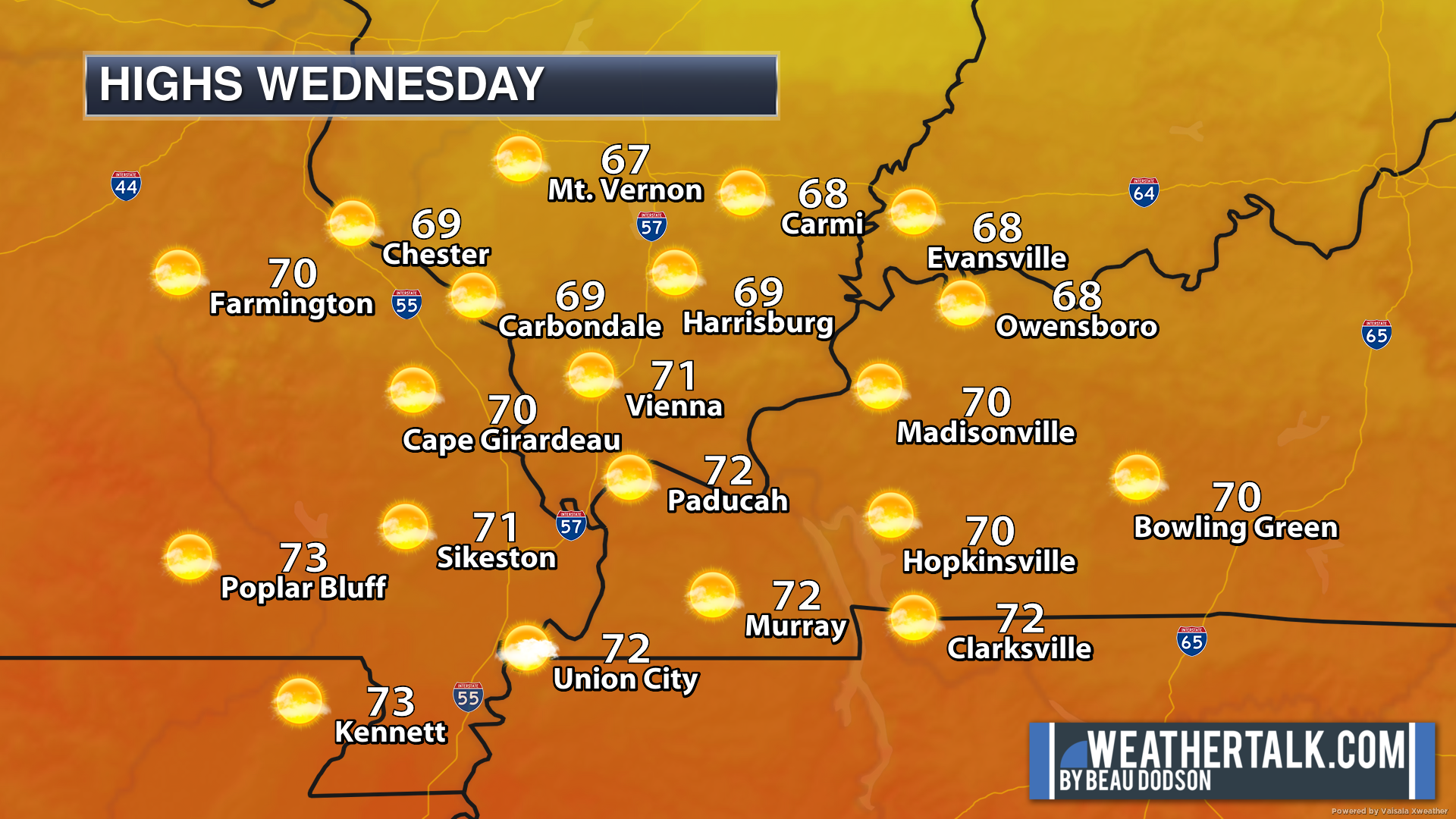
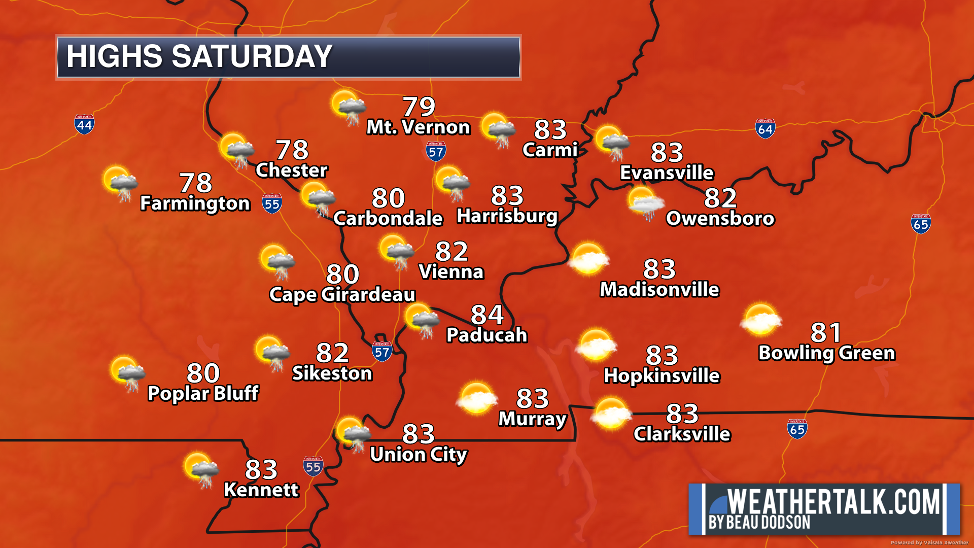
.
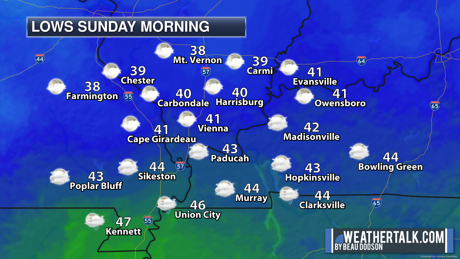
Seven-day outlook graphic.
This is a broad-brush overview of the entire region.
-> When rain is forecast, rain chances will vary across the forecast area. County-by-county rain probabilities are below. Scroll down.
.
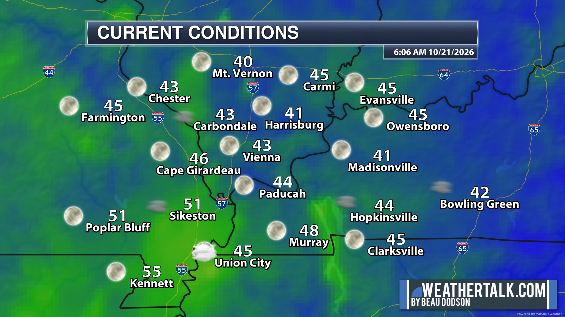
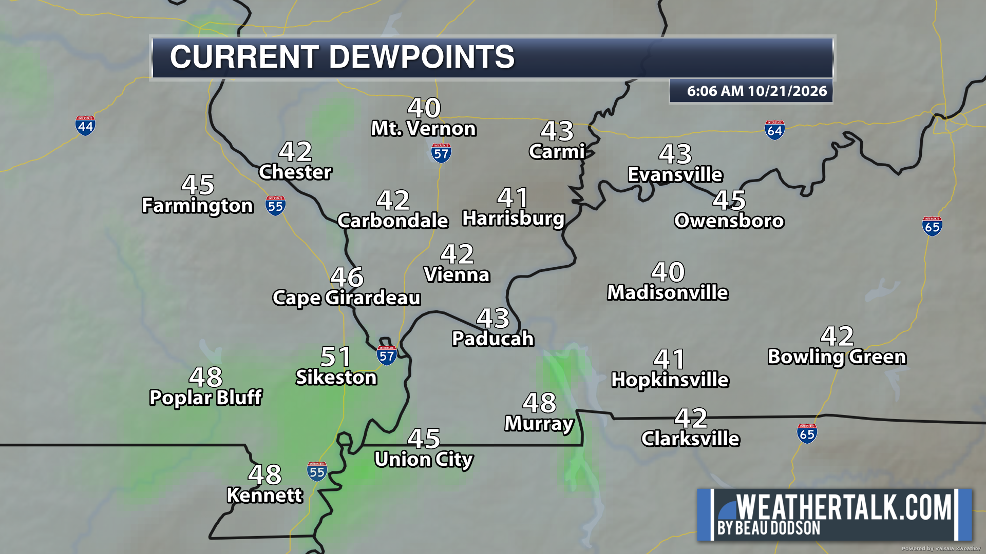
Here are the waking-up temperatures and dew points.
.
.

Eastern View
Double-click on the images to enlarge them.
NO RAIN OVER THROUGH NEXT MONDAY NIGHT. A SLIGHT CHANCE ON TUESDAY.
Western view (Missouri and southwest Illinois)
NO RAIN OVER THROUGH NEXT MONDAY NIGHT. A SLIGHT CHANCE ON TUESDAY.

What is the % chance of rain?
These maps are broken down into 12-hour time periods.
* Remember, a 20% chance of rain during the summer months does not mean that it will not rain. It means there will be a few thunderstorms on the radar.
Double-click maps to enlarge them.
.
Double-click maps to enlarge them.
.


* Future-cast radars are rarely exactly right. Take the general idea from this animation. These models do their best to forecast where precipitation will develop and move. In the end, they are models.
The timestamp (upper left) is in Zulu. 12z=7 AM. 18z=1 PM. 00z=7 PM.
Green is rain. Yellow is moderate rain. Orange and red indicate locally heavy rain.
Double-click the animation to enlarge it.
Hrrr
NO SIGNIFICANT RAIN OVER THE NEXT SEVEN DAYS.
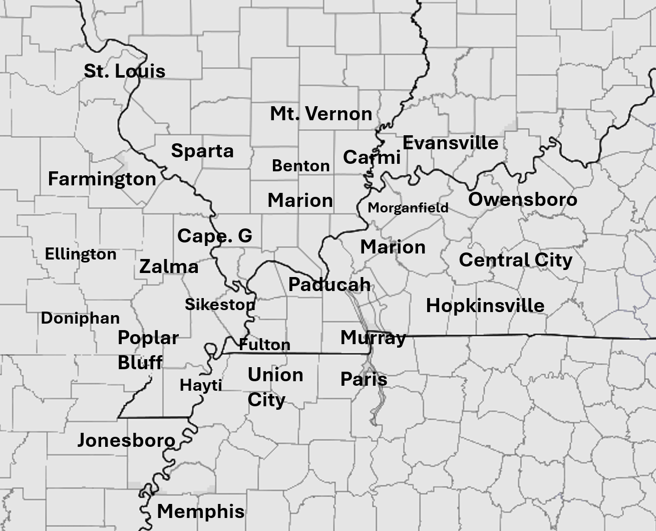
Here is a map to help you find your general location.
.
NAM 3K Model
* Future-cast radars are rarely exactly right. Use this animation for the general idea. These models do their best to forecast where precipitation will develop and move. In the end, they are a model.
The timestamp (upper left) is in Zulu. 12z=7 AM. 18z=1 PM. 00z=7 PM.
Green is rain. Yellow is moderate rain. Orange and red indicate locally heavy rain.
Double-click the animation to enlarge it.
NO SIGNIFICANT RAIN OVER THE NEXT SEVEN DAYS
..
.
Click here if you would like to return to the top of the page.
.Average high temperatures for this time of the year are around 70 degrees.
Average low temperatures for this time of the year are around 45 degrees.
Average precipitation during this time period ranges from 1.00″ to 1.10″
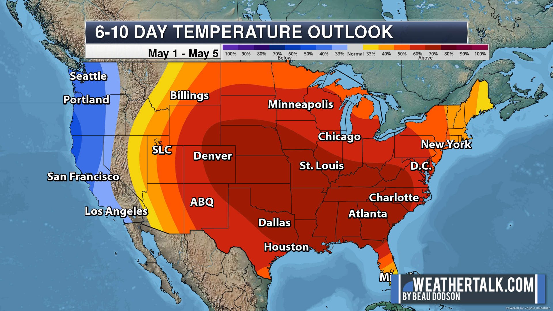
Six to Ten Day Outlook.
Blue is below average. Red is above average. The no color zone represents equal chances.
Average highs for this time of the year are in the lower 60s. Average lows for this time of the year are in the lower 40s.
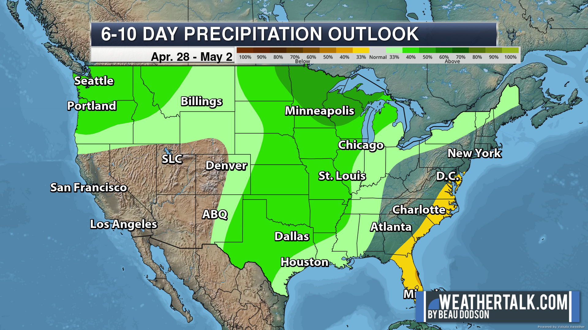
Green is above average precipitation. Yellow and brown favor below-average precipitation. Average precipitation for this time of the year is around one inch per week.
Average low temperatures for this time of the year are around 45 degrees.
Average precipitation during this time period ranges from 1.00″ to 1.10″
.
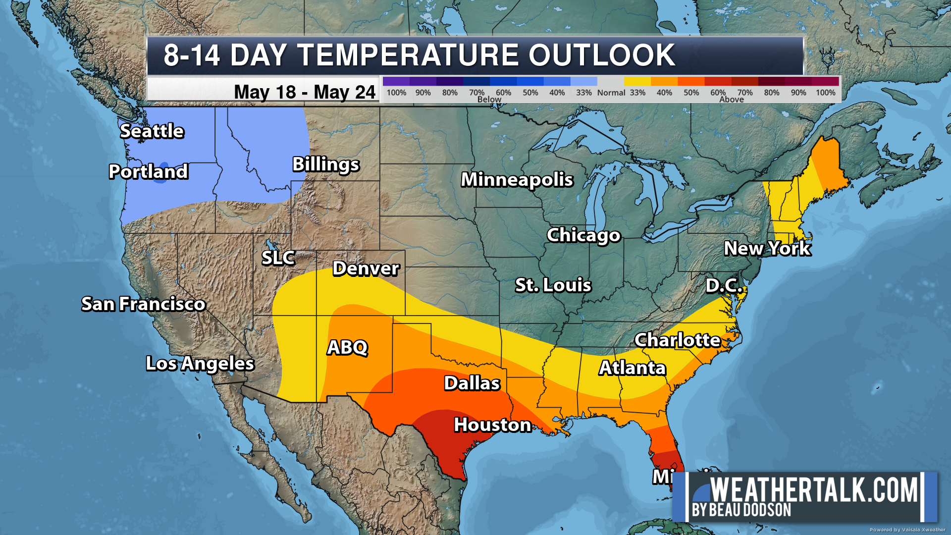
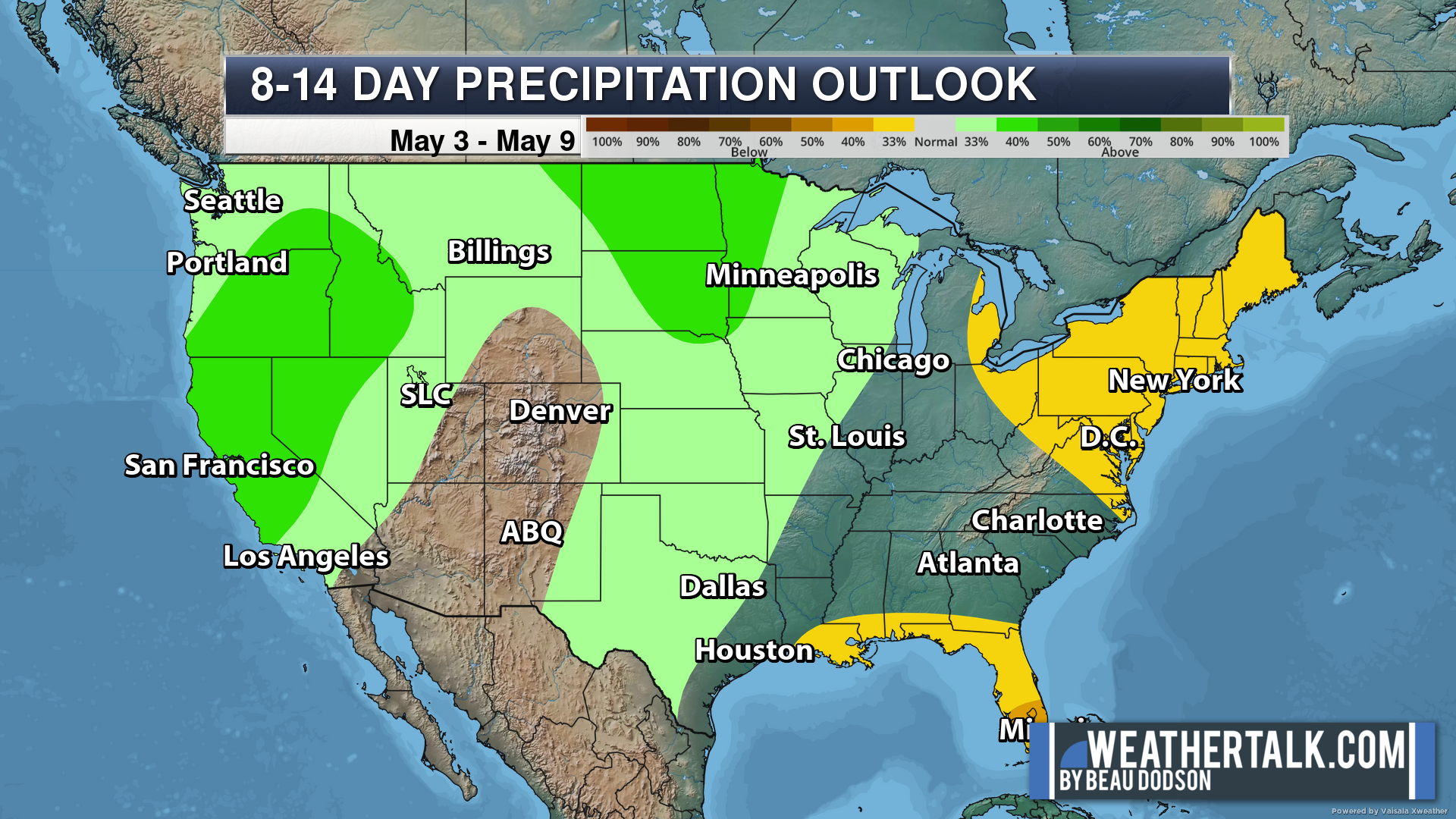
Eight to Fourteen Day Outlook.
Blue is below average. Red is above average. The no color zone represents equal chances.
Green is above average precipitation. Yellow and brown favor below-average precipitation. Average precipitation for this time of the year is around one inch per week.
.

Radars and Lightning Data
Interactive-city-view radars. Clickable watches and warnings.
https://wtalk.co/B3XHASFZ
Old legacy radar site (some of you like it better)
https://weatherobservatory.com/weather-radar.htm
If the radar is not updating then try another one. If a radar does not appear to be refreshing then hit Ctrl F5. You may also try restarting your browser.
Backup radar site in case the above one is not working.
https://weathertalk.com/morani
Regional Radar
https://imagery.weathertalk.com/prx/RadarLoop.mp4
** NEW ** Zoom radar with chaser tracking abilities!
ZoomRadar
Lightning Data (zoom in and out of your local area)
https://wtalk.co/WJ3SN5UZ
Not working? Email me at beaudodson@usawx.com
Live lightning data: Click here.
Real time lightning data (another one) https://map.blitzortung.org/#5.02/37.95/-86.99
.
.
We have a new service to complement your www.weathertalk.com subscription. This does NOT replace www.weathertalk.com It is simply another tool for you to receive severe weather information.
.
https://weathercallservices.com/beau-dodson-weather
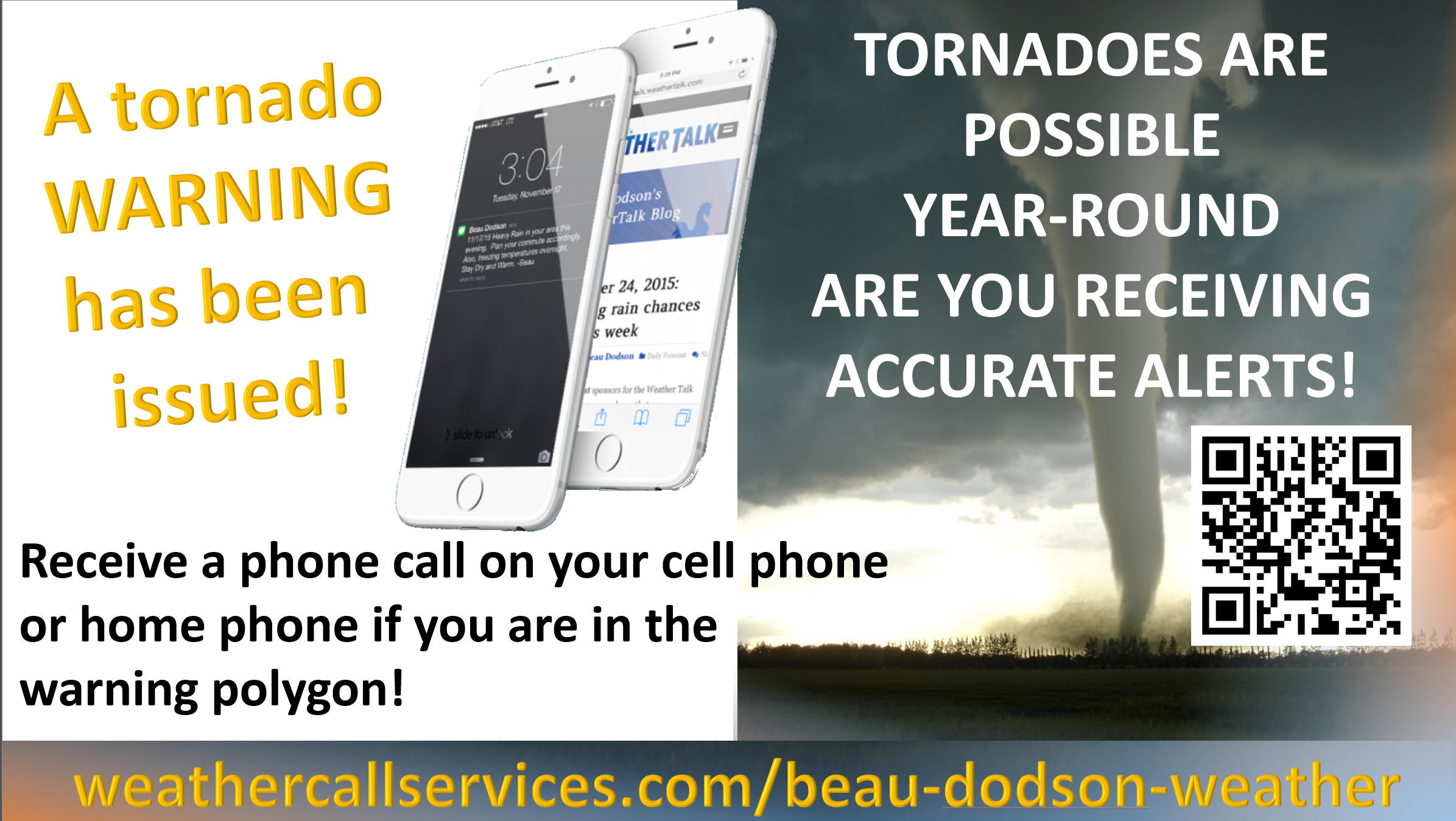
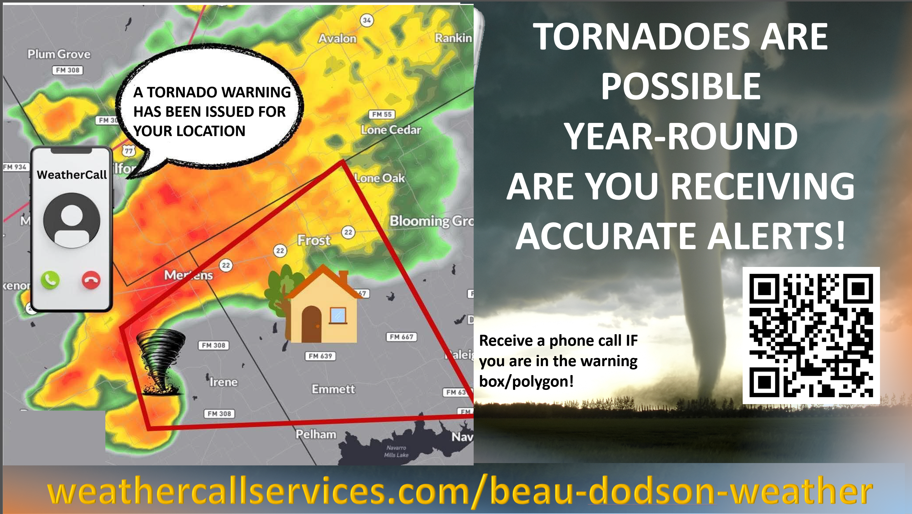
Want to receive the daily forecast/other products on your Beau Dodson Weather app?
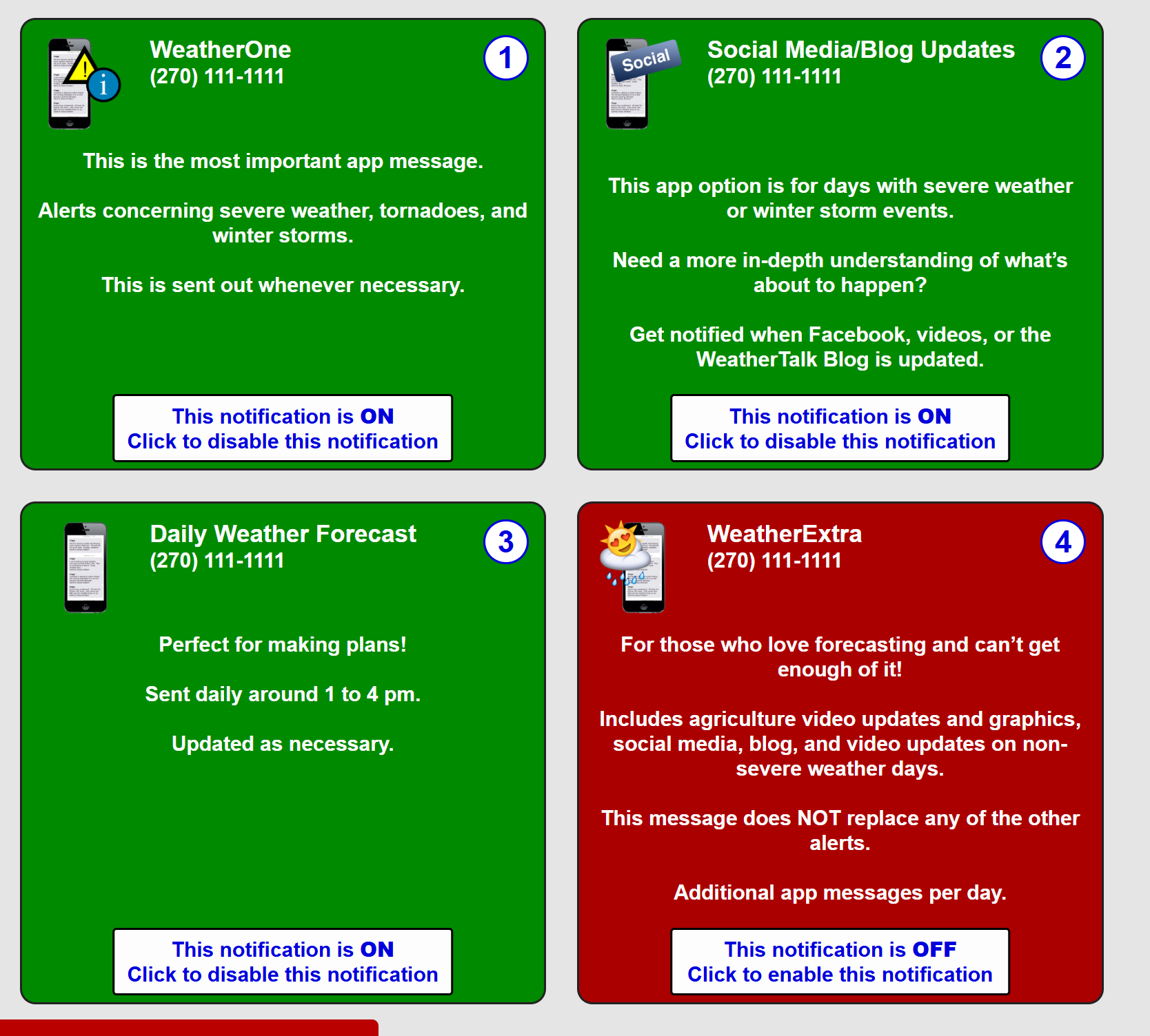
Did you know you have four options in your www.weathertalk.com account
You will then receive these via your Beau Dodson Weather app.
Just log into your www.weathertalk.com account
Click the NOTIFICATION SETTINGS TAB
Then, turn them on (green) and off (red)
🌪️ Number 1 is the most important one. Severe alerts, tornado alerts, and so on.
Number 2 is the daily video, blog, livestream alerts, and severe weather Facebook threads on severe days or winter storm days.
Number 3 is the daily forecast. I send that out every day during the afternoon hours. It is the seven-day forecast, hazardous weather outlook, fire outlook, and more.
Number 4 is to receive the daily video, blog, and other content on NON-severe weather days (every day without severe threats in other words)
GREEN IS ON
RED IS OFF
Want to add more products to your Beau Dodson Weather App?
Receive daily videos, weather blog updates on normal weather days and severe weather and winter storm days, your county by county weather forecast, and more!
Here is how to do add those additional products to your app notification settings!
The app is for subscribers. Subscribe at www.weathertalk.com/welcome then go to your app store and search for WeatherTalk
Subscribers, PLEASE USE THE APP. ATT and Verizon are not reliable during severe weather. They are delaying text messages.
The app is under WeatherTalk in the app store.

Apple users click here

Android users click here
