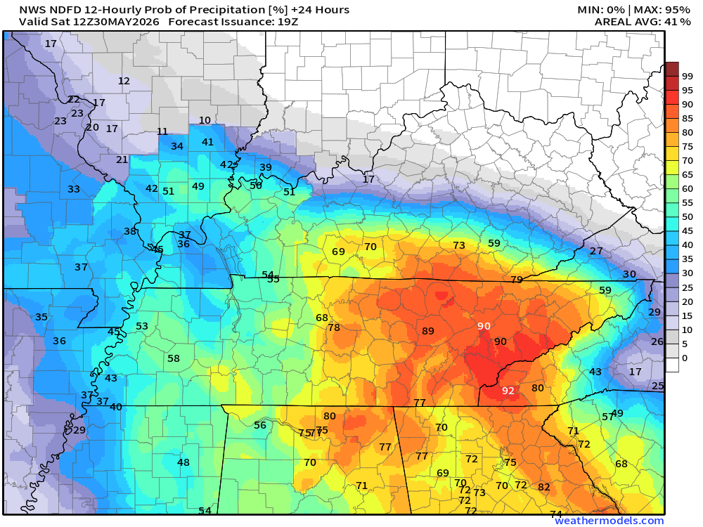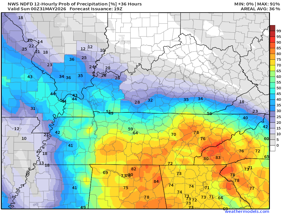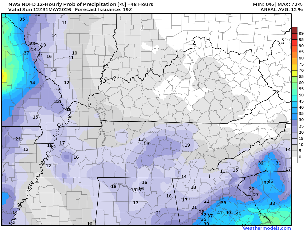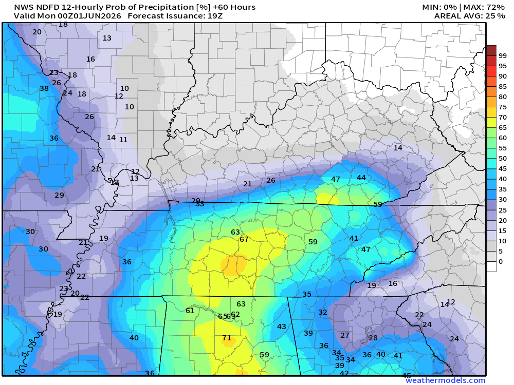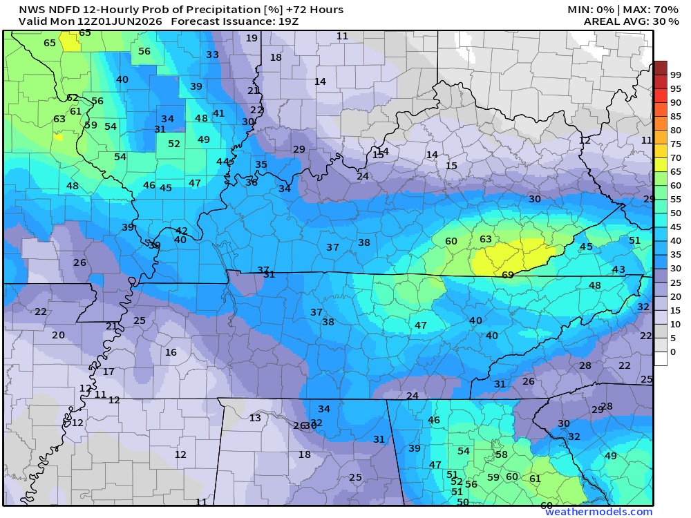

I have updated the rain probabilities. Scroll down for those. This is through Sunday night.
There continues to be some back-and-forth on the exact location of the boundary producing the showers and thunderstorms you see on the weather radars.
Keep in mind, a 20% or 30% chance of showers and thunderstorms does not mean it won’t rain. It just means it will be a bit more scattered than areas with higher chances.

Live Radars and Lightning Data
Interactive-city-view radars. Clickable watches and warnings.
https://wtalk.co/B3XHASFZ
Regional Radar
https://imagery.weathertalk.com/prx/RadarLoop.mp4
** NEW ** Zoom radar with chaser tracking abilities!
ZoomRadar
Lightning Data (zoom in and out of your local area)
https://wtalk.co/WJ3SN5UZ
.
Let’s look at the rain probability maps. What is the % chance of rain?
These maps are broken down into 12-hour time periods.
Double-click maps to enlarge them.
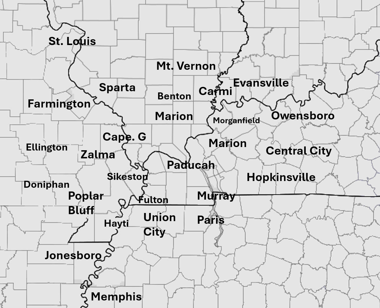
.
7 PM tonight to 7 AM Saturday