

.
I have some question-and-answer threads over on the Facebook page. Link to those threads CLICK HERE
Or email me at beaudodsonweather@gmail.com
..

🌪️ Seven-Day Tornado Outlook ⛈️
December 19th through December 26th
Current risk: NONE
Current confidence level: High confidence.
Comments:
.

Seven-Day Hazardous Weather Outlook
1. Is lightning in the forecast? NO.
2. Are organized/widespread severe thunderstorms in the forecast? NO.
4. Will non-thunderstorm winds top 40 mph? NO.
5. Will the temperature fall below 20 degrees? NO.
6. Is the wind chill forecast to drop below ten degrees? NO.
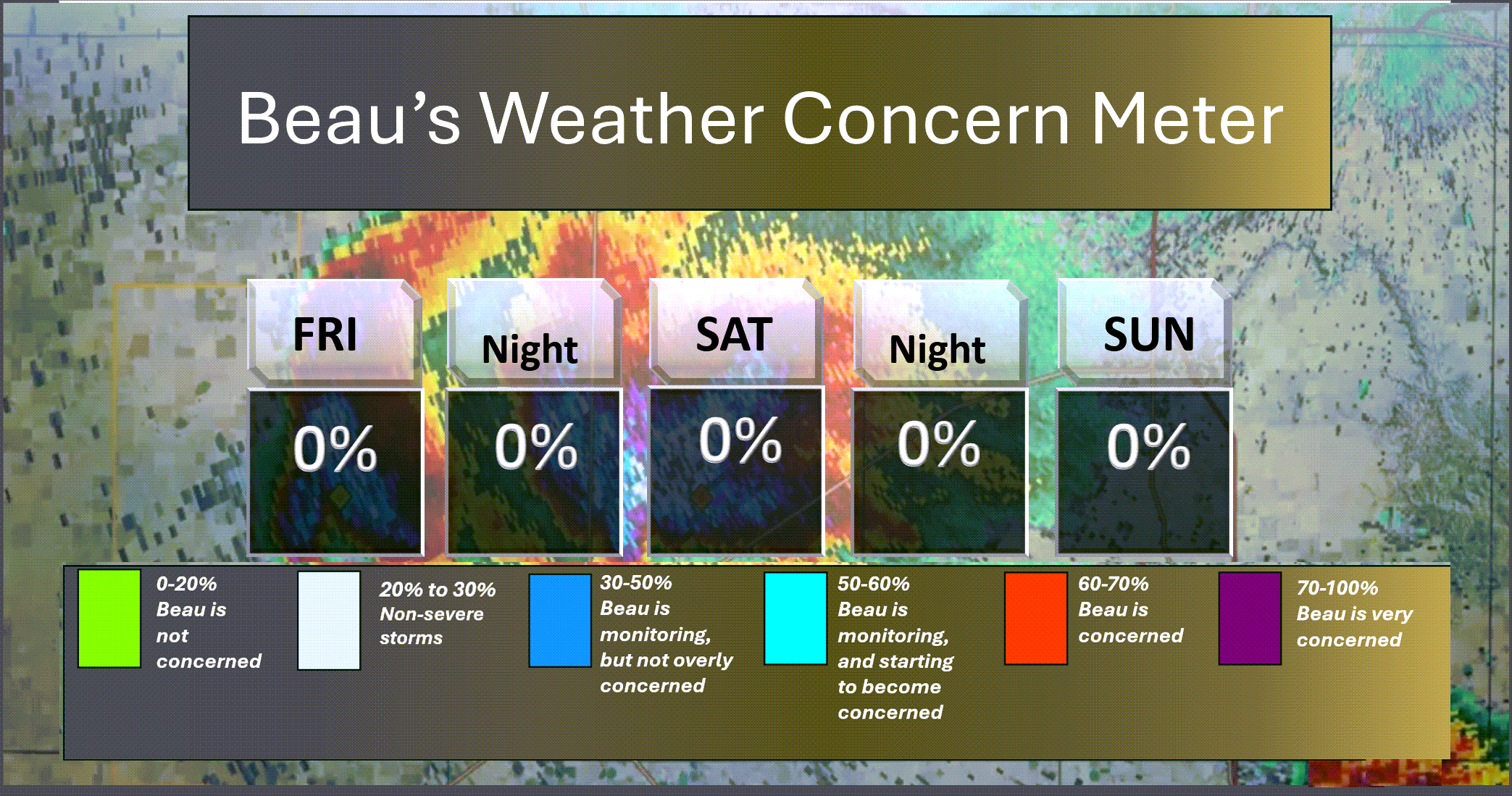
Here is the short-range thunderstorm concern meter.
.
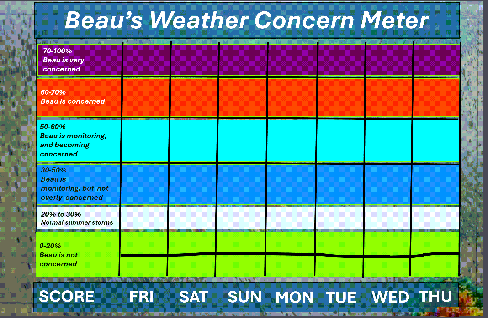
Here is the extended concern meter.
.
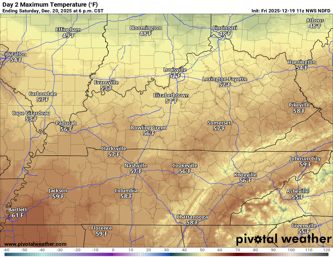
A quick forecast glance. Your 48-hour forecast Graphics


.
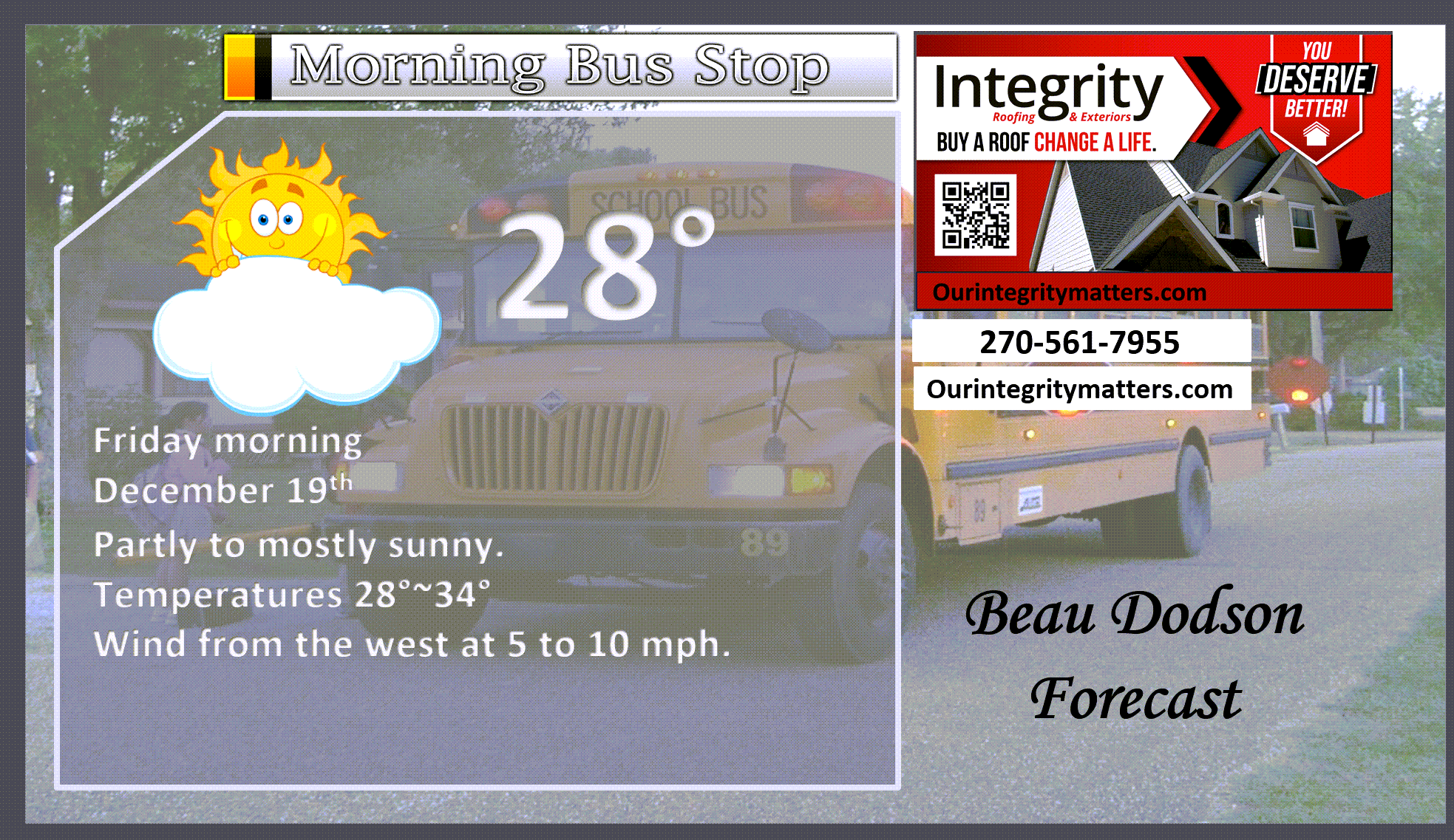
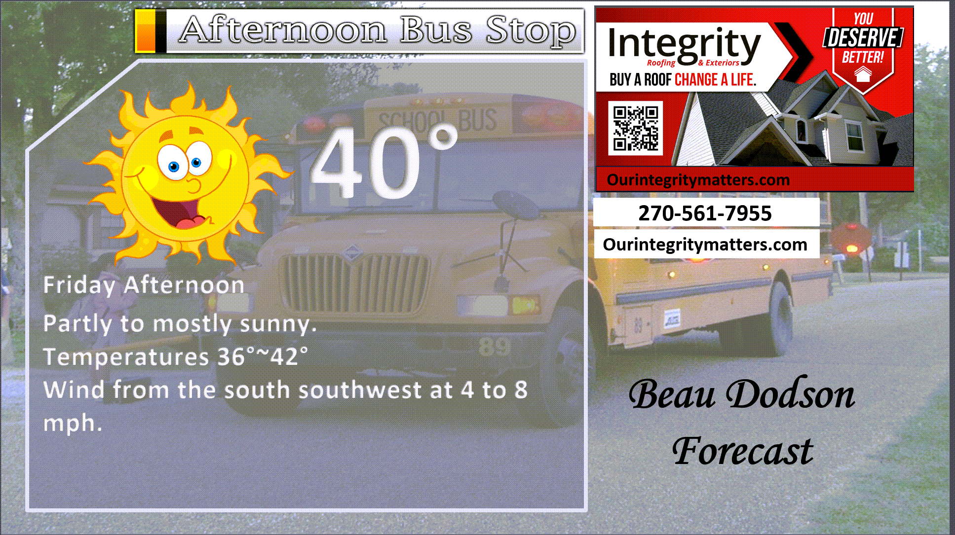
Here is your bus stop forecast
.
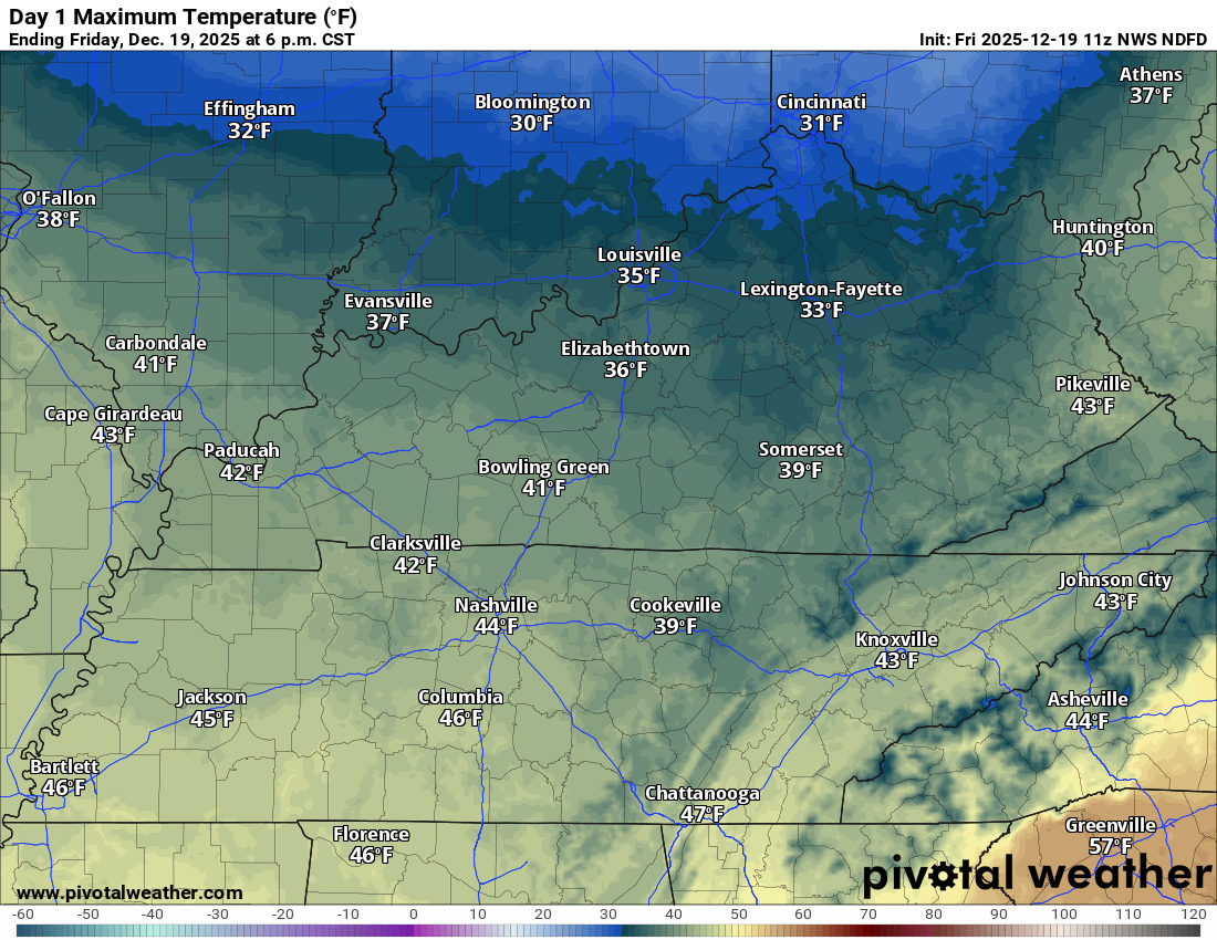
This afternoon
.


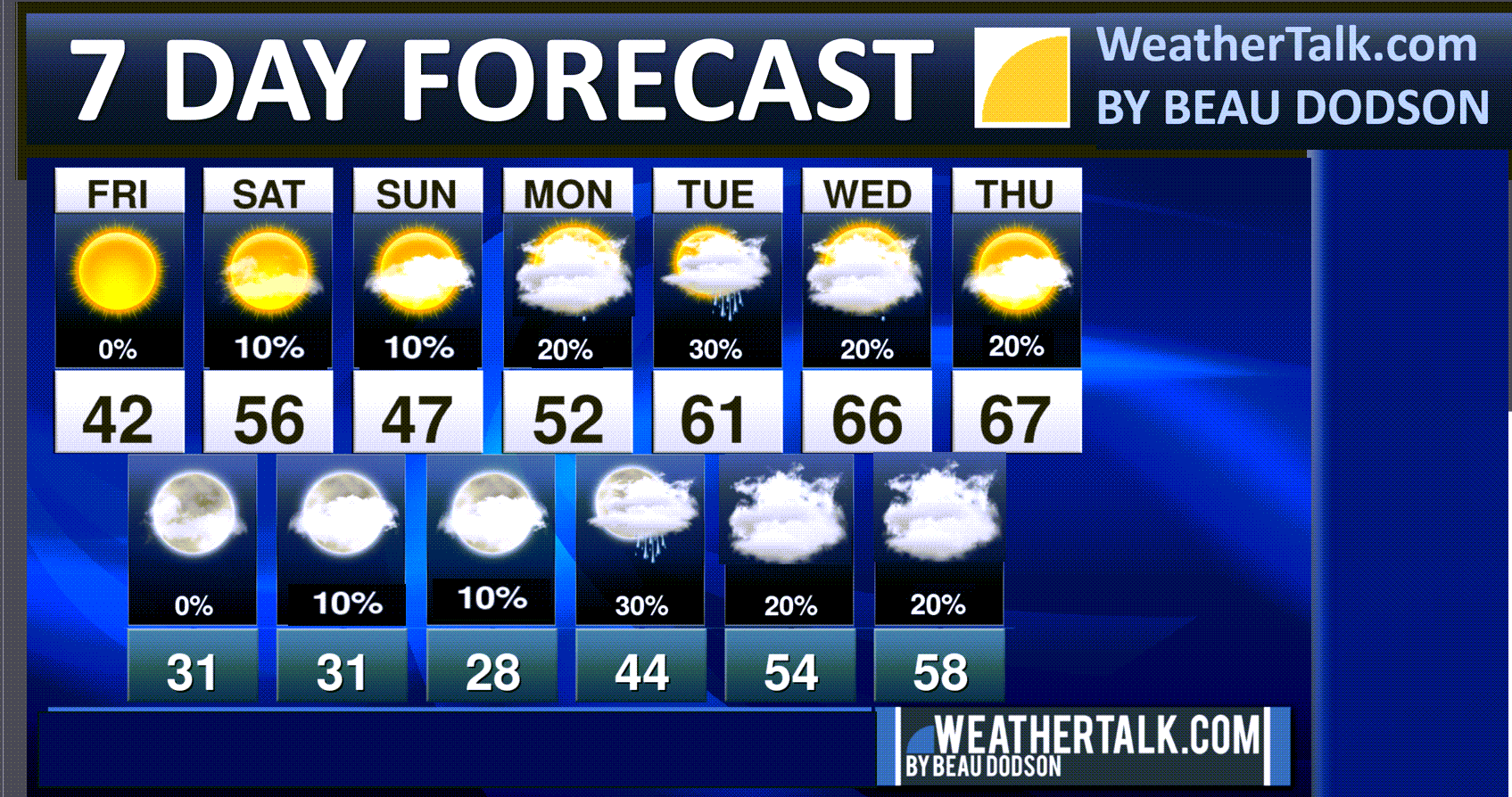
Forecast discussion
- Colder today.
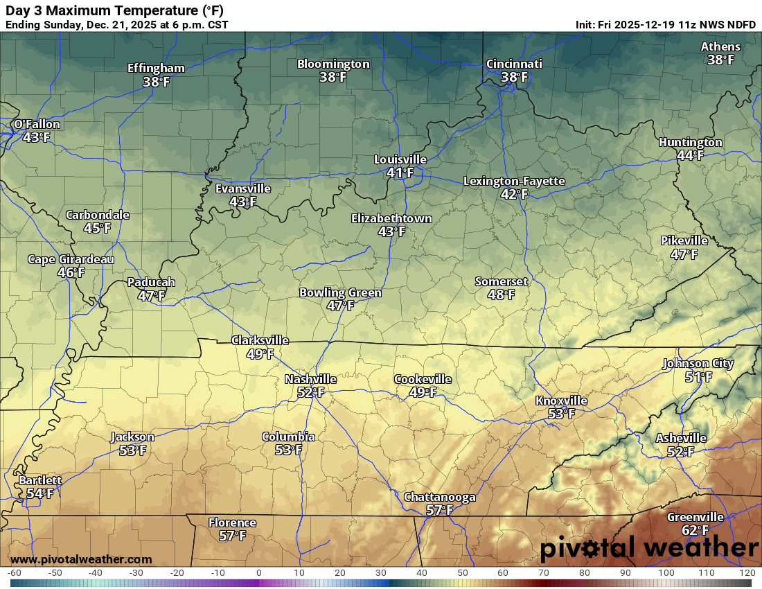
- A little warmer on Saturday. A little cooler on Sunday.
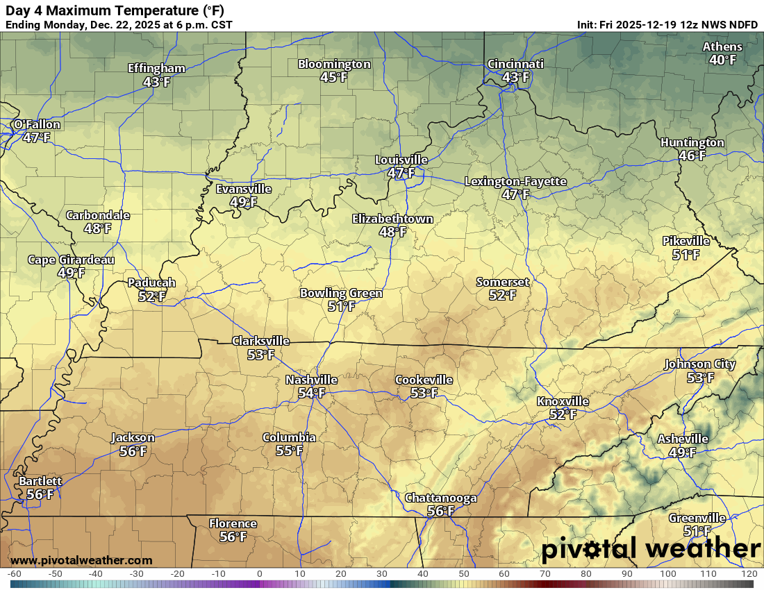
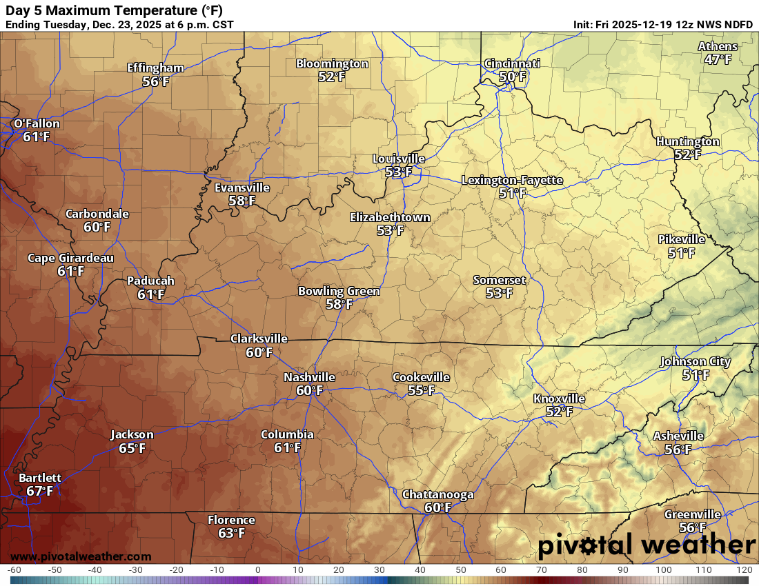
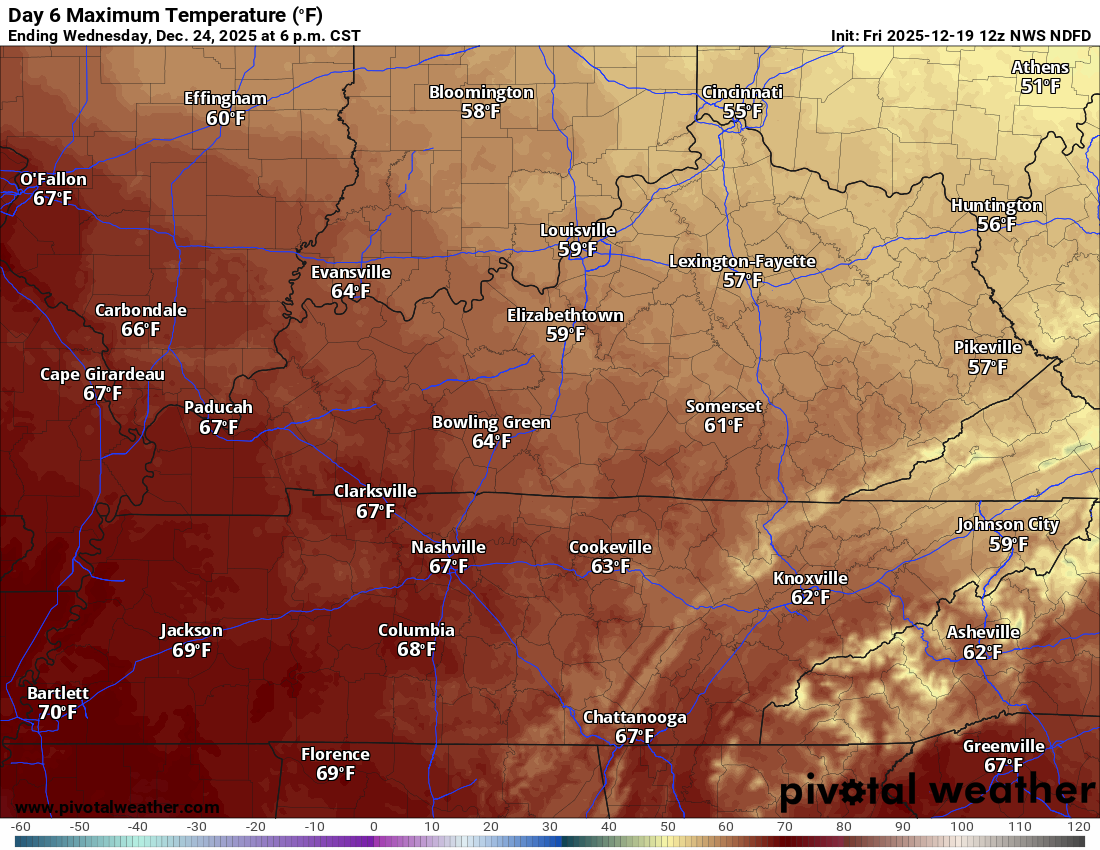
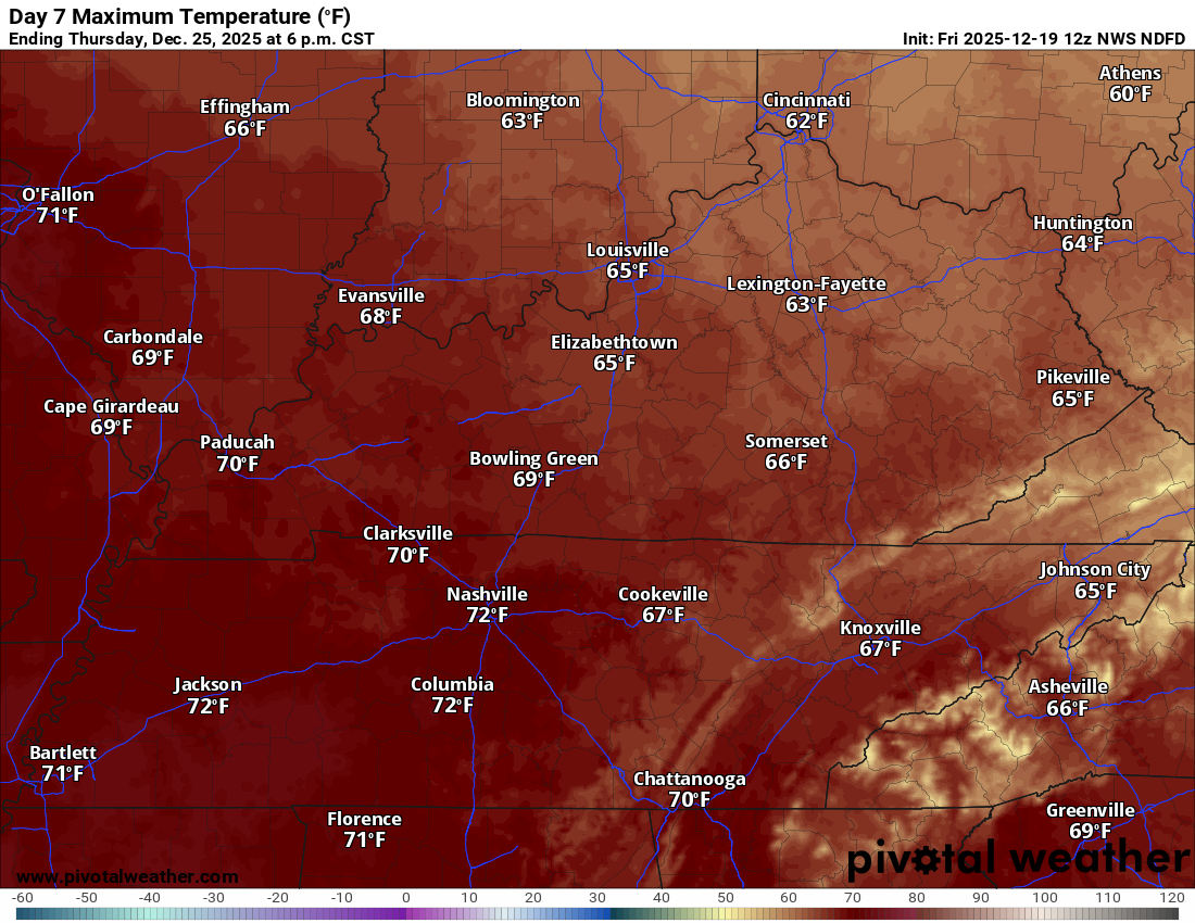
- A lot warmer next week! Mild temperatures on Christmas Eve and Christmas Day.
- A few spotty light showers over the coming six days. No major systems through Christmas.
- A bigger system towards the end of the month and the first part of January. For now, that looks wet.
.
 .
.
.
What is the primary weather concern?
No significant weather concerns over the next several days. There will be low-end rain chances over the coming seven days. See graphics below.
.
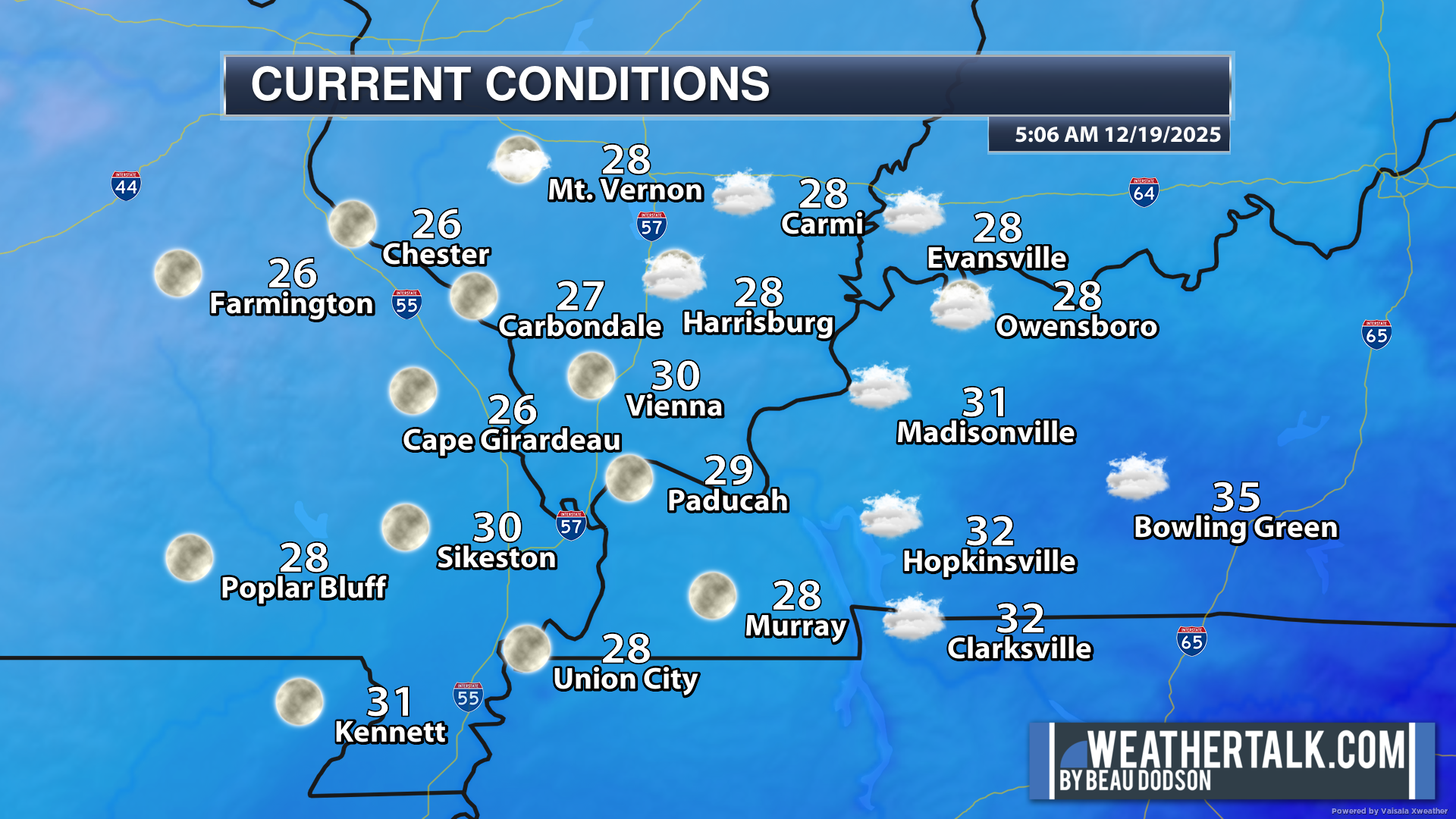
Here were the 6 AM temperatures. A chilly morning. Quite a bit colder than 24 hours ago.
.
Seven-day outlook graphic.
See the video for more details specific to your county. This is a broad-brush overview of the entire region.
.
Today through Sunday
Our rain and wind event has pushed eastward.
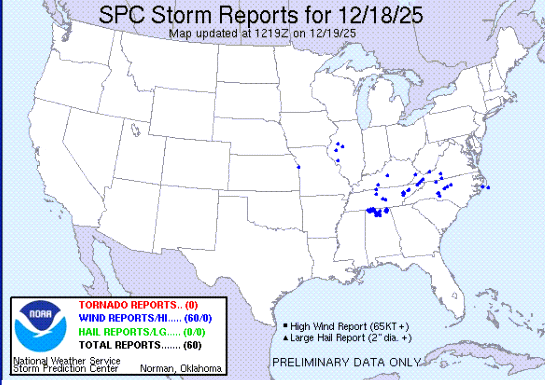
The risk of severe weather yesterday was small. Primarily, we expected strong winds with the cold front and showers. In the end, that did verify.
Our forecast for no tornadoes verified, as well.
We did have a couple of National Weather Service warnings.
The tornado warning was issued because of some rotation in Ballard County. Nothing touched down, and there weren’t any tornadoes. The rotation stayed aloft.
A lot of the showers yesterday (there wasn’t much lightning) produced rotation. But that is to be expected in December when you have strong wind shear aloft. Storms will rotate on radar, but nothing touches down.
There were some reports of strong wind gusts with the showers. That was because of the strong low-level jetstream. Some of those winds gusted above 45 mph.
There were some tree limbs down here and there. A couple of power poles, as well. Primarily associated with the showers that tapped into the cold front winds.
A power pole was pushed over south of Mayfield, Kentucky. Marion, Kentucky, reported some downed tree limbs. Todd County, Kentucky, reported damage to some tree limbs and power poles. I am sure there were some other reports, as well.
There wasn’t any CAPE to work with. CAPE is instability. CAPE is energy for thunderstorms to feed on.
In the end, it was about what we expected from the system.
Here were the Storm Prediction Center severe weather reports from yesterday. As you can see, the only report in our area was from Todd County (my far eastern county). Sometimes, some late reports come in. We will see if anything is added to this today.
.
No real weather concerns over the coming days. That is the good news.
It will be cold today with below-average temperatures.
It will be a bit warmer on Saturday, then a bit cooler on Sunday.
Let’s look at those temperatures.
Cold today. A bit warmer tomorrow. A bit cooler on Sunday.
Today
Tomorrow
Sunday
.
Monday through Friday
Well, the good news is that we do not have any significant weather concerns Monday through Friday.
Temperatures will be mild by Tuesday. Those mild temperatures will continue into Friday.
Let’s look at temperatures.
Monday
Tuesday
Wednesday
Thursday
.
There will be some clouds during this time period.
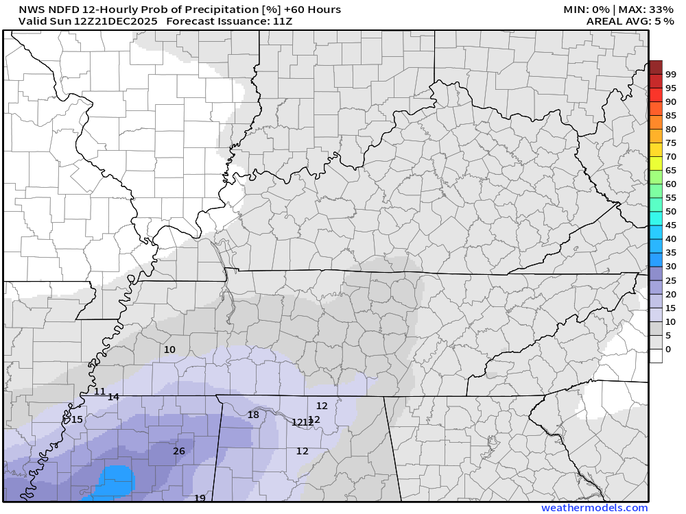
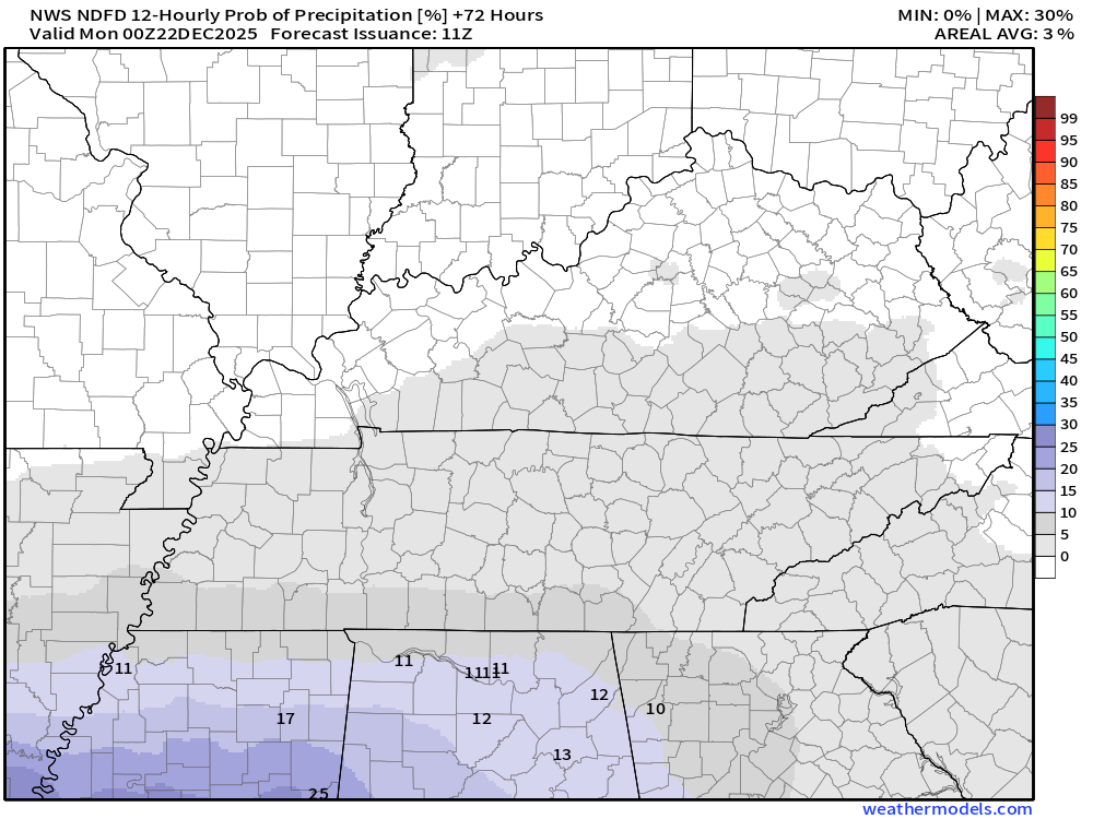
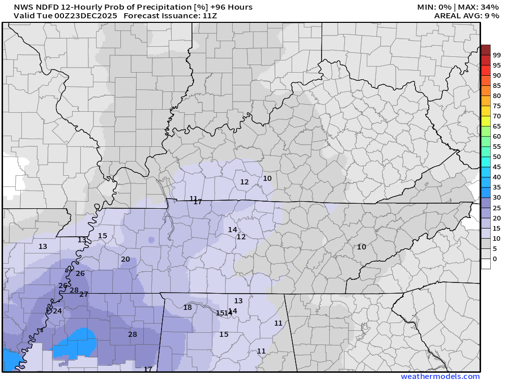
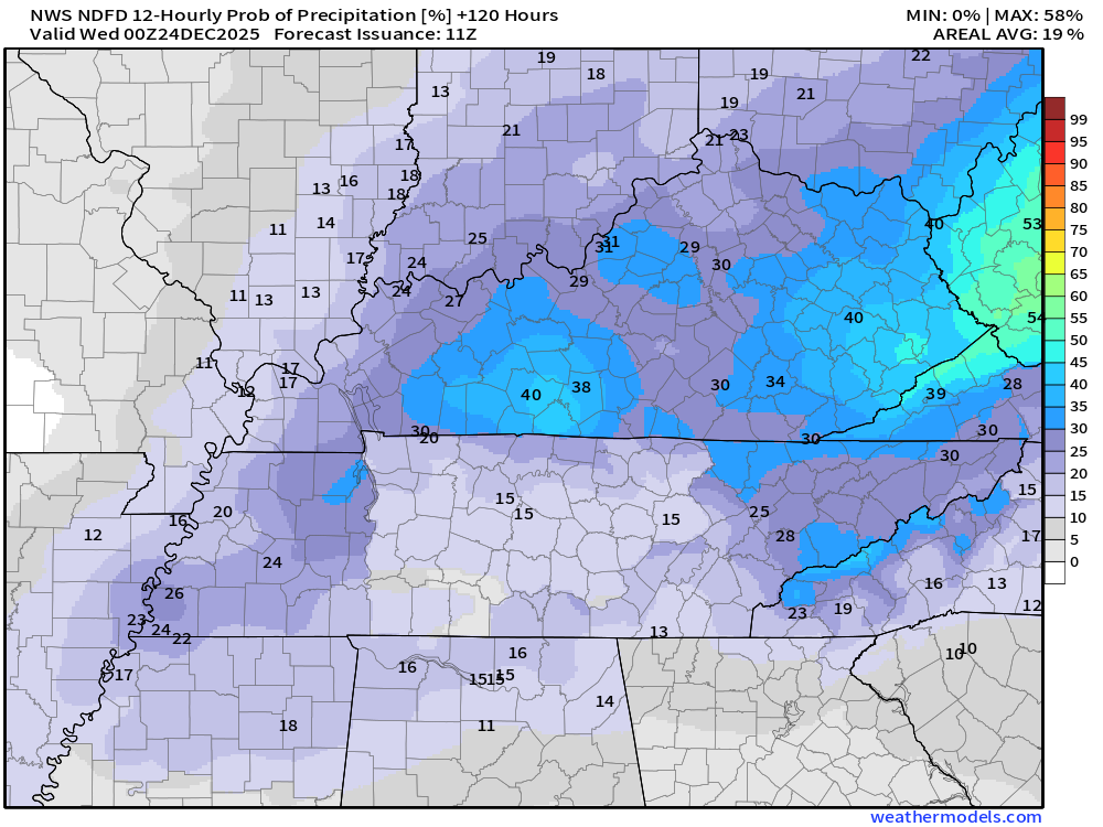
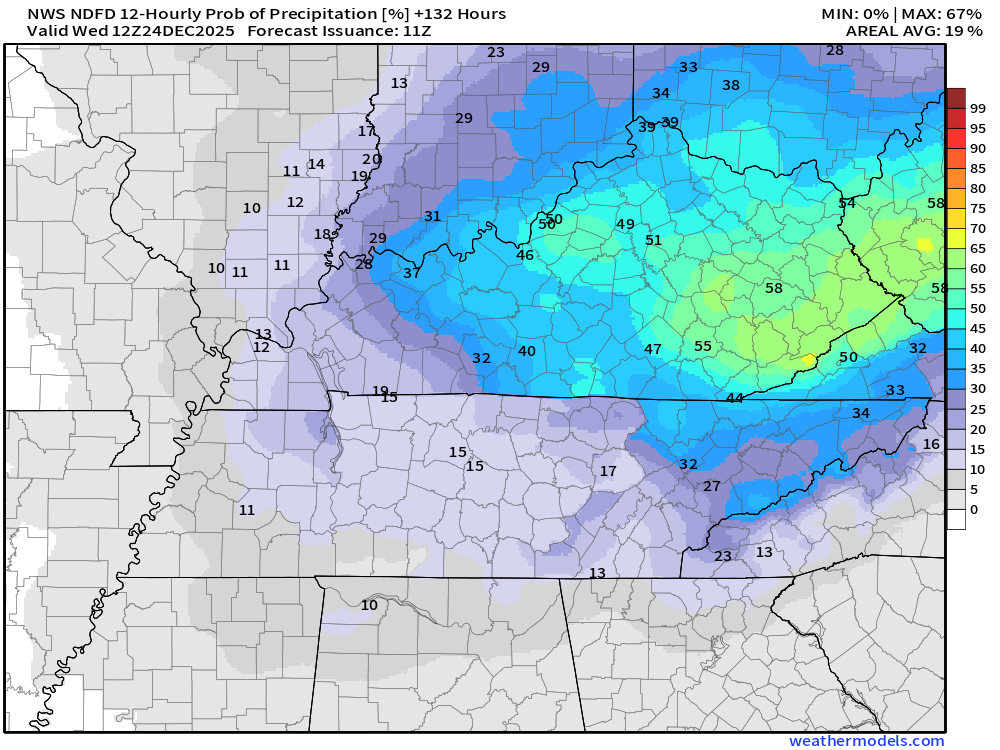
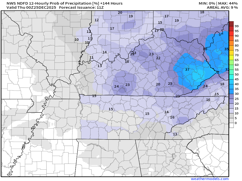
Spotty light showers will also be possible. For now, I kept chances under 30%. I will monitor Wednesday and Thursday in case I need to bump those rain chances up a little bit more. See the graphics below.
Rain totals during this time period will be light. Likely remaining under 0.10″.
Both Christmas Eve and Christmas Day will be mild with highs in the sixties! I can’t rule out some locations hitting seventy degrees. Crazy weather we are having!
The first part of December was cold. Now, we move into a milder pattern.
Some data shows a bigger system towards the end of the month and the first part of January. For now, data indicates that will be a rain event. Long way out. I will monitor trends.
Perhaps colder behind that system.
Let’s look at these rain probabilities.
I will walk you through each day.
Saturday night. As you can see, chances are very low. Around 10% or so in the grey zone.
Sunday (daytime). Low chances.
Sunday night. Low chances of light rain.

Monday (daytime)
Monday night
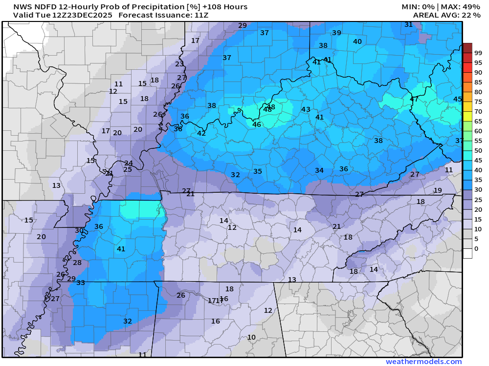
Tuesday
Tuesday night
Wednesday
Wednesday night
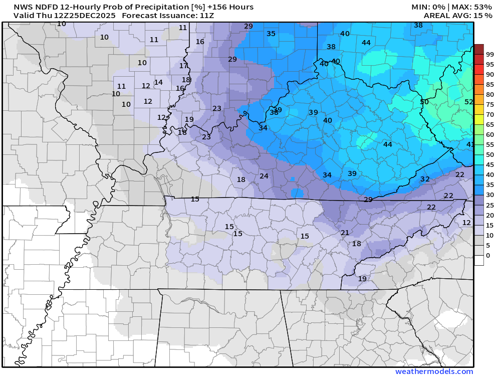
Thursday
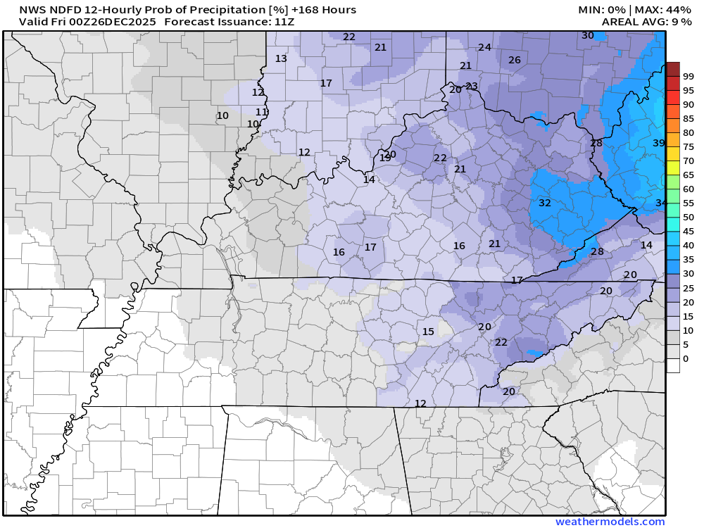
As you can see, chances won’t be zero. They also won’t be all that high. Anything that falls will be light.
At this time, there are no severe weather signals through Christmas.
I know it will be very warm, but there aren’t any storm systems to tap into all that warmth.
I am watching a system towards the end of the month and the first part of January.
Too soon to know if that will bring thunderstorms or just rain. For now, it looks wet and not white.
.

.
Double-click the animation to enlarge it.
Hrrr model
On this particular model, green is rain. Yellow and orange indicate moderate to heavy rain. Blue is snow. Pink and purple are freezing rain and sleet.
.
The timestamp (upper left) is in Zulu. 12z=6 am. 18z=12 pm. 00z=6 pm.
Double-click the animation to enlarge it.
NAM 3K model
.
..
.
Click here if you would like to return to the top of the page.
.Average high temperatures for this time of the year are around 50 degrees.
Average low temperatures for this time of the year are around 32 degrees.
Average precipitation during this time period ranges from 1.00″ to 1.25″
Six to Ten Day Outlook.
Blue is below average. Red is above average. The no color zone represents equal chances.
Average highs for this time of the year are in the lower 60s. Average lows for this time of the year are in the lower 40s.

Green is above average precipitation. Yellow and brown favors below average precipitation. Average precipitation for this time of the year is around one inch per week.

.

Average low temperatures for this time of the year are around 31 degrees.
Average precipitation during this time period ranges from 1.00″ to 1.25″
.
Eight to Fourteen Day Outlook.
Blue is below average. Red is above average. The no color zone represents equal chances.

Green is above average precipitation. Yellow and brown favors below average precipitation. Average precipitation for this time of the year is around one inch per week.

.
.
.
We have a new service to complement your www.weathertalk.com subscription. This does NOTreplace www.weathertalk.com It is simply another tool for you to receive severe weather information.
.
https://weathercallservices.com/beau-dodson-weather


Want to receive the daily forecast/other products on your Beau Dodson Weather app?
Did you know you have four options in your www.weathertalk.com account
You will then receive these via your Beau Dodson Weather app.
Just log into your www.weathertalk.com account
Click the NOTIFICATION SETTINGS TAB
Then, turn them on (green) and off (red)
🌪️ Number 1 is the most important one. Severe alerts, tornado alerts, and so on.
Number 2 is the daily video, blog, livestream alerts, and severe weather Facebook threads on severe days or winter storm days.
Number 3 is the daily forecast. I send that out every day during the afternoon hours. It is the seven-day forecast, hazardous weather outlook, fire outlook, and more.
Number 4 is to receive the daily video, blog, and other content on NON-severe weather days (every day without severe threats in other words)
GREEN IS ON
RED IS OFF

I am going to start going live during bigger severe weather events.
Check it out here https://www.youtube.com/user/beaudodson
Click the subscribe button (it’s a free subscription button), and it will alert you when I go live. I will also send out alerts to the app when I go live for an event.

.

Radars and Lightning Data
Interactive-city-view radars. Clickable watches and warnings.
https://wtalk.co/B3XHASFZ
Old legacy radar site (some of you like it better)
https://weatherobservatory.com/weather-radar.htm
If the radar is not updating then try another one. If a radar does not appear to be refreshing then hit Ctrl F5. You may also try restarting your browser.
Backup radar site in case the above one is not working.
https://weathertalk.com/morani
Regional Radar
https://imagery.weathertalk.com/prx/RadarLoop.mp4
** NEW ** Zoom radar with chaser tracking abilities!
ZoomRadar
If the radar is not working, then email me: Email me at beaudodson@usawx.com
.
We do have some sponsors! Check them out.
Roof damage from recent storms? Link – Click here
INTEGRITY ROOFING AND EXTERIORS!
⛈️ Roof or gutter damage from recent storms? Today’s weather is sponsored by Integrity Roofing. Check out their website at this link https://www.ourintegritymatters.com/

![]()
![]()
![]()
Make sure you have three to five ways of receiving your severe weather information.
Weather Talk is one of those ways! Now, I have another product for you and your family.

.
Want to add more products to your Beau Dodson Weather App?
Receive daily videos, weather blog updates on normal weather days and severe weather and winter storm days, your county by county weather forecast, and more!
Here is how to do add those additional products to your app notification settings!
Here is a video on how to update your Beau Dodson Weather payment.
The app is for subscribers. Subscribe at www.weathertalk.com/welcome then go to your app store and search for WeatherTalk
Subscribers, PLEASE USE THE APP. ATT and Verizon are not reliable during severe weather. They are delaying text messages.
The app is under WeatherTalk in the app store.

Apple users click here

Android users click here
.
Radars and Lightning Data
Interactive-city-view radars. Clickable watches and warnings.
https://wtalk.co/B3XHASFZ
Old legacy radar site (some of you like it better)
https://weatherobservatory.com/weather-radar.htm
If the radar is not updating then try another one. If a radar does not appear to be refreshing then hit Ctrl F5. You may also try restarting your browser.
Backup radar site in case the above one is not working.
https://weathertalk.com/morani
Regional Radar
https://imagery.weathertalk.com/prx/RadarLoop.mp4
** NEW ** Zoom radar with chaser tracking abilities!
ZoomRadar
Lightning Data (zoom in and out of your local area)
https://wtalk.co/WJ3SN5UZ
Not working? Email me at beaudodson@usawx.com
National map of weather watches and warnings. Click here.
Storm Prediction Center. Click here.
Weather Prediction Center. Click here.
.

Live lightning data: Click here.
Real time lightning data (another one) https://map.blitzortung.org/#5.02/37.95/-86.99
Our new Zoom radar with storm chases
.
.

Interactive GOES R satellite. Track clouds. Click here.
GOES 16 slider tool. Click here.
College of DuPage satellites. Click here
.

Here are the latest local river stage forecast numbers Click Here.
Here are the latest lake stage forecast numbers for Kentucky Lake and Lake Barkley Click Here.
.
.
Find Beau on Facebook! Click the banner.


 .
.