

.
I have some question-and-answer threads over on the Facebook page. Link to those threads CLICK HERE
Or email me at beaudodsonweather@gmail.com
..

🌪️ Seven-Day Tornado Outlook ⛈️
November 6th to November 12th
Current risk: At this time, tornadoes are not anticipated.
Current confidence level: Medium confidence.
Comments: Tornadoes are not anticipated. A couple of storms are possible on Friday afternoon. Mainly over Kentucky/Tennessee.
.

Seven-Day Hazardous Weather Outlook
1. Is lightning in the forecast? YES. Isolated lightning is possible on Friday.
2. Are organized/widespread severe thunderstorms in the forecast? UNLIKELY. A few thunderstorms will be possible on Friday. Mainly during the afternoon hours. The primary concern will be a few storms producing gusty winds and small hail. Severe weather is unlikely. A will monitor the Pennyrile area of western Kentucky.
4. Will non-thunderstorm winds top 40 mph? NO.
5. Will temperatures rise above 90 degrees? NO.
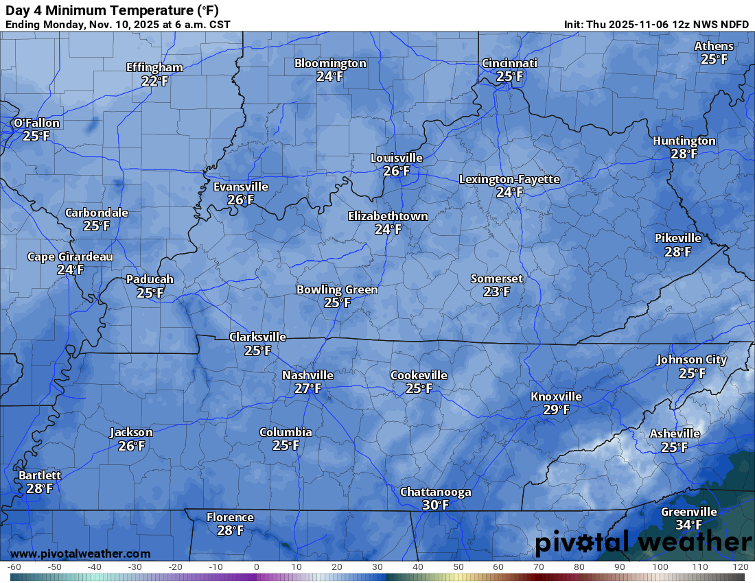
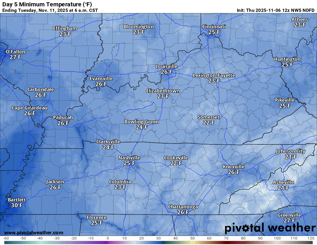
6. Will the temperature fall below 32 degrees? YES. Temperatures will dip below freezing on Sunday night/Monday morning and Monday night/Tuesday morning.
7. Is a killing frost in the forecast? YES. Heavy frost is possible on Monday morning and Tuesday morning.
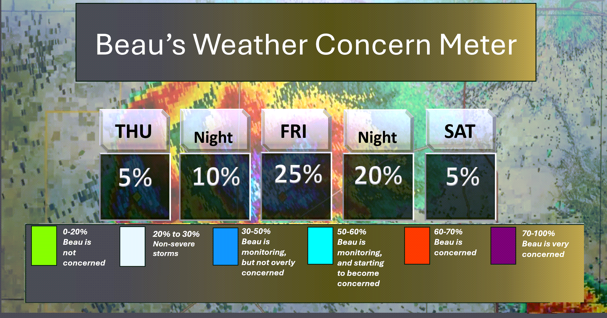
Here is the short-range concern meter.
Lightning is possible on Friday.
.
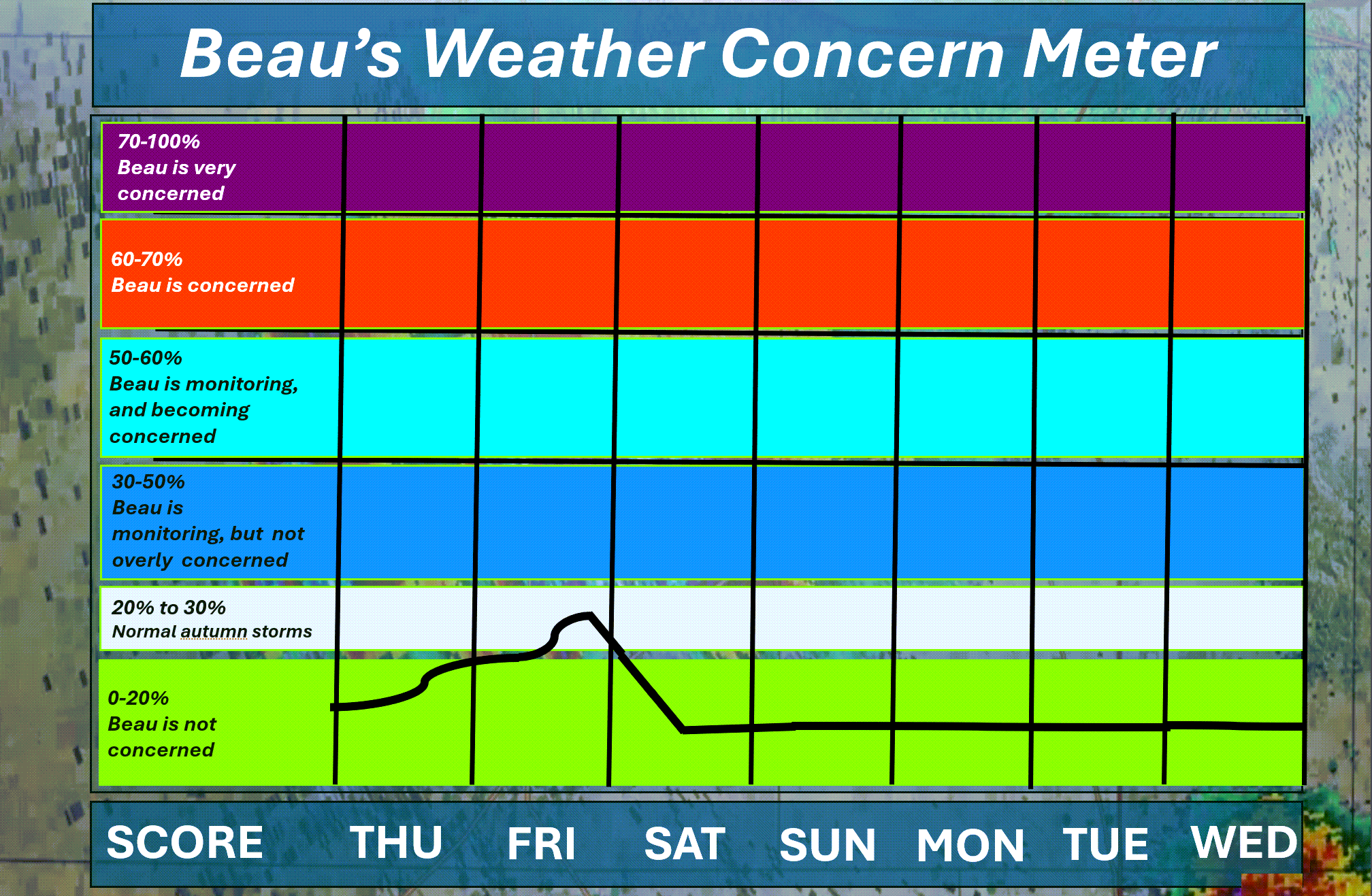
Here is the extended concern meter.
Isolated lightning is possible on Friday. I placed us in the grey zone for lightning on Friday.
A few strong storms are possible across western Kentucky and Tennessee, but the risk of severe weather is very low. I kept us out of the blue.
.
A quick forecast glance. Your 48-hour forecast Graphics


.
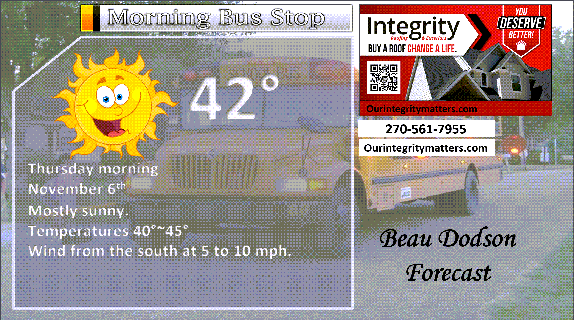
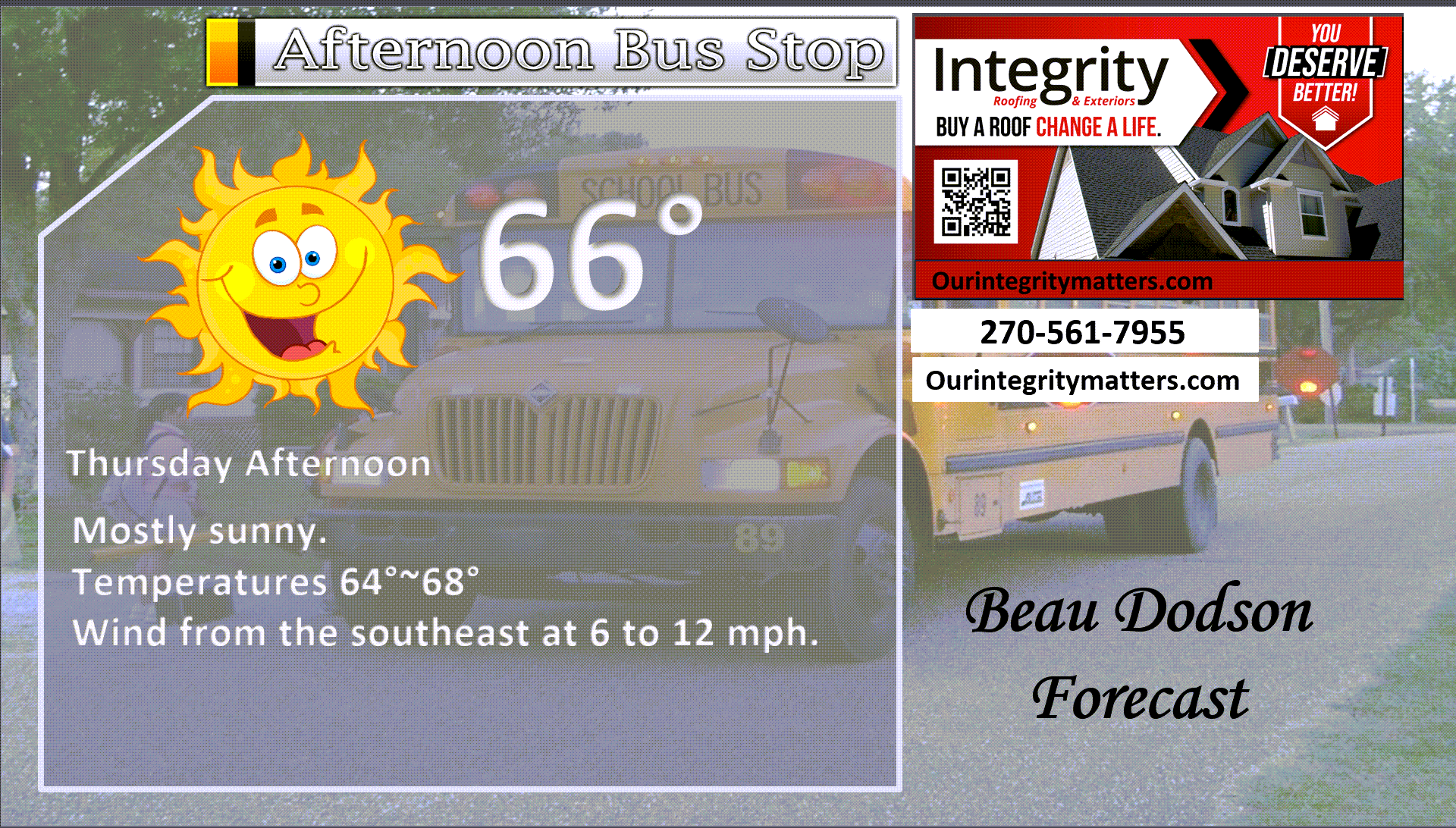
Here is your bus stop forecast.
.
This afternoon
.


Forecast discussion
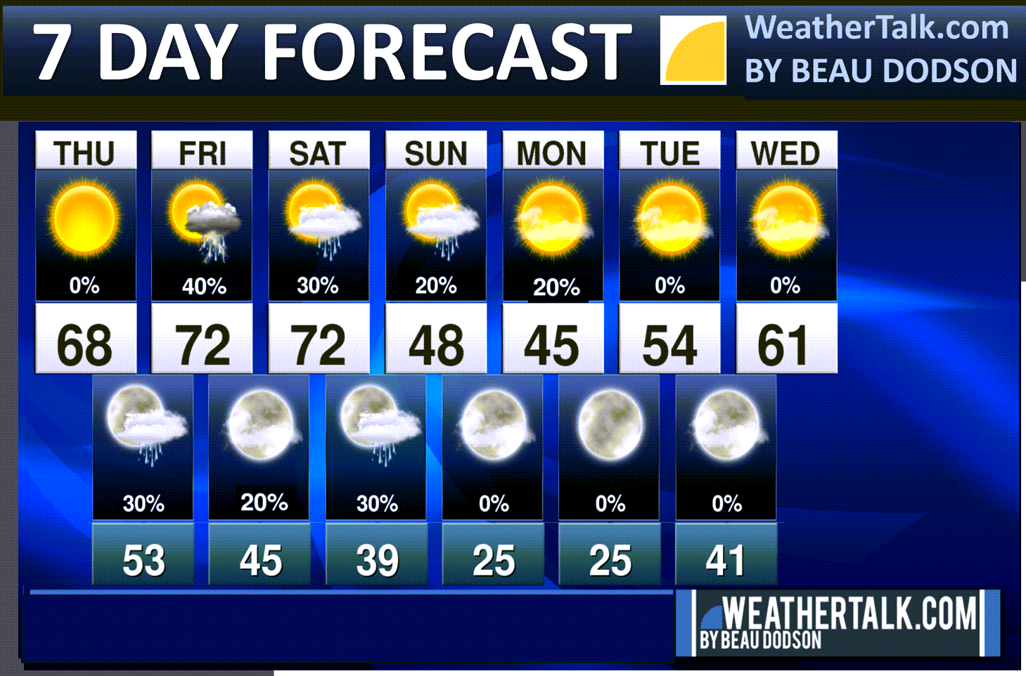
- Mild afternoon temperatures today through Saturday.
- Our Friday rain event is trending drier. Rain totals will be light.
- A stronger cold front is expected on Saturday/Sunday. Moisture is limited with that front. A few showers will also be possible with that front.
- The coldest air of the autumn, thus far, will arrive on Sunday, Monday, and Tuesday.
- A hard freeze is likely on Sunday night and Monday night. Low wind chill values on Sunday into Monday night.
.
 .
.
.
Seven-day outlook graphic.
See the video for more details specific to your county. This is a broad-brushed outlook for the entire region.
.
Today through Saturday
We are waking up to chilly temperatures. Temperatures are cooler than they were yesterday morning.
Here were the 5 am temperatures.
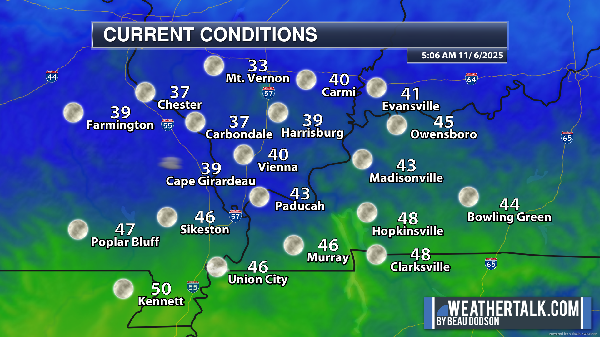
.
There are no weather concerns today. Dry conditions.
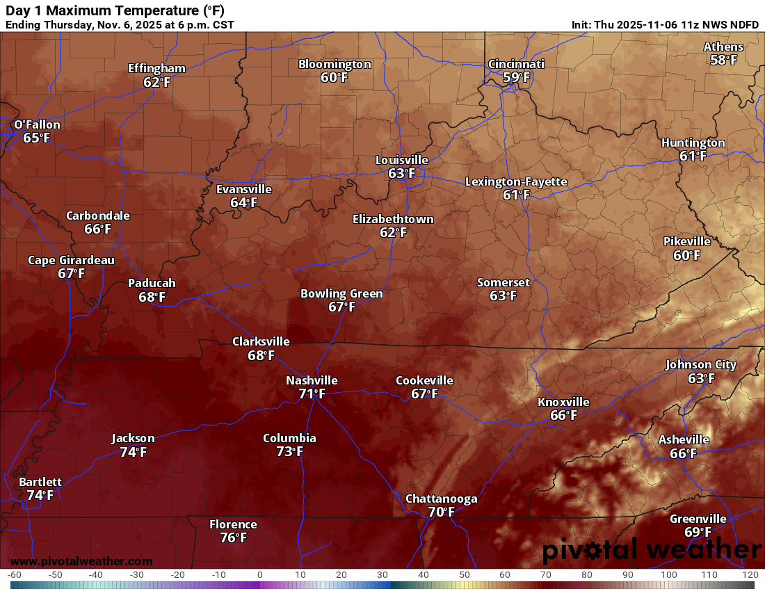
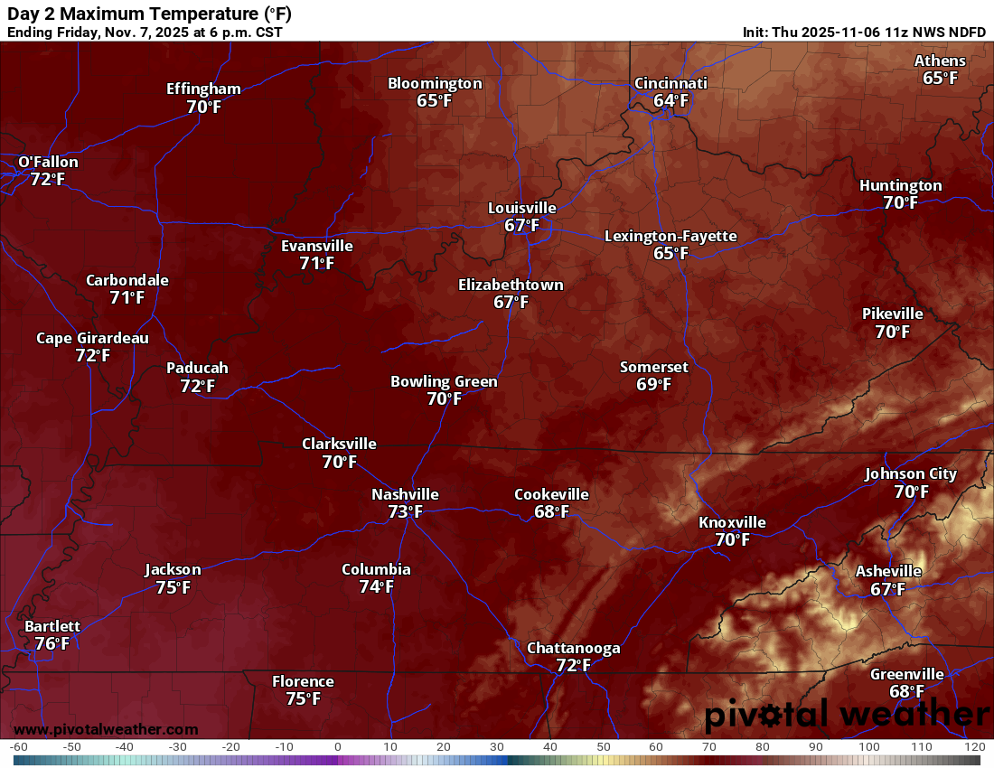
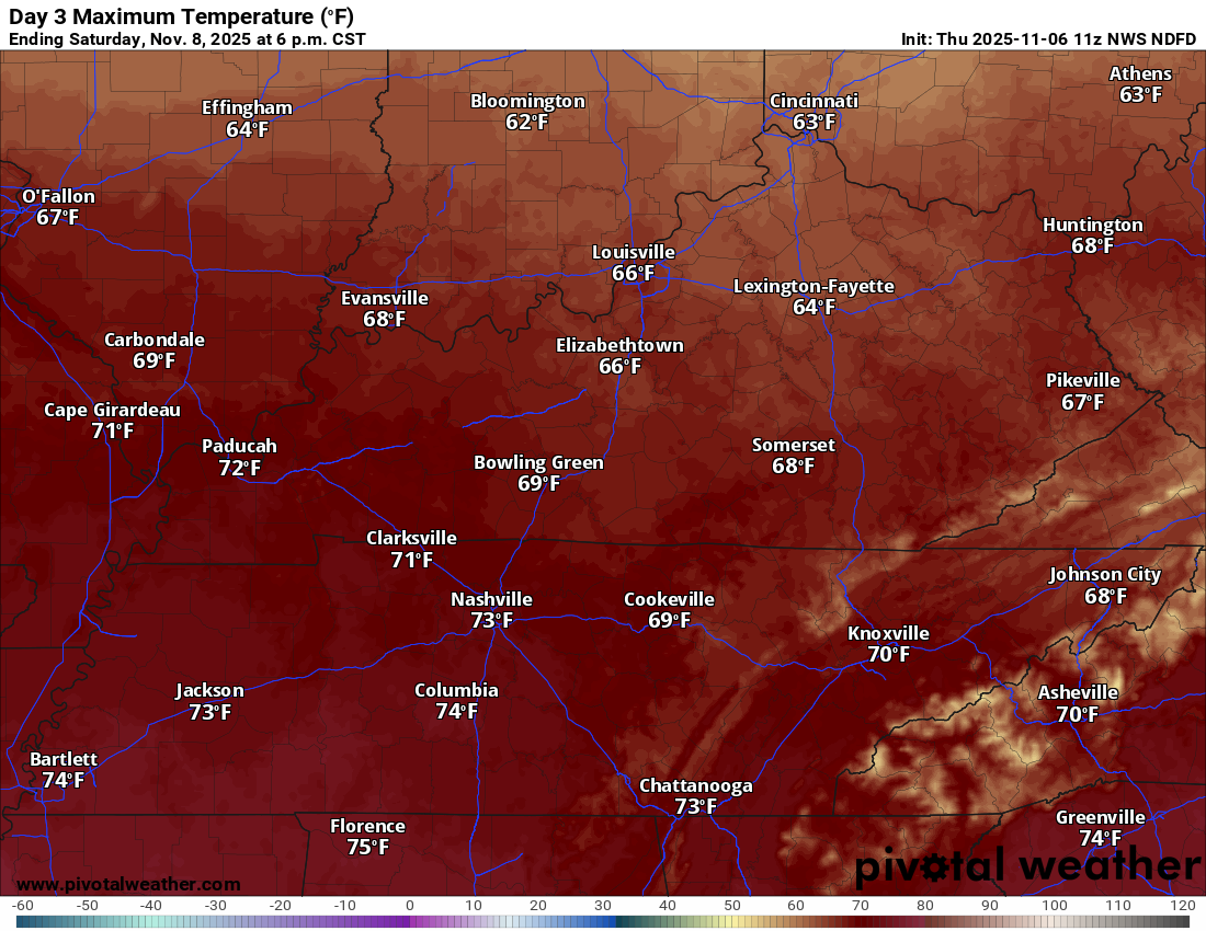
Temperatures will remain above average over the coming days. Some locations will hit 70+ degrees on Friday and Saturday!
Temperatures today will mostly stay in the sixties.
Today’s highs
.
Friday highs (a bit warmer)
.
Saturday highs (mild)
.
A gusty cold front will sweep across the region on Friday and Friday night.
The overall trend in the forecast is drier. Rainfall totals continue to go down.
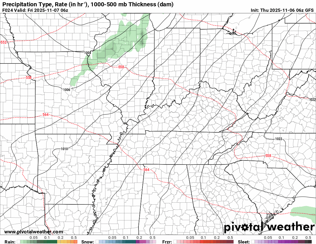
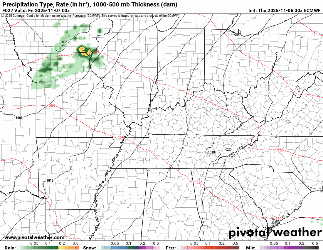
Scattered showers are possible late tonight into Friday evening.
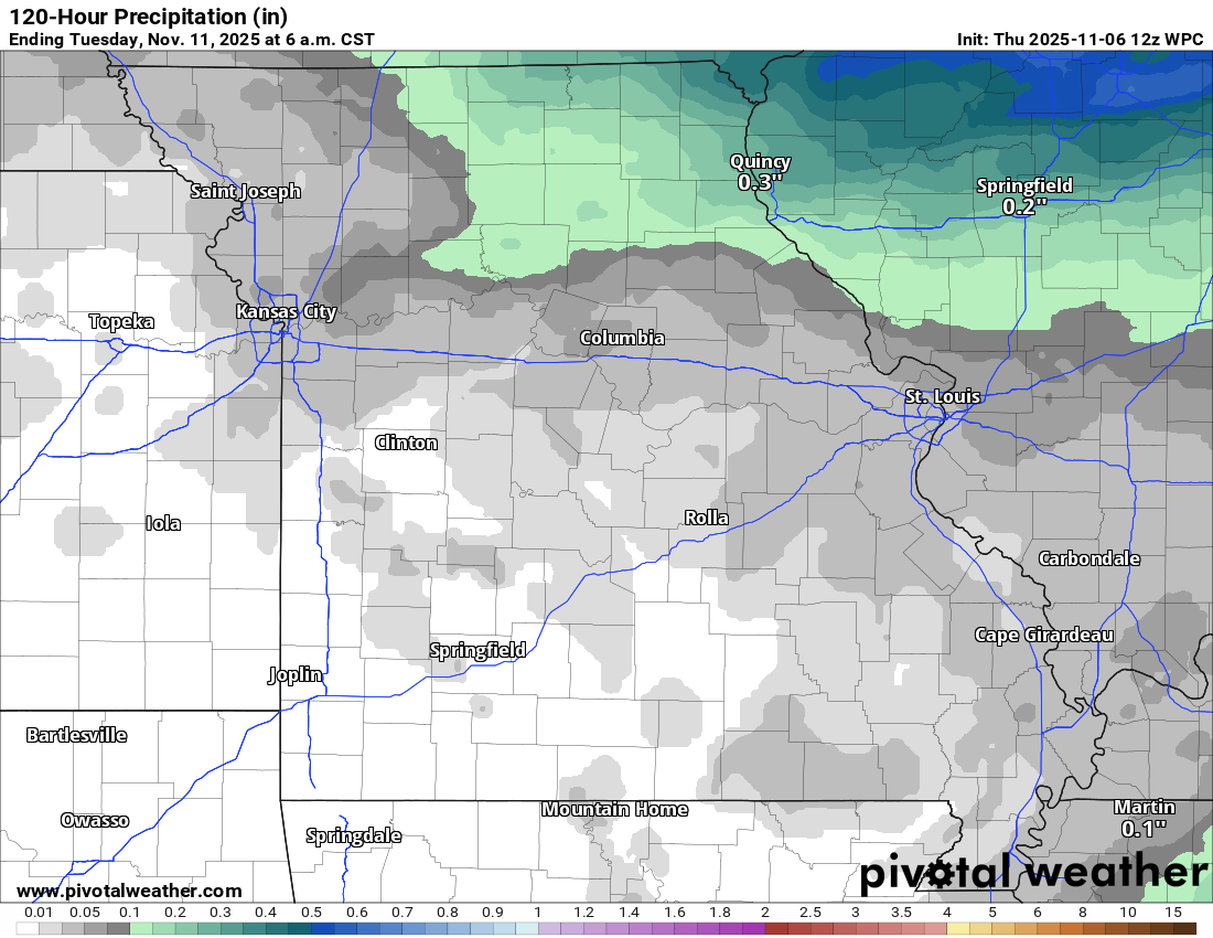
The rain chances tonight (after midnight) will mainly be across southern Illinois and southeast Missouri. Light. Rainfall totals of 0.00″ to 0.10″ are anticipated. Some areas will remain dry (no measurable rain). See the graphics below.
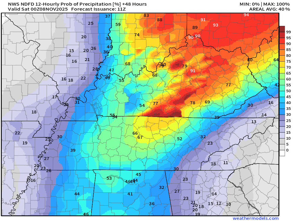
Scattered showers and thunderstorms are likely Friday into Friday evening across the area. The rain chances will be a bit higher over Kentucky and Tennessee.
A second cold front will bring increasing clouds late Saturday into Sunday morning. A couple of showers will accompany that front, as well. Moisture is limited on Saturday. Any rain totals would be light.
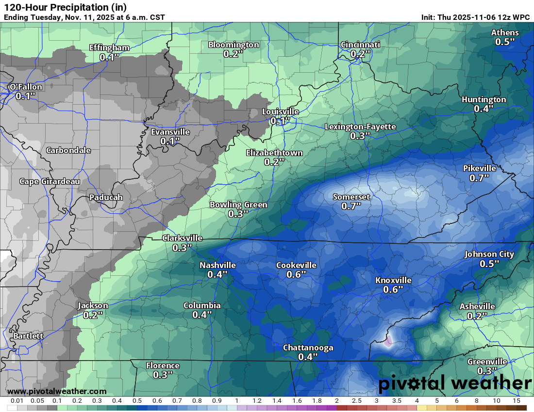
Let me show you the rainfall totals forecast.
Missouri view (light totals 0.00″ to 0.10″)
.
The rest of the area. Rain totals will be light. The only exception will be if a thunderstorm forms. If that occurs, then rain totals would be a bit higher.
.
Let’s look at the rain probabilities. What is the % chance of rain?
Thursday (this evening) 6 PM to Friday 6 AM (a few showers late tonight over mainly Missouri and Illinois).
.
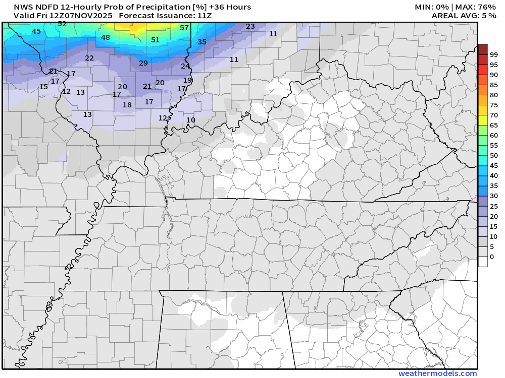
Friday 6 AM to Friday 6 PM (notice rain chances are higher as you travel eastward in the region).
.
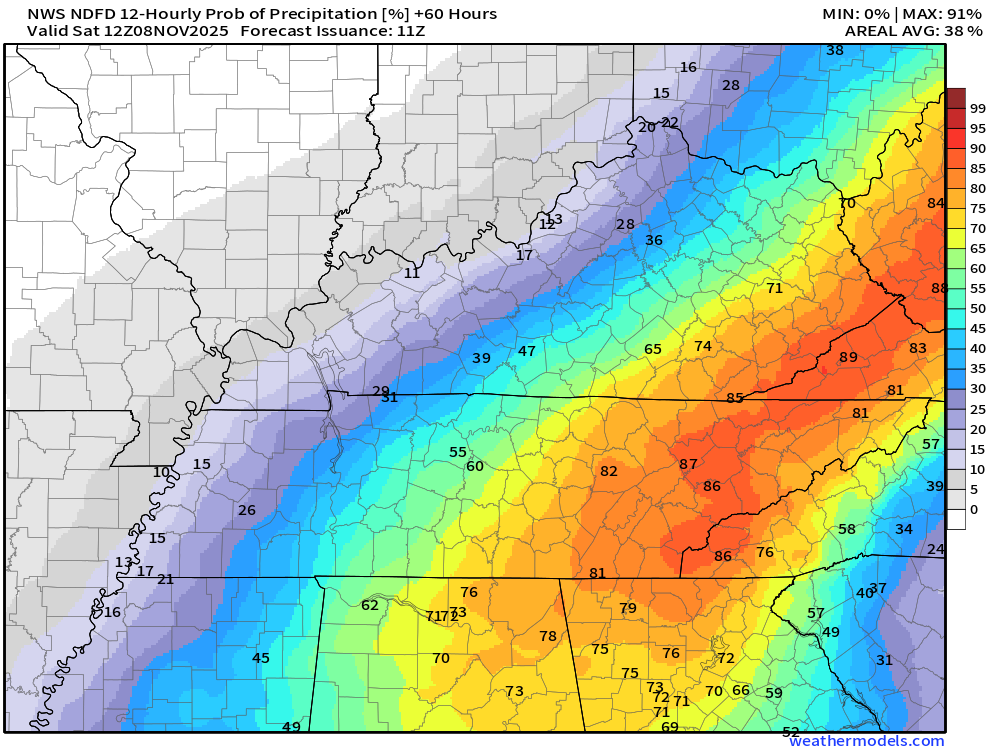
Friday 6 PM to Saturday 6 AM
.
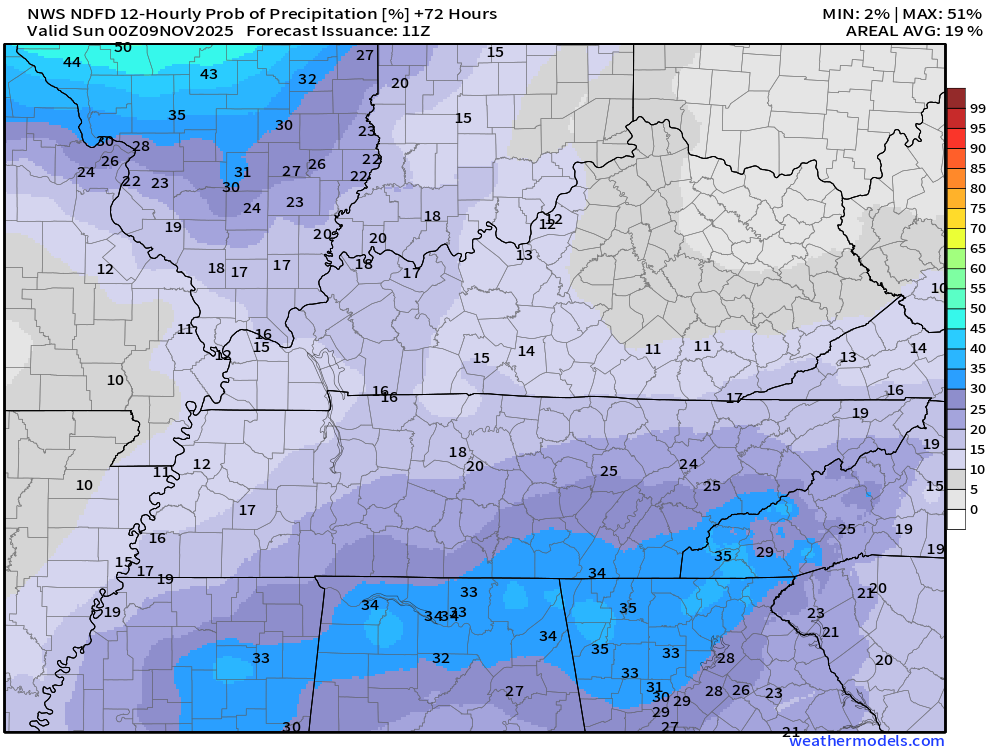
Saturday 6 AM to Saturday 6 PM
.
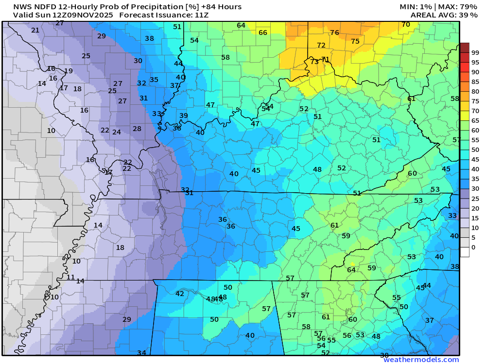
Saturday 6 PM to Sunday 6 AM
.
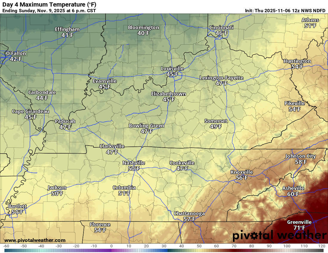
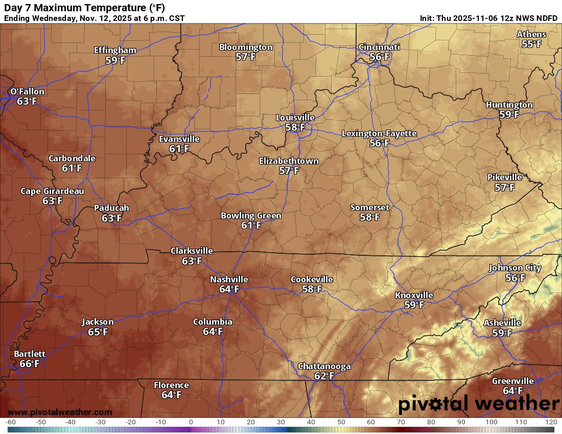
Sunday through Wednesday
A brief blast of cold air
The coldest air of the autumn season will arrive on Sunday, Monday, and Tuesday.
Temperatures may actually fall during the day on Sunday. It is going to be cold.
A hard freeze is likely to occur on Sunday and Monday nights.
Sunday’s high temperature map
.
Monday’s high temperature map
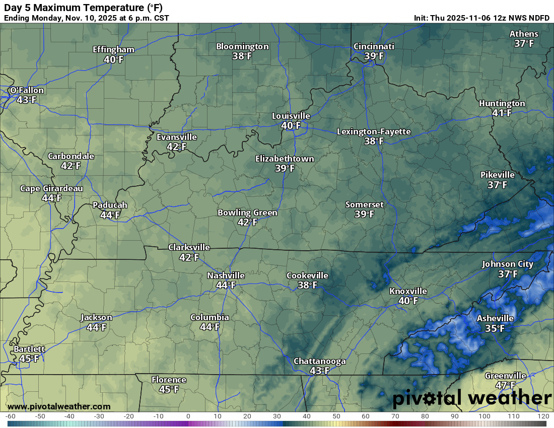
.
We will warm up a bit by Wednesday.
Wednesday’s high temperature map
.
Gusty winds are likely on Saturday and Sunday. At times, gusting above 20 mph.
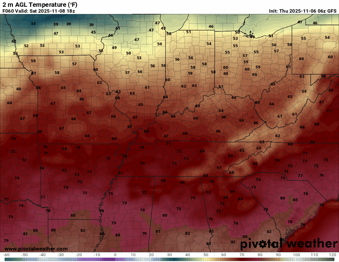
You can see the cold air arriving in this animation. Those blue colors are temperatures in the 20s.
.
Time stamp upper left. Zulu. 12z=6 am. 18z=12 pm. 00z=6 pm.
Double-click the animation to enlarge it.
.
Monday morning low temperature forecast
.
Tuesday morning low temperature forecast
.
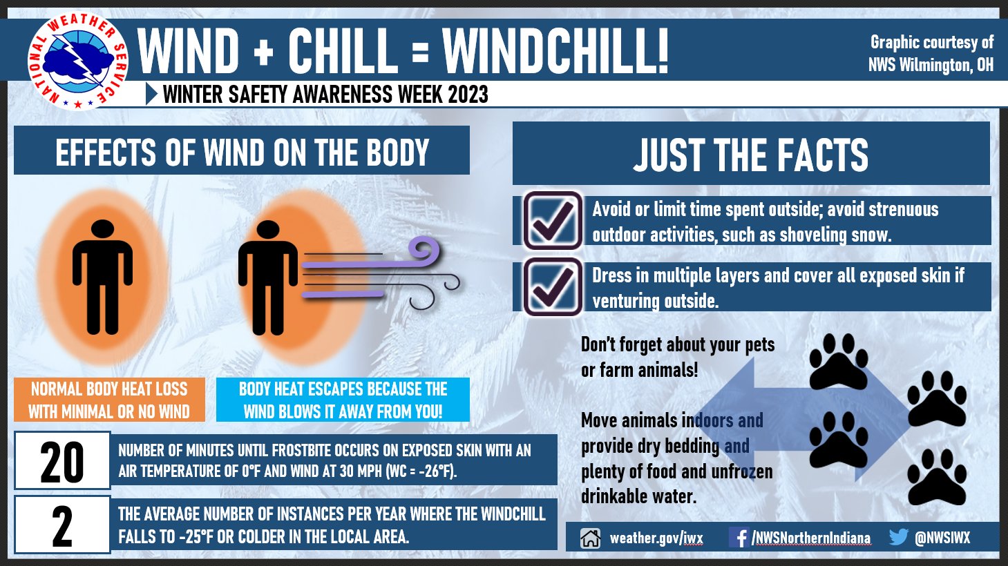
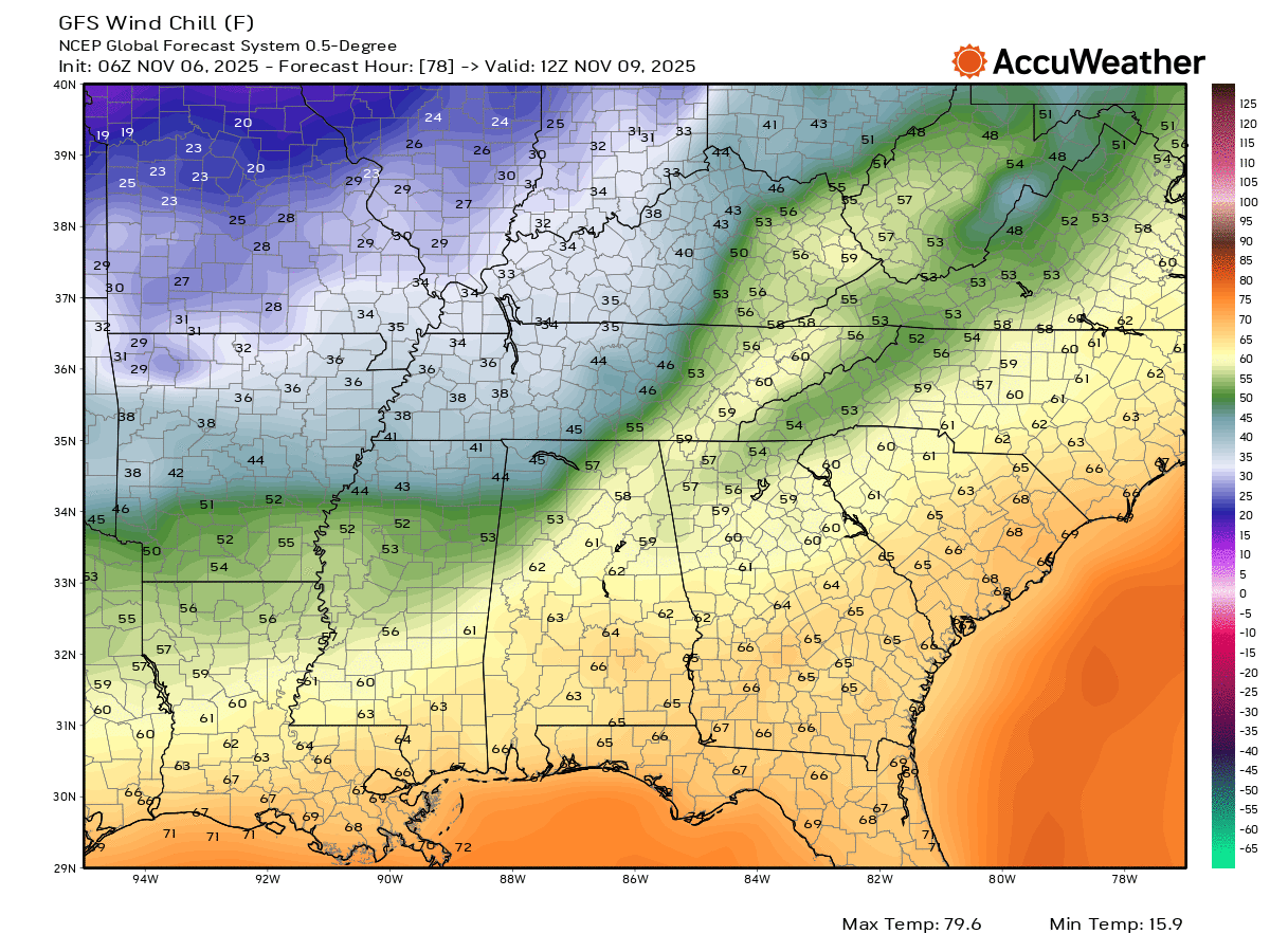
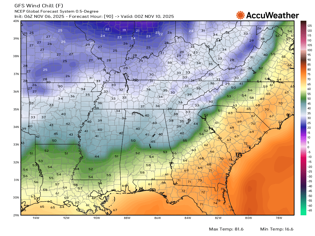
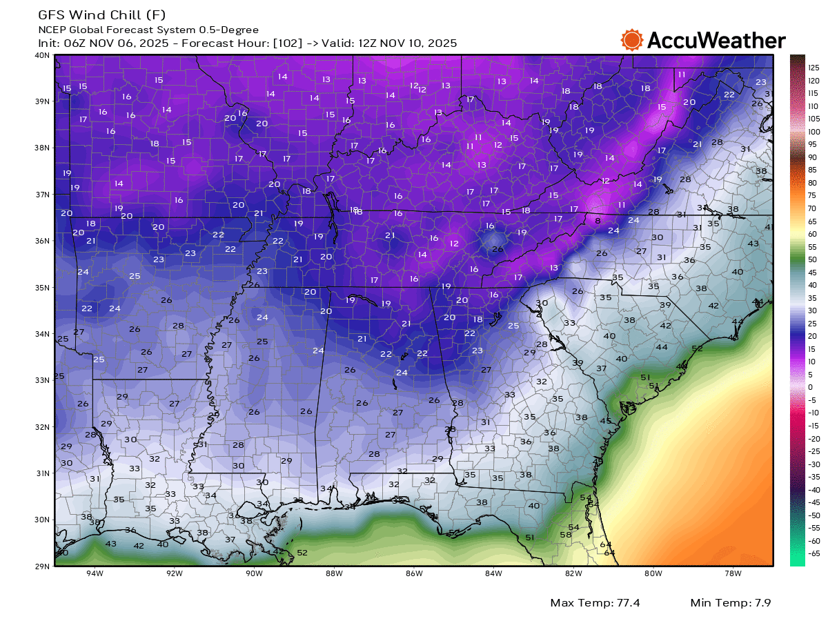
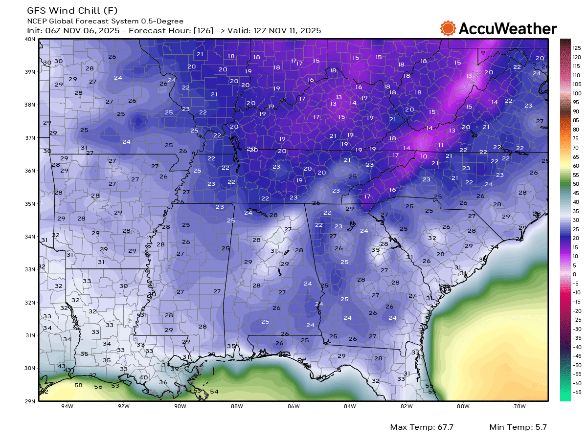
Wind chill values will be cold.
.
This is from the GFS model guidance.
Sunday morning wind chill values (6 AM)
Double-click on the images to enlarge them.
.
Sunday evening wind chill values (6 PM)
.
Monday morning wind chill values (6 AM)
.I can’t rule out some clouds on Sunday and Monday. A sprinkle or flurry isn’t out of the question.
Temperatures are expected to moderate by the middle of next week. It won’t be as cold. Temperatures will pop above average, again.
.

.
The timestamp (upper left) is in Zulu. 12z=6 am. 18z=12 pm. 00z=6 pm.
Double-click the animation to enlarge it.
GFS model
.
The timestamp (upper left) is in Zulu. 12z=6 am. 18z=12 pm. 00z=6 pm.
Double-click the animation to enlarge it.
EC model
.
.
..
.
Click here if you would like to return to the top of the page.
.Average high temperatures for this time of the year are around 68 degrees.
Average low temperatures for this time of the year are around 45 degrees.
Average precipitation during this time period ranges from 1.00″ to 1.25″
Six to Ten Day Outlook.
Blue is below average. Red is above average. The no color zone represents equal chances.
Average highs for this time of the year are in the lower 60s. Average lows for this time of the year are in the lower 40s.

Green is above average precipitation. Yellow and brown favors below average precipitation. Average precipitation for this time of the year is around one inch per week.

.

Average low temperatures for this time of the year are around 43 degrees.
Average precipitation during this time period ranges from 1.00″ to 1.25″
.
Eight to Fourteen Day Outlook.
Blue is below average. Red is above average. The no color zone represents equal chances.

Green is above average precipitation. Yellow and brown favors below average precipitation. Average precipitation for this time of the year is around one inch per week.

.
.
.
We have a new service to complement your www.weathertalk.com subscription. This does NOTreplace www.weathertalk.com It is simply another tool for you to receive severe weather information.
.
https://weathercallservices.com/beau-dodson-weather


Want to receive the daily forecast/other products on your Beau Dodson Weather app?
Did you know you have four options in your www.weathertalk.com account
You will then receive these via your Beau Dodson Weather app.
Just log into your www.weathertalk.com account
Click the NOTIFICATION SETTINGS TAB
Then, turn them on (green) and off (red)
🌪️ Number 1 is the most important one. Severe alerts, tornado alerts, and so on.
Number 2 is the daily video, blog, livestream alerts, and severe weather Facebook threads on severe days or winter storm days.
Number 3 is the daily forecast. I send that out every day during the afternoon hours. It is the seven-day forecast, hazardous weather outlook, fire outlook, and more.
Number 4 is to receive the daily video, blog, and other content on NON-severe weather days (every day without severe threats in other words)
GREEN IS ON
RED IS OFF

I am going to start going live during bigger severe weather events.
Check it out here https://www.youtube.com/user/beaudodson
Click the subscribe button (it’s a free subscription button), and it will alert you when I go live. I will also send out alerts to the app when I go live for an event.

.

Radars and Lightning Data
Interactive-city-view radars. Clickable watches and warnings.
https://wtalk.co/B3XHASFZ
Old legacy radar site (some of you like it better)
https://weatherobservatory.com/weather-radar.htm
If the radar is not updating then try another one. If a radar does not appear to be refreshing then hit Ctrl F5. You may also try restarting your browser.
Backup radar site in case the above one is not working.
https://weathertalk.com/morani
Regional Radar
https://imagery.weathertalk.com/prx/RadarLoop.mp4
** NEW ** Zoom radar with chaser tracking abilities!
ZoomRadar
If the radar is not working, then email me: Email me at beaudodson@usawx.com
.
We do have some sponsors! Check them out.
Roof damage from recent storms? Link – Click here
INTEGRITY ROOFING AND EXTERIORS!
⛈️ Roof or gutter damage from recent storms? Today’s weather is sponsored by Integrity Roofing. Check out their website at this link https://www.ourintegritymatters.com/

![]()
![]()
![]()
Make sure you have three to five ways of receiving your severe weather information.
Weather Talk is one of those ways! Now, I have another product for you and your family.

.
Want to add more products to your Beau Dodson Weather App?
Receive daily videos, weather blog updates on normal weather days and severe weather and winter storm days, your county by county weather forecast, and more!
Here is how to do add those additional products to your app notification settings!
Here is a video on how to update your Beau Dodson Weather payment.
The app is for subscribers. Subscribe at www.weathertalk.com/welcome then go to your app store and search for WeatherTalk
Subscribers, PLEASE USE THE APP. ATT and Verizon are not reliable during severe weather. They are delaying text messages.
The app is under WeatherTalk in the app store.

Apple users click here

Android users click here
.
Radars and Lightning Data
Interactive-city-view radars. Clickable watches and warnings.
https://wtalk.co/B3XHASFZ
Old legacy radar site (some of you like it better)
https://weatherobservatory.com/weather-radar.htm
If the radar is not updating then try another one. If a radar does not appear to be refreshing then hit Ctrl F5. You may also try restarting your browser.
Backup radar site in case the above one is not working.
https://weathertalk.com/morani
Regional Radar
https://imagery.weathertalk.com/prx/RadarLoop.mp4
** NEW ** Zoom radar with chaser tracking abilities!
ZoomRadar
Lightning Data (zoom in and out of your local area)
https://wtalk.co/WJ3SN5UZ
Not working? Email me at beaudodson@usawx.com
National map of weather watches and warnings. Click here.
Storm Prediction Center. Click here.
Weather Prediction Center. Click here.
.

Live lightning data: Click here.
Real time lightning data (another one) https://map.blitzortung.org/#5.02/37.95/-86.99
Our new Zoom radar with storm chases
.
.

Interactive GOES R satellite. Track clouds. Click here.
GOES 16 slider tool. Click here.
College of DuPage satellites. Click here
.

Here are the latest local river stage forecast numbers Click Here.
Here are the latest lake stage forecast numbers for Kentucky Lake and Lake Barkley Click Here.
.
.
Find Beau on Facebook! Click the banner.


 .
.