

.
I have some question-and-answer threads over on the Facebook page. Link to those threads CLICK HERE
Or email me at beaudodsonweather@gmail.com
..

🌪️ Seven-Day Tornado Outlook ⛈️
October 28th through November 3rd
Current risk: None
Current confidence level: High confidence.
Comments:
.

Seven-Day Hazardous Weather Outlook
1. Is lightning in the forecast? NO.
2. Are organized/widespread severe thunderstorms in the forecast? NO. Cold air funnels are possible on Tuesday and Wednesday. These are typically harmless.
4. Will non-thunderstorm winds top 40 mph? NO.
5. Will temperatures rise above 90 degrees? NO.
6. Will the temperature fall below 32 degrees? UNLIKELY. I will monitor Friday and Saturday night over the northern portions of southern Illinois.
7. Is a killing frost in the forecast? POSSIBLE. Frost is possible on Friday and Saturday morning.
.
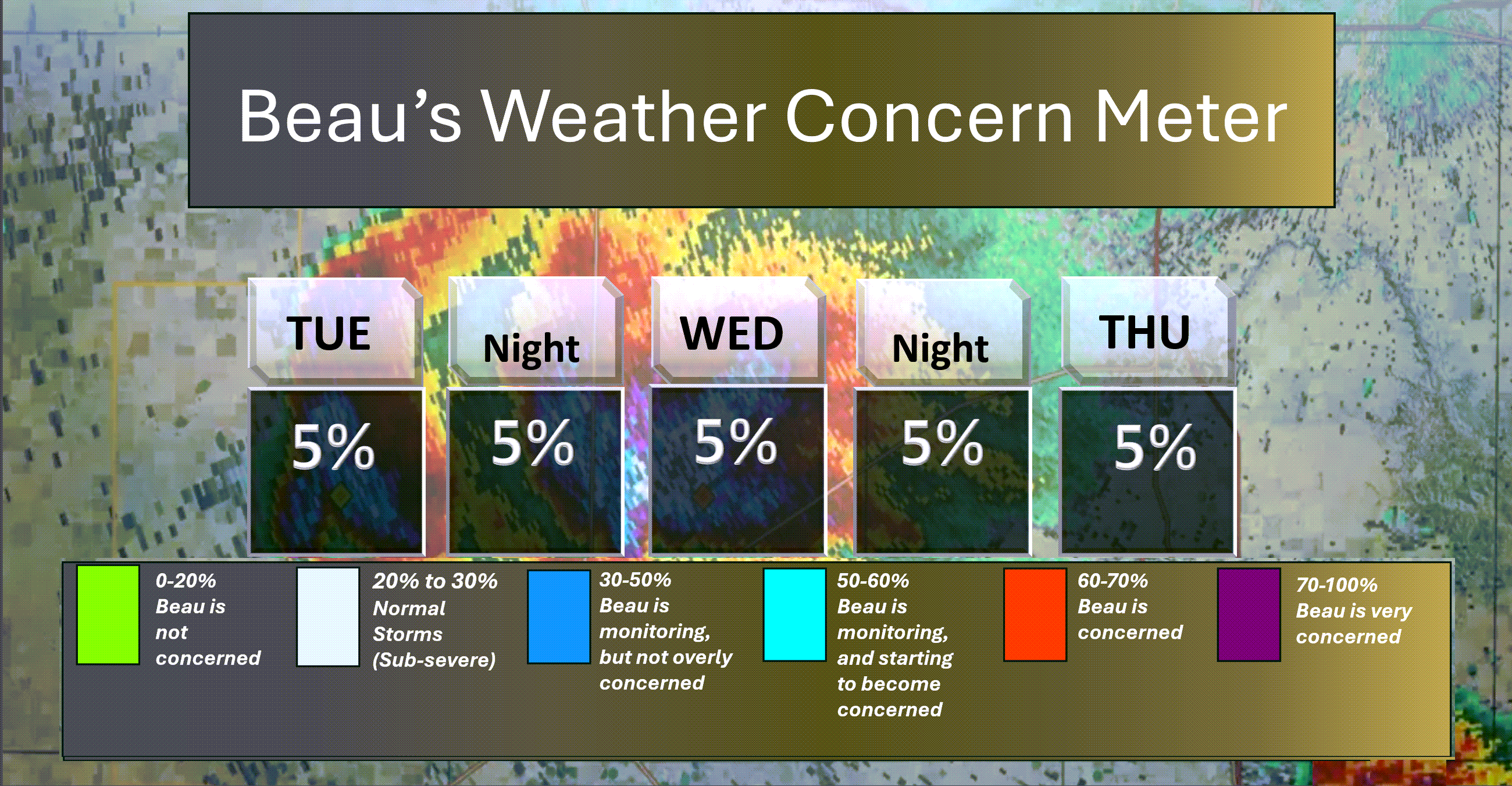
Here is the short-range concern meter.
.
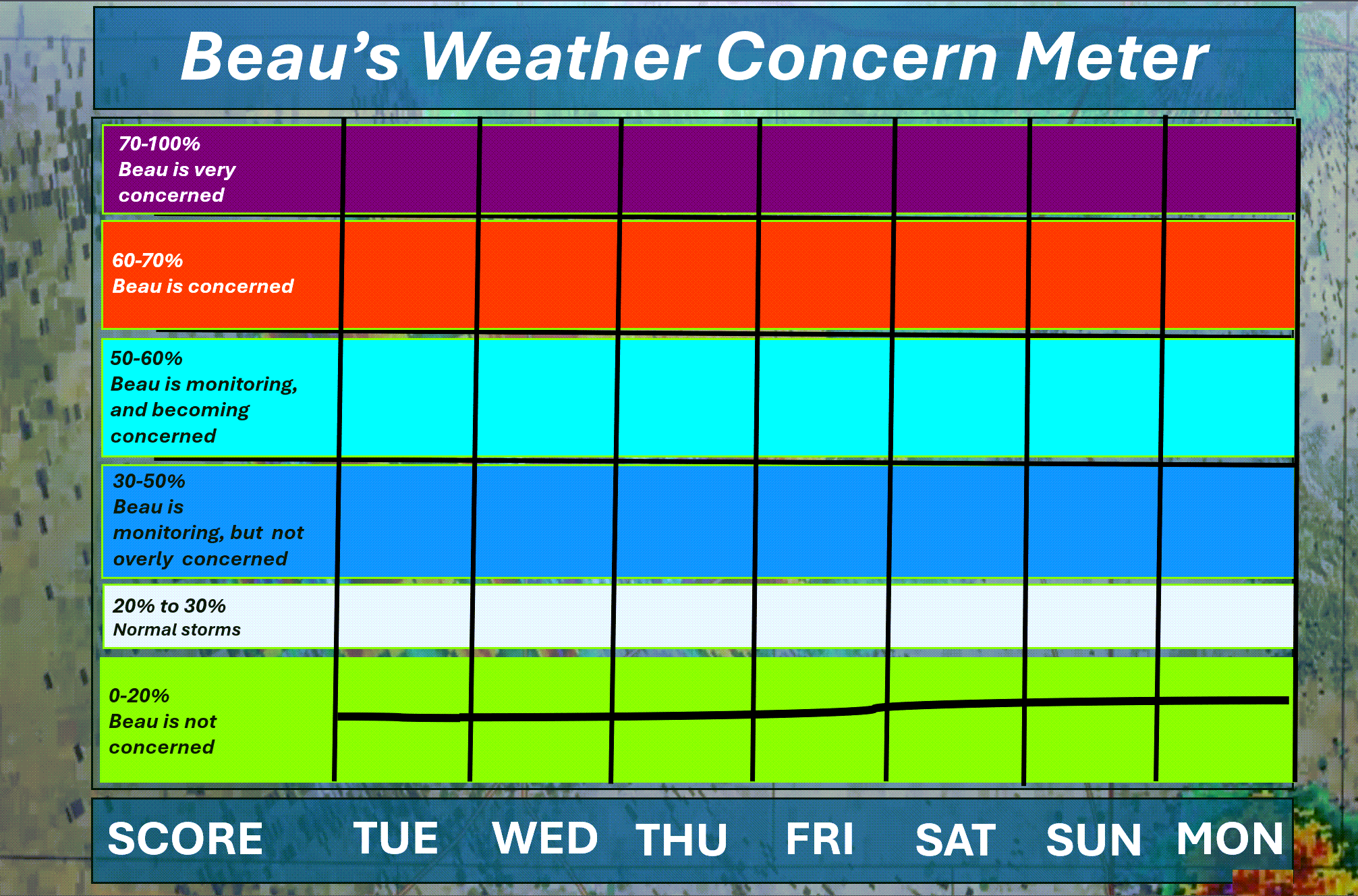
Here is the extended concern meter. This takes us through next Monday.
No severe weather or winter weather concerns.
.
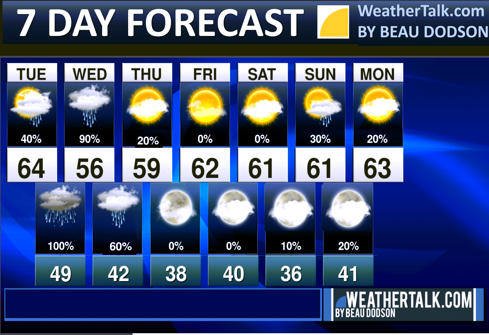
A quick forecast glance. Your 48-hour forecast Graphics


.
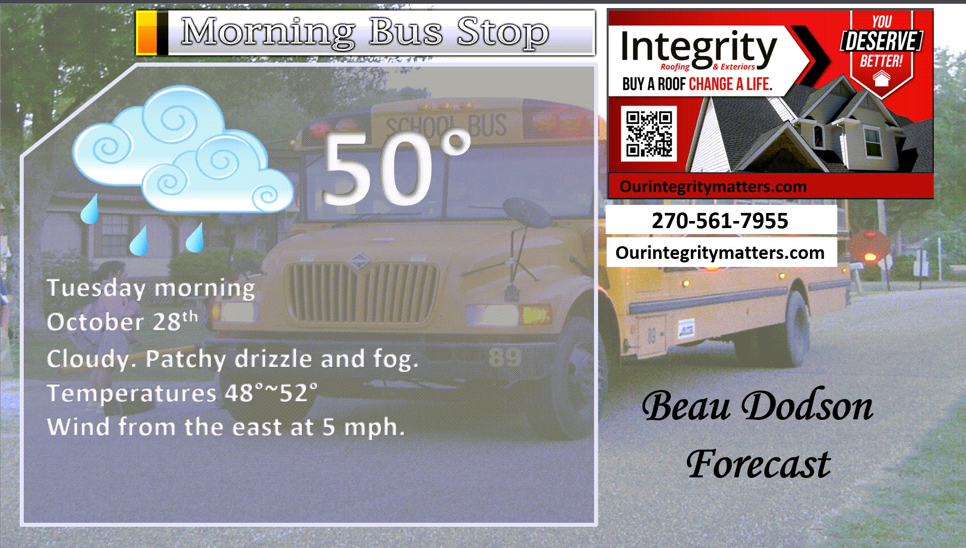
Here is your bus stop forecast.
.
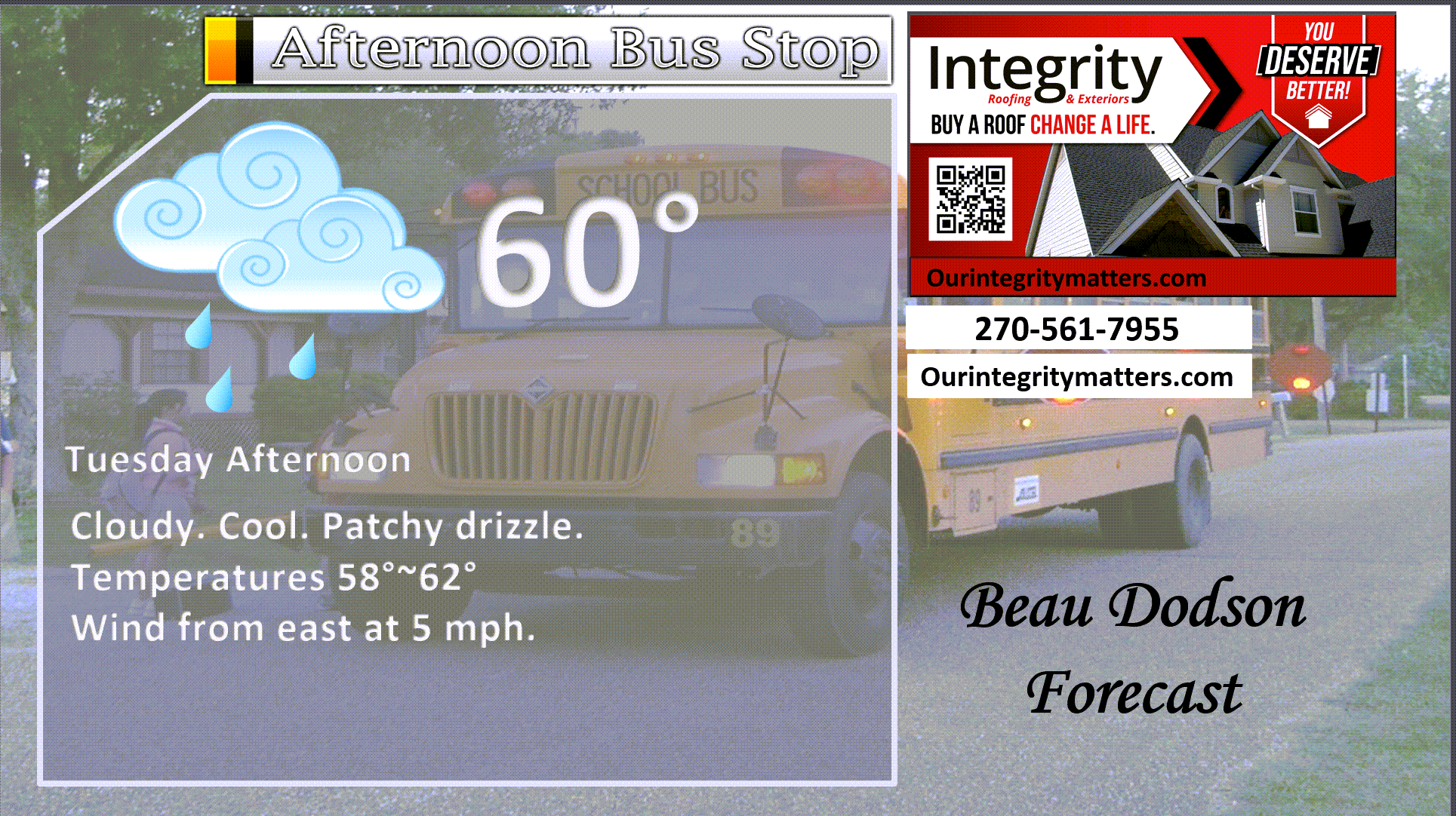
This afternoon
.


Forecast discussion
- Cool temperatures into the weekend.
- Rain chances ramp back up tonight and Wednesday.
- Cool and dry for Halloween.
.
 .
.
.
Seven-day outlook graphic.
See the video for more details for your specific county. This is a broad-brushed outlook for the entire region.
.
Good morning, everyone. We have more rain on the way.
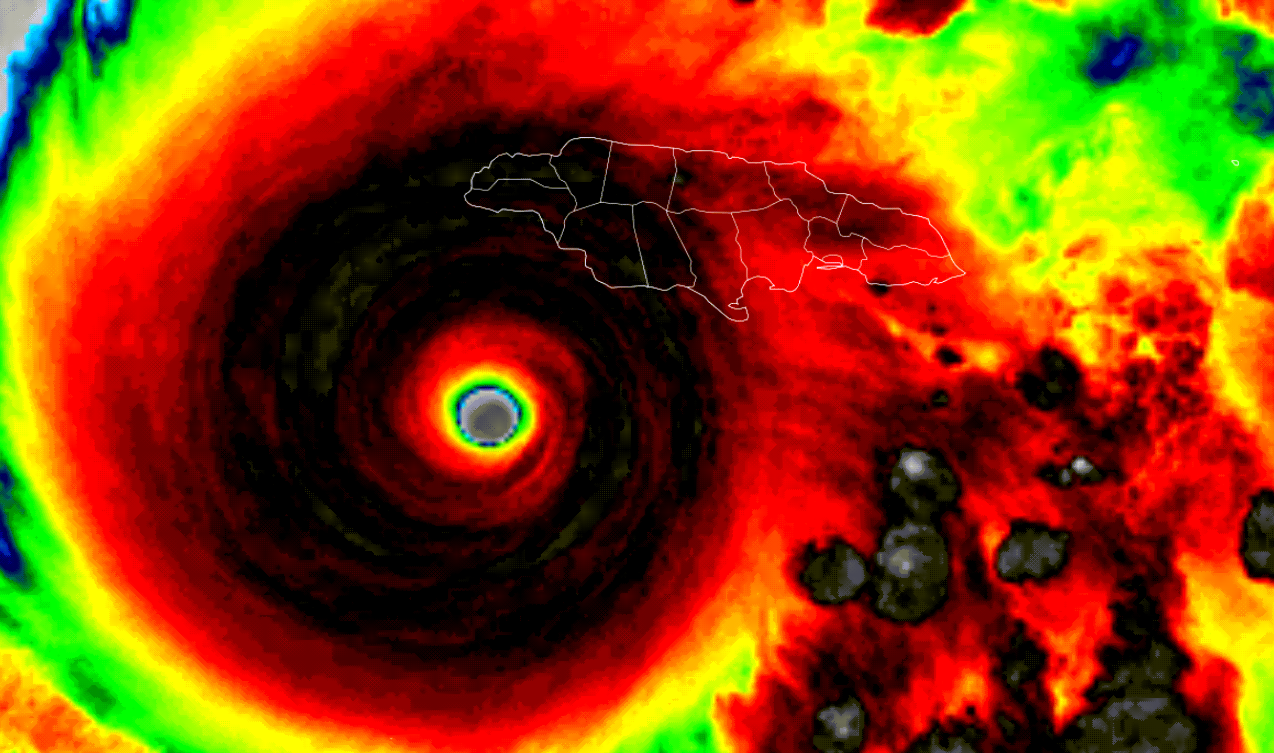
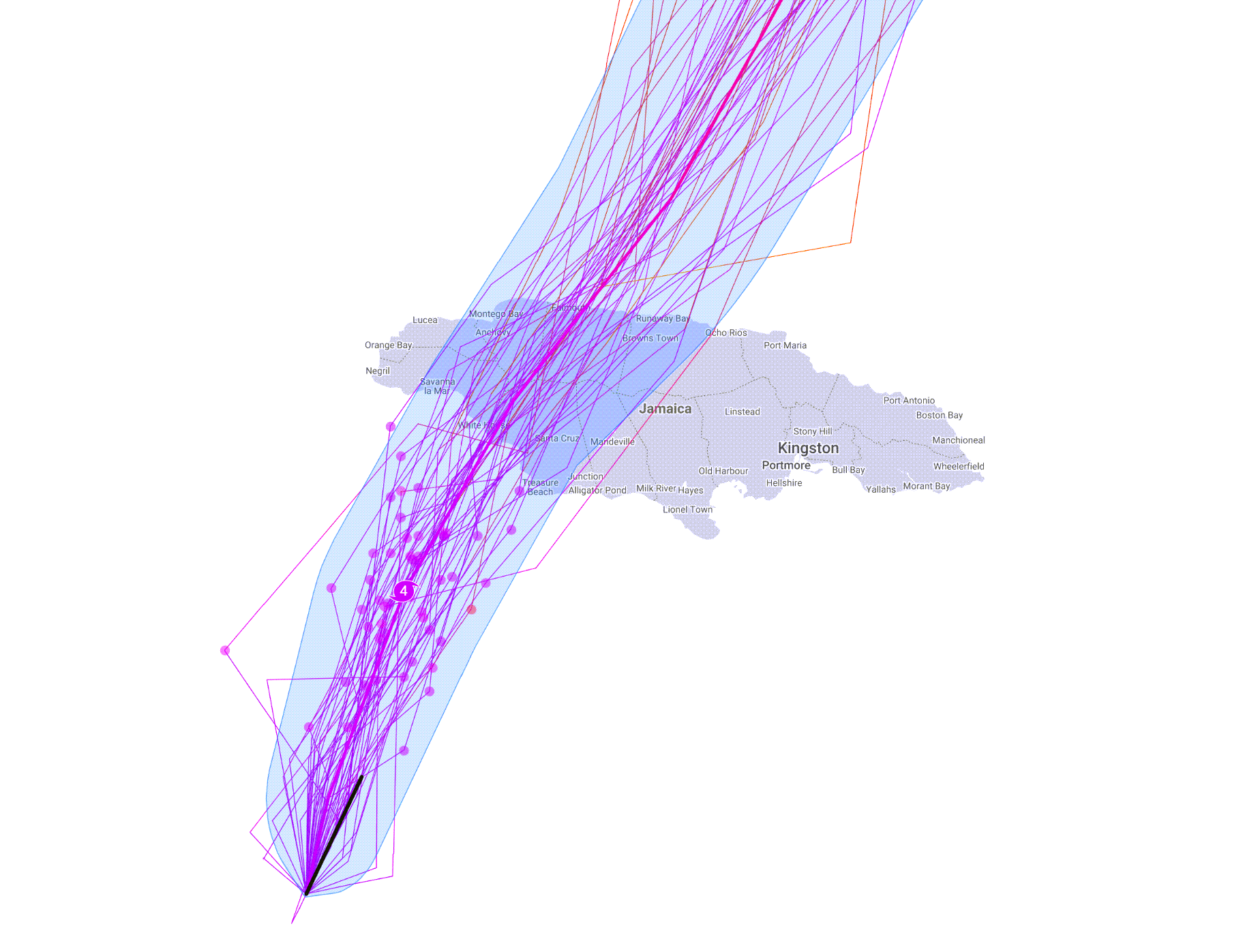
Hurricane Melissa
Jamaica and Cuba are going to need our prayers. Melissa is still a Category Five hurricane. Winds around 175 mph. Gusts are over 200 mph.
This will be the strongest hurricane to hit Jamaica in recorded history.
The worst of the storm will likely strike the central and western half of the country. It will then hit Cuba.
Monday morning satellite
.
The models were spot on with this hurricane. Google’s DeepMind model (AI) did exceptionally well.
It is incredible how far we have come in forecasting these events. This would not have been possible ten years ago.
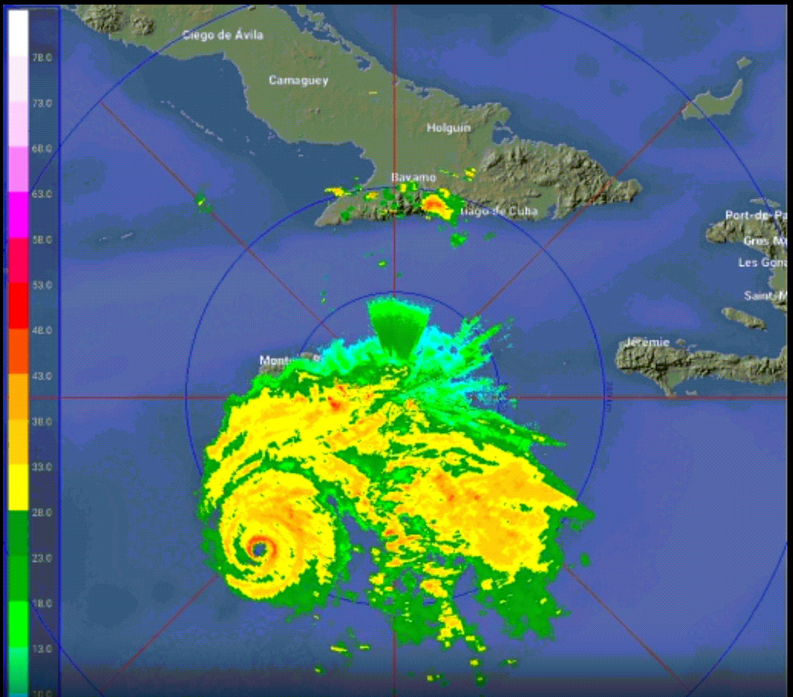
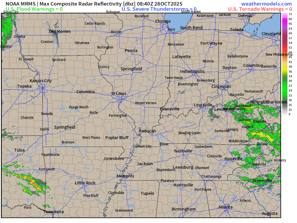
6 AM Radar
.
Today through Thursday.
Wet conditions redeveloping late today and tonight. Lingering into Wednesday night.
This is what radar looked like at 5:45 AM
You can see our next storm system approaching from the west. This will bring widespread rain to the region late today and tonight into Wednesday night. A few showers may linger into Thursday morning. Thursday may end up dry over much of the region. Perhaps some lingering showers over the Pennyrile area of western Kentucky.
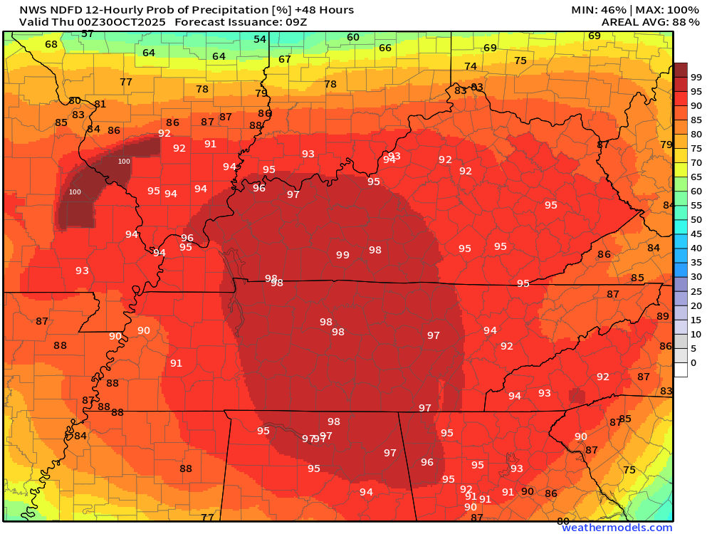
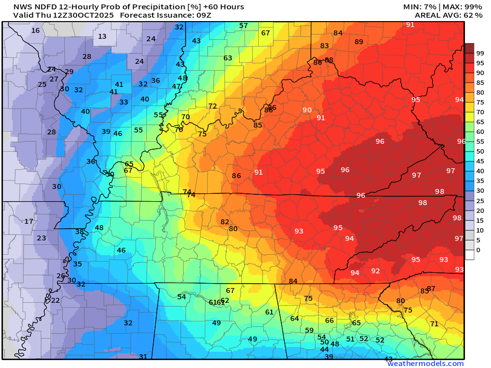
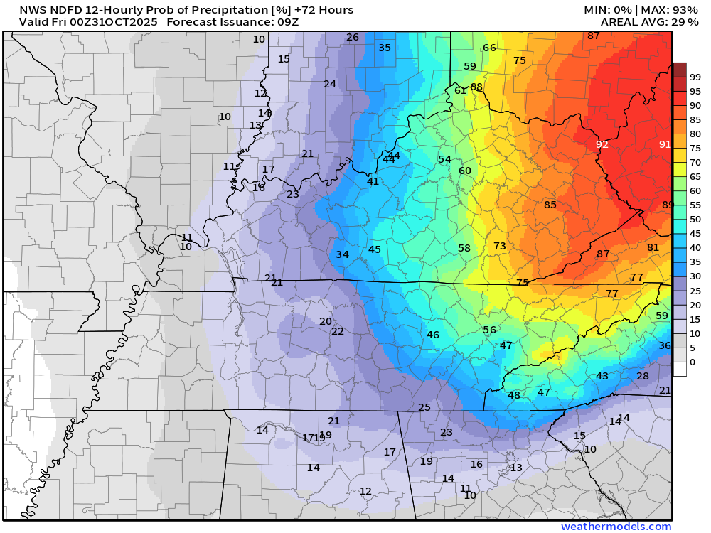
Scroll down to see the twelve-hour rain probabilities (% chances) from today through Thursday.
See the live radar links at the bottom of the blog.
.
Today will be cloudy and cool. Patchy light rain and drizzle. Patchy fog, as well. Mainly this morning.
It will be cool today. It will feel like autumn.
Shower chances will begin to increase late this afternoon over mainly southeast Missouri.
Widespread rain will develop tonight. Locally moderate rain. Winds will begin to pick up, as well.
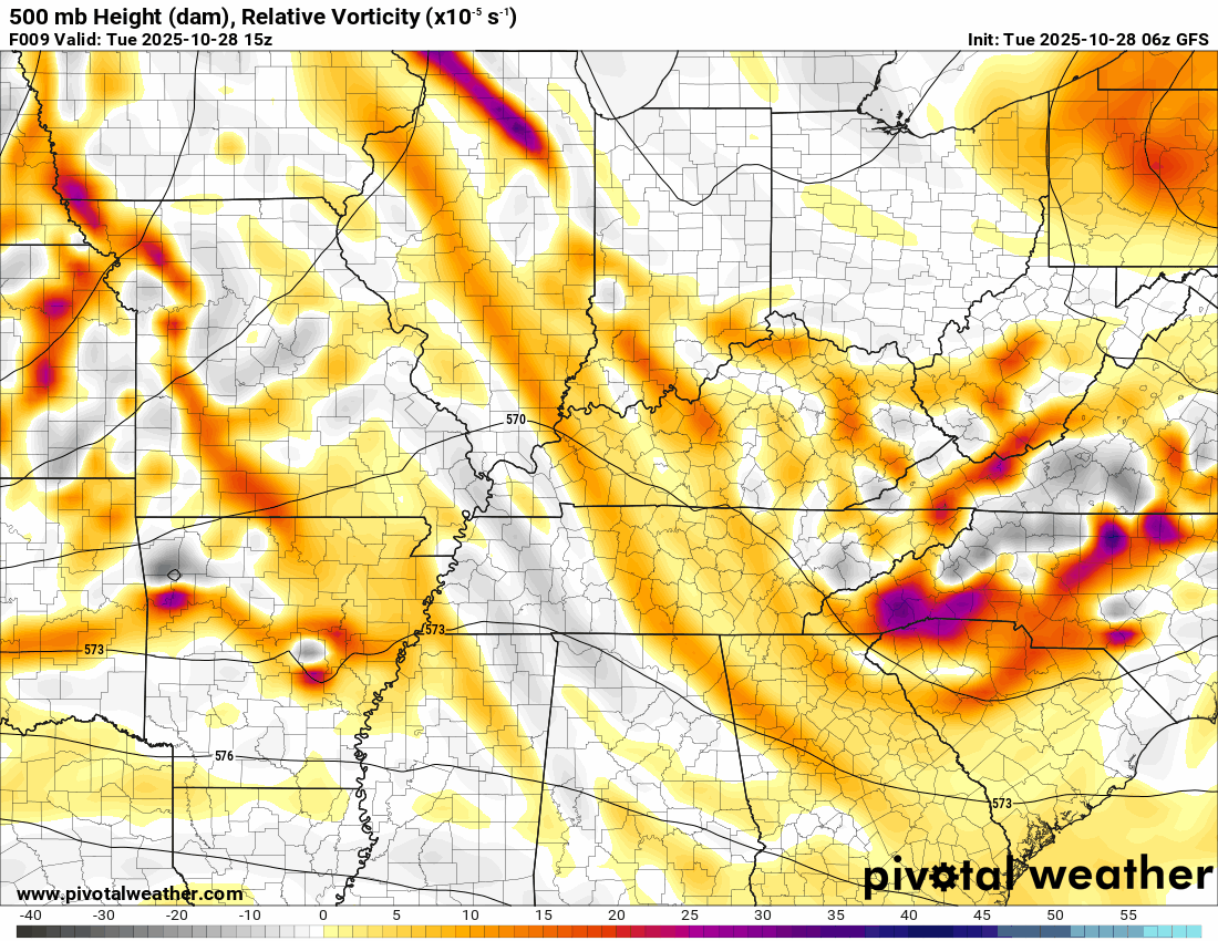
This will be in response to an area of low pressure that will deepen as it moves across our region.
This is what the upper-level 500 mb map looks like. You can see the low development on top of us and spin.
.
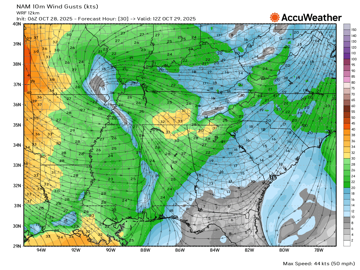
No severe thunderstorm concerns, thankfully.
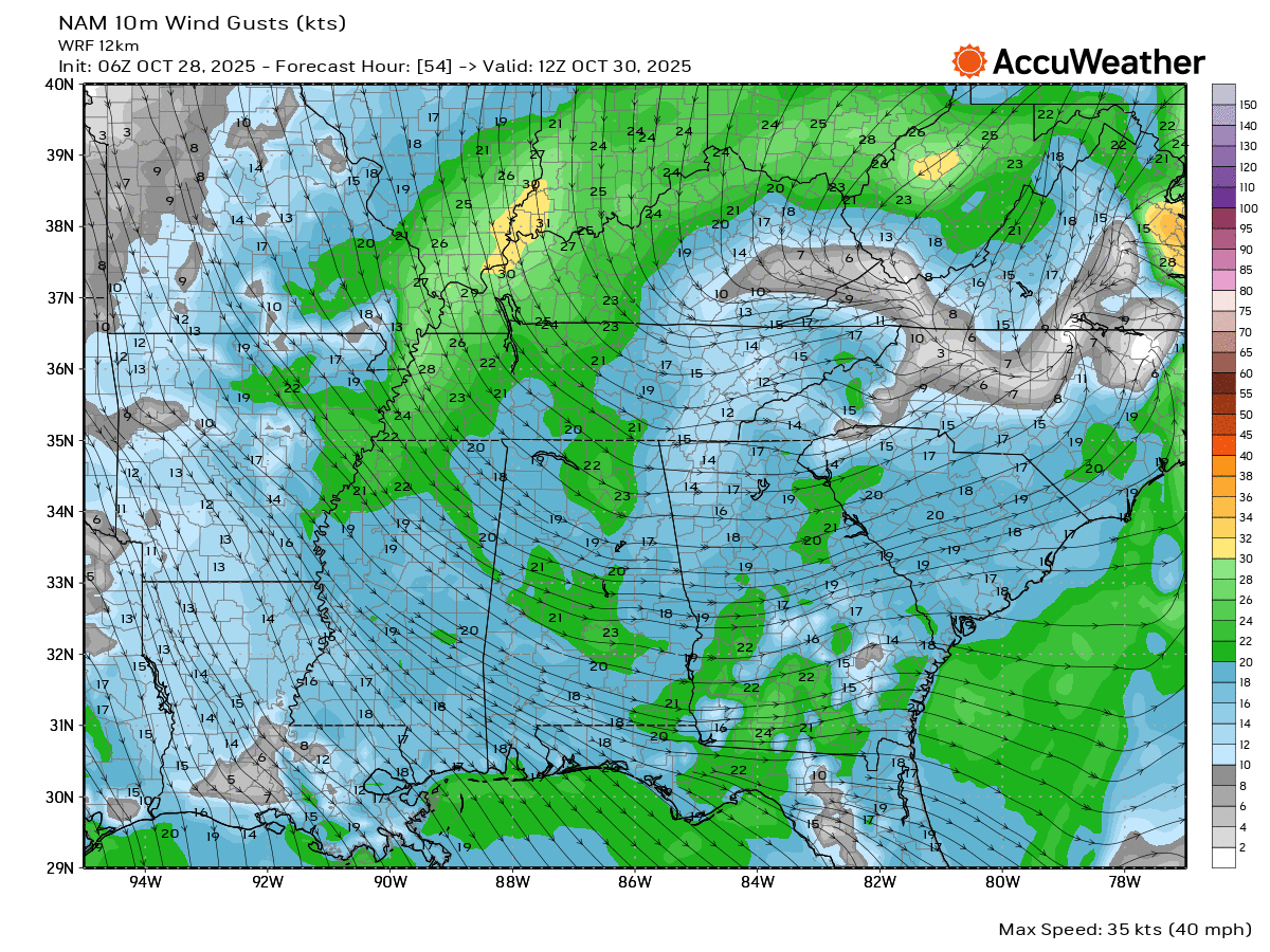
There will be some gusty winds over the coming days. This will be in response to the deepening low. Deepening low-pressure centers create wind.
Wednesday morning wind gusts.
Wednesday afternoon wind gusts.
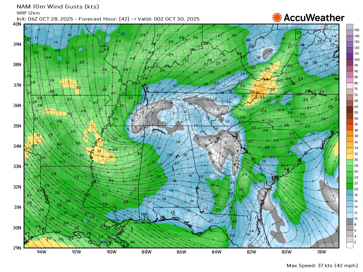
Wednesday night wind gusts.
.
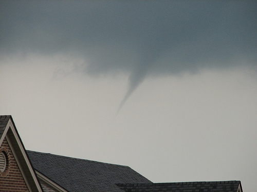
I can’t rule out some cold air funnels on Wednesday and Thursday. Probably no concerns about that today.
Cold air funnels typically are harmless. They rarely touch down. If they do touch down, then the damage is usually light. We don’t consider them a threat. Sort of a novelty.
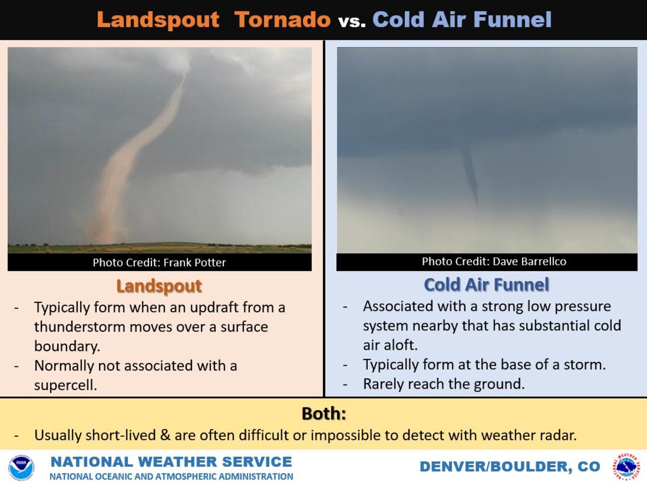
They usually look like this.
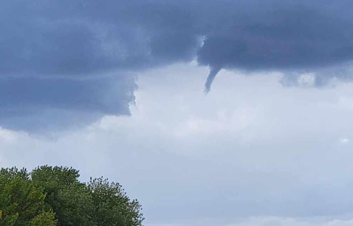
Or this
.
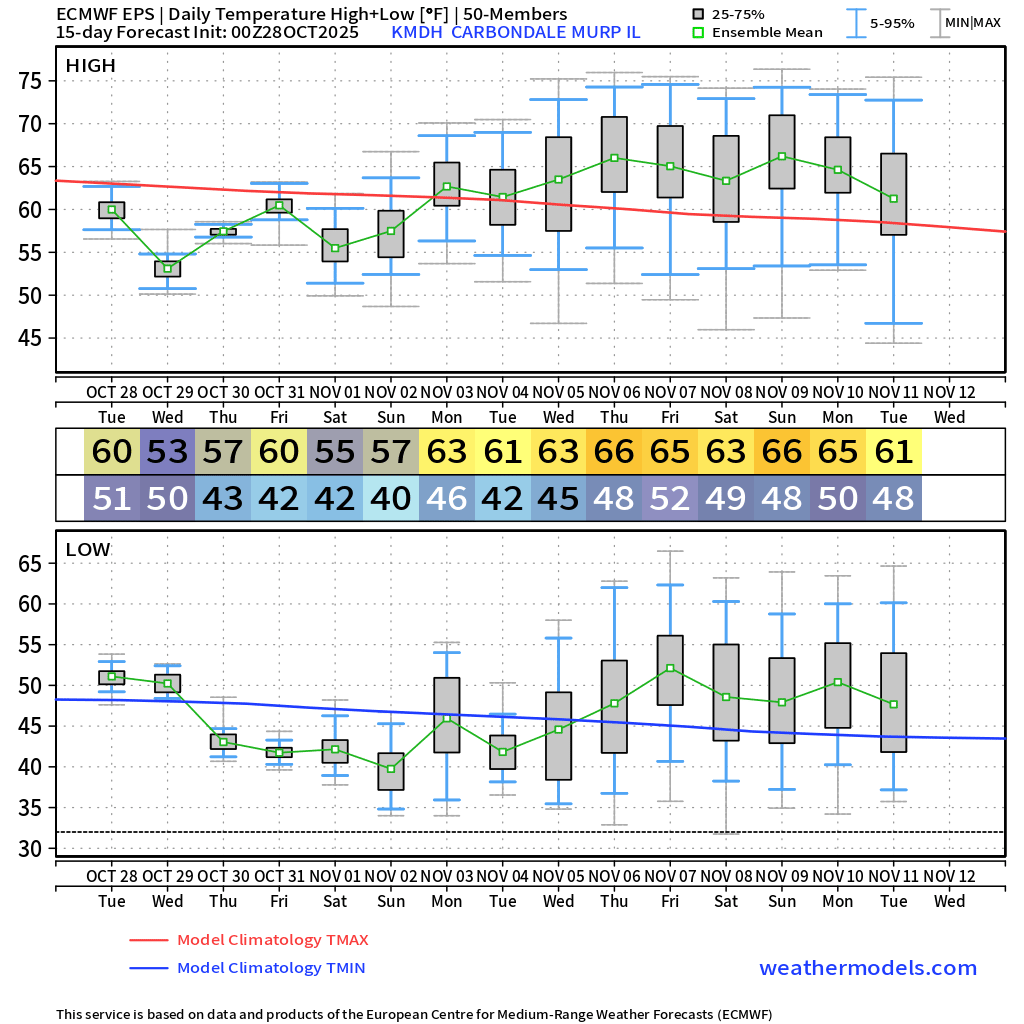
It will remain cool today and tomorrow (into the weekend). Below-average temperatures.
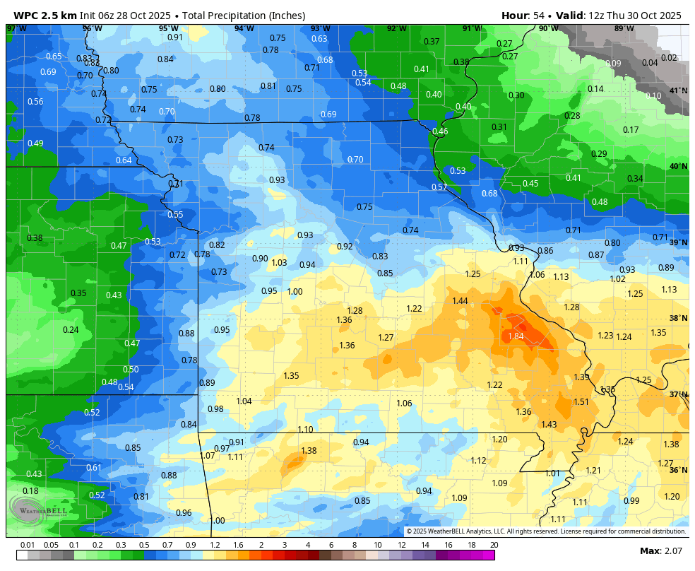
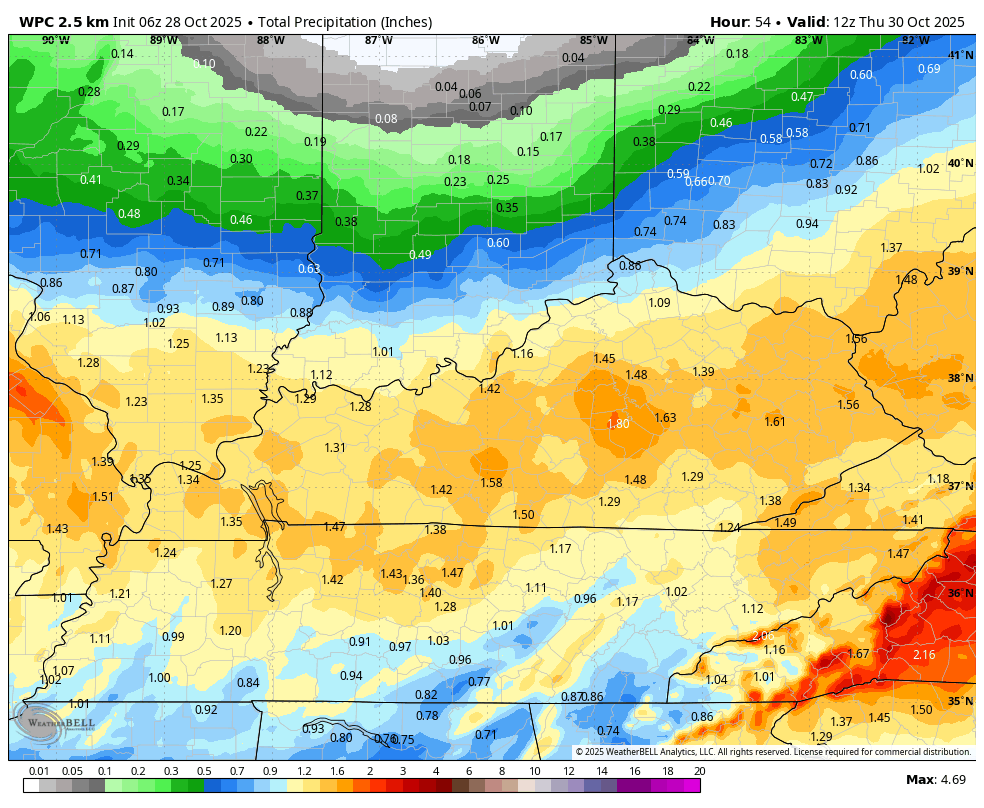
Let’s look at rainfall totals from today through Thursday. This is for the entire event.
Most of this will fall on Tuesday night into Wednesday. Locally moderate rain.
Western view. Double-click the image to enlarge it.
Eastern view
.
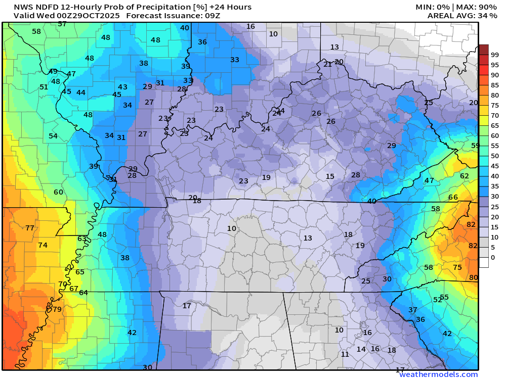
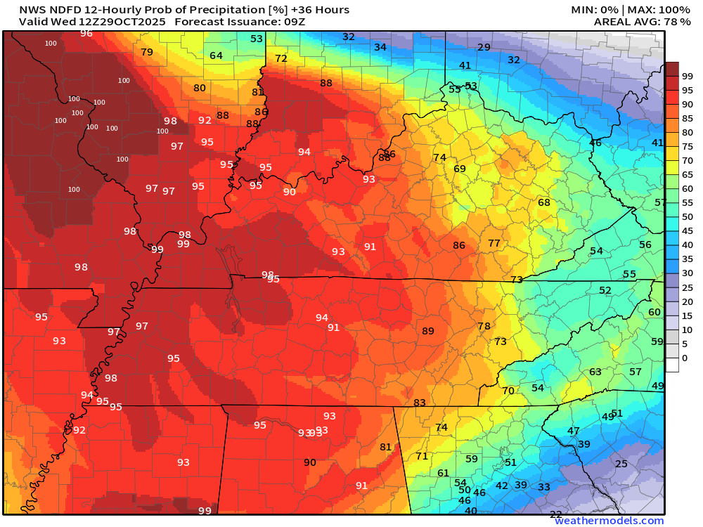
Let’s look at the rain probability graphics.
Tuesday 7 AM to Tuesday 7 PM
Tuesday 7 PM to Wednesday 7 AM
Friday through Sunday
Friday will be dry and cool. Highs will range from the upper 50s to the lower 60s. Evening temperatures will be in the 40s/50s. Lows will be in the 30s.
I can’t rule out frost on Friday and Saturday night. Depending on wind speeds.
There remain some questions about the low temperatures on Friday and Saturday night. Saturday night may be colder with low to mid-30s over my northern counties. That would likely be the central and northern portions of southern Illinois.
We will have a few clouds on Sunday. We do have a slight chance of showers on Sunday and Monday. For now, I capped those at 20%.
Cool temperatures into this weekend. Perhaps a bit warmer next week. No extremes.

.
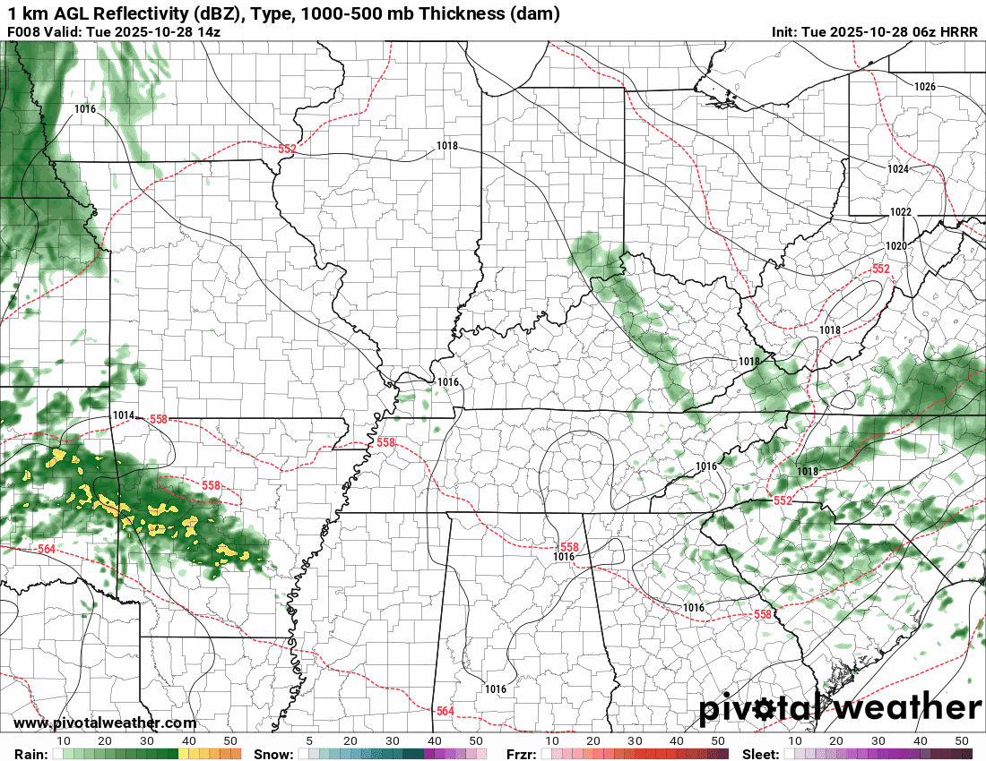
The timestamp (upper left) is in Zulu. 12z=7 am. 18z=1 pm. 00z=7 pm.
Double-click the animation to enlarge it.
Hrrr model
.
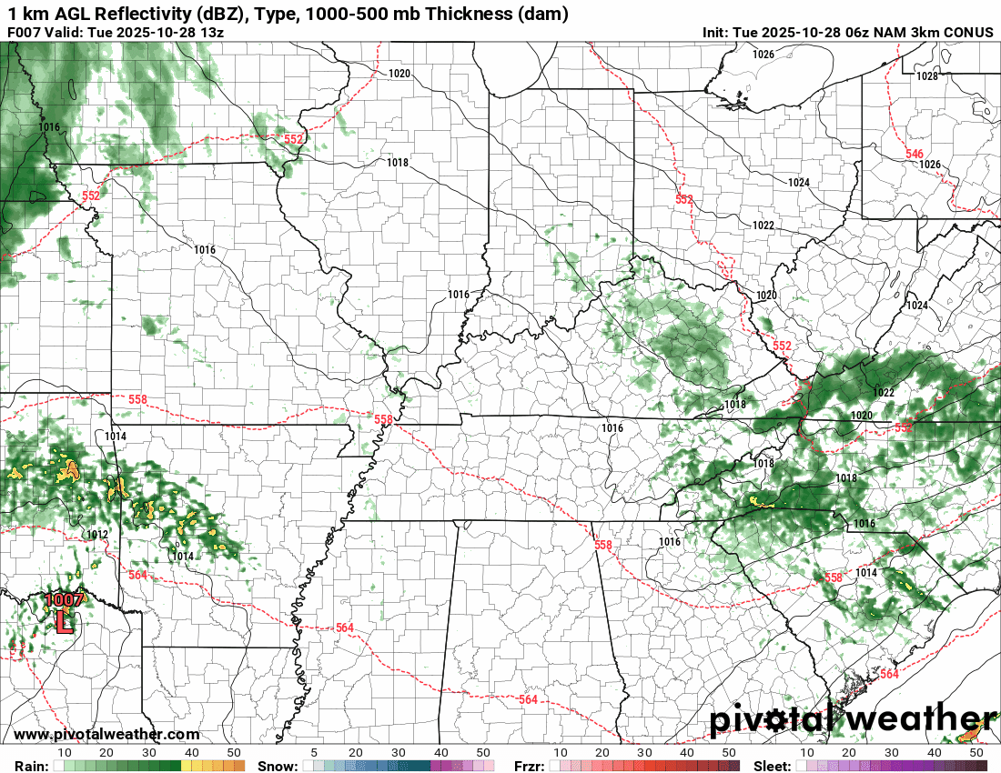
The timestamp (upper left) is in Zulu. 12z=7 am. 18z=1 pm. 00z=7 pm.
Double-click the animation to enlarge it.
NAM 3k model
.
..
.
Click here if you would like to return to the top of the page.
.Average high temperatures for this time of the year are around 68 degrees.
Average low temperatures for this time of the year are around 45 degrees.
Average precipitation during this time period ranges from 1.00″ to 1.25″
Six to Ten Day Outlook.
Blue is below average. Red is above average. The no color zone represents equal chances.
Average highs for this time of the year are in the lower 60s. Average lows for this time of the year are in the lower 40s.

Green is above average precipitation. Yellow and brown favors below average precipitation. Average precipitation for this time of the year is around one inch per week.

.

Average low temperatures for this time of the year are around 43 degrees.
Average precipitation during this time period ranges from 1.00″ to 1.25″
.
Eight to Fourteen Day Outlook.
Blue is below average. Red is above average. The no color zone represents equal chances.

Green is above average precipitation. Yellow and brown favors below average precipitation. Average precipitation for this time of the year is around one inch per week.

.
.
.
We have a new service to complement your www.weathertalk.com subscription. This does NOTreplace www.weathertalk.com It is simply another tool for you to receive severe weather information.
.
https://weathercallservices.com/beau-dodson-weather


Want to receive the daily forecast/other products on your Beau Dodson Weather app?
Did you know you have four options in your www.weathertalk.com account
You will then receive these via your Beau Dodson Weather app.
Just log into your www.weathertalk.com account
Click the NOTIFICATION SETTINGS TAB
Then, turn them on (green) and off (red)
🌪️ Number 1 is the most important one. Severe alerts, tornado alerts, and so on.
Number 2 is the daily video, blog, livestream alerts, and severe weather Facebook threads on severe days or winter storm days.
Number 3 is the daily forecast. I send that out every day during the afternoon hours. It is the seven-day forecast, hazardous weather outlook, fire outlook, and more.
Number 4 is to receive the daily video, blog, and other content on NON-severe weather days (every day without severe threats in other words)
GREEN IS ON
RED IS OFF

I am going to start going live during bigger severe weather events.
Check it out here https://www.youtube.com/user/beaudodson
Click the subscribe button (it’s a free subscription button), and it will alert you when I go live. I will also send out alerts to the app when I go live for an event.

.

Radars and Lightning Data
Interactive-city-view radars. Clickable watches and warnings.
https://wtalk.co/B3XHASFZ
Old legacy radar site (some of you like it better)
https://weatherobservatory.com/weather-radar.htm
If the radar is not updating then try another one. If a radar does not appear to be refreshing then hit Ctrl F5. You may also try restarting your browser.
Backup radar site in case the above one is not working.
https://weathertalk.com/morani
Regional Radar
https://imagery.weathertalk.com/prx/RadarLoop.mp4
** NEW ** Zoom radar with chaser tracking abilities!
ZoomRadar
If the radar is not working, then email me: Email me at beaudodson@usawx.com
.
We do have some sponsors! Check them out.
Roof damage from recent storms? Link – Click here
INTEGRITY ROOFING AND EXTERIORS!
⛈️ Roof or gutter damage from recent storms? Today’s weather is sponsored by Integrity Roofing. Check out their website at this link https://www.ourintegritymatters.com/

![]()
![]()
![]()
Make sure you have three to five ways of receiving your severe weather information.
Weather Talk is one of those ways! Now, I have another product for you and your family.

.
Want to add more products to your Beau Dodson Weather App?
Receive daily videos, weather blog updates on normal weather days and severe weather and winter storm days, your county by county weather forecast, and more!
Here is how to do add those additional products to your app notification settings!
Here is a video on how to update your Beau Dodson Weather payment.
The app is for subscribers. Subscribe at www.weathertalk.com/welcome then go to your app store and search for WeatherTalk
Subscribers, PLEASE USE THE APP. ATT and Verizon are not reliable during severe weather. They are delaying text messages.
The app is under WeatherTalk in the app store.

Apple users click here

Android users click here
.
Radars and Lightning Data
Interactive-city-view radars. Clickable watches and warnings.
https://wtalk.co/B3XHASFZ
Old legacy radar site (some of you like it better)
https://weatherobservatory.com/weather-radar.htm
If the radar is not updating then try another one. If a radar does not appear to be refreshing then hit Ctrl F5. You may also try restarting your browser.
Backup radar site in case the above one is not working.
https://weathertalk.com/morani
Regional Radar
https://imagery.weathertalk.com/prx/RadarLoop.mp4
** NEW ** Zoom radar with chaser tracking abilities!
ZoomRadar
Lightning Data (zoom in and out of your local area)
https://wtalk.co/WJ3SN5UZ
Not working? Email me at beaudodson@usawx.com
National map of weather watches and warnings. Click here.
Storm Prediction Center. Click here.
Weather Prediction Center. Click here.
.

Live lightning data: Click here.
Real time lightning data (another one) https://map.blitzortung.org/#5.02/37.95/-86.99
Our new Zoom radar with storm chases
.
.

Interactive GOES R satellite. Track clouds. Click here.
GOES 16 slider tool. Click here.
College of DuPage satellites. Click here
.

Here are the latest local river stage forecast numbers Click Here.
Here are the latest lake stage forecast numbers for Kentucky Lake and Lake Barkley Click Here.
.
.
Find Beau on Facebook! Click the banner.


 .
.