Sunday, October 26, 2025
A quick morning update.
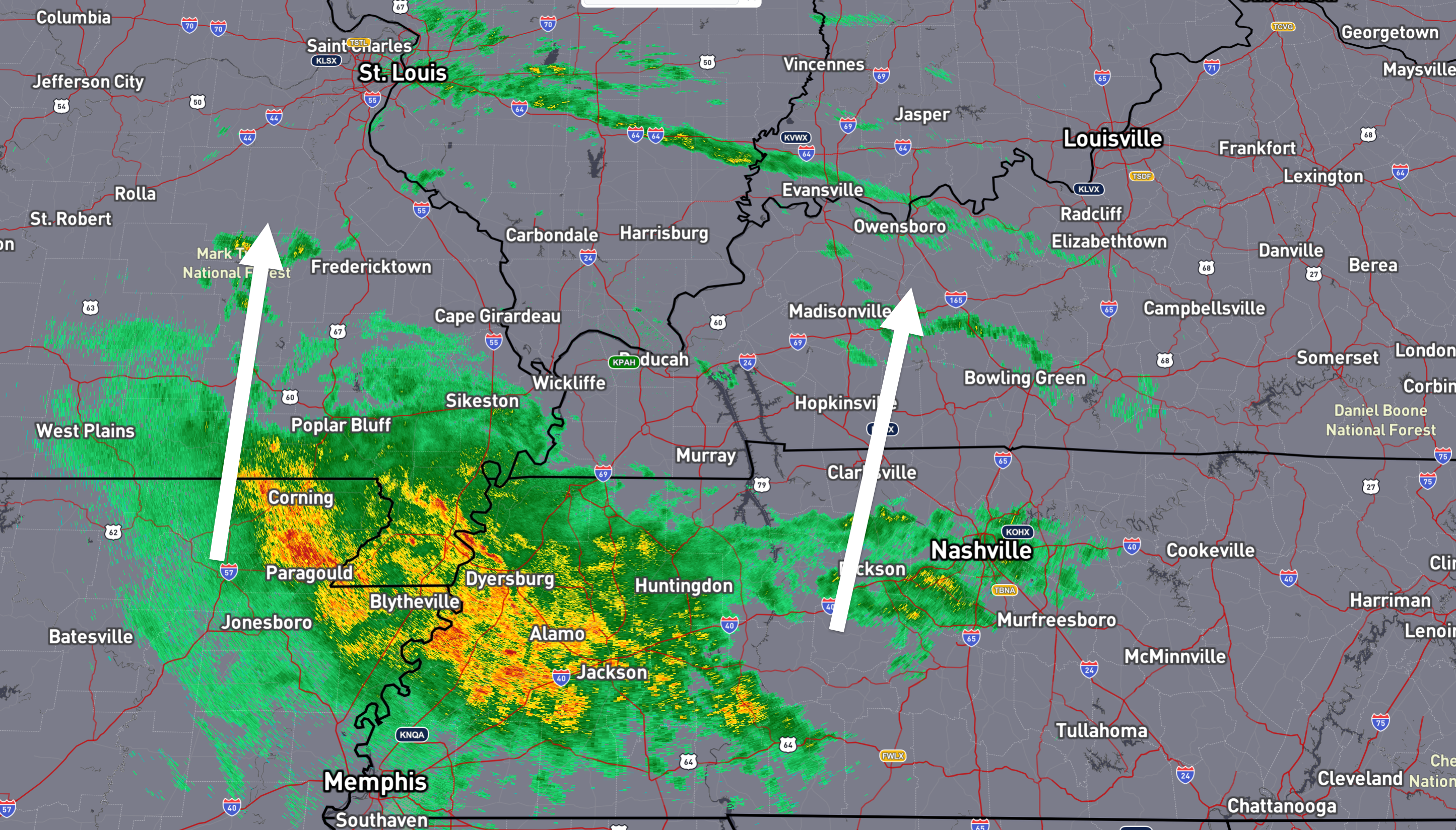
Rain is moving across the region. It is moving in from the south southwest. It will take a few hours to reach our northern and northeastern counties.
6:30 AM radar snapshot
.
Rain totals will be higher south vs north.
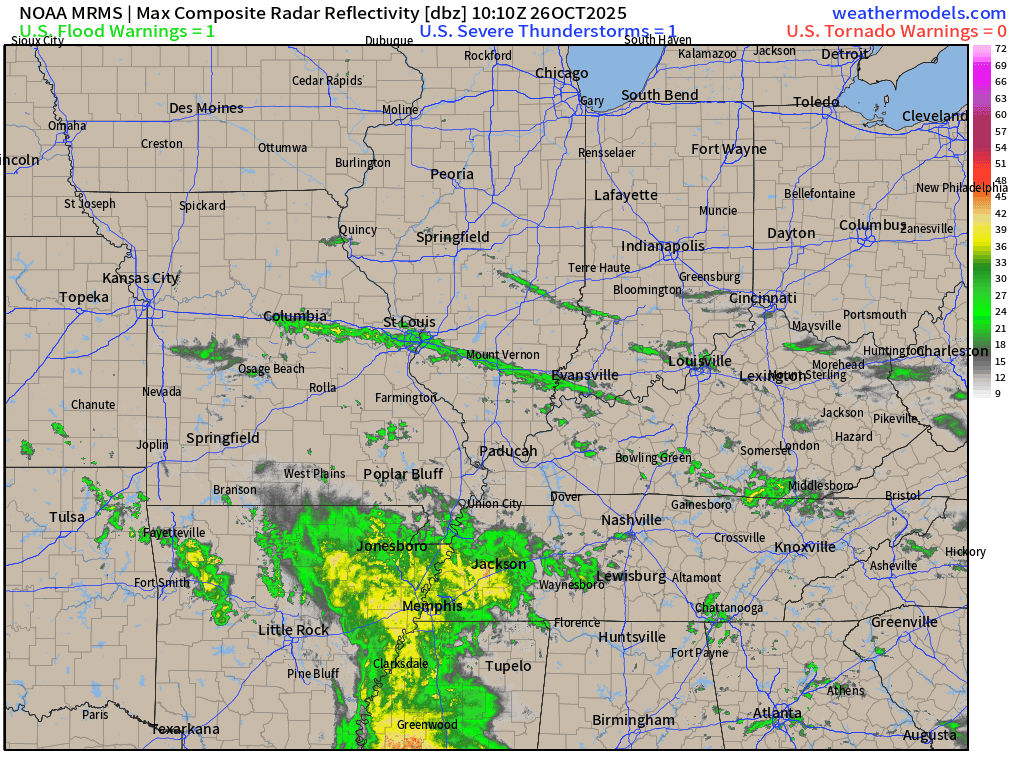
Here is what the 6:30 AM radar animation looked like. See the live radar links further down in the blog.
.
Video update
..
Here is your graphic-cast


.
Sunday’s Rain Update.
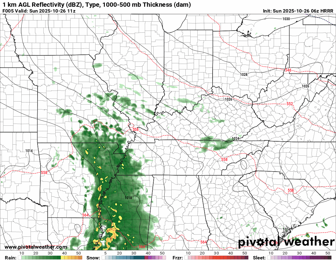
Let’s look at future-cast radar for today into tomorrow.
You can see how the rain spreads east-northeast, but it weakens over time. There is quite a bit of dry air to the north, and that eats into the system.
The timestamp (upper left) is in Zulu. 12z=7 am. 18z=1 pm. 00z=7 pm.
Double-click the animation to enlarge it.
Hrrr model
.
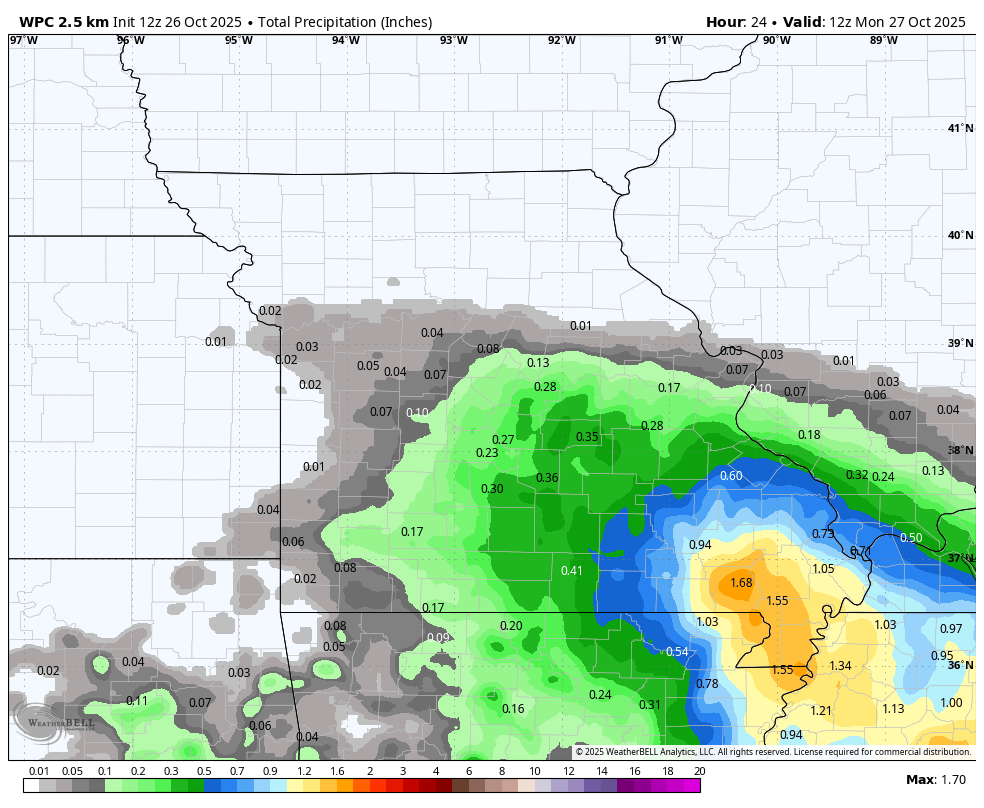
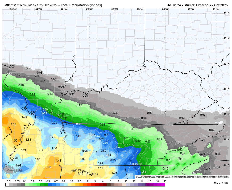
Let’s look at rainfall totals for the upcoming week.
The first two graphics show you the potential rainfall totals from 7 AM today to 7 AM Monday.
Additional showers are likely later this week (mainly on Tuesday/Wednesday). Moderate rain is expected with that event. Gusty winds, as well.
The general theme continues. More rain south-southwest. Less north-northeast.
.
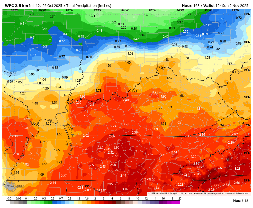
These next two graphics show you the weekly rainfall totals. From today through Thursday.
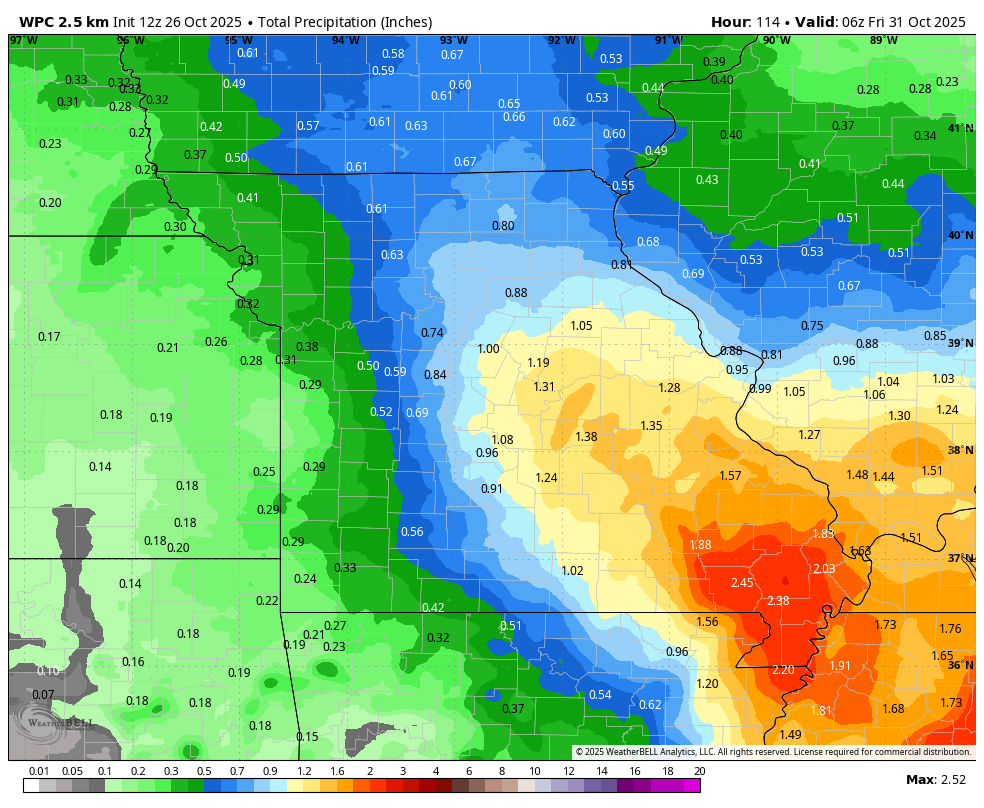
Eastern view
.
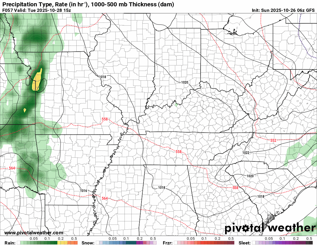
As mentioned, there will be another chance of rain on Tuesday and Wednesday.
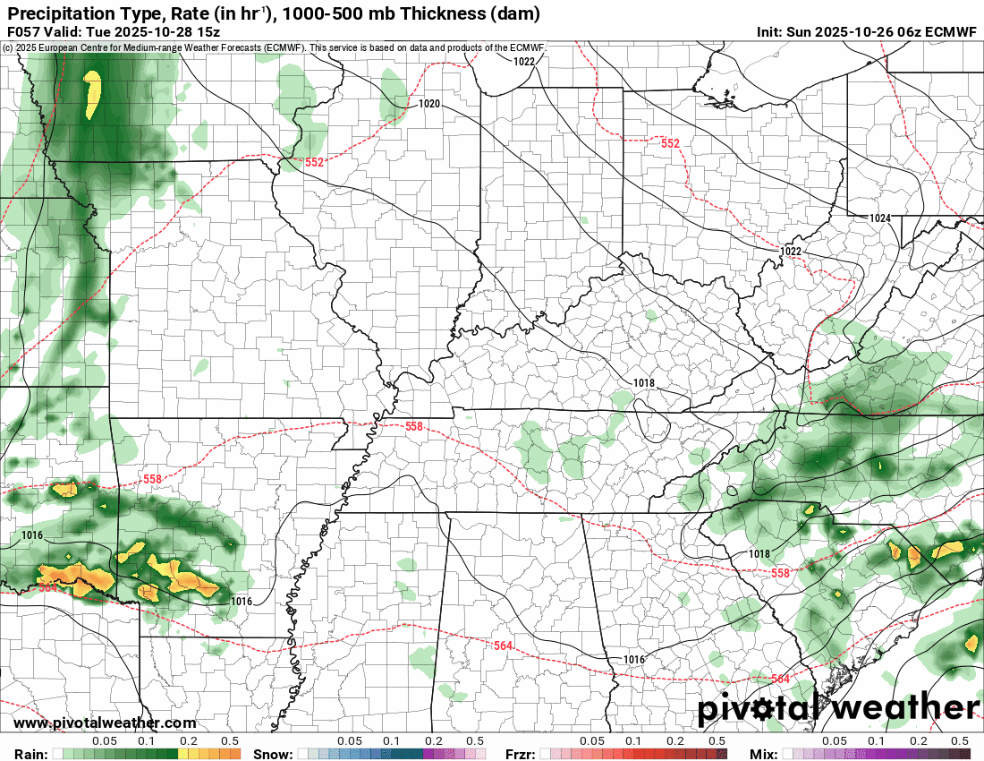
Let’s look at some future-cast radars for that event. This system winds up nicely across our region. Deepening with time. If this were winter, then this would be a significant winter storm!
Most of the rain from that system will arrive on Tuesday afternoon and night. It will continue to spin across our region into Wednesday night. Perhaps a few showers early on Thursday.
The timestamp (upper left) is in Zulu. 12z=7 am. 18z=1 pm. 00z=7 pm.
Double-click the animation to enlarge it.
GFS model
.
The timestamp (upper left) is in Zulu. 12z=7 am. 18z=1 pm. 00z=7 pm.
Double-click the animation to enlarge it.
EC model
.
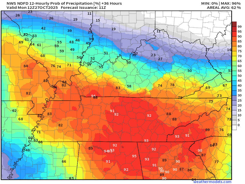
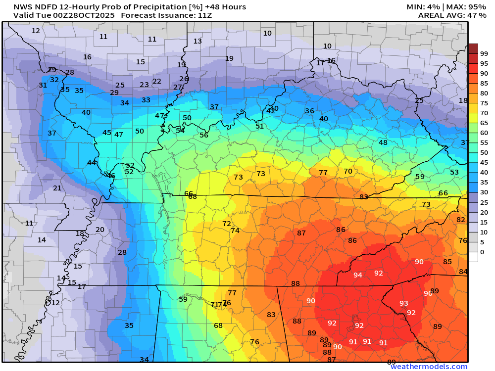
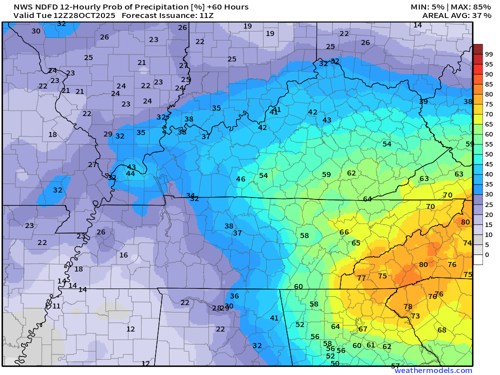
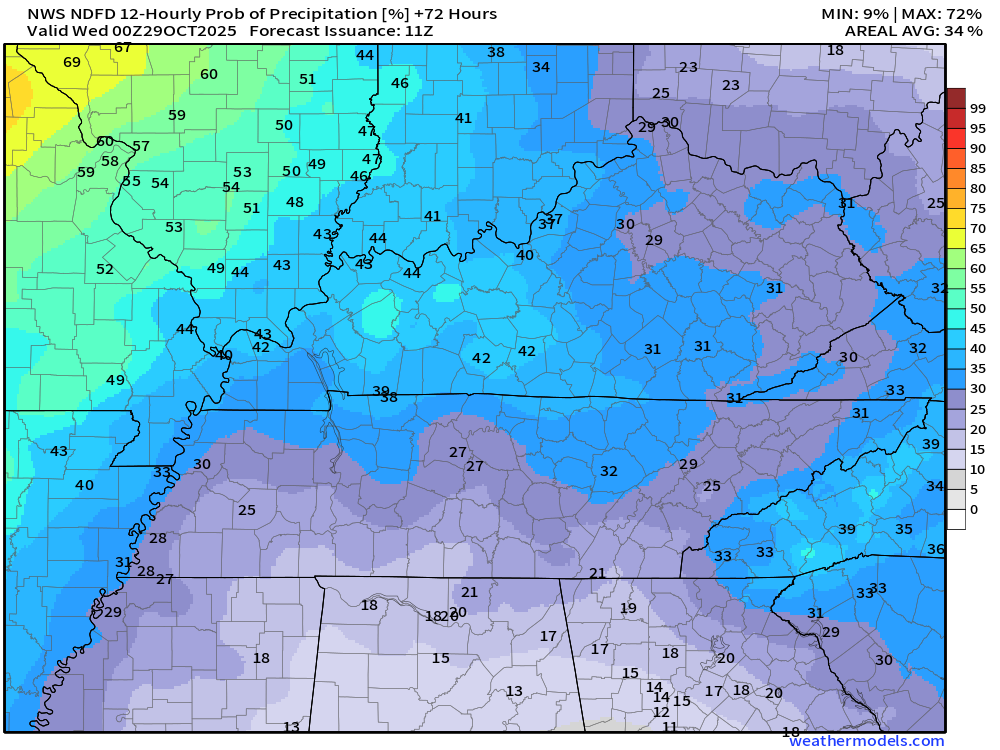
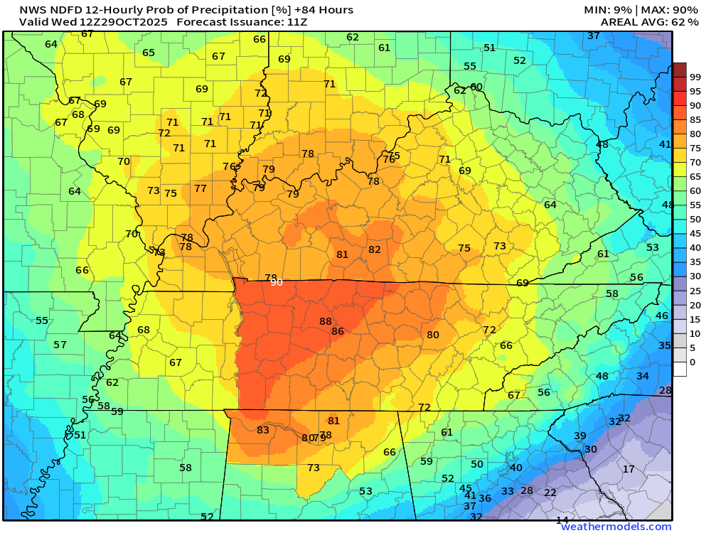
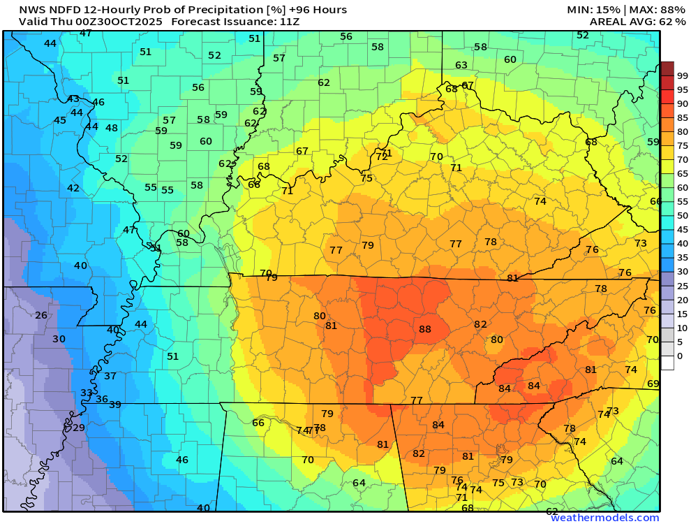
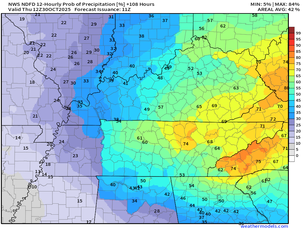
Let’s break down the rain probabilities via a few graphics. This will show you the probability (% chance) of rain for each twelve-hour period of time.
You can double-click on the graphics to enlarge them.
7 AM this morning to 7 PM tonight
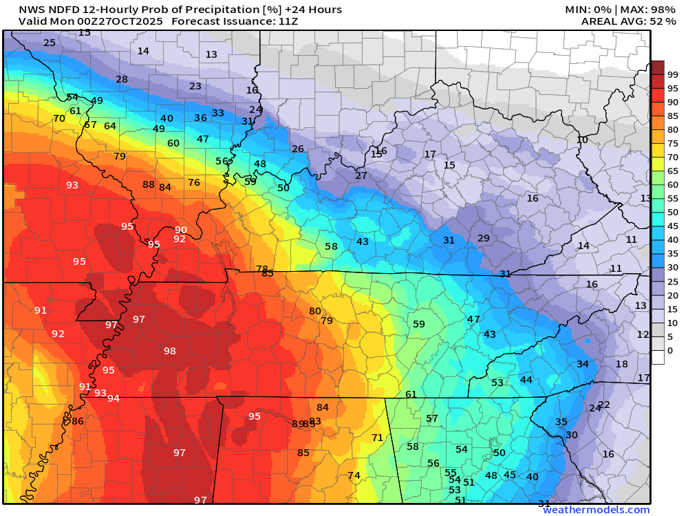
7 PM tonight to 7 AM Monday
.
7 AM Monday to 7 PM Monday night
.
7 PM Monday to 7 AM Tuesday
.
7 AM Tuesday to 7 PM Tuesday
.
7 PM Tuesday night to 7 AM Wednesday
.
7 AM Wednesday to 7 PM Wednesday
.
7 PM Wednesday to 7 AM Thursday
.
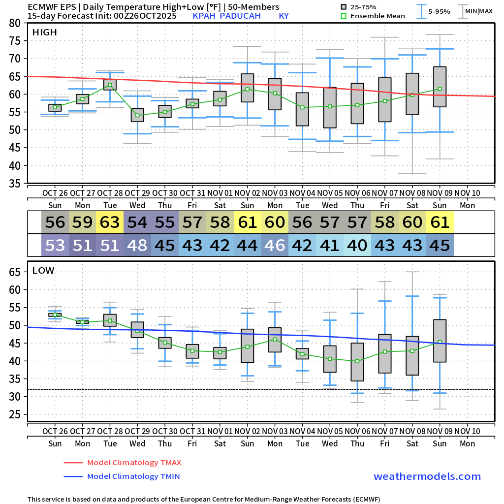
Temperatures over the next ten days will be near or below average.
Here is what the EC ensemble temperature chart looks like. This is the average of 100+ models.
Autumn air!
.

Radars and Lightning Data
Interactive-city-view radars. Clickable watches and warnings.
https://wtalk.co/B3XHASFZ
Old legacy radar site (some of you like it better)
https://weatherobservatory.com/weather-radar.htm
If the radar is not updating then try another one. If a radar does not appear to be refreshing then hit Ctrl F5. You may also try restarting your browser.
Backup radar site in case the above one is not working.
https://weathertalk.com/morani
Regional Radar
https://imagery.weathertalk.com/prx/RadarLoop.mp4
** NEW ** Zoom radar with chaser tracking abilities!
ZoomRadar
If the radar is not working, then email me: Email me at beaudodson@usawx.com
.
We do have some sponsors! Check them out.
Roof damage from recent storms? Link – Click here
INTEGRITY ROOFING AND EXTERIORS!
⛈️ Roof or gutter damage from recent storms? Today’s weather is sponsored by Integrity Roofing. Check out their website at this link https://www.ourintegritymatters.com/

![]()
![]()