Saturday, October 25, 2025
6 AM Update
.
Video update
..
Today will deliver intervals of clouds. Perhaps a sprinkle, but nothing of concern.
Here is your graphic-cast


.
Sunday’s Rain Update.
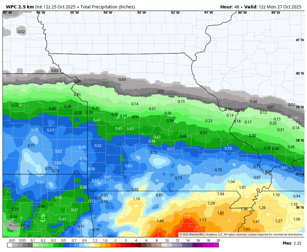
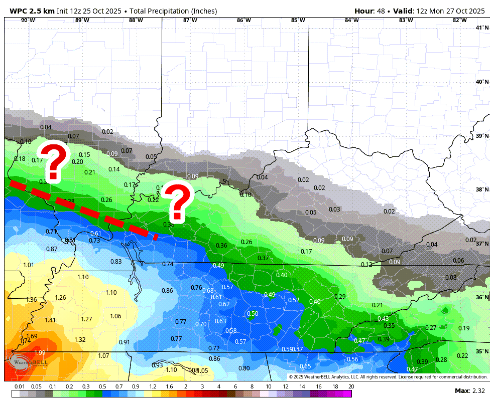
The first two graphics show you the potential rainfall totals from 7 AM Sunday to 7 AM Monday.
Additional showers are likely later this week (mainly on Tuesday/Wednesday).
The general theme continues. More rain south-southwest. Less north-northeast.
There remain questions about the northeast few rows of counties.
The bulk of the rain will move into southeast Missouri during the mid- and late-morning hours on Sunday.
The trend overnight is to slow the system by a few hours.
It will slowly spread northeast. Areas north and northeast of the red dotted line may not see much rain during the daytime hours on Sunday with this event. There remain questions.
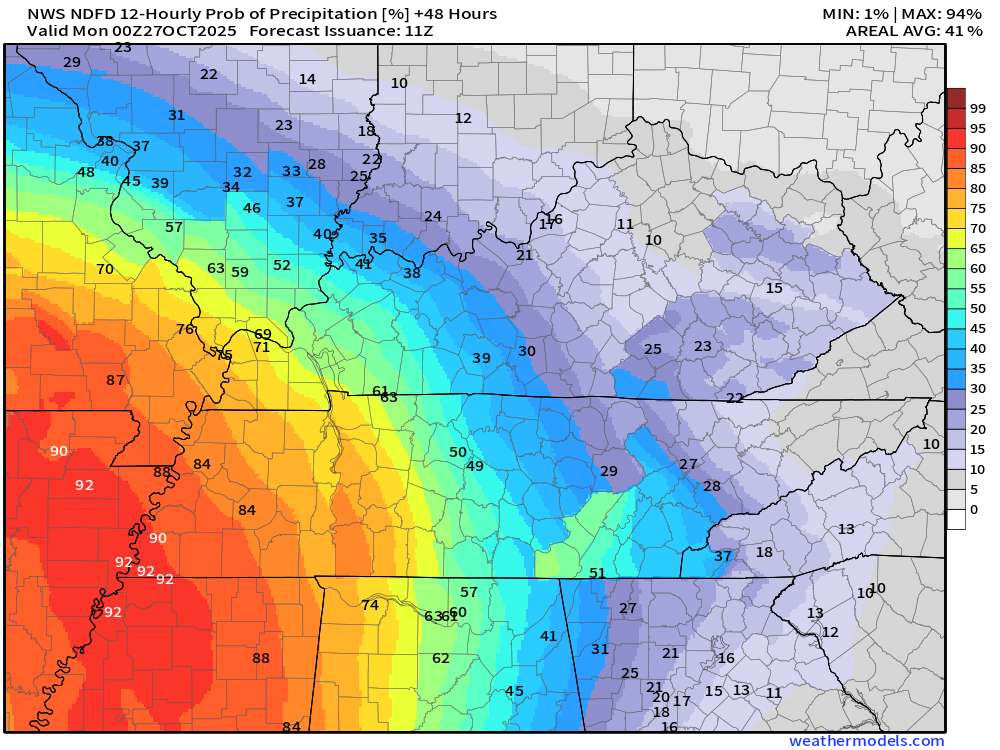
The third graphic is the rain probability (% chance) from 7 AM Sunday to 7 PM Sunday.
Sunday rain probabilities from 7 AM to 7 PM
.
There will be another chance of rain on Tuesday and Wednesday.
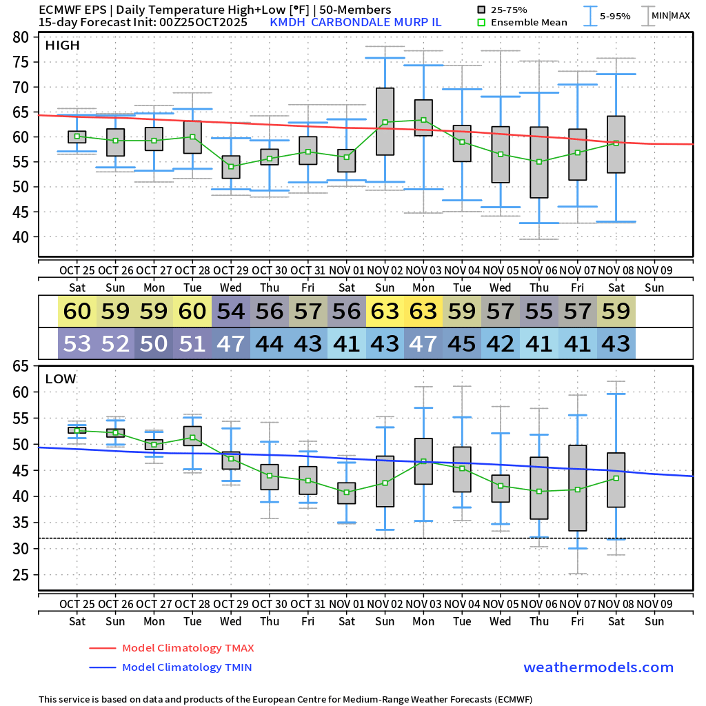
Temperatures over the next ten days will be near or below average.
Here is what the EC ensemble temperature chart looks like. This is the average of 100+ models.
Autumn air!
.
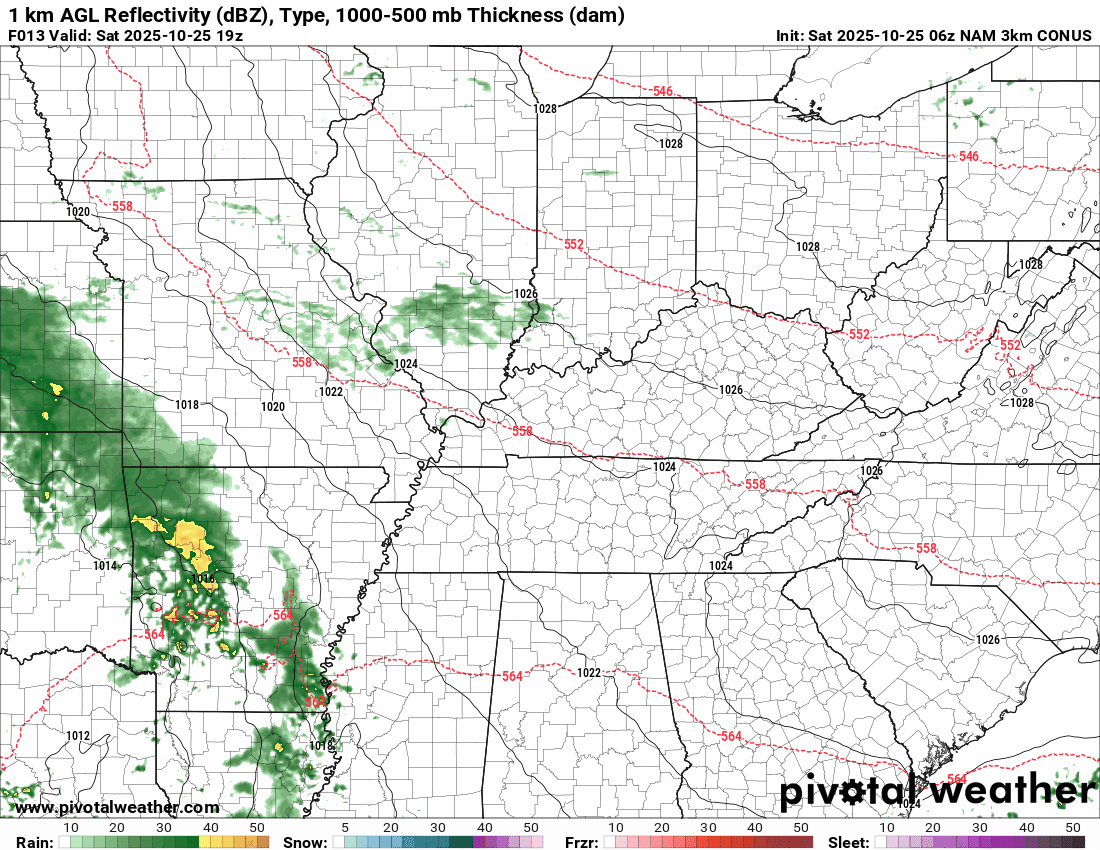
Here is the NAM future-cast radar. Again, we will just have to monitor the northeast side of this system.
The timestamp (upper left) is in Zulu. 12z=7 am. 18z=1 pm. 00z=7 pm.
Double-click the animation to enlarge it.
NAM model
.

Radars and Lightning Data
Interactive-city-view radars. Clickable watches and warnings.
https://wtalk.co/B3XHASFZ
Old legacy radar site (some of you like it better)
https://weatherobservatory.com/weather-radar.htm
If the radar is not updating then try another one. If a radar does not appear to be refreshing then hit Ctrl F5. You may also try restarting your browser.
Backup radar site in case the above one is not working.
https://weathertalk.com/morani
Regional Radar
https://imagery.weathertalk.com/prx/RadarLoop.mp4
** NEW ** Zoom radar with chaser tracking abilities!
ZoomRadar
If the radar is not working, then email me: Email me at beaudodson@usawx.com
.
We do have some sponsors! Check them out.
Roof damage from recent storms? Link – Click here
INTEGRITY ROOFING AND EXTERIORS!
⛈️ Roof or gutter damage from recent storms? Today’s weather is sponsored by Integrity Roofing. Check out their website at this link https://www.ourintegritymatters.com/

![]()
![]()