

.
I have some question-and-answer threads over on the Facebook page. Link to those threads CLICK HERE
Or email me at beaudodsonweather@gmail.com
..

🌪️ Seven-Day Tornado Outlook ⛈️
August 12th through August 18th
Current risk: NONE.
Current confidence level: High confidence in the forecast.
Comments: We are not anticipating tornadoes.
.

Seven-Day Hazardous Weather Outlook
1. Is lightning in the forecast? YES. Scattered lightning will be possible this week. Primarily today, tomorrow, and Thursday. Lower chances Friday through Monday.
2. Are organized severe thunderstorms in the forecast? UNLIKELY. Thunderstorms, during the summer months, can produce isolated gusty winds. Organized severe weather is not anticipated. You can never rule out an isolated severe thunderstorm warning during the summer months (for downburst winds).
3. Is flash flooding in the forecast? LOW RISK. Slow-moving summer storms can produce isolated torrential downpours that can briefly flood ditches and roadways. Organized or widespread flash flooding is not anticipated. Isolated issues are possible.
4. Will non-thunderstorm winds top 40 mph? NO.
5. Will temperatures rise above 90 degrees? YES. Today through next Tuesday.
6. Will temperatures rise above 100 degrees? NO.
7. Will the heat index (feels like) rise above 100 degrees? YES. Heat index values will likely exceed 100 degrees by Friday, Saturday, Sunday, and Monday. I will monitor next Tuesday.
8. Will the heat index rise above 115 degrees? NO.
.
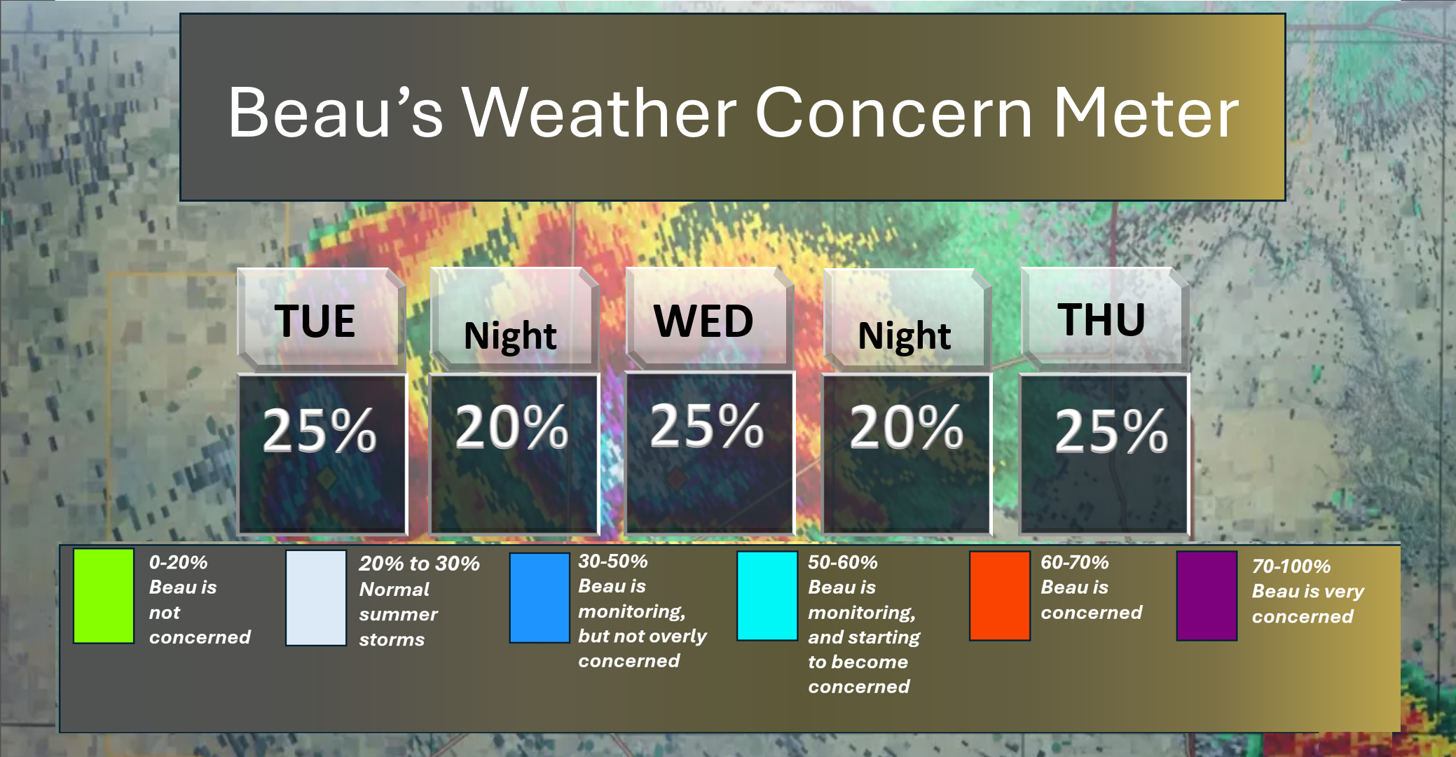
Here is the short-range concern meter. Just normal summer thunderstorms.
Keep in mind that typical August/summer thunderstorms can produce isolated heavy rain, lightning, and gusty winds.
.
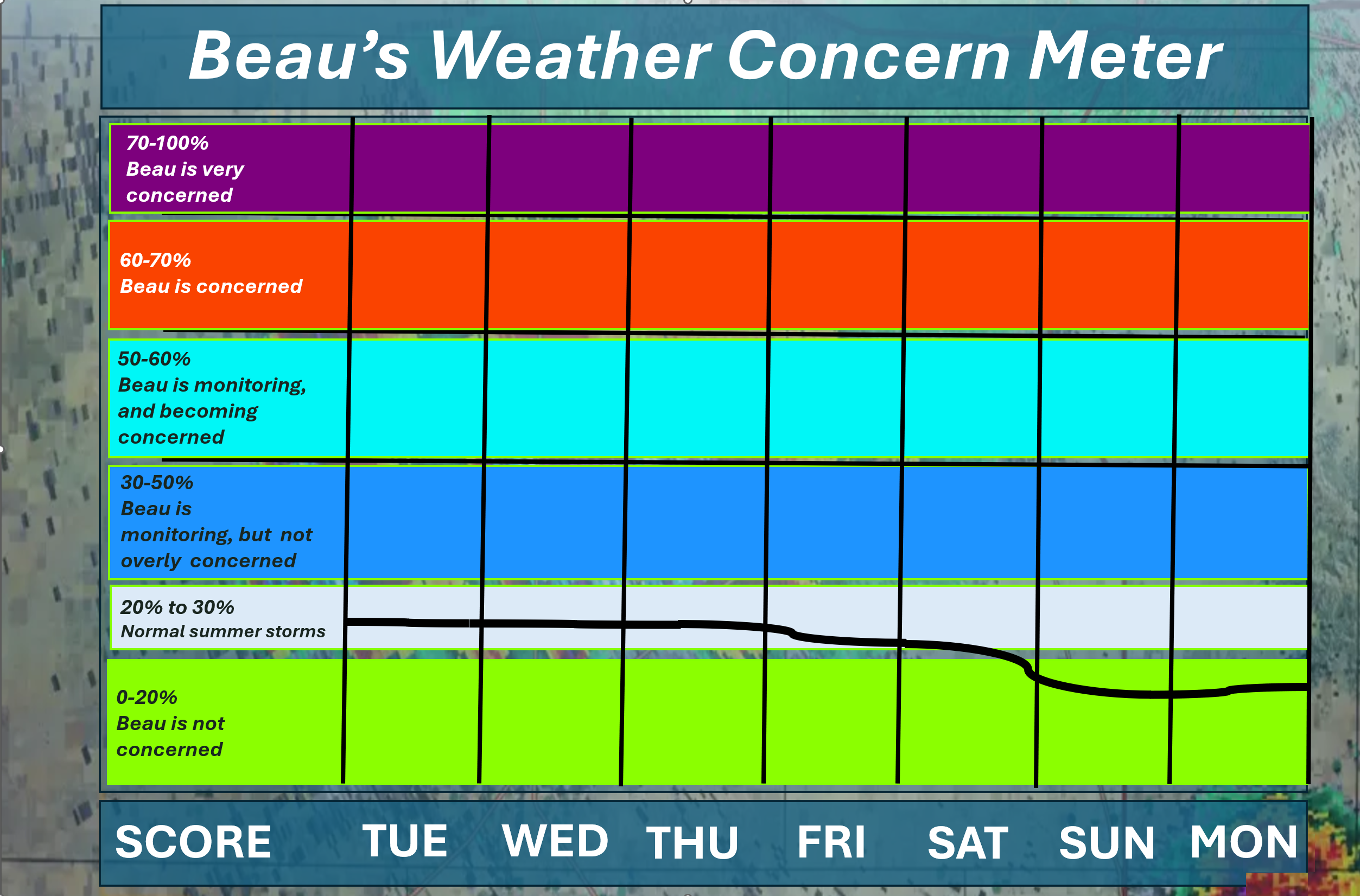
Here is the extended concern meter. This takes us through next Monday. Extreme weather is not anticipated.
A few normal summer-time thunderstorms will be possible this week.
.A quick forecast glance. Your 48-hour forecast Graphics


.
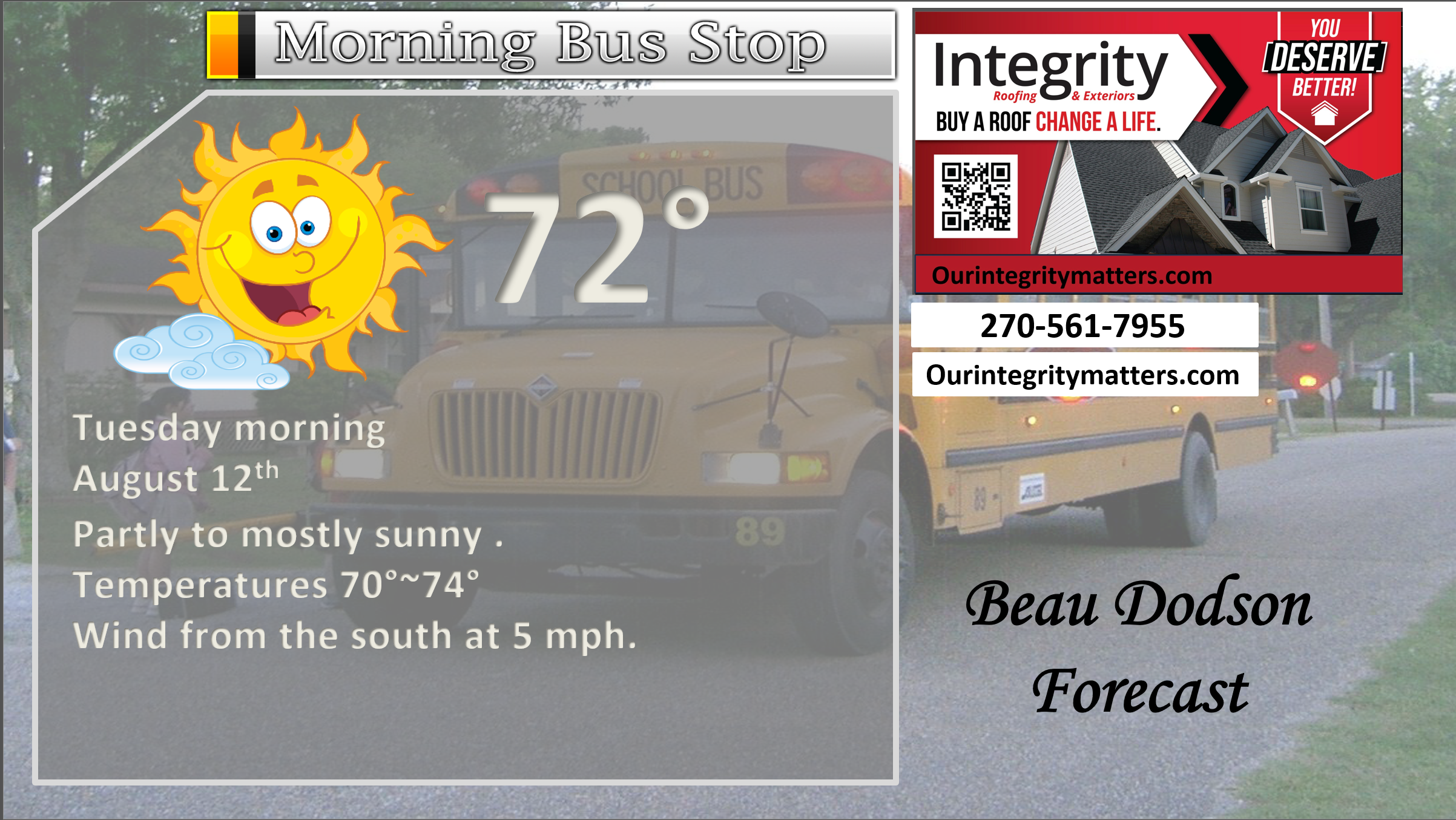
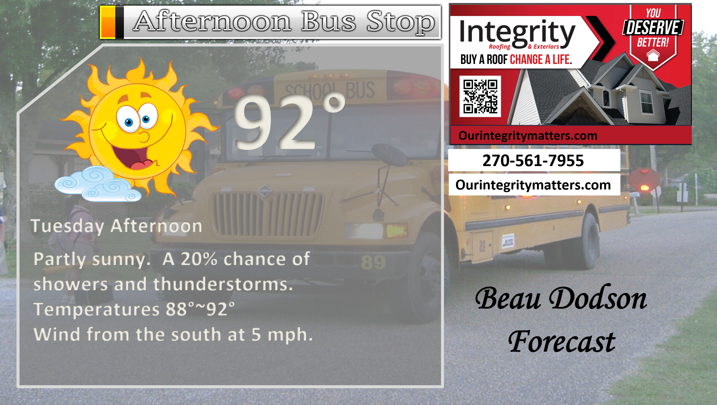
This afternoon
.

.

Forecast discussion.
- Hot and humid conditions are expected over the next seven days. Temperatures will be a few degrees above average.
- Warm mornings. Warm/hot afternoons. Humid throughout the period.
- Scattered thunderstorms are possible today, tomorrow, and Thursday. Lower chances from Friday through Tuesday.
- Some of you will remain dry with little or no rainfall.
.

.
Good morning, everyone.
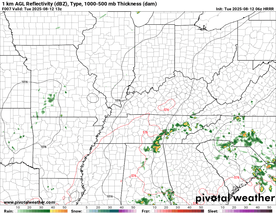
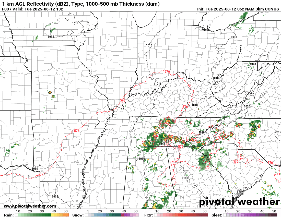
We did have some thunderstorms form overnight in western Kentucky. They moved north northeast into southeast Illinois and southwest Indiana.
A few locations picked up a brief downpour and some lightning.
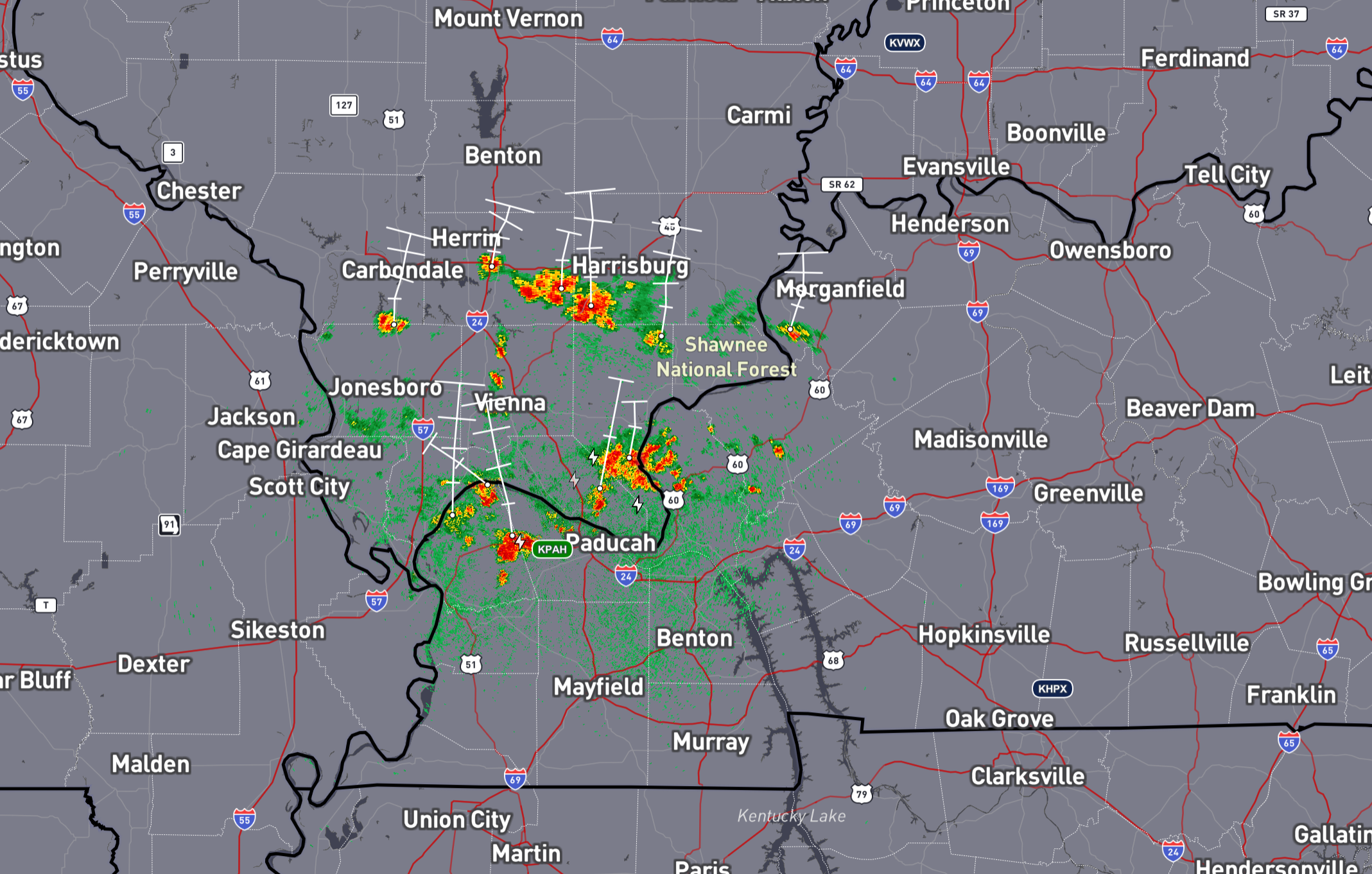
This is what radar looked like earlier this morning.
2 AM radar (the white lines show what direction the storms were moving)
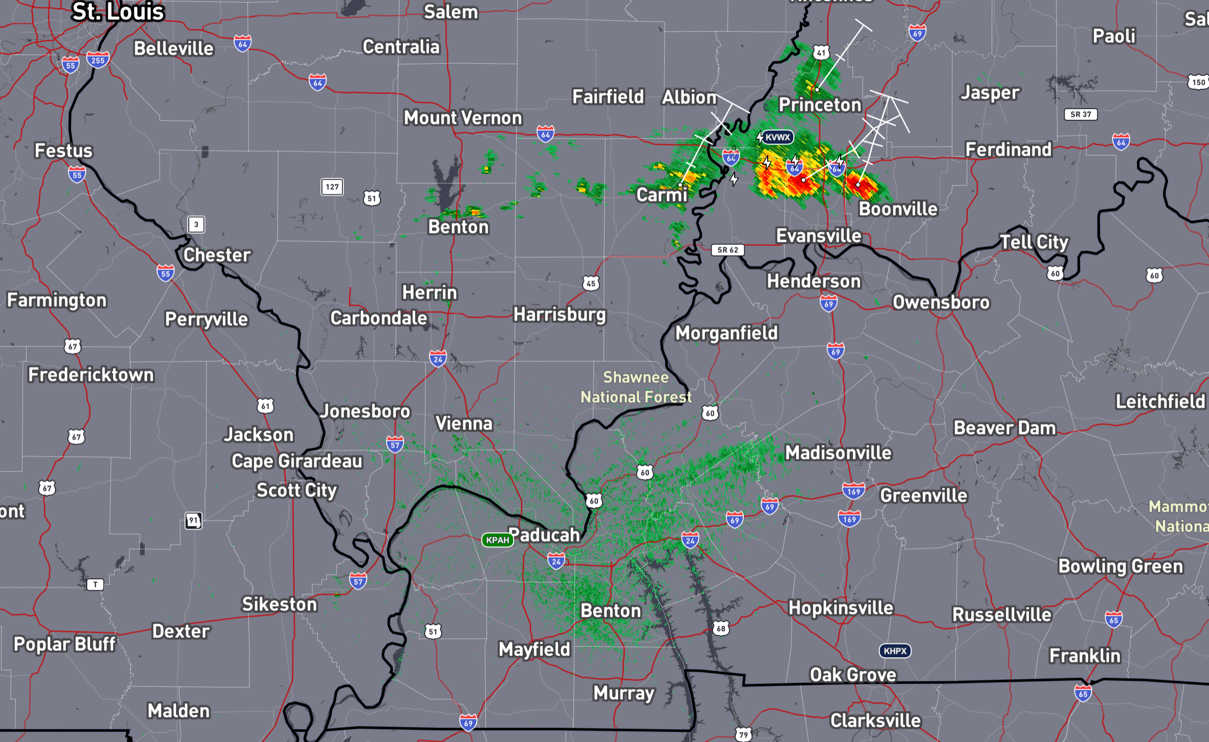
Here is what it looked like at 5 am
.
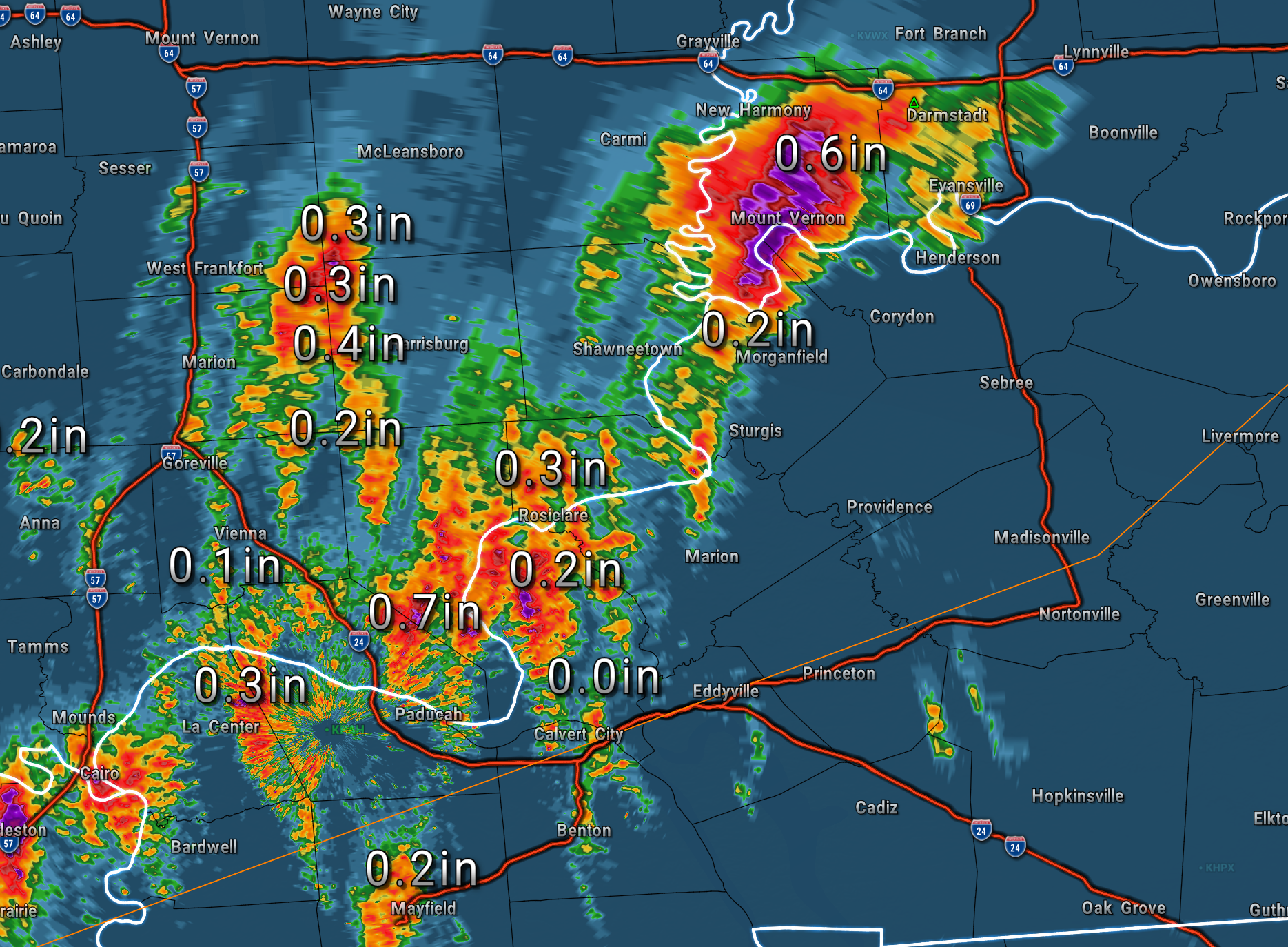
Here is what radar rainfall estimates looked like with those overnight showers and storms. This is what fell overnight.
Mainly in the 0.10″ to 0.30″ range. Locally higher.
.
An upper-level disturbance will bring scattered showers and thunderstorms to the region today, tomorrow, and Thursday.
The risk of severe weather is low. It is rarely zero during the summer months. You can always have an isolated warning for gusty winds. Organized or widespread severe weather is not anticipated. That is the good news.
Again, not everyone will receive rain. A few locations will pick up 0.25″ to 0.50″. Remember, summer storms can produce locally higher totals (above one inch).
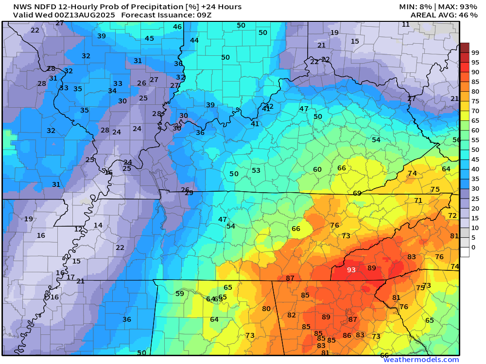
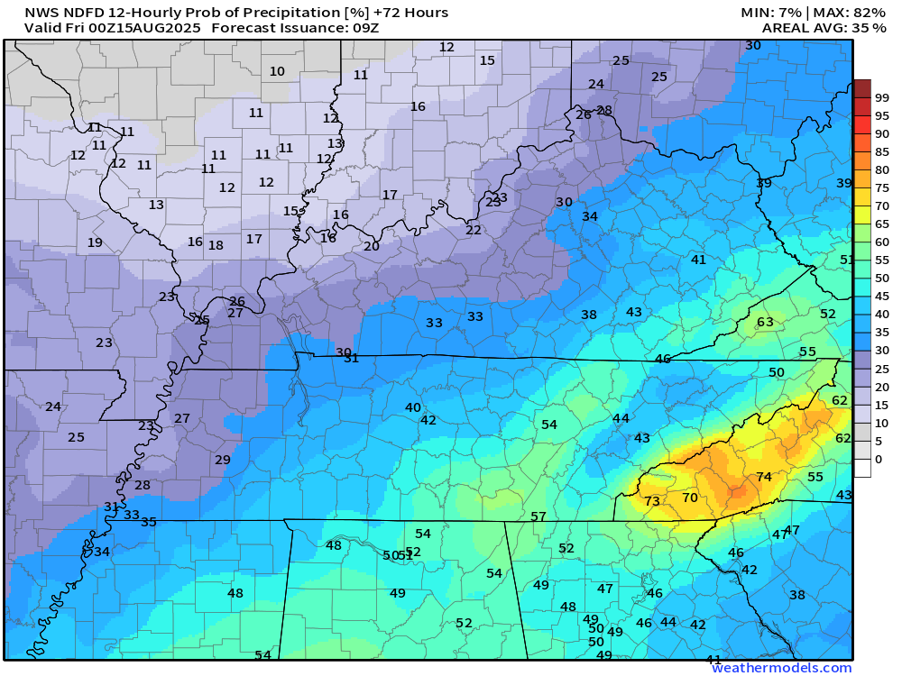
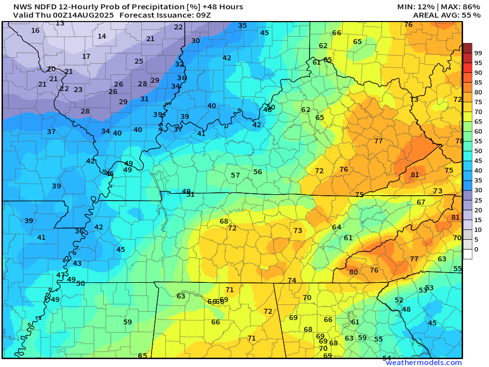
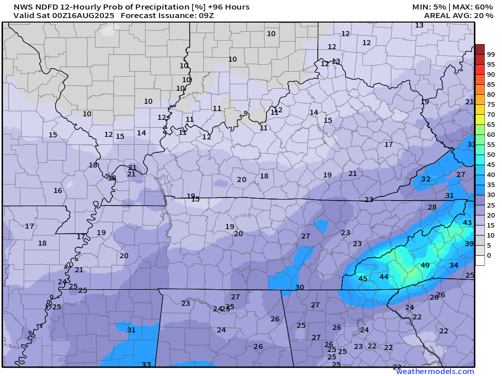
Here are the official rainfall probability graphics. This shows you the % chance of precipitation.
Today
Tomorrow
Thursday
Friday
.
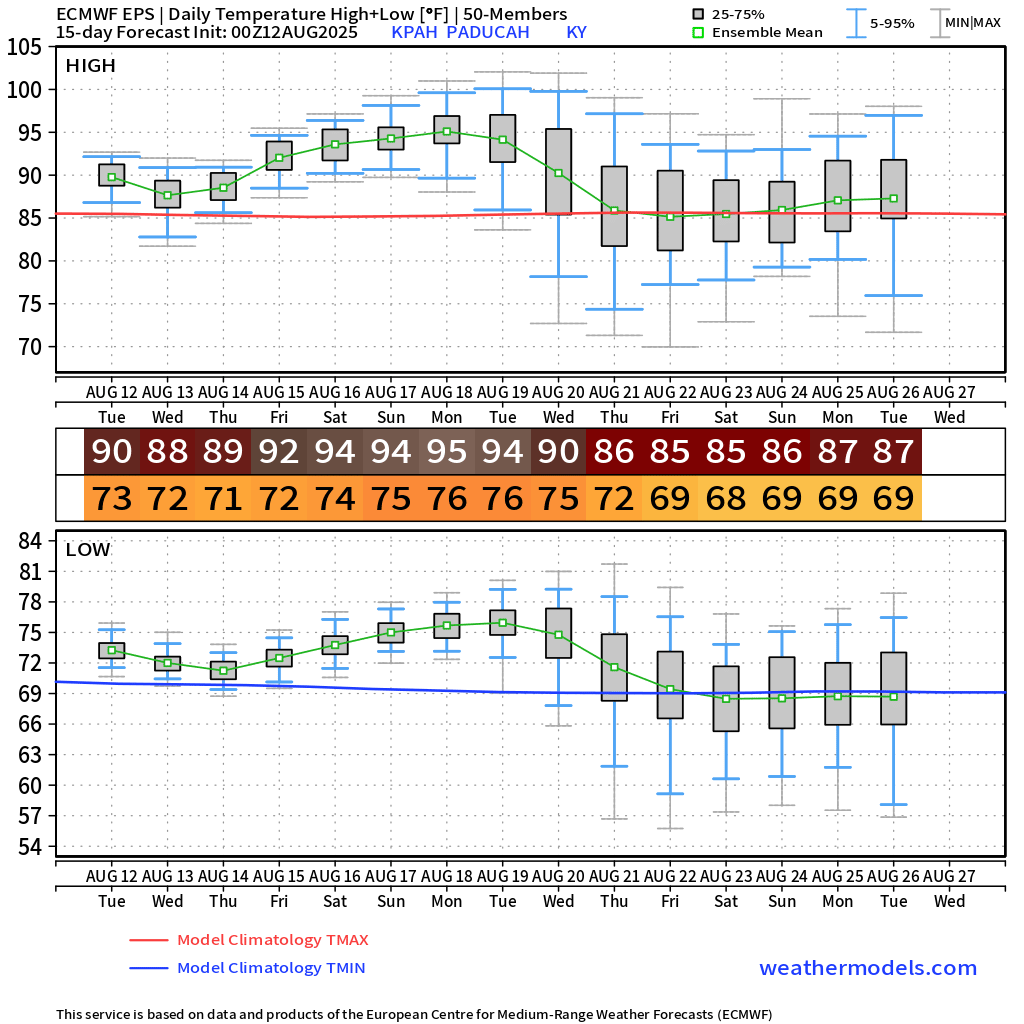
The weather is going to remain hot and humid this week. Highs will range from the upper 80s to lower 90s. Overnight lows will dip into the seventies. These temperatures will be a few degrees above seasonal averages.
Rain chances will begin to decrease by Friday and Saturday. Perhaps a few remaining showers and storms on Friday. Even less on Saturday and Sunday.
This is a fairly typical summer pattern. Temperatures will be a few degrees above seasonal averages.
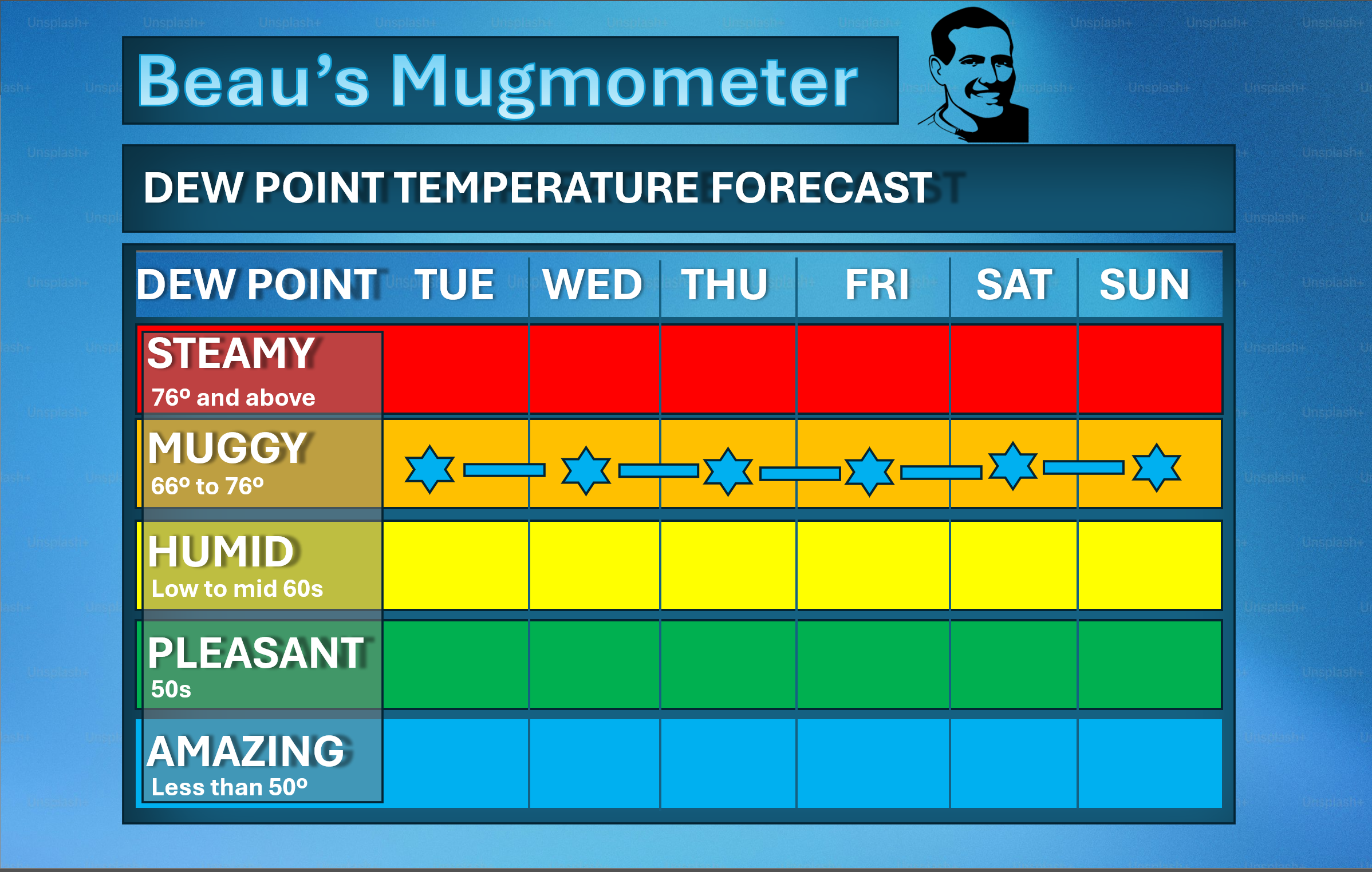
Here is my mugmometer. How muggy will it feel? It is going to be sticky outside. Muggy.
Remember, dew point is what controls how humid it feels outside. It will be a bit more humid/sticky as we move through the week, but nothing extreme.
.
I am watching the weekend temperature forecast. The ridge of high pressure will be a bit stronger. That means low to middle 90s for highs vs lower 90s.
Heat index values of 100 to 106 degrees are likely as we move towards Friday, Saturday, and Sunday.
There may be another cold front towards the middle/end of next week. I am monitoring trends in the guidance.
That would help lower our temperatures. It would also increase rain chances. Fingers crossed for those who need rain.
You can see that on the EC ensembles. A bit far out for certainty, but worth monitoring.
.
No tropical storm or hurricane threats in our region through the next ten days.
.

.
The timestamp (upper left) is in Zulu. 12z=7 am. 18z=1 pm. 00z=7 pm.
Double-click the animation to enlarge it.
Hrrr model
.
The timestamp (upper left) is in Zulu. 12z=7 am. 18z=1 pm. 00z=7 pm.
Double-click the animation to enlarge it.
3K model
..
.
Click here if you would like to return to the top of the page.
.Average high temperatures for this time of the year are around 90 degrees.
Average low temperatures for this time of the year are around 68 degrees.
Average precipitation during this time period ranges from 1.00″ to 1.25″
Six to Ten Day Outlook.
Blue is below average. Red is above average. The no color zone represents equal chances.
Average highs for this time of the year are in the lower 60s. Average lows for this time of the year are in the lower 40s.

Green is above average precipitation. Yellow and brown favors below average precipitation. Average precipitation for this time of the year is around one inch per week.

.

Average low temperatures for this time of the year are around 67 degrees.
Average precipitation during this time period ranges from 1.00″ to 1.25″
.
Eight to Fourteen Day Outlook.
Blue is below average. Red is above average. The no color zone represents equal chances.

Green is above average precipitation. Yellow and brown favors below average precipitation. Average precipitation for this time of the year is around one inch per week.

.
.
.
We have a new service to complement your www.weathertalk.com subscription. This does NOTreplace www.weathertalk.com It is simply another tool for you to receive severe weather information.
.
https://weathercallservices.com/beau-dodson-weather


Want to receive the daily forecast/other products on your Beau Dodson Weather app?
Did you know you have four options in your www.weathertalk.com account
You will then receive these via your Beau Dodson Weather app.
Just log into your www.weathertalk.com account
Click the NOTIFICATION SETTINGS TAB
Then, turn them on (green) and off (red)
🌪️ Number 1 is the most important one. Severe alerts, tornado alerts, and so on.
Number 2 is the daily video, blog, livestream alerts, and severe weather Facebook threads on severe days or winter storm days.
Number 3 is the daily forecast. I send that out every day during the afternoon hours. It is the seven-day forecast, hazardous weather outlook, fire outlook, and more.
Number 4 is to receive the daily video, blog, and other content on NON-severe weather days (every day without severe threats in other words)
GREEN IS ON
RED IS OFF

I am going to start going live during bigger severe weather events.
Check it out here https://www.youtube.com/user/beaudodson
Click the subscribe button (it’s a free subscription button), and it will alert you when I go live. I will also send out alerts to the app when I go live for an event.

.

Radars and Lightning Data
Interactive-city-view radars. Clickable watches and warnings.
https://wtalk.co/B3XHASFZ
Old legacy radar site (some of you like it better)
https://weatherobservatory.com/weather-radar.htm
If the radar is not updating then try another one. If a radar does not appear to be refreshing then hit Ctrl F5. You may also try restarting your browser.
Backup radar site in case the above one is not working.
https://weathertalk.com/morani
Regional Radar
https://imagery.weathertalk.com/prx/RadarLoop.mp4
** NEW ** Zoom radar with chaser tracking abilities!
ZoomRadar
If the radar is not working, then email me: Email me at beaudodson@usawx.com
.
We do have some sponsors! Check them out.
Roof damage from recent storms? Link – Click here
INTEGRITY ROOFING AND EXTERIORS!
⛈️ Roof or gutter damage from recent storms? Today’s weather is sponsored by Integrity Roofing. Check out their website at this link https://www.ourintegritymatters.com/

![]()
![]()
![]()
Make sure you have three to five ways of receiving your severe weather information.
Weather Talk is one of those ways! Now, I have another product for you and your family.

.
Want to add more products to your Beau Dodson Weather App?
Receive daily videos, weather blog updates on normal weather days and severe weather and winter storm days, your county by county weather forecast, and more!
Here is how to do add those additional products to your app notification settings!
Here is a video on how to update your Beau Dodson Weather payment.
The app is for subscribers. Subscribe at www.weathertalk.com/welcome then go to your app store and search for WeatherTalk
Subscribers, PLEASE USE THE APP. ATT and Verizon are not reliable during severe weather. They are delaying text messages.
The app is under WeatherTalk in the app store.

Apple users click here

Android users click here
.
Radars and Lightning Data
Interactive-city-view radars. Clickable watches and warnings.
https://wtalk.co/B3XHASFZ
Old legacy radar site (some of you like it better)
https://weatherobservatory.com/weather-radar.htm
If the radar is not updating then try another one. If a radar does not appear to be refreshing then hit Ctrl F5. You may also try restarting your browser.
Backup radar site in case the above one is not working.
https://weathertalk.com/morani
Regional Radar
https://imagery.weathertalk.com/prx/RadarLoop.mp4
** NEW ** Zoom radar with chaser tracking abilities!
ZoomRadar
Lightning Data (zoom in and out of your local area)
https://wtalk.co/WJ3SN5UZ
Not working? Email me at beaudodson@usawx.com
National map of weather watches and warnings. Click here.
Storm Prediction Center. Click here.
Weather Prediction Center. Click here.
.

Live lightning data: Click here.
Real time lightning data (another one) https://map.blitzortung.org/#5.02/37.95/-86.99
Our new Zoom radar with storm chases
.
.

Interactive GOES R satellite. Track clouds. Click here.
GOES 16 slider tool. Click here.
College of DuPage satellites. Click here
.

Here are the latest local river stage forecast numbers Click Here.
Here are the latest lake stage forecast numbers for Kentucky Lake and Lake Barkley Click Here.
.
.
Find Beau on Facebook! Click the banner.


 .
.