

.
I have some question-and-answer threads over on the Facebook page. Link to those threads CLICK HERE
Or email me at beaudodsonweather@gmail.com
..

🌪️ Seven-Day Tornado Outlook ⛈️
August 4th through August 10th
Current risk: NONE.
Current confidence level: High confidence in the forecast.
Comments: We are not anticipating tornadoes.
.

Seven-Day Hazardous Weather Outlook
1. Is lightning in the forecast? YES. Scattered lightning is possible today and tomorrow. A small chance on Wednesday and Saturday. Scattered lightning is possible on Sunday and Monday of next week.
2. Are organized severe thunderstorms in the forecast? NO. Thunderstorms, during the summer months, can produce isolated gusty winds. Organized severe weather is not anticipated.
3. Is flash flooding in the forecast? NO. Slow-moving summer storms can produce isolated torrential downpours that can briefly flood ditches and roadways. Organized or widespread flash flooding is not anticipated.
4. Will non-thunderstorm winds top 40 mph? NO.
5. Will temperatures rise above 90 degrees? POSSIBLE. I will monitor Thursday through Sunday. Temperatures may approach 90 degrees.
6. Will temperatures rise above 100 degrees? NO.
7. Will the heat index (feels like) rise above 100 degrees? NOT AT THIS TIME. I will monitor Thursday through Sunday.
8. Will the heat index rise above 115 degrees? NO.
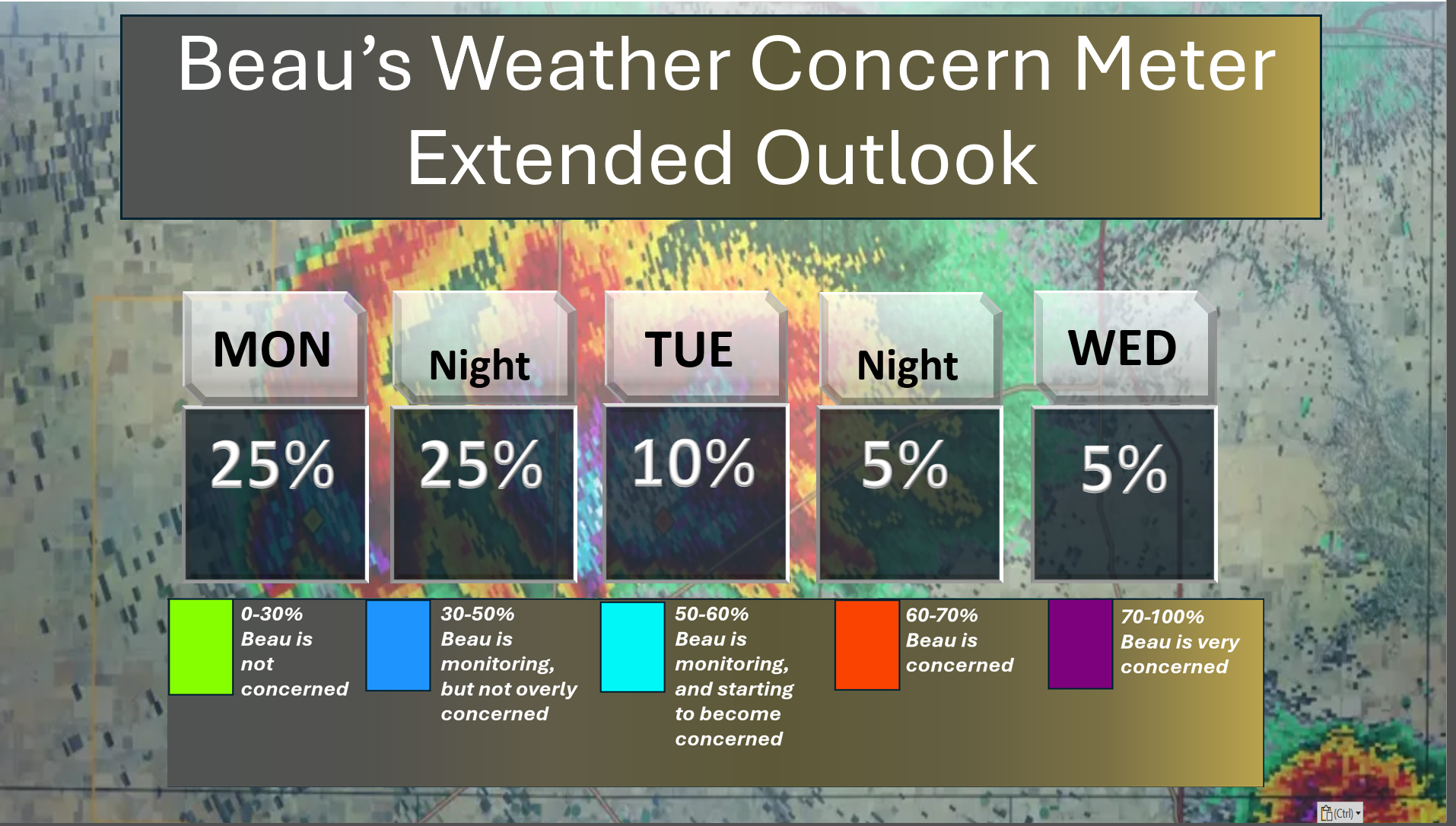
Here is my concern meter through Wednesday. No significant concerns. A few lightning strikes are possible today and tomorrow.
.
A quick forecast glance. Your 48-hour forecast Graphics


.

The kids are headed back to school in some counties!
.
.

.

Forecast discussion.
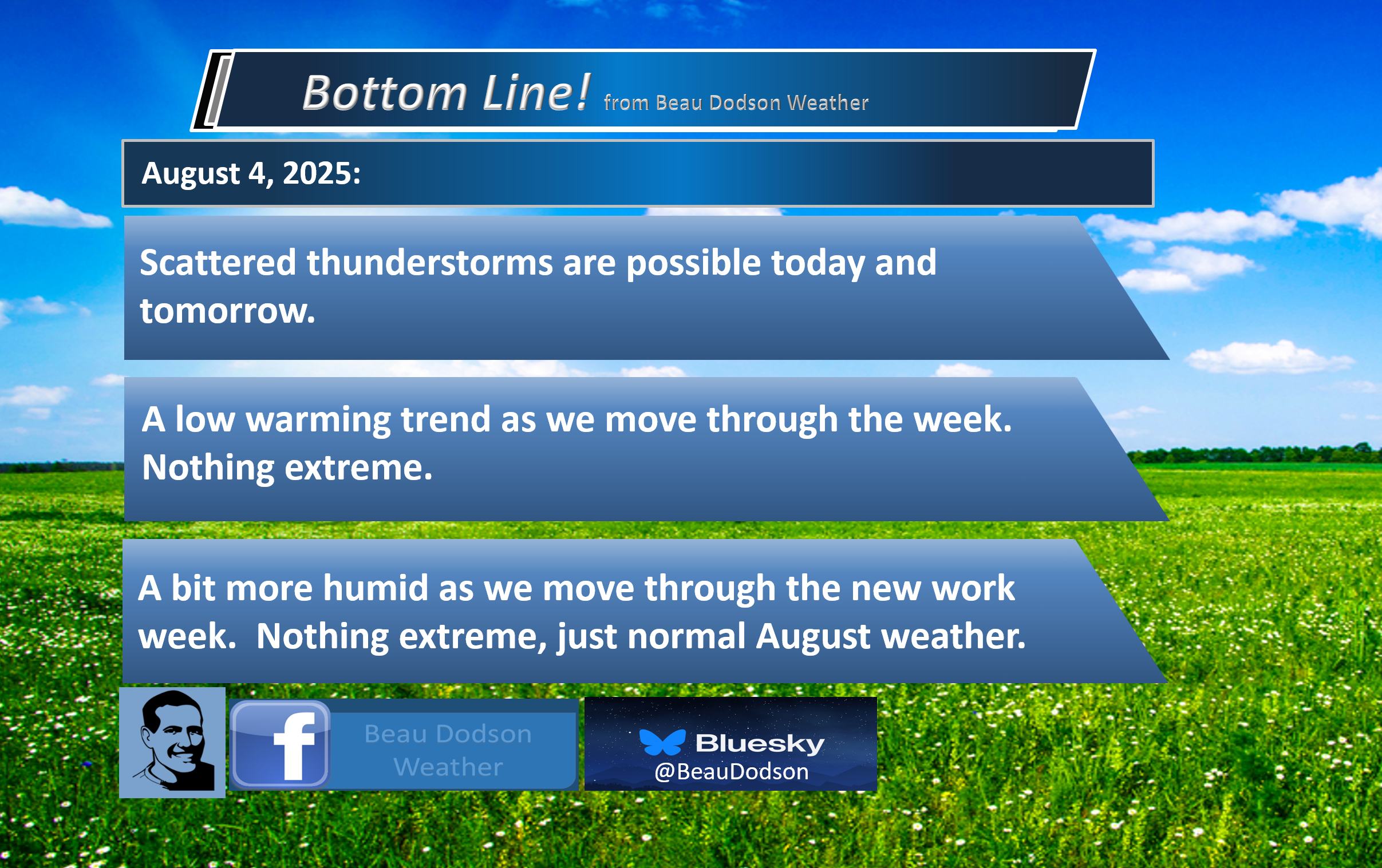
- A decent week of weather ahead of us.
- A few showers and thunderstorms today and tomorrow. An isolated thunderstorm is possible on Wednesday.
- A slow warming trend as we move through the new work week. A bit more humid mid to late week. Nothing extreme. Normal August weather.
- A chance of scattered showers and thunderstorms on Sunday and Monday.
.

Good morning, everyone
I hope you had a nice weekend. The weather was amazing.
There was some smoke/haze around the region, and I know that bothered some of you with asthma. That smoke was from the US/Canadian wildfires.
Canada is experiencing their second-worst wildfire season on record.
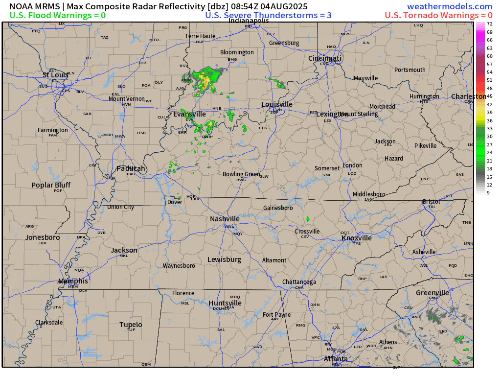
We are waking up to a few clouds and even a couple of showers and thunderstorms on the weather radars.
Here was the 5 am radar
You can barely see the showers east of LBL and some showers and thunderstorms across southwest Indiana, as well.
See the live radar links at the bottom of the page.
.
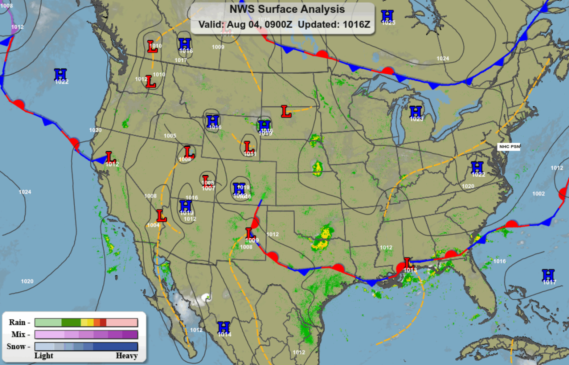
This morning’s weather map shows a frontal boundary to our north and south. A trough over our region. That is the reason for the scattered showers and thunderstorms.
.
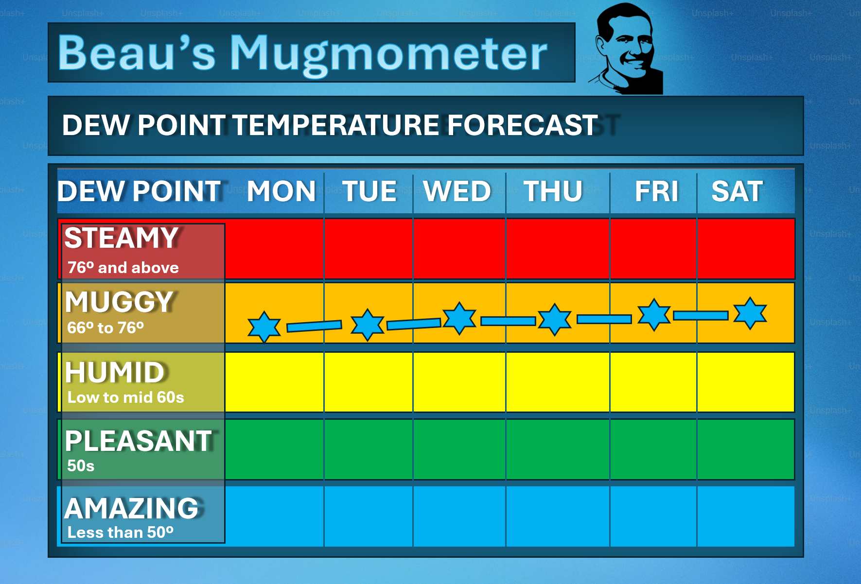
We will have a warming trend this week. Temperatures will approach 90 degrees by the middle and end of the week. We are not going back to the extreme numbers we saw over the last two weeks. Thankfully.
It will be a bit humid, at times. Normal August weather.
Here is the mugmometer.
Remember, dew point is what controls how humid it feels outside. It will be a bit more humid/sticky as we move through the week, but nothing extreme.
.
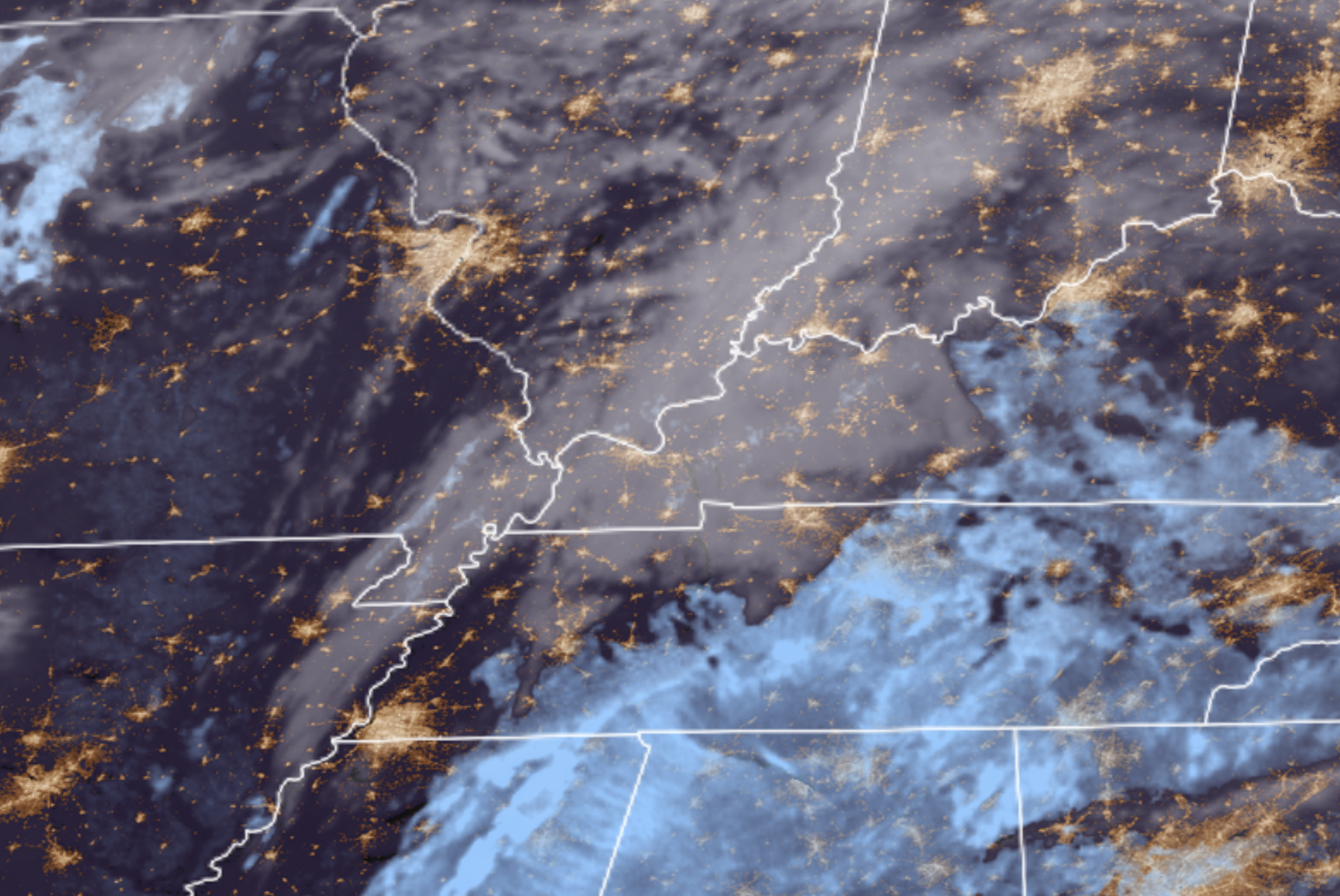
This morning’s satellite shows quite a few clouds in the region.
.
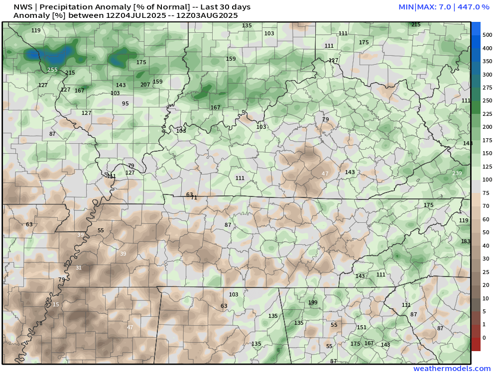
We will have a chance of showers and thunderstorms today and tomorrow. Not everyone will experience rain. I know some areas need rain.
Here is a map showing you the 30-day precipitation anomalies. This is the percent of normal precipitation. The brown areas are a bit dry. The green/blue areas are a bit wetter.
Double-click the image to enlarge it.
.
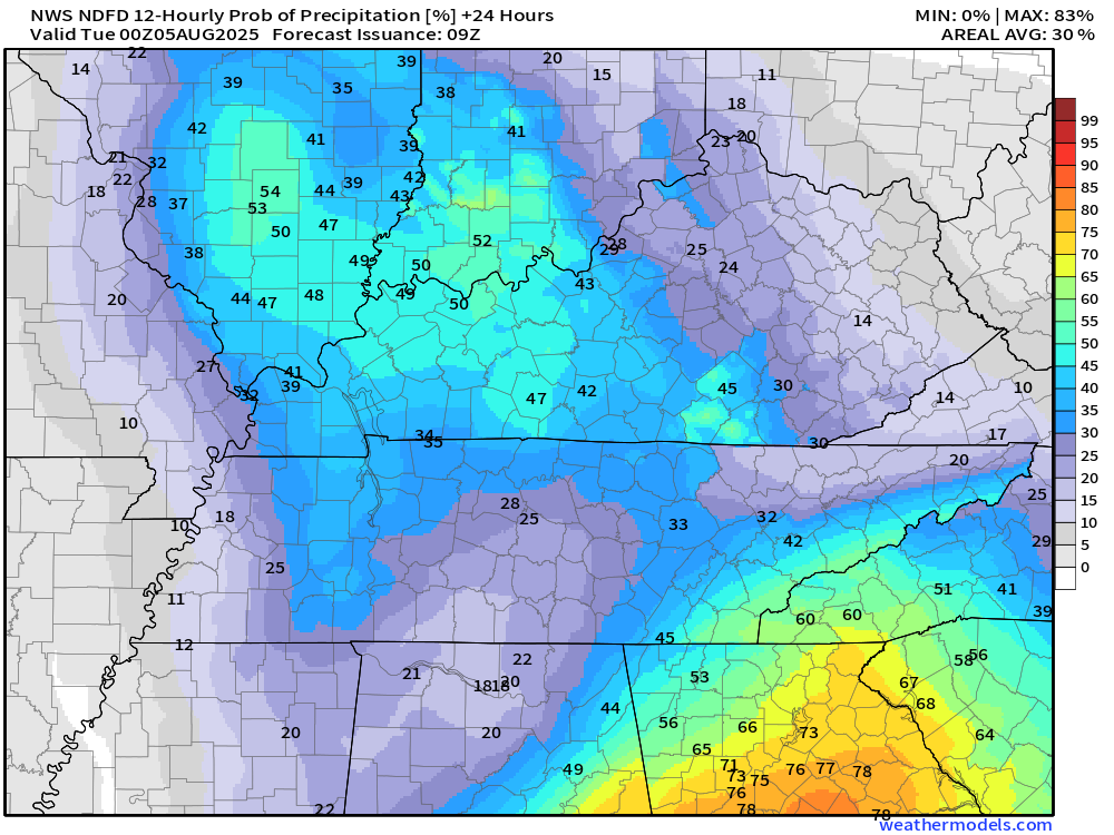
Let me show you the rain probabilities for today through tomorrow.
As you can see, the chances are a bit higher as you travel east of the Mississippi River. A bit lower west.
Rain totals will mainly range from 0.05″ to 0.40″. Of course, summer thunderstorms can drop locally much higher amounts.
Here are today’s rain probabilities. This morning through 7 pm this evening.
.
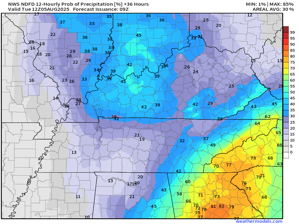
Tonight 7 PM to 7 AM
.
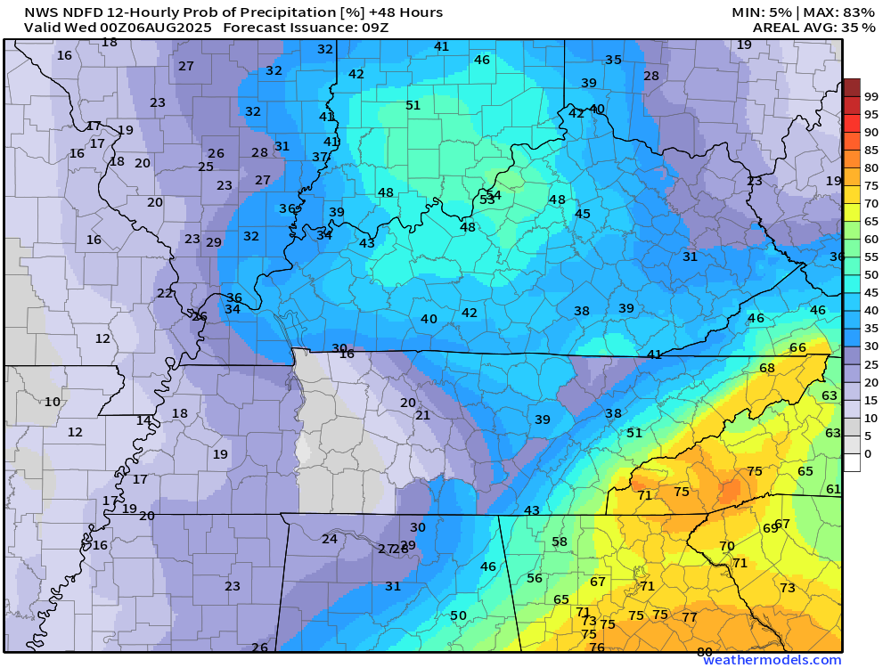
Here are the rain probabilities for tomorrow.
7 AM to 7 PM.
.
Thursday through Saturday appear to be shaping up dry and warm.
I am watching Sunday and Monday for a return of isolated to scattered showers and thunderstorms.
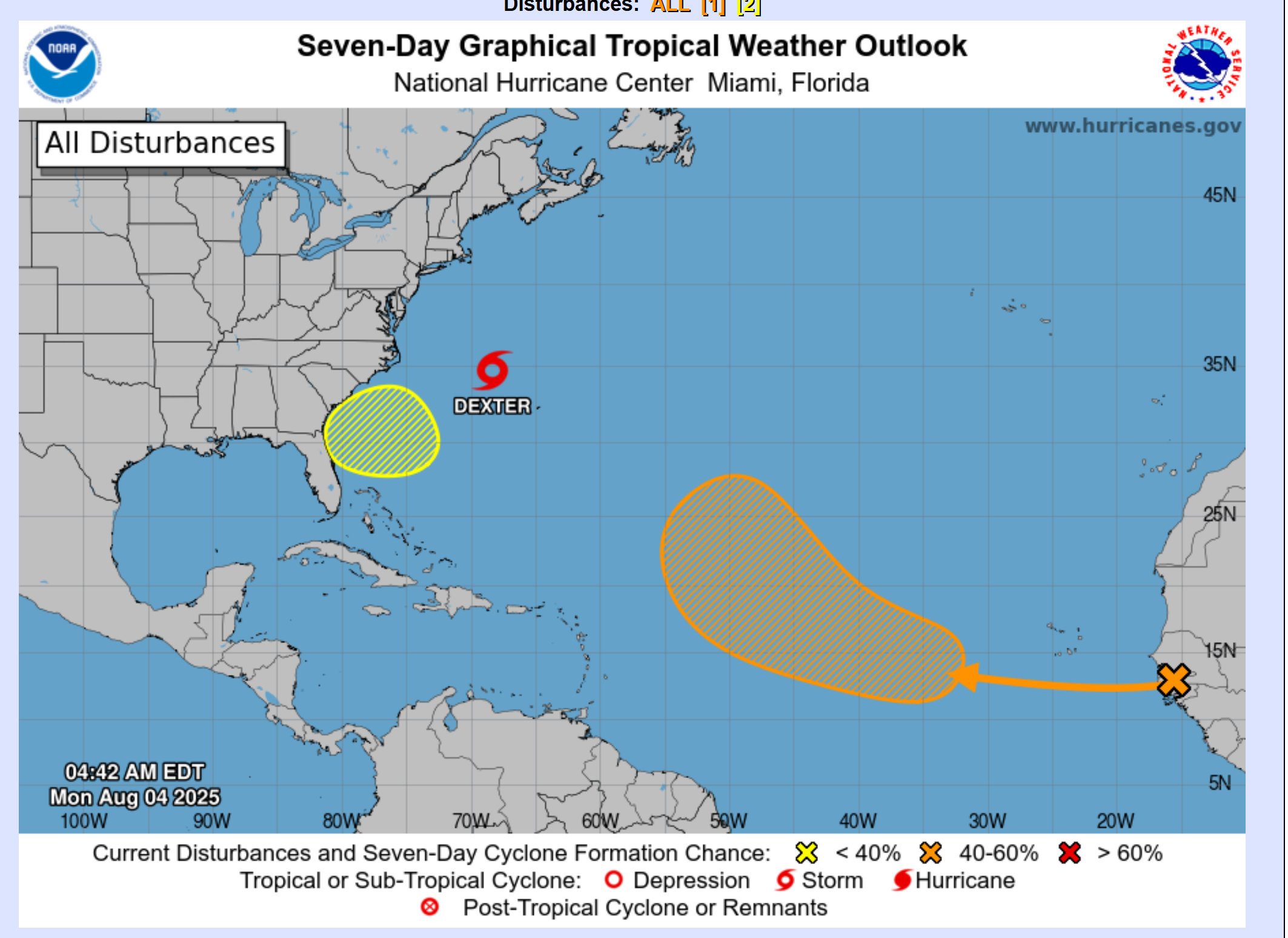
I am watching the tropics. One area of concern is off the East Coast. Thankfully, that is a fish storm. It will move away from the United States.
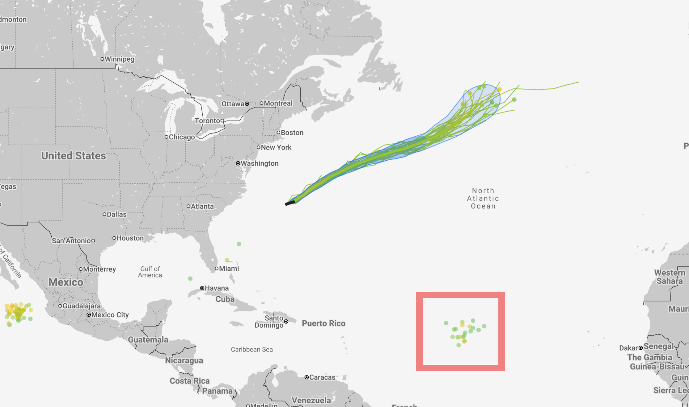
.
We will then observe a system moving off the coast of Africa. Another area off the southeast coast of the United States.
For now, none of these systems poses an immediate threat to the United States.
.
The tropics are always a wild card in August and September for our region. If a system moves into our region, then widespread rainfall would be the end result.
For now, we are not seeing anything that appears to be of concern.
.

.
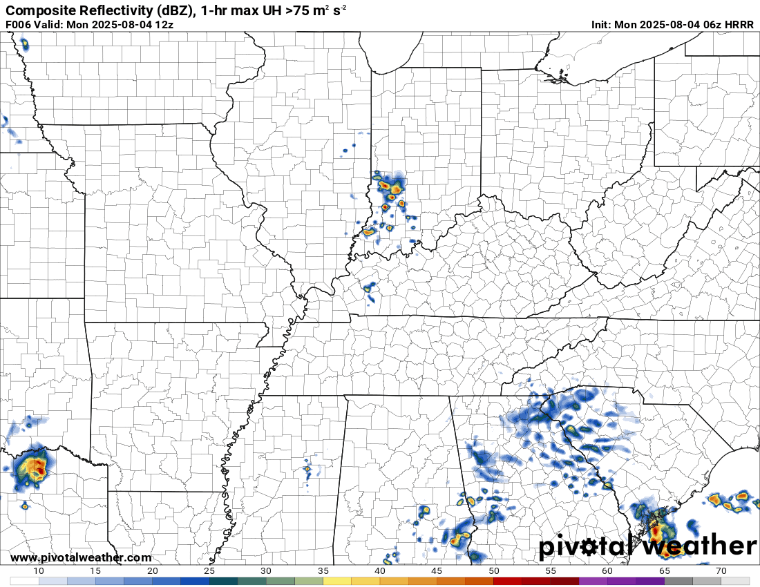
The timestamp (upper left) is in Zulu. 12z=7 am. 18z=1 pm. 00z=7 pm.
Double-click the animation to enlarge it.
Hrrr model
.
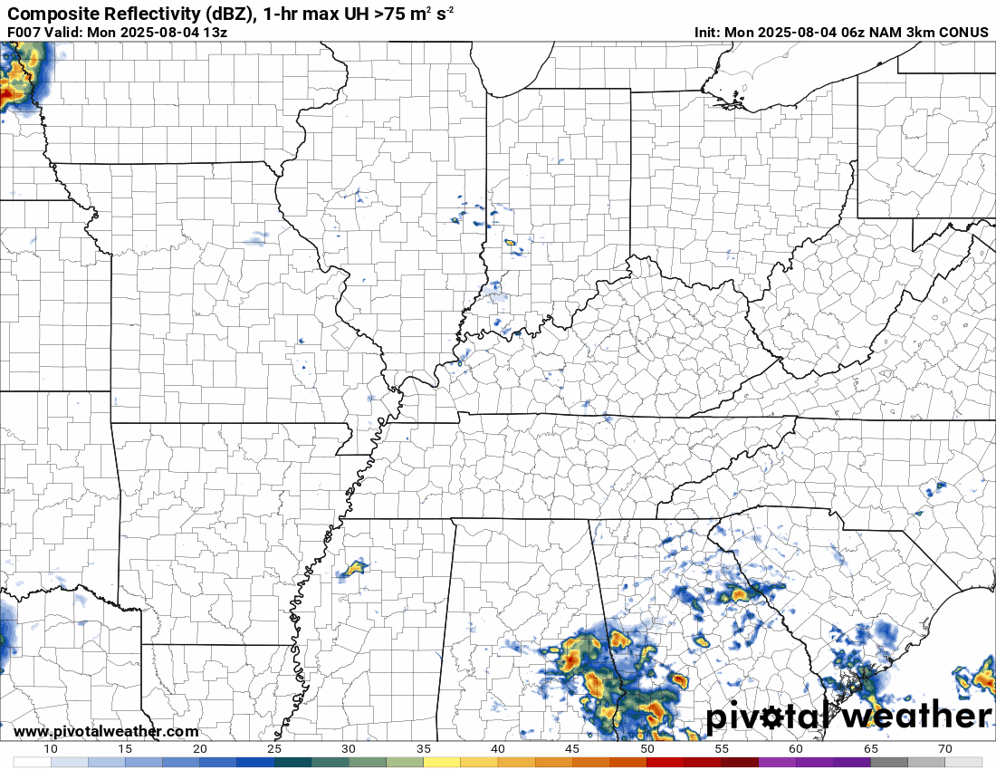
The timestamp (upper left) is in Zulu. 12z=7 am. 18z=1 pm. 00z=7 pm.
Double-click the animation to enlarge it.
NAM 3K model
..
.
Click here if you would like to return to the top of the page.
.Average high temperatures for this time of the year are around 88 degrees.
Average low temperatures for this time of the year are around 68 degrees.
Average precipitation during this time period ranges from 1.00″ to 1.25″
Six to Ten Day Outlook.
Blue is below average. Red is above average. The no color zone represents equal chances.
Average highs for this time of the year are in the lower 60s. Average lows for this time of the year are in the lower 40s.

Green is above average precipitation. Yellow and brown favors below average precipitation. Average precipitation for this time of the year is around one inch per week.

.

Average low temperatures for this time of the year are around 67 degrees.
Average precipitation during this time period ranges from 1.00″ to 1.25″
.
Eight to Fourteen Day Outlook.
Blue is below average. Red is above average. The no color zone represents equal chances.

Green is above average precipitation. Yellow and brown favors below average precipitation. Average precipitation for this time of the year is around one inch per week.

.
.
.
We have a new service to complement your www.weathertalk.com subscription. This does NOTreplace www.weathertalk.com It is simply another tool for you to receive severe weather information.
.
https://weathercallservices.com/beau-dodson-weather


Want to receive the daily forecast/other products on your Beau Dodson Weather app?
Did you know you have four options in your www.weathertalk.com account
You will then receive these via your Beau Dodson Weather app.
Just log into your www.weathertalk.com account
Click the NOTIFICATION SETTINGS TAB
Then, turn them on (green) and off (red)
🌪️ Number 1 is the most important one. Severe alerts, tornado alerts, and so on.
Number 2 is the daily video, blog, livestream alerts, and severe weather Facebook threads on severe days or winter storm days.
Number 3 is the daily forecast. I send that out every day during the afternoon hours. It is the seven-day forecast, hazardous weather outlook, fire outlook, and more.
Number 4 is to receive the daily video, blog, and other content on NON-severe weather days (every day without severe threats in other words)
GREEN IS ON
RED IS OFF

I am going to start going live during bigger severe weather events.
Check it out here https://www.youtube.com/user/beaudodson
Click the subscribe button (it’s a free subscription button), and it will alert you when I go live. I will also send out alerts to the app when I go live for an event.

.

Radars and Lightning Data
Interactive-city-view radars. Clickable watches and warnings.
https://wtalk.co/B3XHASFZ
Old legacy radar site (some of you like it better)
https://weatherobservatory.com/weather-radar.htm
If the radar is not updating then try another one. If a radar does not appear to be refreshing then hit Ctrl F5. You may also try restarting your browser.
Backup radar site in case the above one is not working.
https://weathertalk.com/morani
Regional Radar
https://imagery.weathertalk.com/prx/RadarLoop.mp4
** NEW ** Zoom radar with chaser tracking abilities!
ZoomRadar
If the radar is not working, then email me: Email me at beaudodson@usawx.com
.
We do have some sponsors! Check them out.
Roof damage from recent storms? Link – Click here
INTEGRITY ROOFING AND EXTERIORS!
⛈️ Roof or gutter damage from recent storms? Today’s weather is sponsored by Integrity Roofing. Check out their website at this link https://www.ourintegritymatters.com/

![]()
![]()
![]()
Make sure you have three to five ways of receiving your severe weather information.
Weather Talk is one of those ways! Now, I have another product for you and your family.

.
Want to add more products to your Beau Dodson Weather App?
Receive daily videos, weather blog updates on normal weather days and severe weather and winter storm days, your county by county weather forecast, and more!
Here is how to do add those additional products to your app notification settings!
Here is a video on how to update your Beau Dodson Weather payment.
The app is for subscribers. Subscribe at www.weathertalk.com/welcome then go to your app store and search for WeatherTalk
Subscribers, PLEASE USE THE APP. ATT and Verizon are not reliable during severe weather. They are delaying text messages.
The app is under WeatherTalk in the app store.

Apple users click here

Android users click here
.
Radars and Lightning Data
Interactive-city-view radars. Clickable watches and warnings.
https://wtalk.co/B3XHASFZ
Old legacy radar site (some of you like it better)
https://weatherobservatory.com/weather-radar.htm
If the radar is not updating then try another one. If a radar does not appear to be refreshing then hit Ctrl F5. You may also try restarting your browser.
Backup radar site in case the above one is not working.
https://weathertalk.com/morani
Regional Radar
https://imagery.weathertalk.com/prx/RadarLoop.mp4
** NEW ** Zoom radar with chaser tracking abilities!
ZoomRadar
Lightning Data (zoom in and out of your local area)
https://wtalk.co/WJ3SN5UZ
Not working? Email me at beaudodson@usawx.com
National map of weather watches and warnings. Click here.
Storm Prediction Center. Click here.
Weather Prediction Center. Click here.
.

Live lightning data: Click here.
Real time lightning data (another one) https://map.blitzortung.org/#5.02/37.95/-86.99
Our new Zoom radar with storm chases
.
.

Interactive GOES R satellite. Track clouds. Click here.
GOES 16 slider tool. Click here.
College of DuPage satellites. Click here
.

Here are the latest local river stage forecast numbers Click Here.
Here are the latest lake stage forecast numbers for Kentucky Lake and Lake Barkley Click Here.
.
.
Find Beau on Facebook! Click the banner.


 .
.