

.
I have some question-and-answer threads over on the Facebook page. Link to those threads CLICK HERE
Or email me at beaudodsonweather@gmail.com
..

🌪️ Seven-Day Tornado Outlook ⛈️
June 30th through July 6th
Current risk: None.
Current confidence level: High confidence in the forecast.
Comment: No tornado threats.
.

Seven-Day Hazardous Weather Outlook
1. Is lightning in the forecast? YES. There is a chance of lightning today and tonight. A slight chance of lightning on Tuesday across the Missouri Bootheel, western Kentucky, and western Tennessee. A slight chance of lightning on Saturday. Scattered lightning is possible on Sunday. I will monitor next Monday.
2. Are organized severe thunderstorms in the forecast? POSSIBLE. A few thunderstorms could produce damaging wind gusts today and tonight. Overall, the severe weather risk is low, but not zero.
3. Is flash flooding in the forecast? ISOLATED. Summer thunderstorms can produce an inch or two of rain in less than thirty minutes. This can temporarily flood ditches and some roadways.
4. Will non-thunderstorm winds top 40 mph? NO.
5. Will temperatures rise above 90 degrees? YES. Temperatures are anticipated to be near or above 90 degrees this coming Thursday through Sunday. I will monitor next Monday.
6. Will temperatures rise above 100 degrees? NO.
7. Will the heat index rise above 100 degrees? MONITOR. I will monitor this coming Saturday and Sunday. Dew points and humidity will likely slowly rise as we move towards the weekend.
8. Will the heat index rise above 115 degrees? NO.
.
A quick forecast glance. Your 48-hour forecast Graphics


.

.


Forecast discussion.
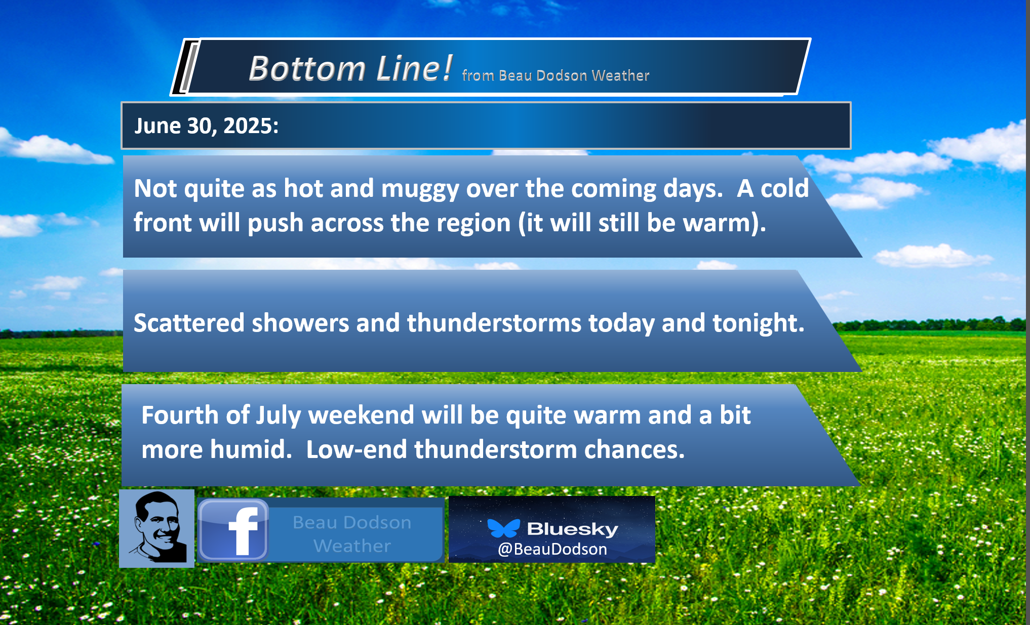
- A cold front will push across the region later today/tonight.
- Scattered thunderstorms are expected into tonight. A few storms could produce damaging wind gusts.
- A couple of storms may linger into Tuesday.
- Somewhat less muggy over the coming days (behind the cold front).
- Warming trend by the weekend. Becoming a bit more muggy as we move into the weekend, as well.
.

.
Good day, everyone.
I hope you had a nice weekend. It sure did go by fast!
Over the last few days, some of you received a month’s worth of rainfall. Other locations received very little. Typical for early summer. I call that feast or famine weather. Your neighbor can pick up a gullywasher, meanwhile, your location receives little or no rainfall.
A cold front is approaching the region from the north and west.
This front will push southeast today and tonight. It will push through the region by tomorrow afternoon.
Scattered showers and thunderstorms will accompany the front today and tonight. A few remaining showers and storms will be possible on Tuesday over our far southern counties.
Peak shower and thunderstorm chances will be this afternoon and tonight.
There is plenty of moisture in the atmosphere. This will lead to locally heavy rainfall totals. June thunderstorms can produce an inch or two of rain in less than thirty minutes. This can briefly flood ditches and roadways. Avoid flooded roadways.
A few of the thunderstorms could be severe, as well. The primary concern will be damaging wind gusts. A low chance of nickel-sized hail. We are not anticipating tornadoes.
The Storm Prediction Center has placed us in a low-level one risk of severe weather today. You can see that here. The dark green zone is the level one risk. The concern will be damaging wind gusts.
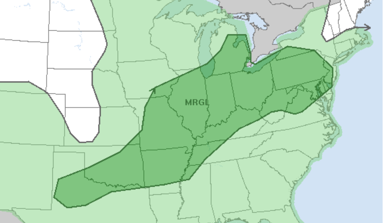
The primary time frame of concern for severe weather will be 1 PM to 12 AM (today/tonight).
Lightning will also be a concern. Thunderstorms will produce frequent cloud-to-ground lightning. When thunder roars, go indoors.
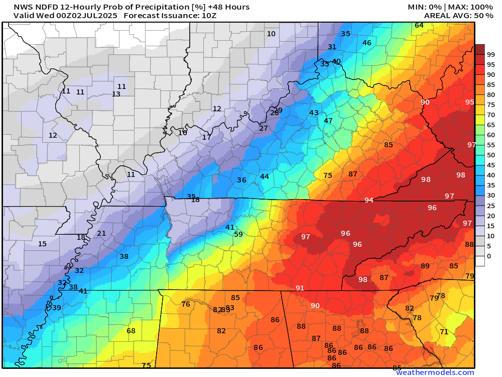
The Tuesday shower and thunderstorm chances will mainly be across the Missouri Bootheel, western Kentucky, and western Tennessee. As you move northward, the chance of rain will be lower on Tuesday.
Here are the Tuesday rain probabilities.
Most of the region will be dry on Wednesday, Thursday, Friday, and Saturday.
I have low-end thunderstorm chances by late in the weekend. Confidence in the chance of thunderstorms this coming weekend is currently low.
It will be somewhat less humid tomorrow through Friday. Then, with time, temperatures will slowly rise back into the 90s by the weekend. A bit more humid, as well.
.

The timestamp (upper left) is in Zulu. 12z=7 am. 18z=1 pm. 00z=7 pm.
Double-click the animation to enlarge it.
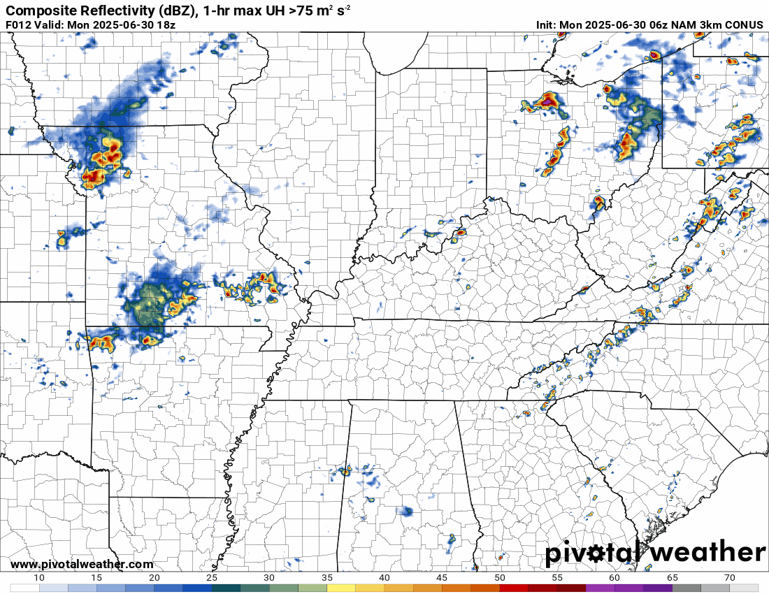
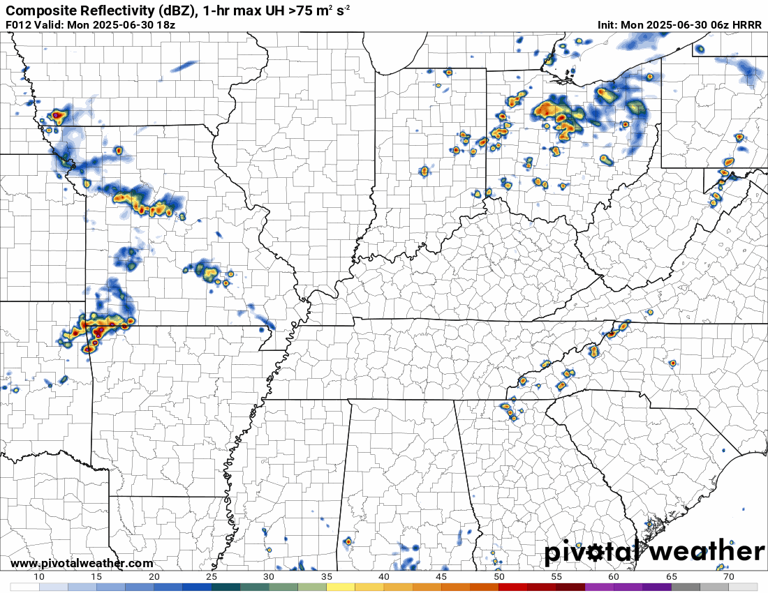
NAM 3K model
 .
.
.
Hrrr model..
The timestamp (upper left) is in Zulu. 12z=7 am. 18z=1 pm. 00z=7 pm.
..
.
Click here if you would like to return to the top of the page.
.Average high temperatures for this time of the year are around 87 degrees.
Average low temperatures for this time of the year are around 66 degrees.
Average precipitation during this time period ranges from 1.00″ to 1.40″
Six to Ten Day Outlook.
Blue is below average. Red is above average. The no color zone represents equal chances.
Average highs for this time of the year are in the lower 60s. Average lows for this time of the year are in the lower 40s.

Green is above average precipitation. Yellow and brown favors below average precipitation. Average precipitation for this time of the year is around one inch per week.

.

Average low temperatures for this time of the year are around 67 degrees.
Average precipitation during this time period ranges from 1.20″ to 1.50″
.
Eight to Fourteen Day Outlook.
Blue is below average. Red is above average. The no color zone represents equal chances.

Green is above average precipitation. Yellow and brown favors below average precipitation. Average precipitation for this time of the year is around one inch per week.

.
.
.
We have a new service to complement your www.weathertalk.com subscription. This does NOTreplace www.weathertalk.com It is simply another tool for you to receive severe weather information.
.
https://weathercallservices.com/beau-dodson-weather


Want to receive the daily forecast/other products on your Beau Dodson Weather app?
Did you know you have four options in your www.weathertalk.com account
You will then receive these via your Beau Dodson Weather app.
Just log into your www.weathertalk.com account
Click the NOTIFICATION SETTINGS TAB
Then, turn them on (green) and off (red)
🌪️ Number 1 is the most important one. Severe alerts, tornado alerts, and so on.
Number 2 is the daily video, blog, livestream alerts, and severe weather Facebook threads on severe days or winter storm days.
Number 3 is the daily forecast. I send that out every day during the afternoon hours. It is the seven-day forecast, hazardous weather outlook, fire outlook, and more.
Number 4 is to receive the daily video, blog, and other content on NON-severe weather days (every day without severe threats in other words)
GREEN IS ON
RED IS OFF

I am going to start going live during bigger severe weather events.
Check it out here https://www.youtube.com/user/beaudodson
Click the subscribe button (it’s a free subscription button), and it will alert you when I go live. I will also send out alerts to the app when I go live for an event.

.

Radars and Lightning Data
Interactive-city-view radars. Clickable watches and warnings.
https://wtalk.co/B3XHASFZ
Old legacy radar site (some of you like it better)
https://weatherobservatory.com/weather-radar.htm
If the radar is not updating then try another one. If a radar does not appear to be refreshing then hit Ctrl F5. You may also try restarting your browser.
Backup radar site in case the above one is not working.
https://weathertalk.com/morani
Regional Radar
https://imagery.weathertalk.com/prx/RadarLoop.mp4
** NEW ** Zoom radar with chaser tracking abilities!
ZoomRadar
If the radar is not working, then email me: Email me at beaudodson@usawx.com
.
We do have some sponsors! Check them out.
Roof damage from recent storms? Link – Click here
INTEGRITY ROOFING AND EXTERIORS!
⛈️ Roof or gutter damage from recent storms? Today’s weather is sponsored by Integrity Roofing. Check out their website at this link https://www.ourintegritymatters.com/

![]()
![]()
![]()
Make sure you have three to five ways of receiving your severe weather information.
Weather Talk is one of those ways! Now, I have another product for you and your family.

.
Want to add more products to your Beau Dodson Weather App?
Receive daily videos, weather blog updates on normal weather days and severe weather and winter storm days, your county by county weather forecast, and more!
Here is how to do add those additional products to your app notification settings!
Here is a video on how to update your Beau Dodson Weather payment.
The app is for subscribers. Subscribe at www.weathertalk.com/welcome then go to your app store and search for WeatherTalk
Subscribers, PLEASE USE THE APP. ATT and Verizon are not reliable during severe weather. They are delaying text messages.
The app is under WeatherTalk in the app store.

Apple users click here

Android users click here
.
Radars and Lightning Data
Interactive-city-view radars. Clickable watches and warnings.
https://wtalk.co/B3XHASFZ
Old legacy radar site (some of you like it better)
https://weatherobservatory.com/weather-radar.htm
If the radar is not updating then try another one. If a radar does not appear to be refreshing then hit Ctrl F5. You may also try restarting your browser.
Backup radar site in case the above one is not working.
https://weathertalk.com/morani
Regional Radar
https://imagery.weathertalk.com/prx/RadarLoop.mp4
** NEW ** Zoom radar with chaser tracking abilities!
ZoomRadar
Lightning Data (zoom in and out of your local area)
https://wtalk.co/WJ3SN5UZ
Not working? Email me at beaudodson@usawx.com
National map of weather watches and warnings. Click here.
Storm Prediction Center. Click here.
Weather Prediction Center. Click here.
.

Live lightning data: Click here.
Real time lightning data (another one) https://map.blitzortung.org/#5.02/37.95/-86.99
Our new Zoom radar with storm chases
.
.

Interactive GOES R satellite. Track clouds. Click here.
GOES 16 slider tool. Click here.
College of DuPage satellites. Click here
.

Here are the latest local river stage forecast numbers Click Here.
Here are the latest lake stage forecast numbers for Kentucky Lake and Lake Barkley Click Here.
.
.
Find Beau on Facebook! Click the banner.


 .
.