

.
I have some question-and-answer threads over on the Facebook page. Link to those threads CLICK HERE
Or email me at beaudodsonweather@gmail.com
..

🌪️ Seven-Day Tornado Outlook ⛈️
June 27th through July 3rd
Current risk: None.
Current confidence level: High confidence in the forecast.
Comment: No tornado threats.
.

Seven-Day Hazardous Weather Outlook
1. Is lightning in the forecast? YES. There is an isolated risk of lightning today. Scattered to numerous lightning strikes are possible Saturday through Monday. Scattered lightning Tuesday through at least Wednesday. Perhaps Thursday.
It is lightning awareness week.
.
2. Are organized severe thunderstorms in the forecast? LOW RISK. The risk of organized severe weather is low. I can’t rule out a few thunderstorms producing high wind gusts. Downburst winds are possible with summer thunderstorms. These tend to be isolated.
A few severe thunderstorm warnings can’t be ruled out over the coming days. Widespread severe weather is not anticipated.
3. Is flash flooding in the forecast? ISOLATED. Summer thunderstorms can produce an inch of rain in less than thirty minutes. This can temporarily flood ditches and some roadways.
4. Will non-thunderstorm winds top 40 mph? NO.
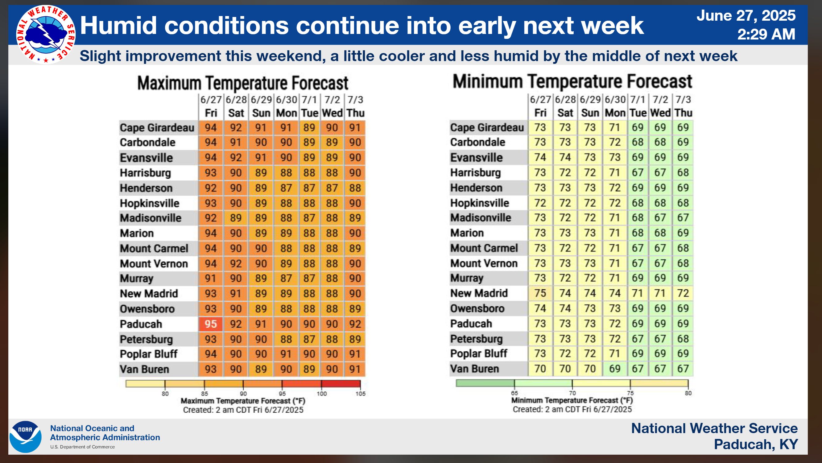
5. Will temperatures rise above 90 degrees? YES. Temperatures will reach 90°F or higher today and Saturday. The risk of 90 degrees or higher is a bit lower on Sunday and Monday. I will monitor late next week.
6. Will the heat index rise above 100 degrees? YES. Heat index values are expected to rise above 100 degrees today and Saturday.
Double click on this graphic to enlarge it.
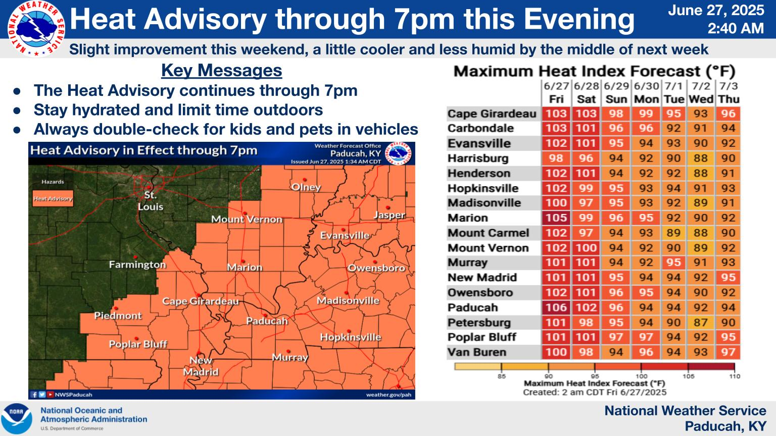
Double click on this graphic to enlarge it. Notice the heat index values.
.
A quick forecast glance. Your 48-hour forecast Graphics


.

.


Forecast discussion.
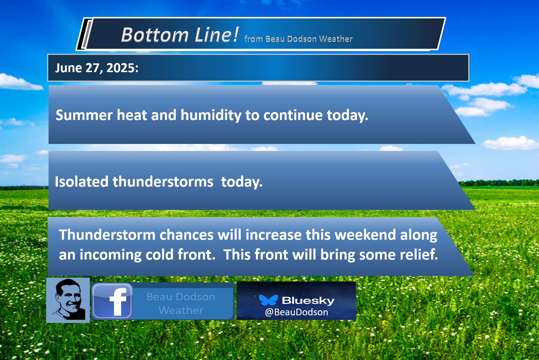
- Hot and muggy weather today. Not quite as muggy on Saturday and Sunday (it will still be muggy).
- Heat index values are expected to exceed 100 degrees today. Around 100 degrees on Saturday. A bit lower Sunday through Thursday.
- Isolated storms today. Scattered storms on Saturday.
- Thunderstorm chances increase along a cold front on Sunday and Monday. Thunderstorm chances will be lower on Tuesday, Wednesday, and Thursday.
- The placement and speed of the cold front will be key to when the thunderstorm chances shift southward.
- Watching for another ridge of high pressure late next week. That would mean the hot weather returns.
.

.
Good day, everyone. Welcome to the weekend!
Wow, it is the last weekend of June, already. Here comes July!
Meteorological fall is about eight weeks away! Hard to believe. But, one season at a time!
Summer Weather Today
The weather has felt more like July over the past week. Hot and muggy. Isolated storms.
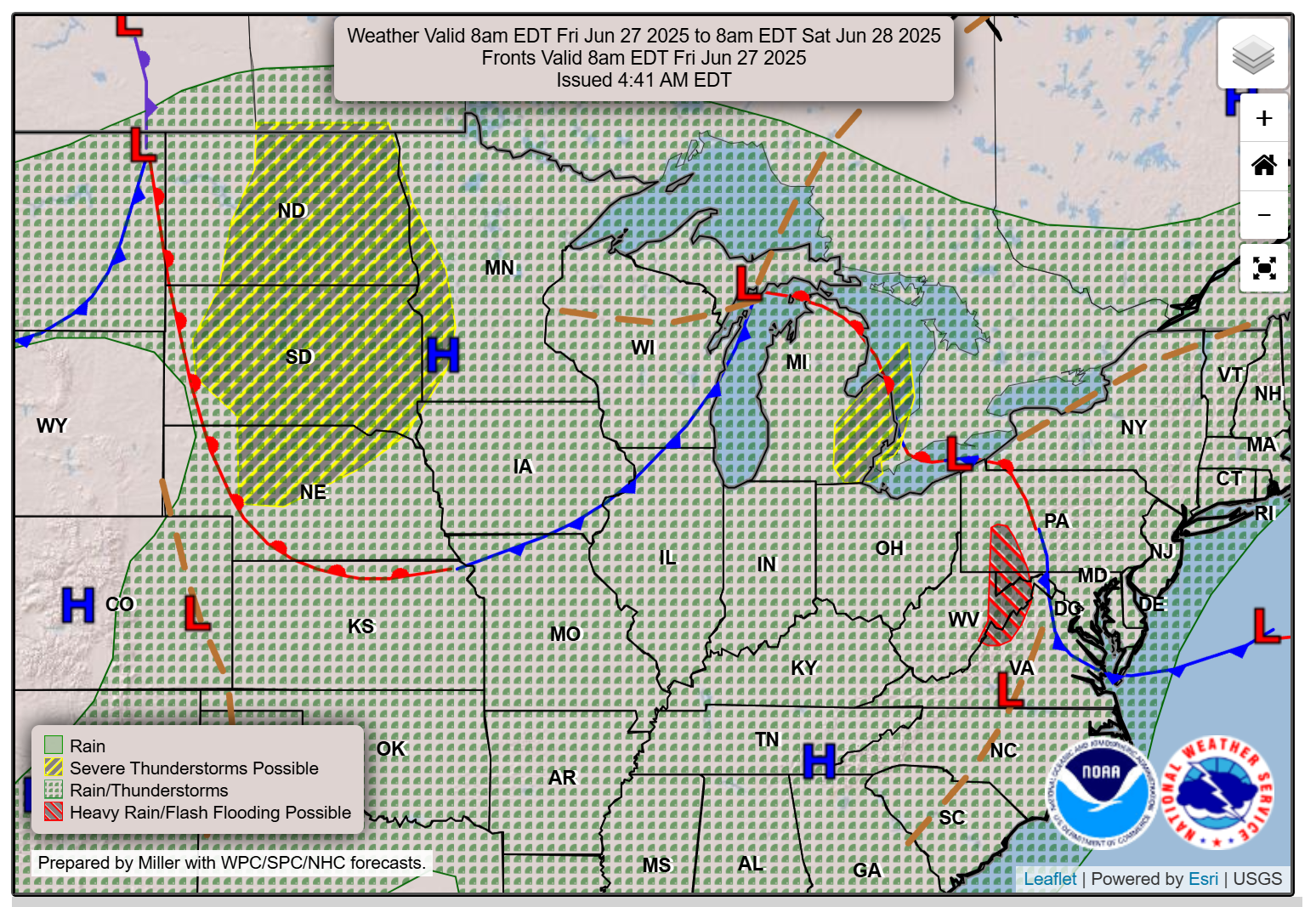
The good news is that a cold front is pushing into the region from the north.
You can see that front on this surface map. The blue line is the cold front.
It remains well to our northwest, but it is moving southeast. It is moving into our region.
.
The front will arrive on Sunday and Monday.
We will experience scattered thunderstorms in the region today, particularly during the peak heating period. That would be noon to 6 pm.
Scattered thunderstorms tonight into Saturday night.
Lightning will be the primary concern. Summer thunderstorms can always produce isolated downburst winds.
Thunderstorms can also produce strong wind gusts and heavy rain. Typically, summer thunderstorms are known to produce an inch of rain in less than thirty minutes. This can flood ditches and roadways.
Thunderstorm chances are expected to increase on Saturday, Sunday, and Monday.
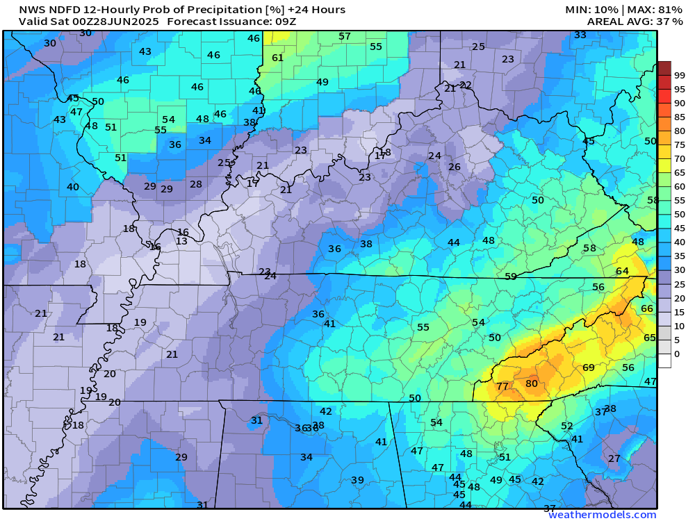
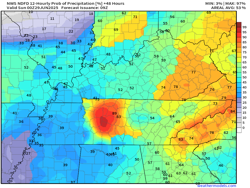
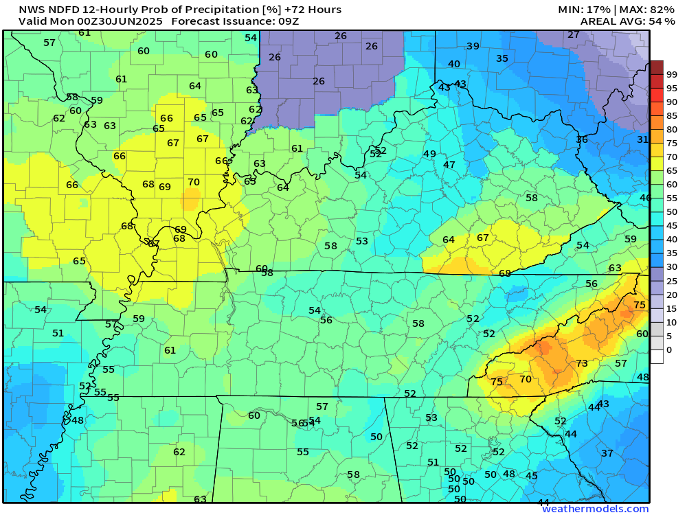
Let’s look at the daily rain probabilities. Rain chances will be somewhat lower at night.
Today (7 AM to 7 PM)
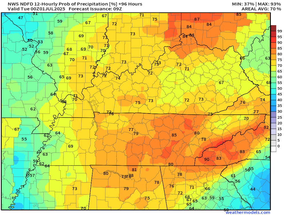
Tomorrow (7 AM to 7 PM)
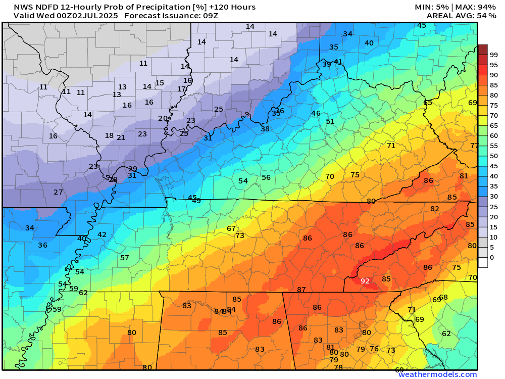
Sunday (7 AM to 7 PM)
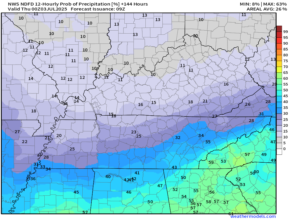
Monday (7 AM to 7 PM)
Tuesday (7 AM to 7 PM)
Wednesday (7 AM to 7 PM)
.
I am monitoring the speed of the front. There remain questions about how fast it departs the region.
If the front slows, then thunderstorm chances will linger into Monday and Tuesday. If the front speeds up a bit, then the chances will be lower.
For now, I have the highest thunderstorm probabilities on Sunday and Monday. Then, slowly lowering them after Monday.
Today will be the hottest and muggiest day. Then, a bit lower on Saturday and Sunday.
The heat advisory will expire today. The NWS thought about extending it into Saturday, but held off.
Either way, it will still be quite warm on Saturday and Sunday.
With time, lower humidity, lower dew points, and somewhat lower temperatures will push into the region on Monday, Tuesday, Wednesday, and Thursday.
It will still be warm, but won’t be quite as awful outside.
Lowering the humidity and dew points will help our cause. Dew point is a measure of moisture in the atmosphere. That is what makes it feel muggy outside.
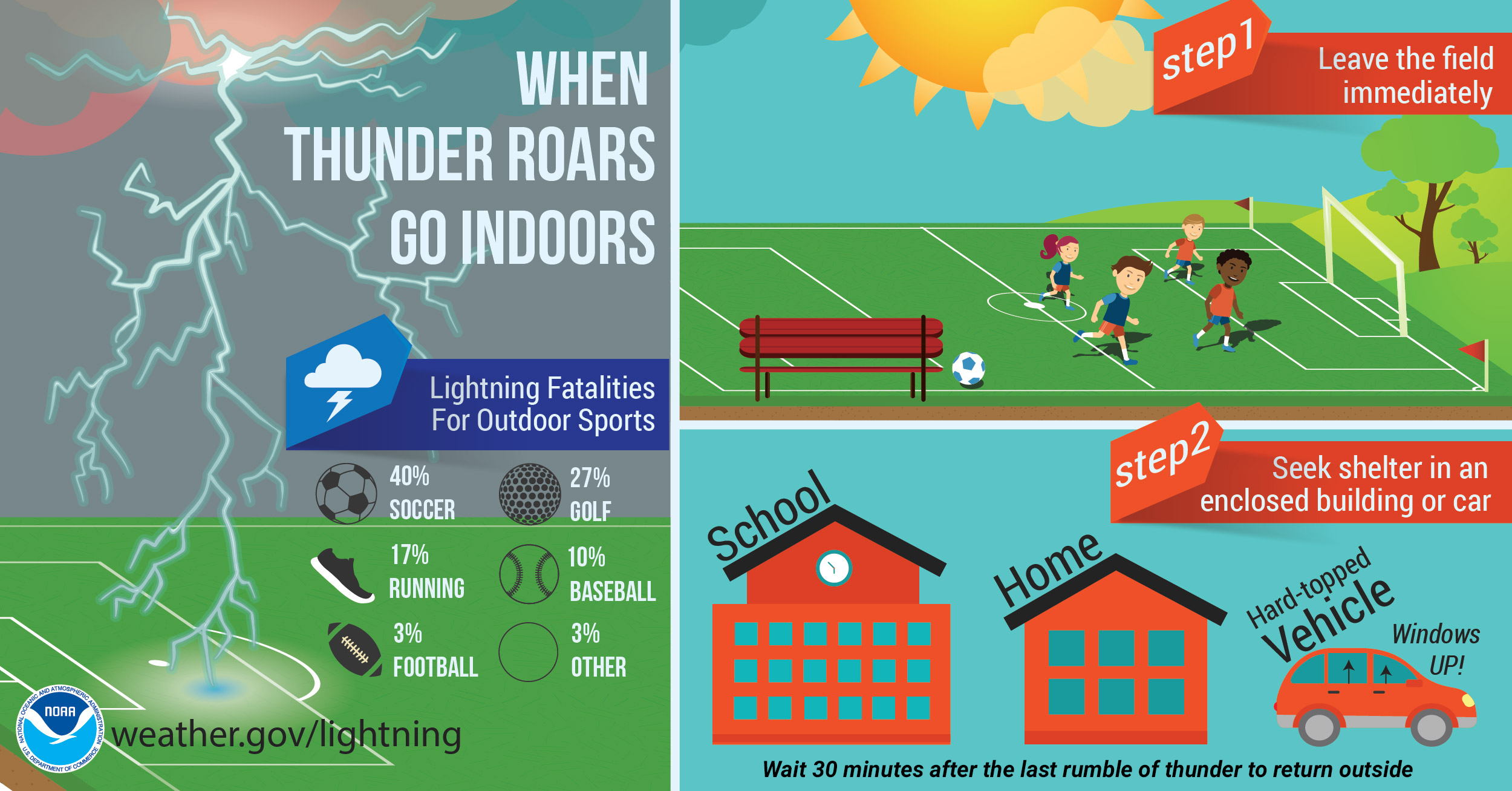
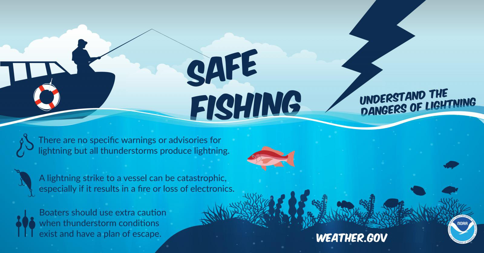
If you have outdoor events this weekend, then monitor the Beau Dodson Weather Radars. If thunder roars, then move indoors.
Lightning can strike ten or more miles away from a thunderstorm. We call those bolts out of the blue.
The best advice is to head indoors when lightning approaches. Let’s keep everyone safe this summer.
When does the heat build back in? That is a great question.
I am watching for another ridge of high pressure to build back in late next week. That would mean temperatures return to the 90s. Hopefully, it won’t be as muggy, but that is certainly a possibility.
I will keep an eye on it.
I hope you have a great weekend! Rain or shine.

The timestamp (upper left) is in Zulu. 12z=7 am. 18z=1 pm. 00z=7 pm.
Double-click the animation to enlarge it.
NAM 3K model
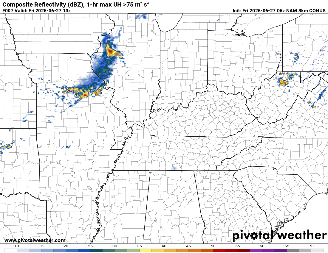 .
.
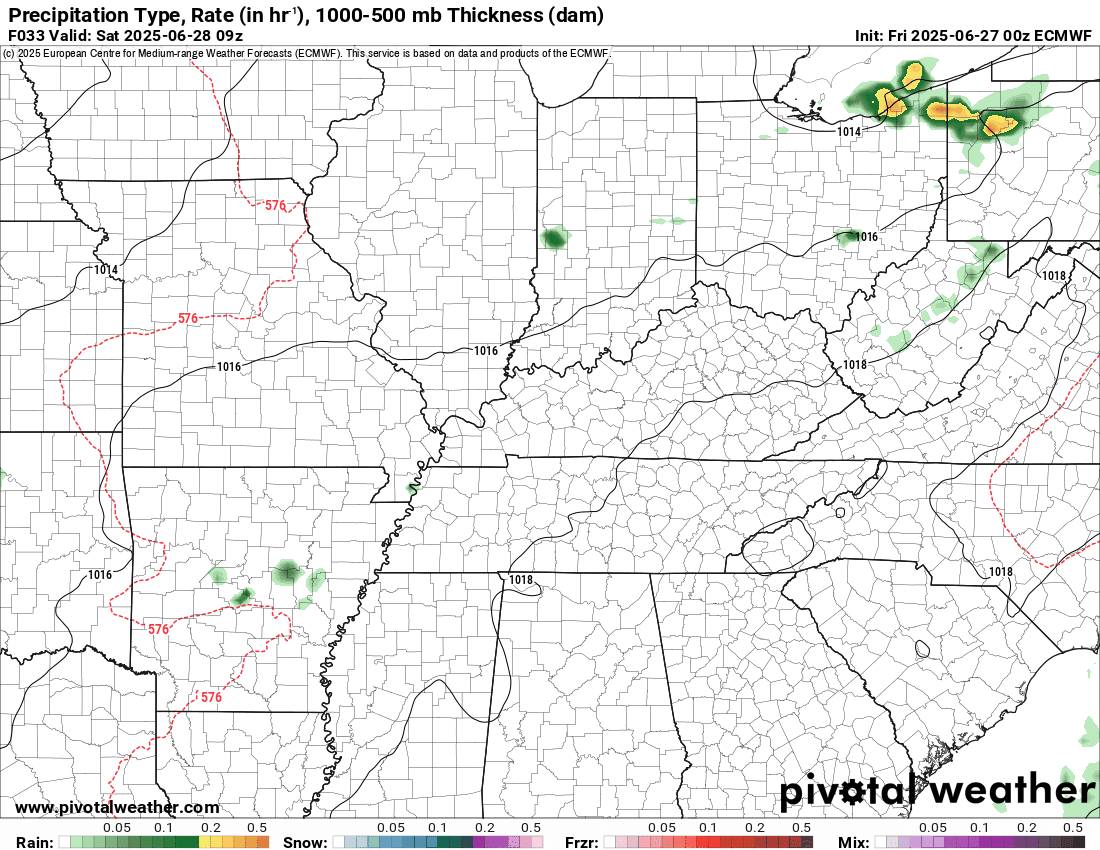
EC model..
The timestamp (upper left) is in Zulu. 12z=7 am. 18z=1 pm. 00z=7 pm.
..
.
Click here if you would like to return to the top of the page.
.Average high temperatures for this time of the year are around 87 degrees.
Average low temperatures for this time of the year are around 66 degrees.
Average precipitation during this time period ranges from 1.00″ to 1.40″
Six to Ten Day Outlook.
Blue is below average. Red is above average. The no color zone represents equal chances.
Average highs for this time of the year are in the lower 60s. Average lows for this time of the year are in the lower 40s.

Green is above average precipitation. Yellow and brown favors below average precipitation. Average precipitation for this time of the year is around one inch per week.

.

Average low temperatures for this time of the year are around 67 degrees.
Average precipitation during this time period ranges from 1.20″ to 1.50″
.
Eight to Fourteen Day Outlook.
Blue is below average. Red is above average. The no color zone represents equal chances.

Green is above average precipitation. Yellow and brown favors below average precipitation. Average precipitation for this time of the year is around one inch per week.

.
.
.
We have a new service to complement your www.weathertalk.com subscription. This does NOTreplace www.weathertalk.com It is simply another tool for you to receive severe weather information.
.
https://weathercallservices.com/beau-dodson-weather


Want to receive the daily forecast/other products on your Beau Dodson Weather app?
Did you know you have four options in your www.weathertalk.com account
You will then receive these via your Beau Dodson Weather app.
Just log into your www.weathertalk.com account
Click the NOTIFICATION SETTINGS TAB
Then, turn them on (green) and off (red)
🌪️ Number 1 is the most important one. Severe alerts, tornado alerts, and so on.
Number 2 is the daily video, blog, livestream alerts, and severe weather Facebook threads on severe days or winter storm days.
Number 3 is the daily forecast. I send that out every day during the afternoon hours. It is the seven-day forecast, hazardous weather outlook, fire outlook, and more.
Number 4 is to receive the daily video, blog, and other content on NON-severe weather days (every day without severe threats in other words)
GREEN IS ON
RED IS OFF

I am going to start going live during bigger severe weather events.
Check it out here https://www.youtube.com/user/beaudodson
Click the subscribe button (it’s a free subscription button), and it will alert you when I go live. I will also send out alerts to the app when I go live for an event.

.

Radars and Lightning Data
Interactive-city-view radars. Clickable watches and warnings.
https://wtalk.co/B3XHASFZ
Old legacy radar site (some of you like it better)
https://weatherobservatory.com/weather-radar.htm
If the radar is not updating then try another one. If a radar does not appear to be refreshing then hit Ctrl F5. You may also try restarting your browser.
Backup radar site in case the above one is not working.
https://weathertalk.com/morani
Regional Radar
https://imagery.weathertalk.com/prx/RadarLoop.mp4
** NEW ** Zoom radar with chaser tracking abilities!
ZoomRadar
If the radar is not working, then email me: Email me at beaudodson@usawx.com
.
We do have some sponsors! Check them out.
Roof damage from recent storms? Link – Click here
INTEGRITY ROOFING AND EXTERIORS!
⛈️ Roof or gutter damage from recent storms? Today’s weather is sponsored by Integrity Roofing. Check out their website at this link https://www.ourintegritymatters.com/

![]()
![]()
![]()
Make sure you have three to five ways of receiving your severe weather information.
Weather Talk is one of those ways! Now, I have another product for you and your family.

.
Want to add more products to your Beau Dodson Weather App?
Receive daily videos, weather blog updates on normal weather days and severe weather and winter storm days, your county by county weather forecast, and more!
Here is how to do add those additional products to your app notification settings!
Here is a video on how to update your Beau Dodson Weather payment.
The app is for subscribers. Subscribe at www.weathertalk.com/welcome then go to your app store and search for WeatherTalk
Subscribers, PLEASE USE THE APP. ATT and Verizon are not reliable during severe weather. They are delaying text messages.
The app is under WeatherTalk in the app store.

Apple users click here

Android users click here
.
Radars and Lightning Data
Interactive-city-view radars. Clickable watches and warnings.
https://wtalk.co/B3XHASFZ
Old legacy radar site (some of you like it better)
https://weatherobservatory.com/weather-radar.htm
If the radar is not updating then try another one. If a radar does not appear to be refreshing then hit Ctrl F5. You may also try restarting your browser.
Backup radar site in case the above one is not working.
https://weathertalk.com/morani
Regional Radar
https://imagery.weathertalk.com/prx/RadarLoop.mp4
** NEW ** Zoom radar with chaser tracking abilities!
ZoomRadar
Lightning Data (zoom in and out of your local area)
https://wtalk.co/WJ3SN5UZ
Not working? Email me at beaudodson@usawx.com
National map of weather watches and warnings. Click here.
Storm Prediction Center. Click here.
Weather Prediction Center. Click here.
.

Live lightning data: Click here.
Real time lightning data (another one) https://map.blitzortung.org/#5.02/37.95/-86.99
Our new Zoom radar with storm chases
.
.

Interactive GOES R satellite. Track clouds. Click here.
GOES 16 slider tool. Click here.
College of DuPage satellites. Click here
.

Here are the latest local river stage forecast numbers Click Here.
Here are the latest lake stage forecast numbers for Kentucky Lake and Lake Barkley Click Here.
.
.
Find Beau on Facebook! Click the banner.


 .
.