

.
I have some question-and-answer threads over on the Facebook page. Link to those threads CLICK HERE
Or email me at beaudodsonweather@gmail.com
I am going to start going live during events.
Check it out here https://www.youtube.com/user/beaudodson
Click the subscribe button (it’s a free subscription button), and it will alert you when I go live. I will also send out alerts to the app when I go live for an event.

.

🌪️ Seven-Day Tornado Outlook ⛈️
June 13th through June 20th
Current risk: UNLIKELY.
Current confidence level: High confidence in the forecast.
Comment: The risk of tornadoes is low. An upper-level low will be spinning over our region today through Sunday. Occasionally, these types of weather systems can produce brief weak landspouts. They can cause light damage to trees and property.
The actual threat at any given location is extremely low.
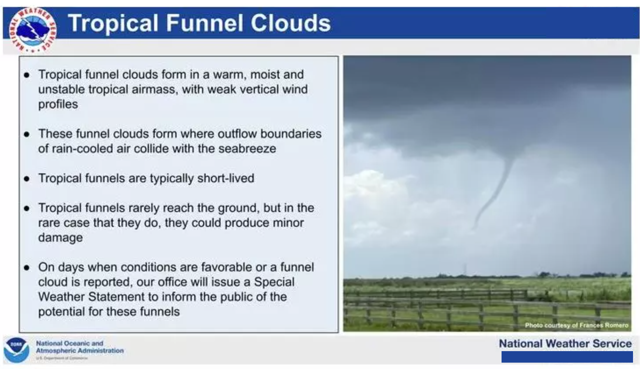
There could be some tropical and cold air funnels over the coming days.
.

Seven-Day Hazardous Weather Outlook
1. Is lightning in the forecast? YES. Lightning will be possible today through Saturday night. Isolated lightning is possible on Sunday, Monday, Tuesday, and Wednesday. I will monitor next Thursday onward.
2. Are severe thunderstorms in the forecast? ORGANIZED SEVERE WEATHER IS NOT ANTICIPATED.
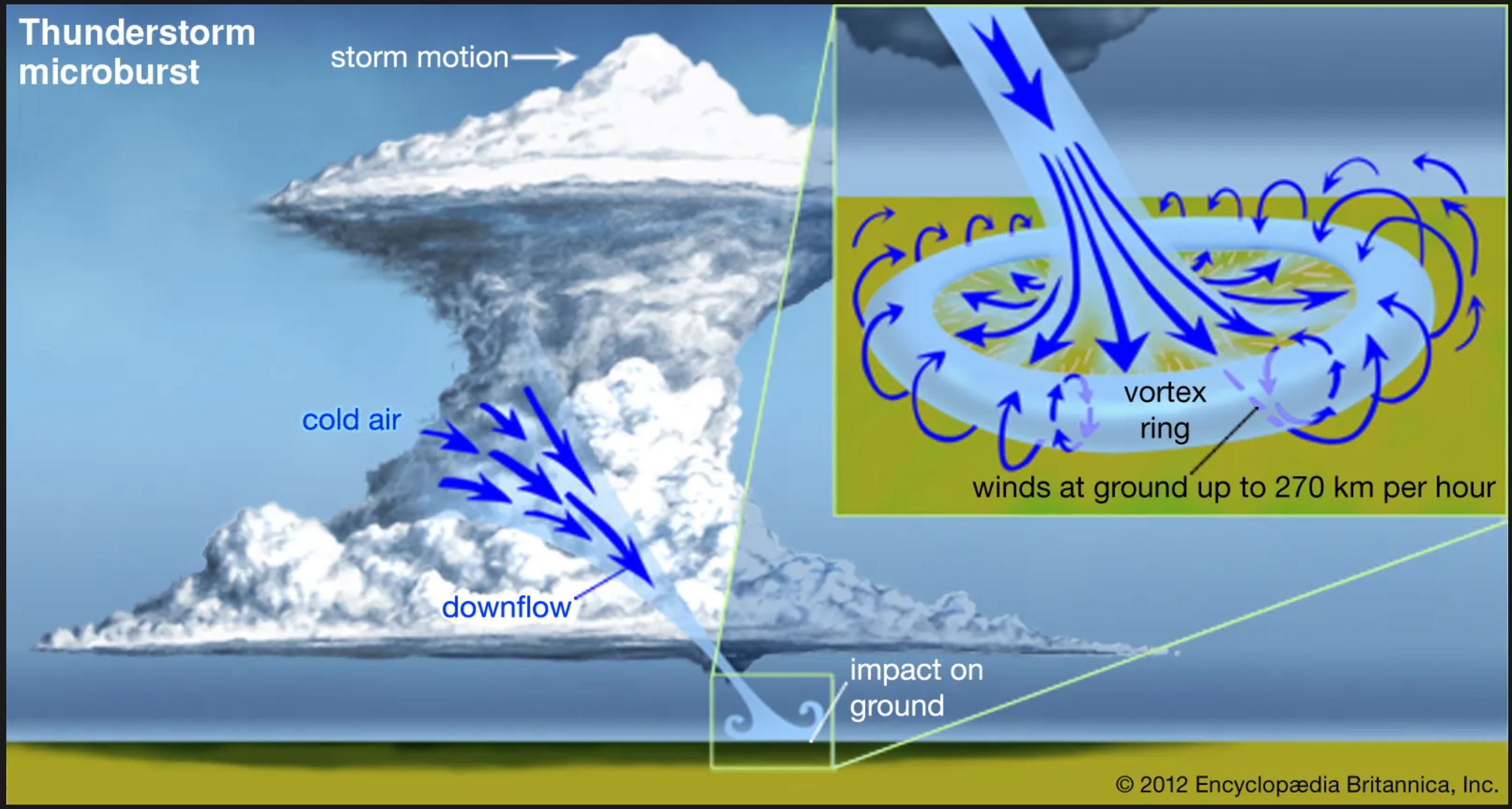
Thunderstorms during the summer months can produce isolated, damaging wind gusts. Downburst winds. This can occur with little or no warning.
Organized severe weather is not currently in the forecast. As always, keep an eye on your Beau Dodson Weather app for updates.
3. Is flash flooding in the forecast? ISOLATED. Locally heavy thunderstorms are likely this weekend. Some storms could produce heavy downpours. There will be plenty of moisture in the atmosphere. Thunderstorms will tap into that moisture and produce heavy downpours.
4. Will non-thunderstorm winds top 40 mph? NO.
5. Will temperatures rise above 90 degrees? POSSIBLE. I will monitor next Tuesday onward.
6. Will the heat index rise above 100 degrees? POSSIBLE. I am monitoring the middle of next week. It will turn quite warm on us. Heat index values could approach or exceed 100 degrees.
.
A quick forecast glance. Your 48-hour forecast Graphics


.

.


Forecast discussion.
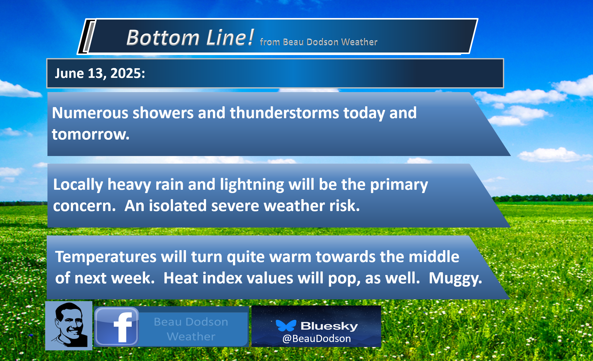
- Showers and thunderstorms today and tomorrow.
- Scattered showers and thunderstorms are expected Sunday into much of next week.
- Locally heavy rain downpours. Lightning, as well.
- The most intense storms could produce strong wind gusts and pea-sized hail. We are not anticipating organized severe weather. Isolated downburst wind gusts are always possible during the summer months.
- I can’t rule out the NWS issuing a severe thunderstorm or tornado warning (for landspouts). The threat at any given location is very small.
- Muggy and warm weather next week. Perhaps hot, at times.
.

Happy weekend, everyone
Not the best weekend forecast.
Not much has changed since yesterday.
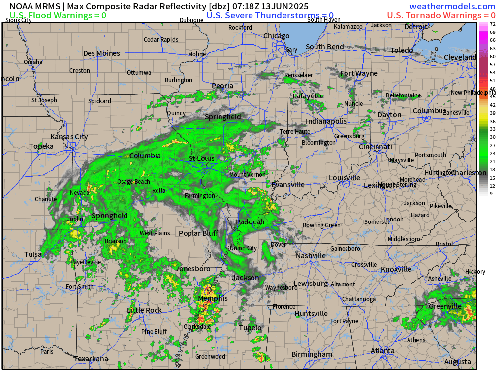
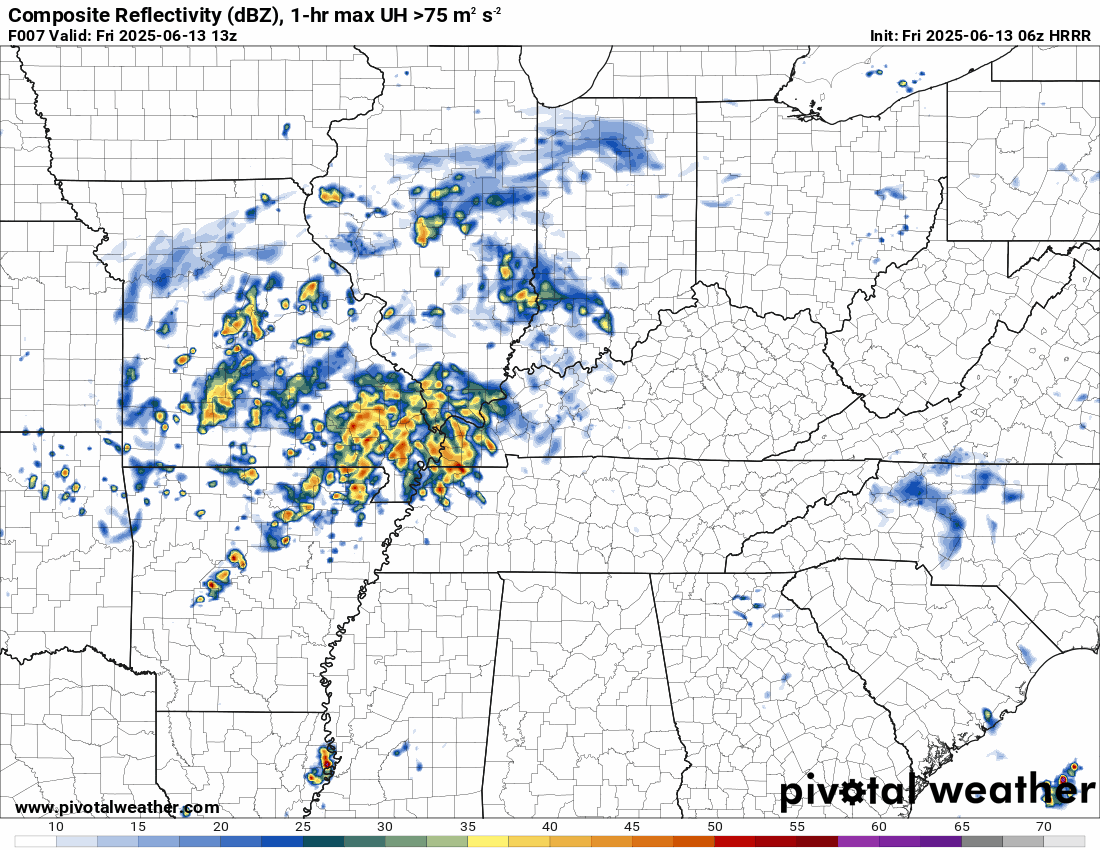
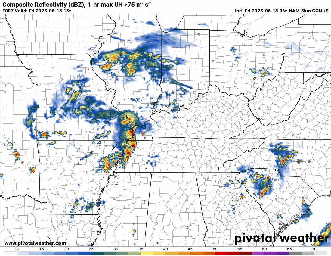
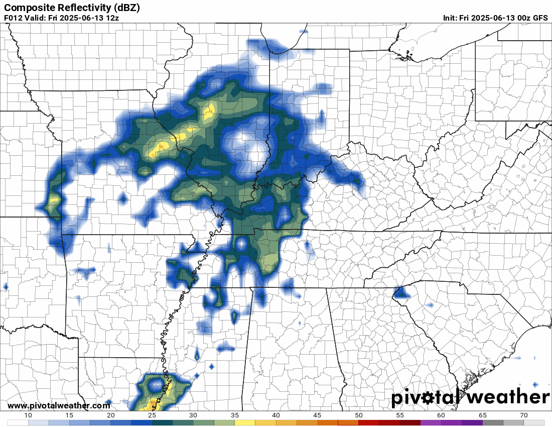
As of 5 am, we have numerous showers and thunderstorms on the weather radars.
You can see the upper-level low rotating across the Missouri and Mississippi Valleys.
Remember, low pressure rotates counter-clockwise. All of this precipitation will pivot through the region over the coming days.
Rain may move in odd directions because of the upper-level low.
.
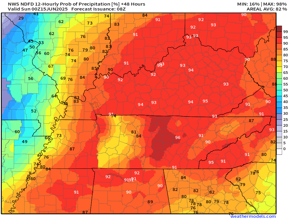
Showers and thunderstorms will be an issue today and tomorrow.
If you have outdoor plans, then have a solid plan B. Be flexible. There will be rain on the weather radars.
Some of the showers and thunderstorms will produce locally heavy rain nd lightning. It is summer. Any storms that form can produce heavy rain. Lighting is a threat, as well. If you have lived around here, then you know this.
Organized severe weather is not in the forecast. That doesn’t mean there can’t be a warning or two. I will be off work, so please ensure you have multiple ways to receive your severe weather information.
Isolated severe weather is always possible during June and July.
The primary concern will be isolated damaging wind gusts and downburst winds. These types of winds can last seconds to a few minutes. They are difficult to issue a warning on. Oftentimes, they can occur with little or no warning. Just keep that in mind.
There will be some spin in the atmosphere from the upper-level low. This could cause brief funnel clouds and perhaps even a landspout tornado. These are usually weak, but can produce light damage. If a tornado warning is issued, then seek shelter.
It will be warm and humid over the coming days. Highs will mostly be in the eighties. Humid.
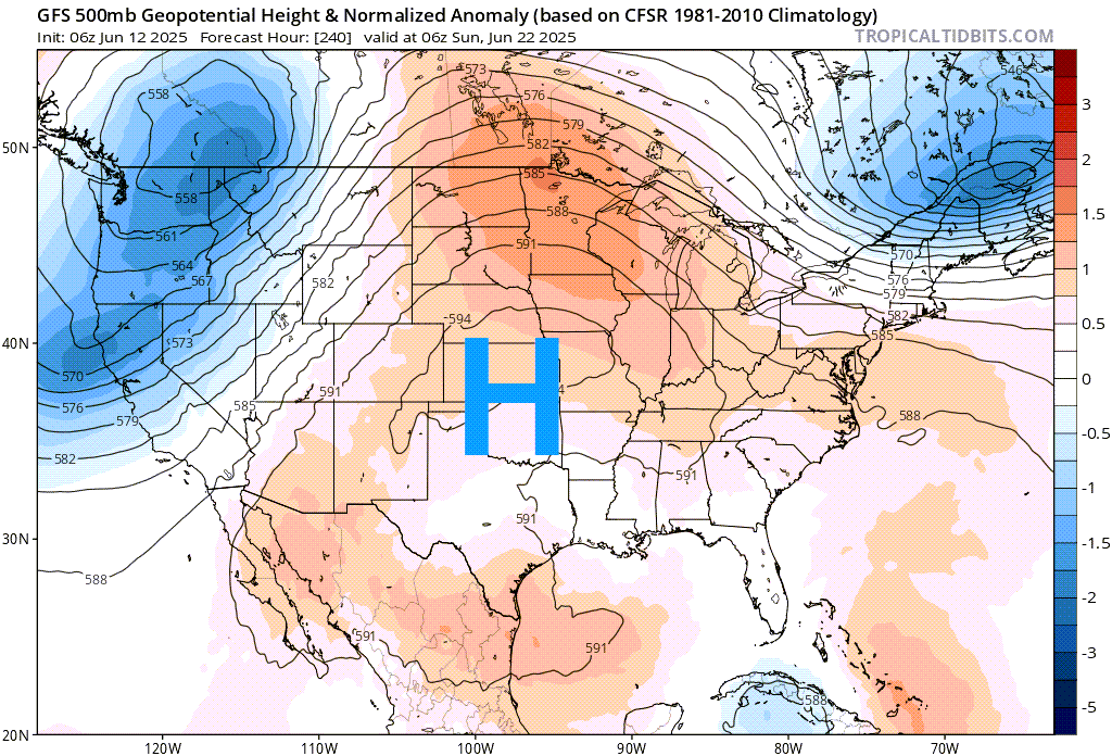
Scattered thunderstorms are possible Sunday into the middle of next week. Perhaps the end of next week.
Both the GFS and EC long-range models are active into next weekend. On and off showers and thunderstorms.
It likely won’t rain every day at every location, but there will likely be on and off showers and storms on radar, especially during the afternoon and evening. During peak heating.
I will be monitoring this area of high pressure over the central United States as we move into next week. Thunderstorms typically occur near the edge of the high-pressure system. If we find ourselves under the high, then it will be dry, hot, and humid.
The placement of the high, during the summer months, will control our weather.
.
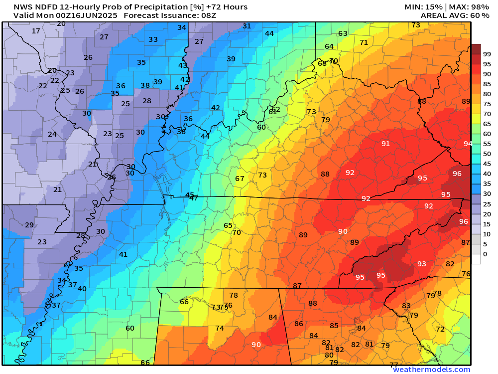
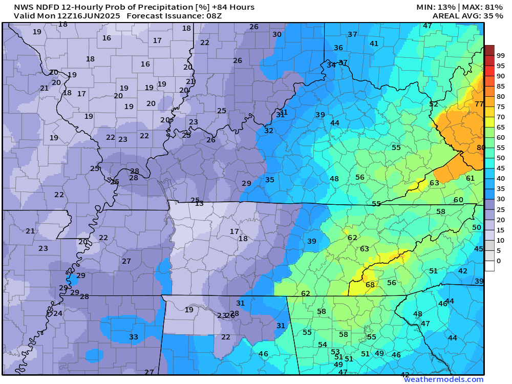
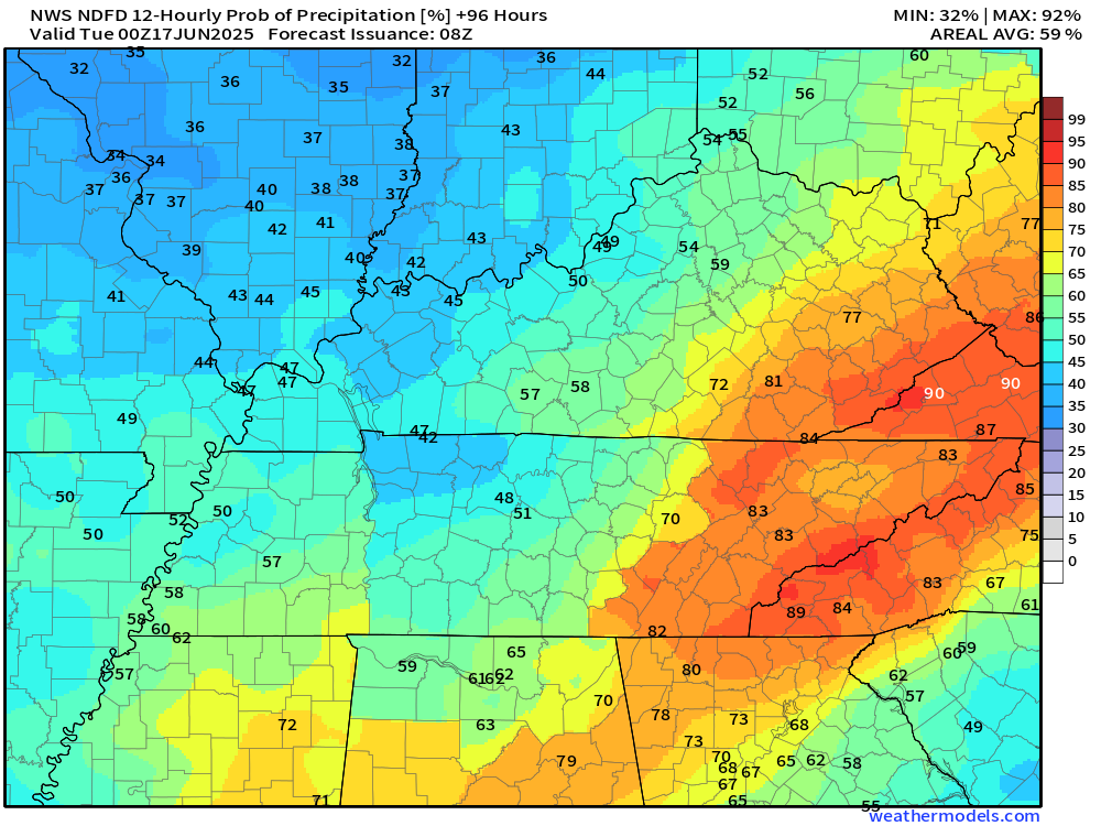
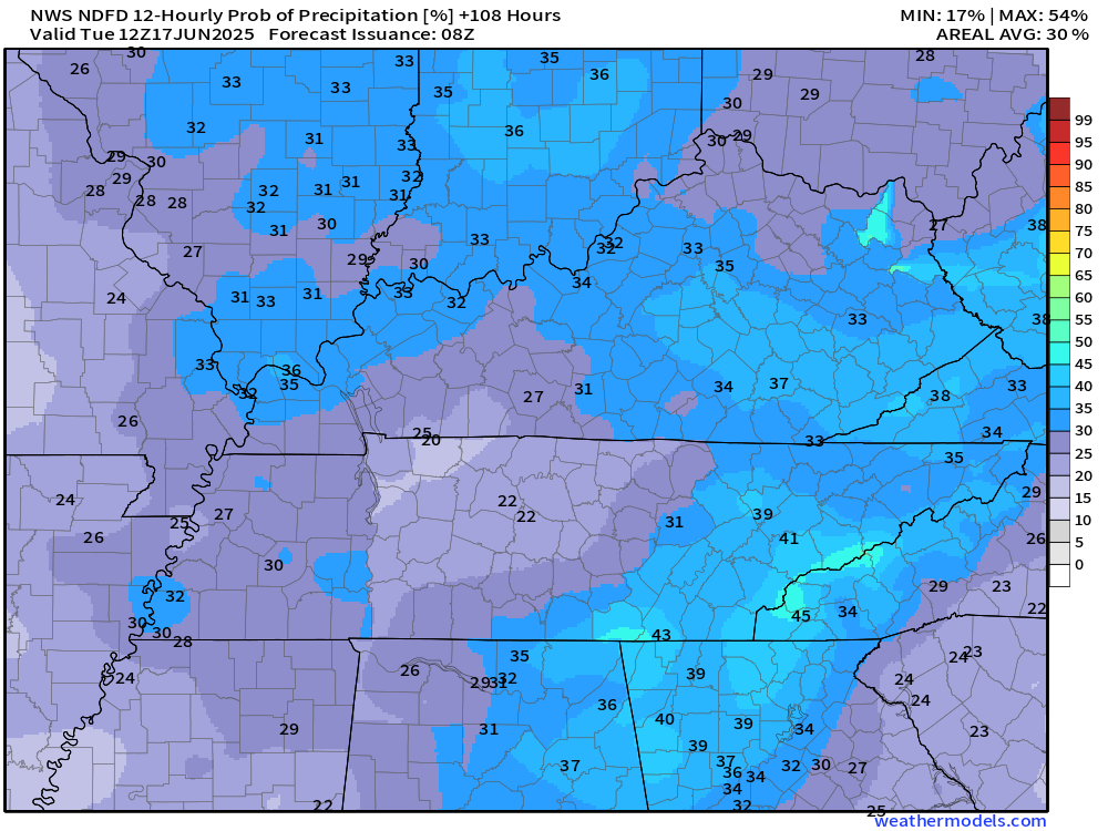
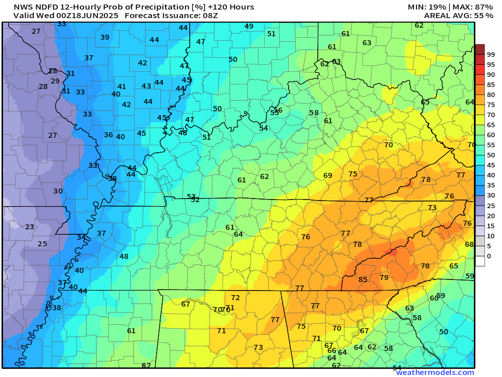
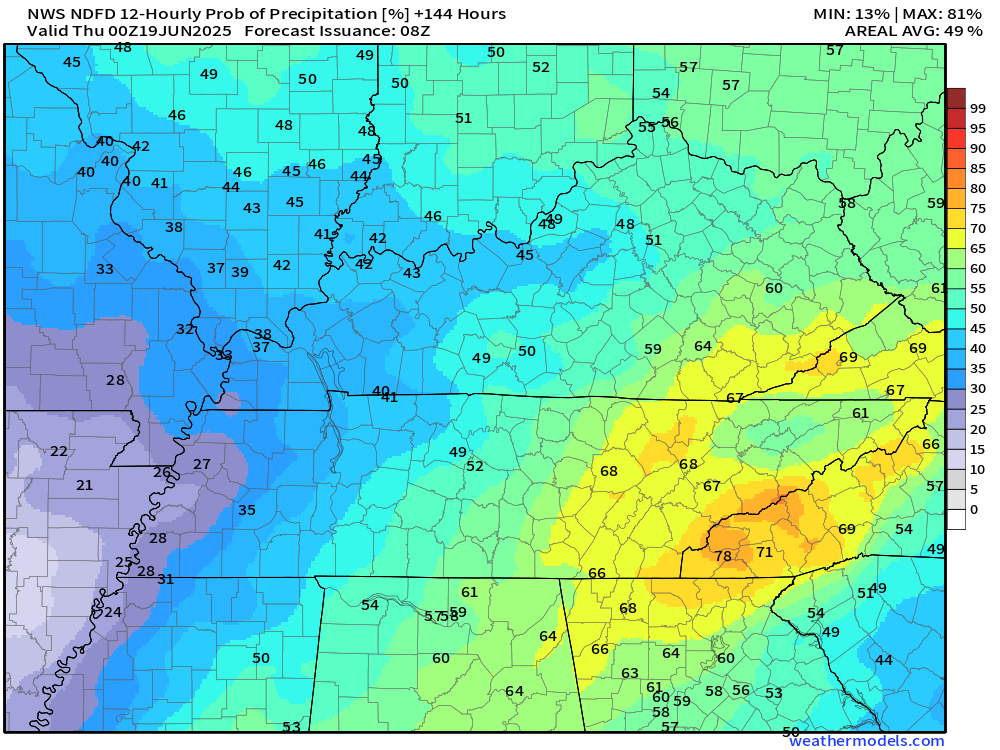
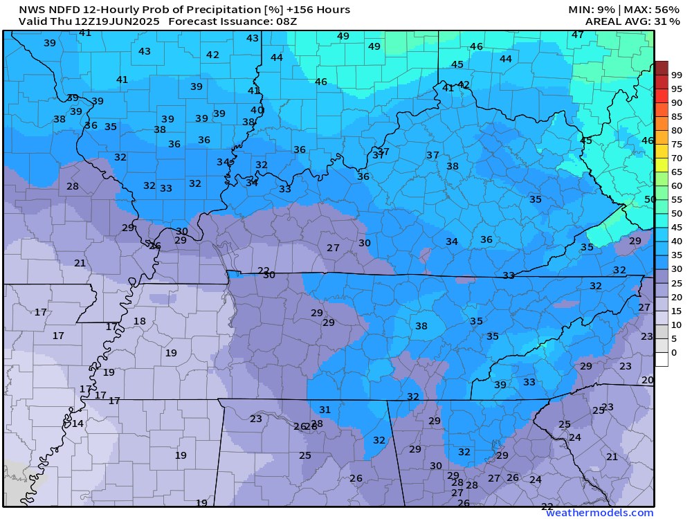
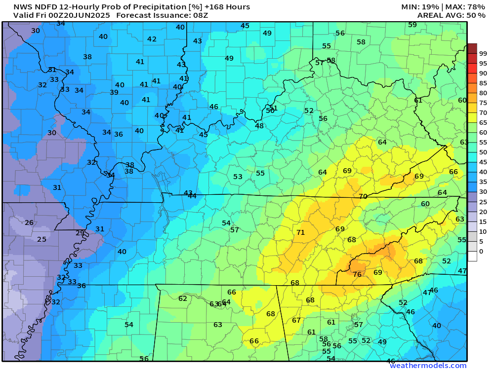
Let’s examine the guidance rainfall probabilities.
Friday
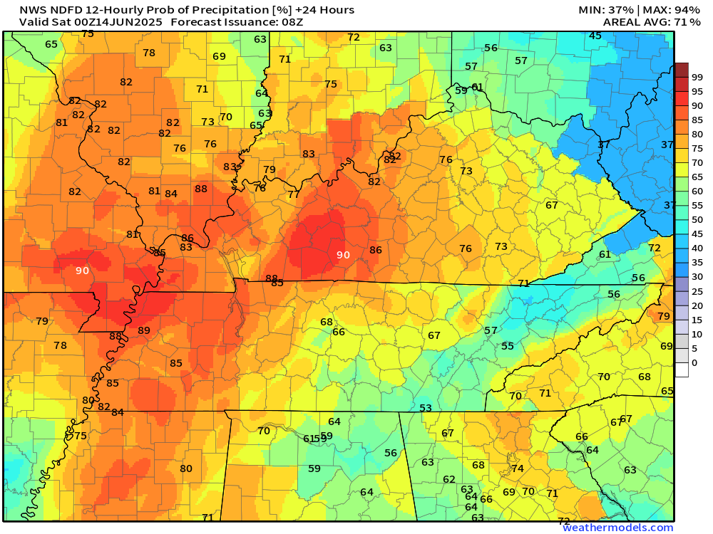
Friday night
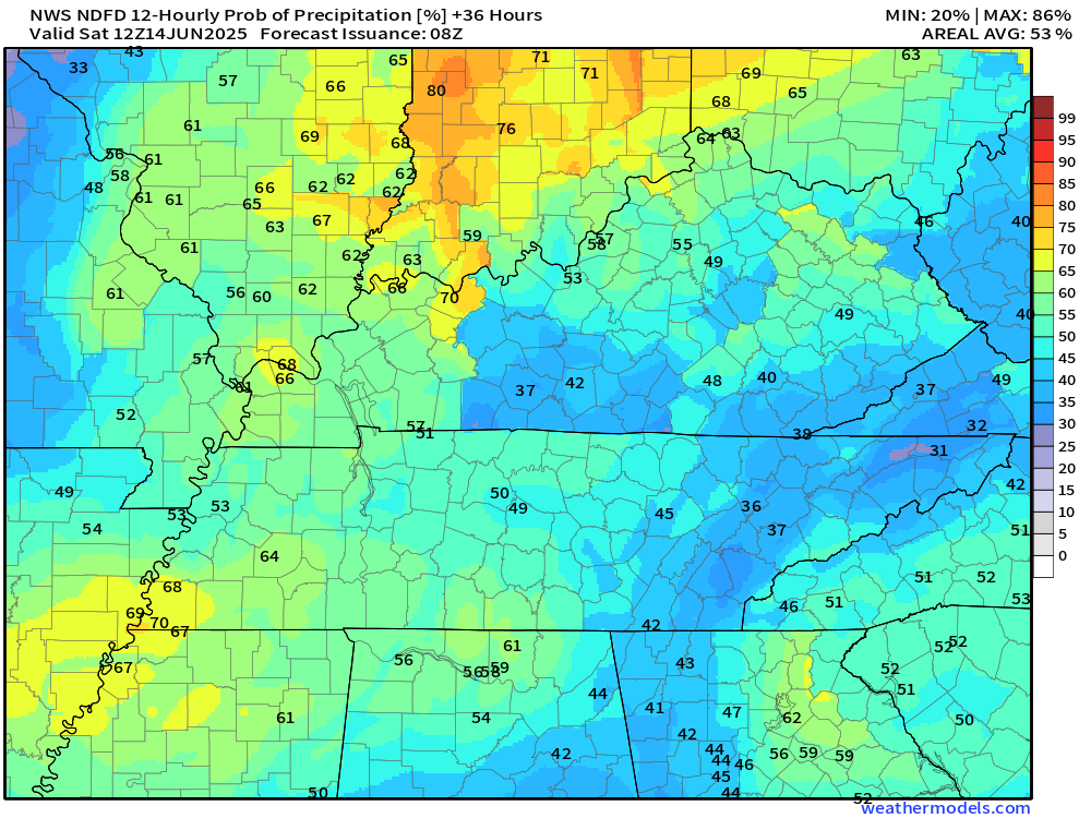
Saturday
Saturday night
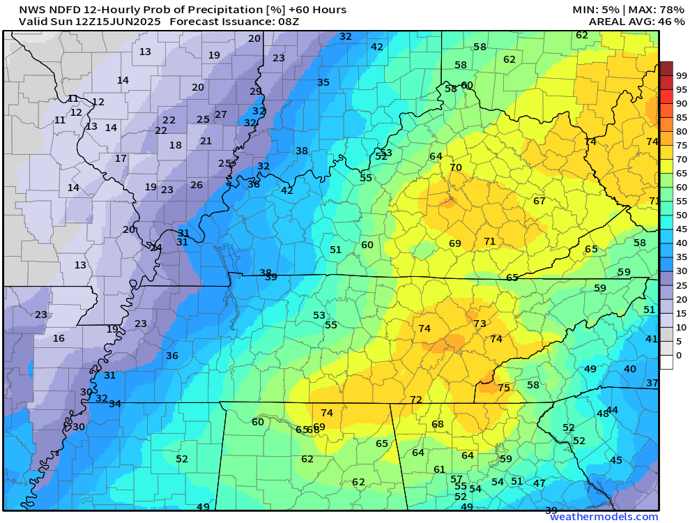
Sunday (7 AM to 7 PM)
.
Sunday night (7 pm to 7 AM)
.
Monday (7 AM to 7 PM)
.
Monday night (7 pm to 7 AM)
.
Tuesday (7 AM to 7 PM)
Tuesday night (7 PM to 7 AM)
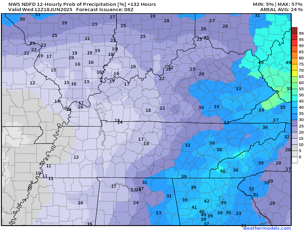
Wednedsay (7 AM to 7 PM)
Wednesday night (7 PM to 7 AM)
Thursday (7 AM to 7 PM)
.
Generally, an unsettled weather forecast. Warm and humid.
I know some farmers have not been able to get to their fields to plant corn. This has been an issue because of wet ground conditions.
This weekend’s rain event won’t help those efforts.
Hopefully, the pattern will calm down a bit by late June. For now, however, the active pattern will continue.
Temperatures on Tuesday, Wednesday, and Thursday of next week will approach 90 degrees with heat index values in the 90s.
I can’t rule out some 100-degree heat index values.
.

The timestamp (upper left) is in Zulu. 12z=7 am. 18z=1 pm. 00z=7 pm.
Double-click the animation to enlarge it.
Hrrr model
.
NAM 3K model..
The timestamp (upper left) is in Zulu. 12z=7 am. 18z=1 pm. 00z=7 pm.
..
.
Click here if you would like to return to the top of the page.
.Average high temperatures for this time of the year are around 83 degrees.
Average low temperatures for this time of the year are around 62 degrees.
Average precipitation during this time period ranges from 1.00″ to 1.40″
Six to Ten Day Outlook.
Blue is below average. Red is above average. The no color zone represents equal chances.
Average highs for this time of the year are in the lower 60s. Average lows for this time of the year are in the lower 40s.

Green is above average precipitation. Yellow and brown favors below average precipitation. Average precipitation for this time of the year is around one inch per week.

.

Average low temperatures for this time of the year are around 63 degrees.
Average precipitation during this time period ranges from 1.20″ to 1.50″
.
Eight to Fourteen Day Outlook.
Blue is below average. Red is above average. The no color zone represents equal chances.

Green is above average precipitation. Yellow and brown favors below average precipitation. Average precipitation for this time of the year is around one inch per week.

.
.
.
We have a new service to complement your www.weathertalk.com subscription. This does NOTreplace www.weathertalk.com It is simply another tool for you to receive severe weather information.
.


.

Radars and Lightning Data
Interactive-city-view radars. Clickable watches and warnings.
https://wtalk.co/B3XHASFZ
Old legacy radar site (some of you like it better)
https://weatherobservatory.com/weather-radar.htm
If the radar is not updating then try another one. If a radar does not appear to be refreshing then hit Ctrl F5. You may also try restarting your browser.
Backup radar site in case the above one is not working.
https://weathertalk.com/morani
Regional Radar
https://imagery.weathertalk.com/prx/RadarLoop.mp4
** NEW ** Zoom radar with chaser tracking abilities!
ZoomRadar
If the radar is not working, then email me: Email me at beaudodson@usawx.com
.
We do have some sponsors! Check them out.
Roof damage from recent storms? Link – Click here
INTEGRITY ROOFING AND EXTERIORS!
⛈️ Roof or gutter damage from recent storms? Today’s weather is sponsored by Integrity Roofing. Check out their website at this link https://www.ourintegritymatters.com/

![]()
![]()
![]()
Make sure you have three to five ways of receiving your severe weather information.
Weather Talk is one of those ways! Now, I have another product for you and your family.

.
Want to add more products to your Beau Dodson Weather App?
Receive daily videos, weather blog updates on normal weather days and severe weather and winter storm days, your county by county weather forecast, and more!
Here is how to do add those additional products to your app notification settings!
Here is a video on how to update your Beau Dodson Weather payment.
The app is for subscribers. Subscribe at www.weathertalk.com/welcome then go to your app store and search for WeatherTalk
Subscribers, PLEASE USE THE APP. ATT and Verizon are not reliable during severe weather. They are delaying text messages.
The app is under WeatherTalk in the app store.

Apple users click here

Android users click here
.
Radars and Lightning Data
Interactive-city-view radars. Clickable watches and warnings.
https://wtalk.co/B3XHASFZ
Old legacy radar site (some of you like it better)
https://weatherobservatory.com/weather-radar.htm
If the radar is not updating then try another one. If a radar does not appear to be refreshing then hit Ctrl F5. You may also try restarting your browser.
Backup radar site in case the above one is not working.
https://weathertalk.com/morani
Regional Radar
https://imagery.weathertalk.com/prx/RadarLoop.mp4
** NEW ** Zoom radar with chaser tracking abilities!
ZoomRadar
Lightning Data (zoom in and out of your local area)
https://wtalk.co/WJ3SN5UZ
Not working? Email me at beaudodson@usawx.com
National map of weather watches and warnings. Click here.
Storm Prediction Center. Click here.
Weather Prediction Center. Click here.
.

Live lightning data: Click here.
Real time lightning data (another one) https://map.blitzortung.org/#5.02/37.95/-86.99
Our new Zoom radar with storm chases
.
.

Interactive GOES R satellite. Track clouds. Click here.
GOES 16 slider tool. Click here.
College of DuPage satellites. Click here
.

Here are the latest local river stage forecast numbers Click Here.
Here are the latest lake stage forecast numbers for Kentucky Lake and Lake Barkley Click Here.
.
.
Find Beau on Facebook! Click the banner.


 .
.