

.
I have some question-and-answer threads over on the Facebook page. Link to those threads CLICK HERE
Or email me at beaudodsonweather@gmail.com
I am going to start going live during events.
I have a live stream running now (I am learning how to use the software).
Check it out here https://www.youtube.com/user/beaudodson
Click the subscribe button (it is a free subscribe button), and it will alert you when I go live. I will also send out alerts to the app when I go live for an event.

.

🌪️ Seven-Day Tornado Outlook ⛈️
May 27th through June 2nd
Current risk: Currently, we do not have a tornado risk.
Current confidence level: High confidence in the forecast.
Comment: At this time, I do not have tornadoes in the forecast.
.

Seven-Day Hazardous Weather Outlook
1. Is lightning in the forecast? YES. There is an isolated risk of lightning today. Another chance late Wednesday night and Thursday. I will monitor Saturday and Sunday.
2. Are severe thunderstorms in the forecast? NO.
3. Is flash flooding in the forecast? NO.
4. Will non-thunderstorm winds top 40 mph? NO.
5. Will temperatures rise above 90 degrees? NO.
6. Will the heat index rise above 100 degrees? NO.
.
A quick forecast glance. Your 48-hour forecast Graphics


.

.


Forecast discussion.
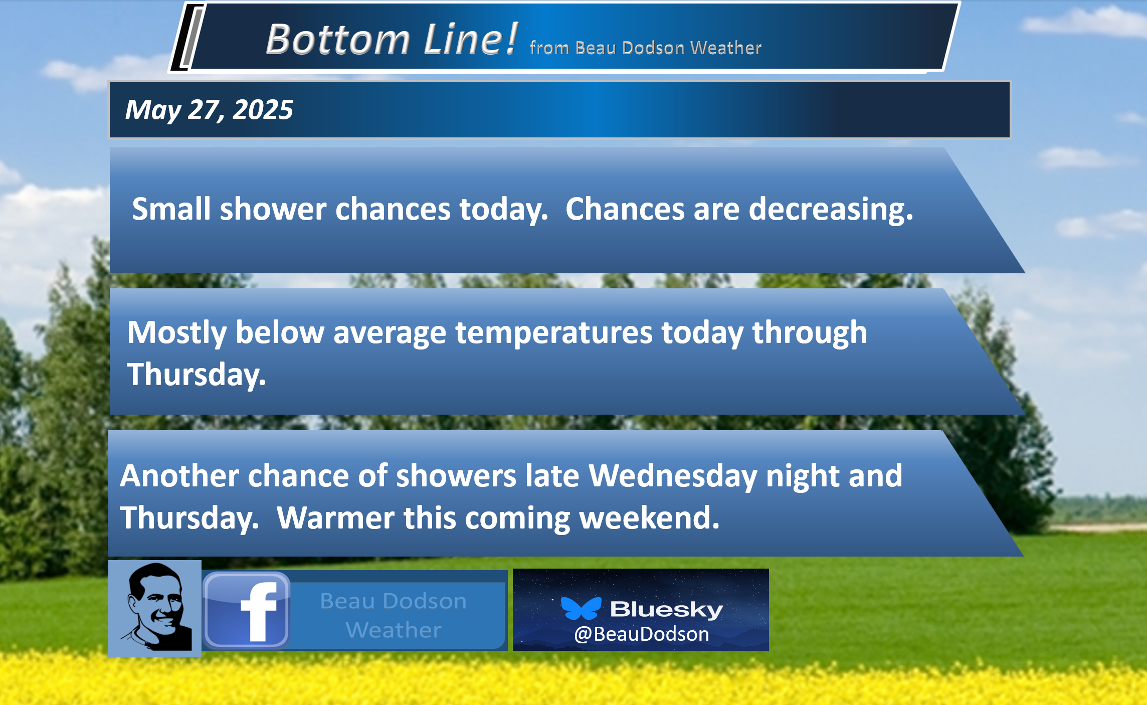
- Below-average temperatures today through Thursday.
- A slight chance of showers today.
- There is a chance of a few showers late Wednesday night and Thursday.
- Most of the data shows dry conditions on Saturday. Then, the data shows an isolated storm chance on Sunday. I will keep an eye on the weekend forecast.
- Temperatures will pop above average Saturday through Tuesday of next week.
.

Well, I hope you had a great weekend.
I’m unsure how to evaluate/grade the forecast. Many areas received some rain, but the coverage and totals were less than anticipated for most.
Honestly, I wasn’t happy with my rain probabilities. I should have kept them lower, in some counties. It’s been a forecast struggle.
The front was a bit farther south than expected.
This is one reason I told everyone not to cancel plans, but have a plan B. Hopefully, most people were able to keep their outdoor activities.
It was cloudy most of the last few days with below to well below average temperatures. At times, temperatures were 10 to 15+ degrees below season averages.
Average highs are around 80 degrees.
I lowered rain probabilities today. The bulk of the system has pushed out of the region. A few showers can’t be ruled out, but generally dry conditions.
Dry conditions are expected tomorrow.
Another system will bring a few showers back into the region late Wednesday night and Thursday.
Here are the rain probabilities for that event.
Thursday rain probabilities
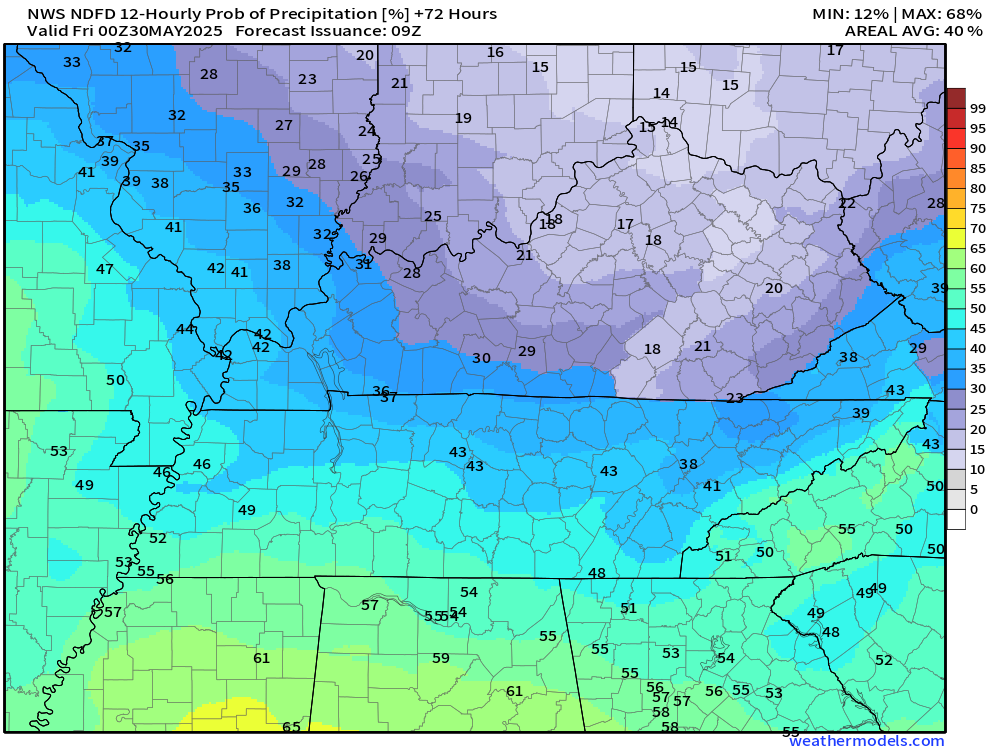
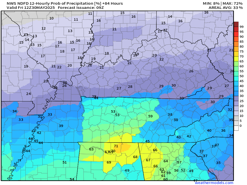
Thursday night rain probabilities
Friday and Saturday should be dry. Perhaps a 10% chance of a shower on Friday. No big deal.
No severe weather concerns through Friday. That is the good news.
Again, temperatures will remain below average today, tomorrow, Thursday, and Friday.
Temperatures will pop above average by Saturday, Sunday, Monday, and Tuesday.
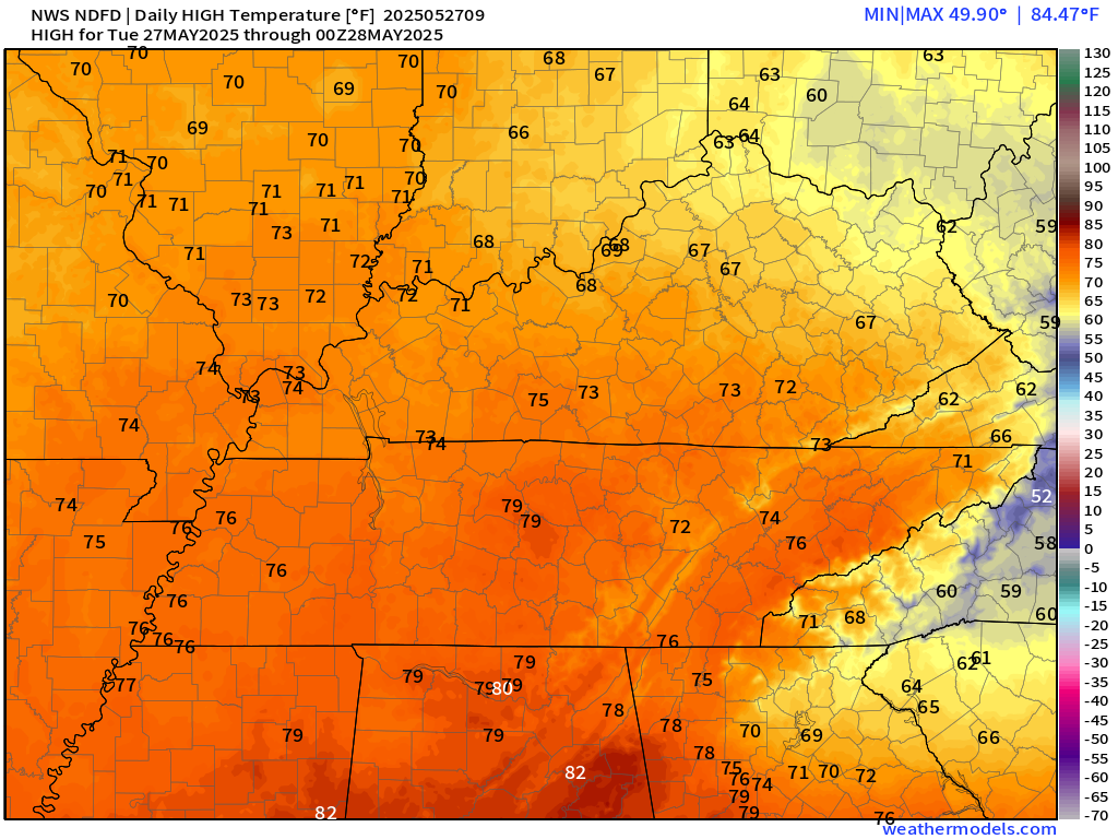
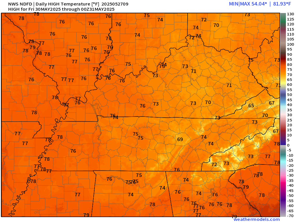
Today’s highs
Friday highs
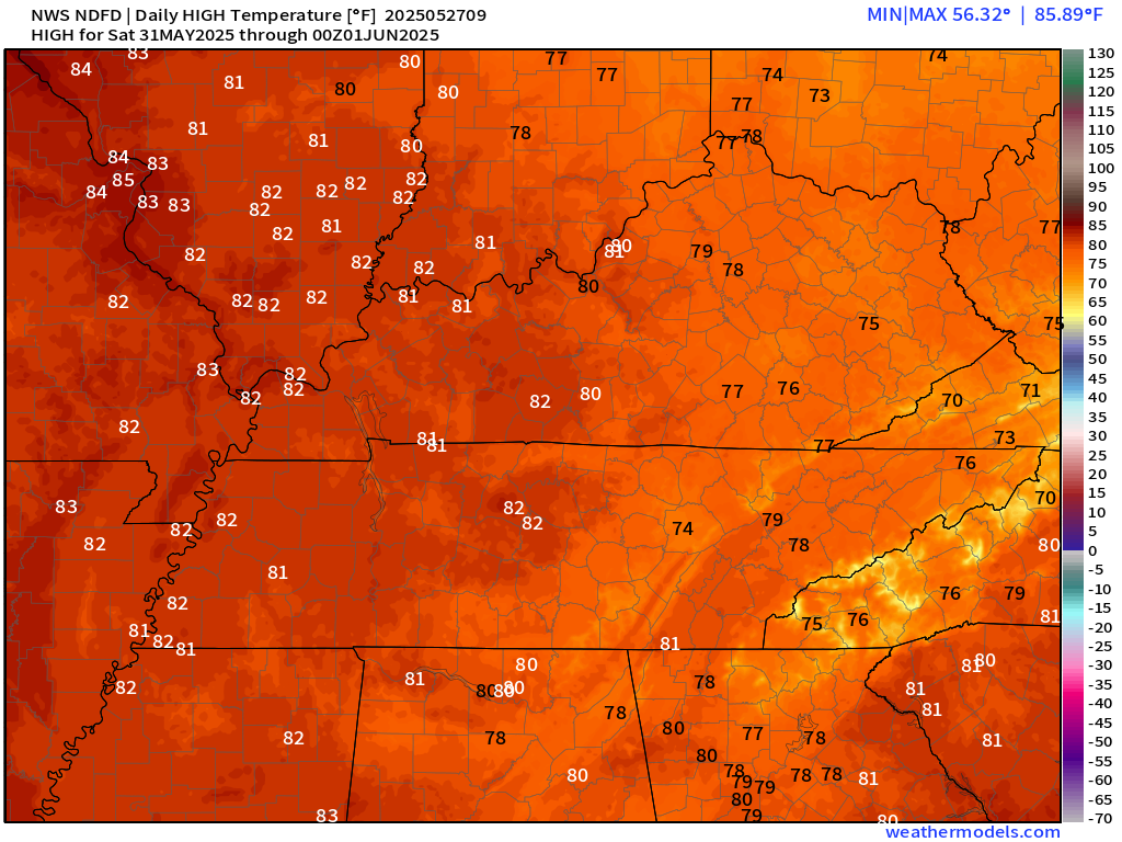
Saturday highs
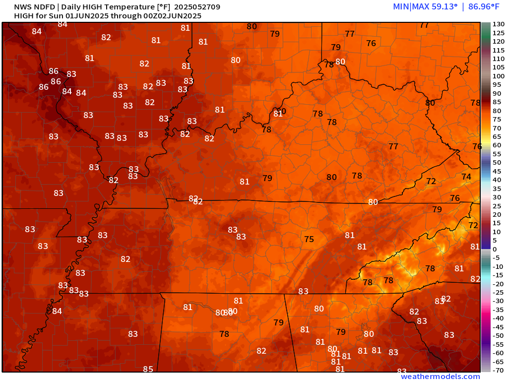
Sunday highs
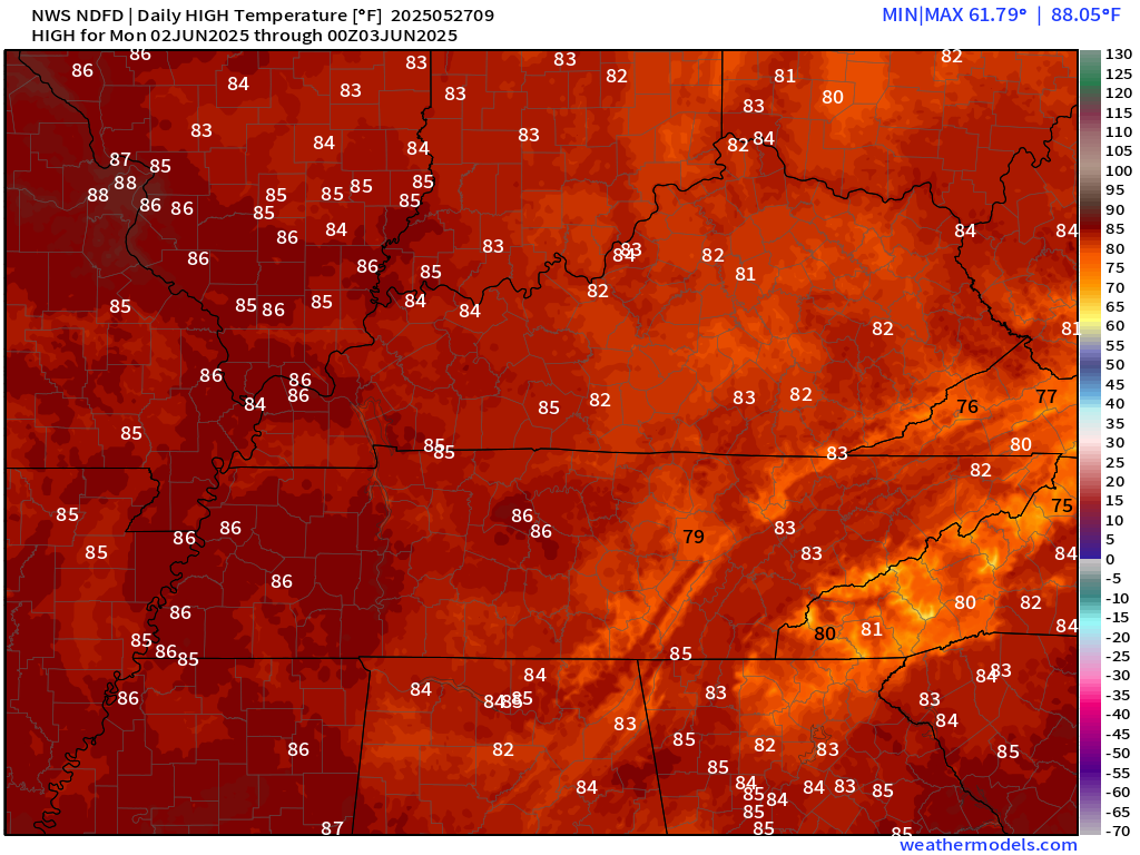
Monday highs
I am monitoring the chance of a thunderstorm on Sunday. For now, I have capped chances at around 20%.
.

The timestamp (upper left) is in Zulu. 12z=7 am. 18z=1 pm. 00z=7 pm.
Double-click the animation to enlarge it.
GFS model.
.
Here is the EC model
.
Here is the GFS model
.
.
.
Click here if you would like to return to the top of the page.
.Average high temperatures for this time of the year are around 80 degrees.
Average low temperatures for this time of the year are around 60 degrees.
Average precipitation during this time period ranges from 1.00″ to 1.40″
Six to Ten Day Outlook.
Blue is below average. Red is above average. The no color zone represents equal chances.
Average highs for this time of the year are in the lower 60s. Average lows for this time of the year are in the lower 40s.

Green is above average precipitation. Yellow and brown favors below average precipitation. Average precipitation for this time of the year is around one inch per week.

.

Average low temperatures for this time of the year are around 60 degrees.
Average precipitation during this time period ranges from 1.20″ to 1.50″
.
Eight to Fourteen Day Outlook.
Blue is below average. Red is above average. The no color zone represents equal chances.

Green is above average precipitation. Yellow and brown favors below average precipitation. Average precipitation for this time of the year is around one inch per week.

.
.
.
We have a new service to complement your www.weathertalk.com subscription. This does NOTreplace www.weathertalk.com It is simply another tool for you to receive severe weather information.
.


.

Radars and Lightning Data
Interactive-city-view radars. Clickable watches and warnings.
https://wtalk.co/B3XHASFZ
Old legacy radar site (some of you like it better)
https://weatherobservatory.com/weather-radar.htm
If the radar is not updating then try another one. If a radar does not appear to be refreshing then hit Ctrl F5. You may also try restarting your browser.
Backup radar site in case the above one is not working.
https://weathertalk.com/morani
Regional Radar
https://imagery.weathertalk.com/prx/RadarLoop.mp4
** NEW ** Zoom radar with chaser tracking abilities!
ZoomRadar
If the radar is not working, then email me: Email me at beaudodson@usawx.com
.
We do have some sponsors! Check them out.
Roof damage from recent storms? Link – Click here
INTEGRITY ROOFING AND EXTERIORS!
⛈️ Roof or gutter damage from recent storms? Today’s weather is sponsored by Integrity Roofing. Check out their website at this link https://www.ourintegritymatters.com/

![]()
![]()
![]()
Make sure you have three to five ways of receiving your severe weather information.
Weather Talk is one of those ways! Now, I have another product for you and your family.

.
Want to add more products to your Beau Dodson Weather App?
Receive daily videos, weather blog updates on normal weather days and severe weather and winter storm days, your county by county weather forecast, and more!
Here is how to do add those additional products to your app notification settings!
Here is a video on how to update your Beau Dodson Weather payment.
The app is for subscribers. Subscribe at www.weathertalk.com/welcome then go to your app store and search for WeatherTalk
Subscribers, PLEASE USE THE APP. ATT and Verizon are not reliable during severe weather. They are delaying text messages.
The app is under WeatherTalk in the app store.

Apple users click here

Android users click here
.
Radars and Lightning Data
Interactive-city-view radars. Clickable watches and warnings.
https://wtalk.co/B3XHASFZ
Old legacy radar site (some of you like it better)
https://weatherobservatory.com/weather-radar.htm
If the radar is not updating then try another one. If a radar does not appear to be refreshing then hit Ctrl F5. You may also try restarting your browser.
Backup radar site in case the above one is not working.
https://weathertalk.com/morani
Regional Radar
https://imagery.weathertalk.com/prx/RadarLoop.mp4
** NEW ** Zoom radar with chaser tracking abilities!
ZoomRadar
Lightning Data (zoom in and out of your local area)
https://wtalk.co/WJ3SN5UZ
Not working? Email me at beaudodson@usawx.com
National map of weather watches and warnings. Click here.
Storm Prediction Center. Click here.
Weather Prediction Center. Click here.
.

Live lightning data: Click here.
Real time lightning data (another one) https://map.blitzortung.org/#5.02/37.95/-86.99
Our new Zoom radar with storm chases
.
.

Interactive GOES R satellite. Track clouds. Click here.
GOES 16 slider tool. Click here.
College of DuPage satellites. Click here
.

Here are the latest local river stage forecast numbers Click Here.
Here are the latest lake stage forecast numbers for Kentucky Lake and Lake Barkley Click Here.
.
.
Find Beau on Facebook! Click the banner.


 .
.