

.
I have some question-and-answer threads over on the Facebook page. Link to those threads CLICK HERE
Or email me at beaudodsonweather@gmail.com
.

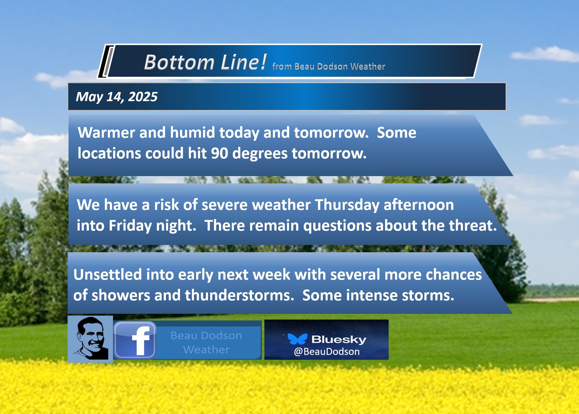
🌪️ Seven-Day Tornado Outlook ⛈️
May 14th through May 20tth
Current risk: Tornadoes are possible.
Current confidence level: Medium confidence in the forecast.
Comment: We do have a risk of severe thunderstorms on Thursday afternoon and night. Another risk is on Friday afternoon and night. I am monitoring Sunday through Tuesday.
There remain questions about the threat level on Thursday and Friday. There will be a very strong CAP (lid on the atmosphere) on Thursday. A weaker CAP on Friday. If the CAP holds on Thursday, then severe storms won’t form.
At this time, we believe storms are more likely to form on Friday than on Thursday. With that said, I will need to monitor both days closely. If supercells do form, then they would likely produce severe weather. I can’t rule out a few tornadoes.
A couple of storm systems will move through the region Sunday through Tuesday. I will monitor the risk of additional severe weather.
Monitor your app notifications.
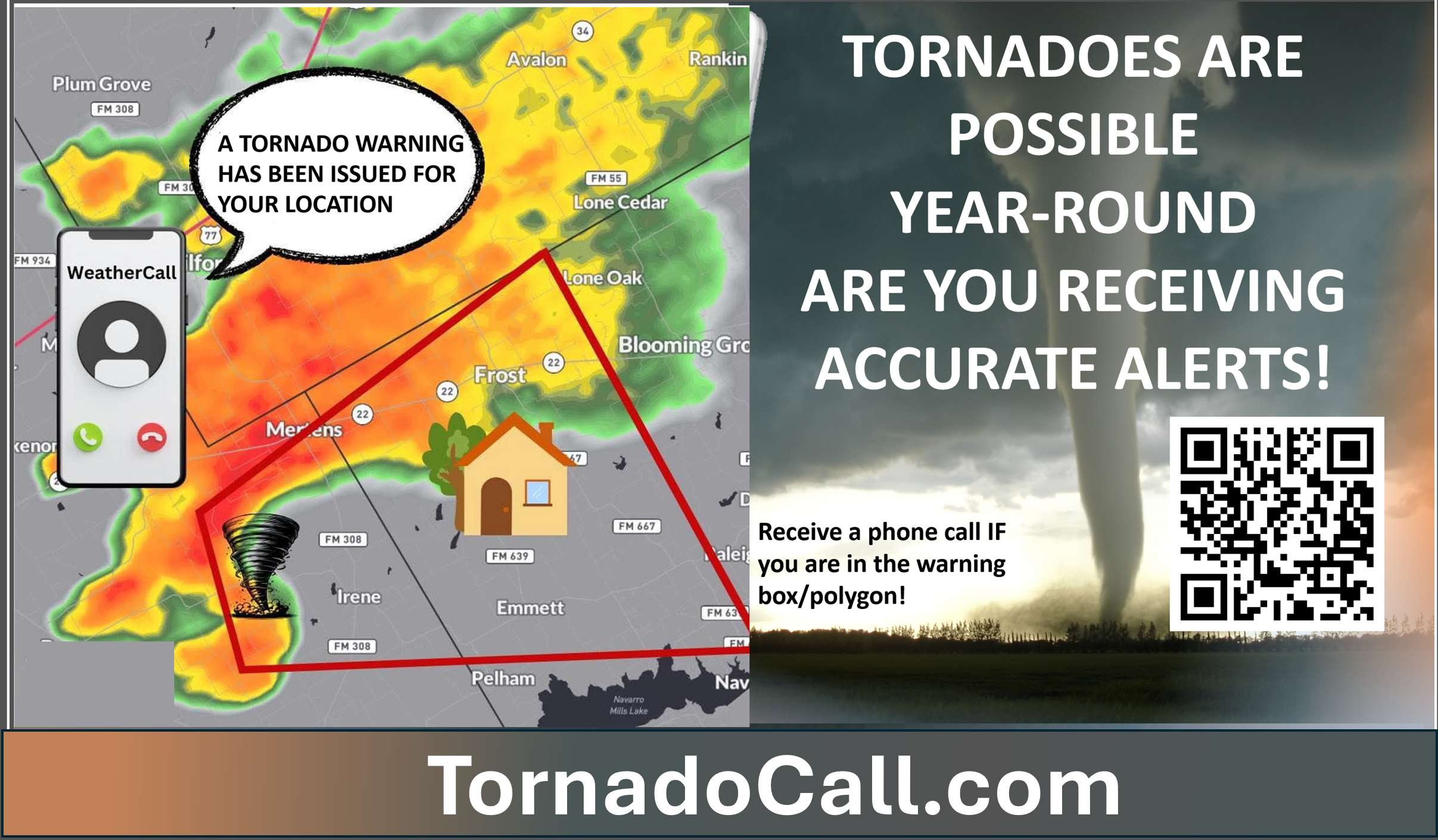
Don’t forget that I have partnered with a company that will call you in case of a tornado or severe thunderstorm warning. I use it myself. This does not replace WeatherTalk, but it is an added layer of protection.
Here is more information on the service
YouTube Video
https://www.youtube.com/watch?v=ve2UY2mAkEI
What the tornado warning sounds like
https://www.youtube.com/watch?v=MXBc03tW_N0
.

Seven-Day Hazardous Weather Outlook
1. Is lightning in the forecast? YES. Lightning is possible Thursday afternoon through Friday night. A lower risk on Saturday. Another risk from Sunday through Tuesday.
2. Are severe thunderstorms in the forecast? YES. Severe weather is possible on Thursday afternoon and night (if the CAP breaks). A higher chance on Friday afternoon and night. I am monitoring Sunday through Tuesday.
The primary concern will be large hail and damaging wind gusts. A few tornadoes are possible, as well.
3. Is flash flooding in the forecast? LOW RISK. Overall, the risk is low. Heavy storms could briefly flood ditches and roadways on Friday and Friday night. I will monitor thunderstorm chances early next week. There will be plenty of moisture in the atmosphere for storms to tap into.
4. Will non-thunderstorm winds top 40 mph? NO.
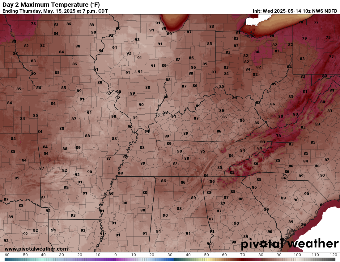
5. Will temperatures rise above 90 degrees? YES. Some reporting stations will hit 90 degrees on Thursday.
6. Will the heat index rise above 100 degrees? NOT AT THIS TIME.
.
A quick forecast glance. Your 48-hour forecast Graphics


.

.


Forecast discussion.
- Warmer today and tomorrow. More humid, as well.
- I am monitoring the risk of severe thunderstorms on Thursday afternoon through Friday night. There will be a strong CAP. If the CAP holds, then we won’t have severe weather. That is more likely on Thursday vs Friday.
- A lower chance of thunderstorms on Saturday.
- Another chance of thunderstorms Sunday through Tuesday. Some of those storms could be intense, as well.
.

.
Good morning, everyone. I hope you are having a nice week.
We do have quite a bit of weather to track. Let’s break it down!
TODAY
It will be warmer today with widespread eighties for high temperatures. A small chance of an isolated shower or thunderstorm. Most of the region will remain dry today. One or two spots could pick up a brief shower/storm.
THURSDAY
It will be even warmer on Thursday. Some locations will hit the 90-degree mark. Heat index values will be even higher.
Thursday’s highs. Some of you might consider this hot weather. I usually reserve the word “hot” for ninety and above.
.
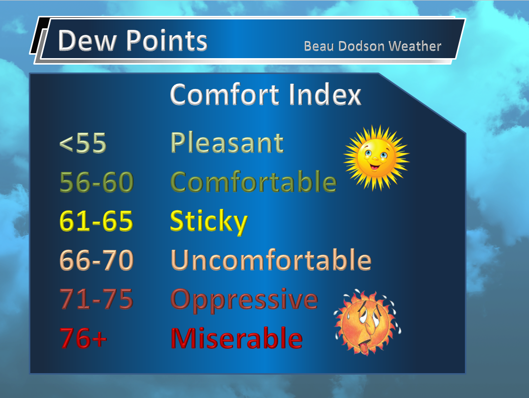
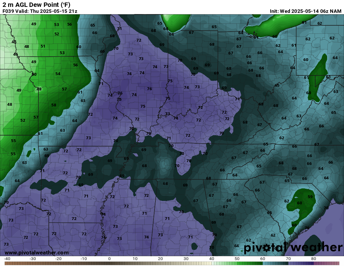
Dew points (a measure of moisture in the air) will become muggier today and tomorrow. Perhaps in the 70s on Thursday! That is air you wear. Humid!
Those dew points will linger into early next week. They will go up and down depending on the placement of the cold/warm front. Those north of the front won’t be as muggy. Those south of the front will be muggier.
.
Dew points are a measure of moisture. Those high dew points will help build an unstable atmosphere, as well. Thunderstorms in these dew points will produce heavy downpours, as well (plenty of moisture to tap into).
Moisture is energy for thunderstorms.
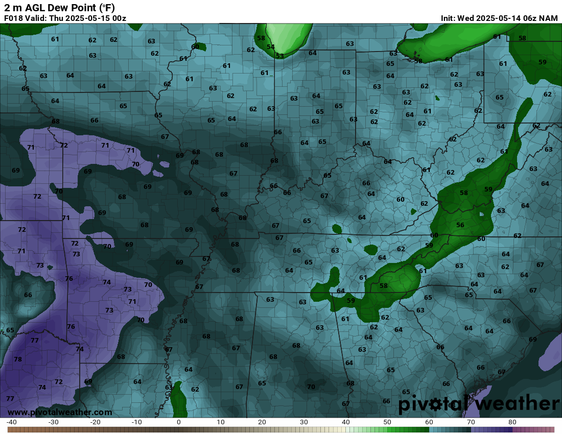
Here are the dew point graphics.
Wednesday (mostly mid to upper 60s). Double-click the dew point maps to enlarge them.
.
Thursday afternoon (the purple color represents 70 degrees and above dew points).
.
THURSDAY’S THUNDERSTORM CHANCES
A cold front will push towards the region on Thursday and Friday.
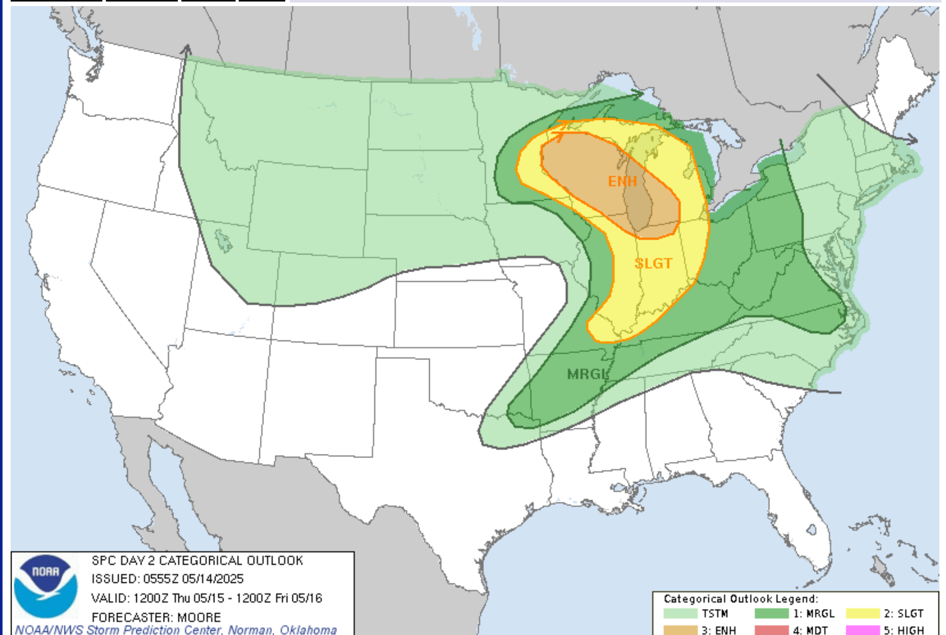
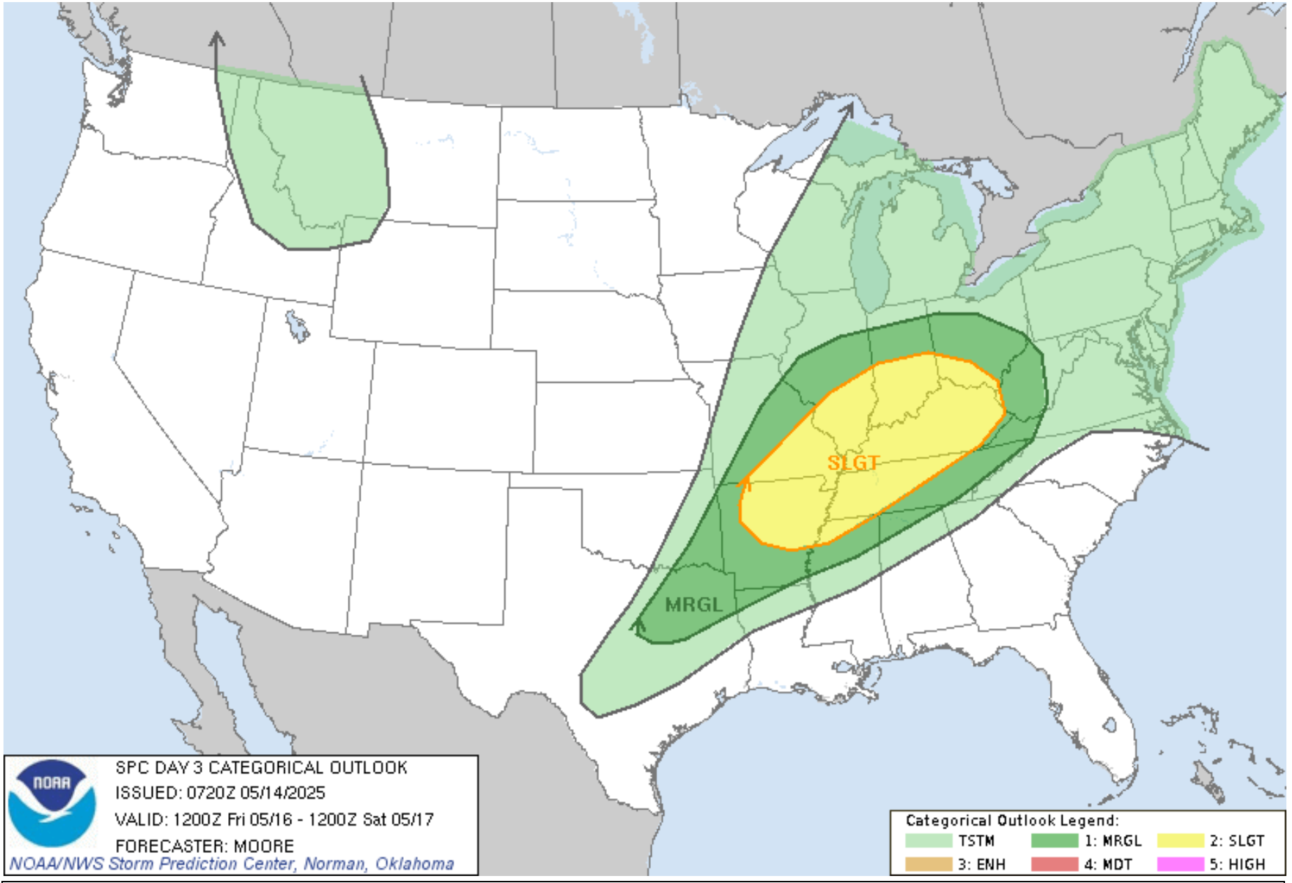
We are still outlooked, by the Storm Prediction Center, for a severe weather threat on Thursday afternoon and night.
Confidence in severe weather on Thursday remains low. That is because of a strong CAP.
Here is the Storm Prediction Center’s latest severe weather outlook for Thursday. This is a level one and two severe weather risk. Dark green is the level one risk. Yellow is the level two risk. This will continue to evolve.
.
Again, as mentioned above, the atmosphere will be capped on Thursday. This raises questions about the threat level.
What is a cap? A warm layer of air aloft that prevents thunderstorms from forming.
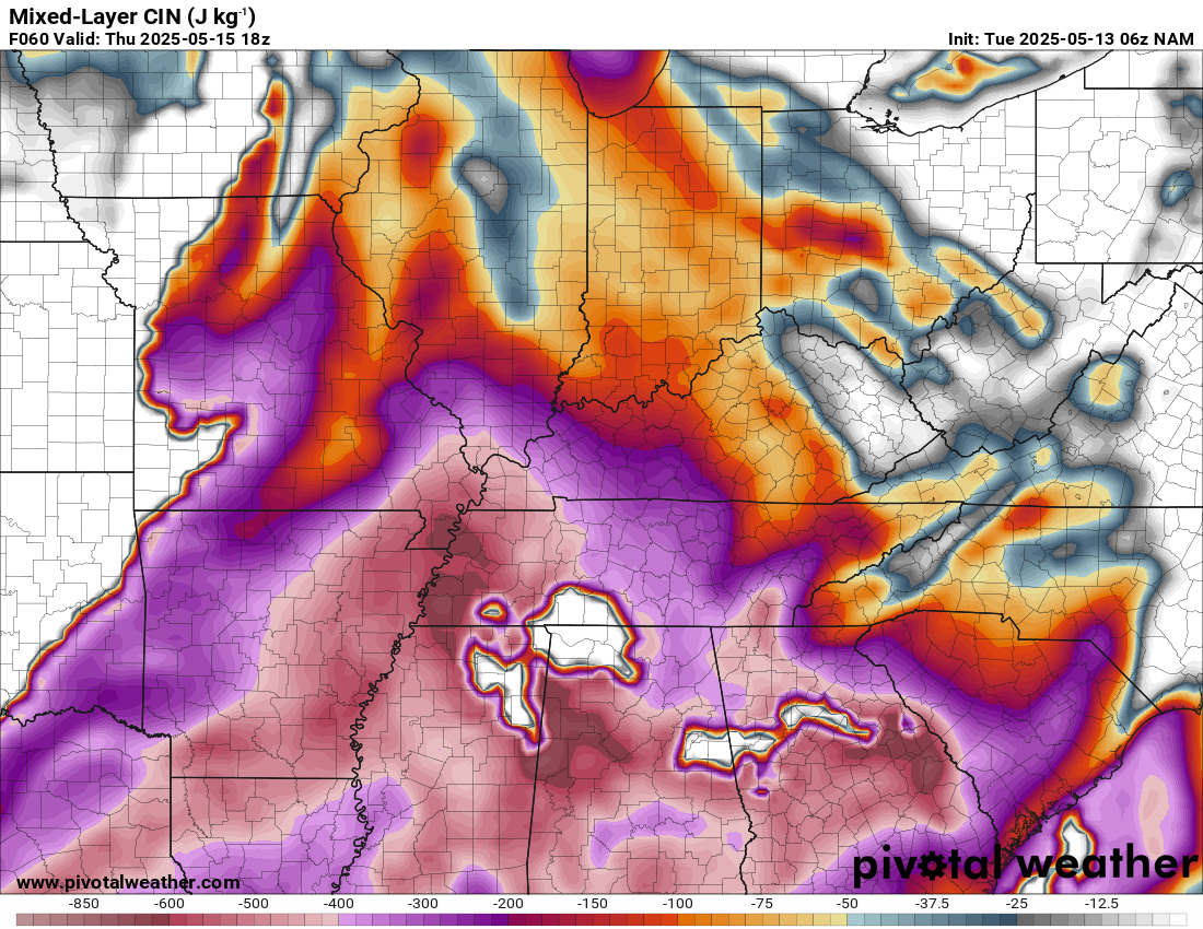
Here is the Thursday CAP. Very strong.
.
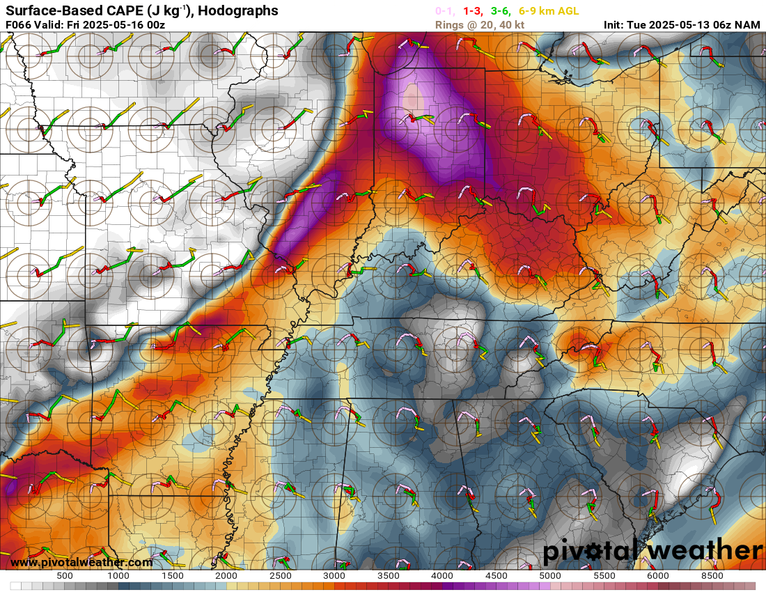
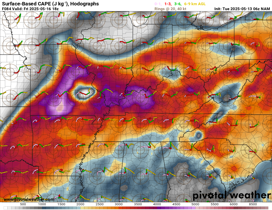
Here are the CAPE levels on Thursday. These are high numbers. Plenty of unstable air, but questions remain on whether storms will form during the day. A strong cap could help prevent storms.
CAPE is basically energy that thunderstorms tap into.
Again, if storms form in this environment, they would be likely be severe.
.
I currently have 20% thunderstorm chances on Thursday. I have 30% thunderstorm chances on Thursday night. If storms form, they would likely be severe. There will be no shortage of instability and wind shear.
Let me show you a few high-resolution models.
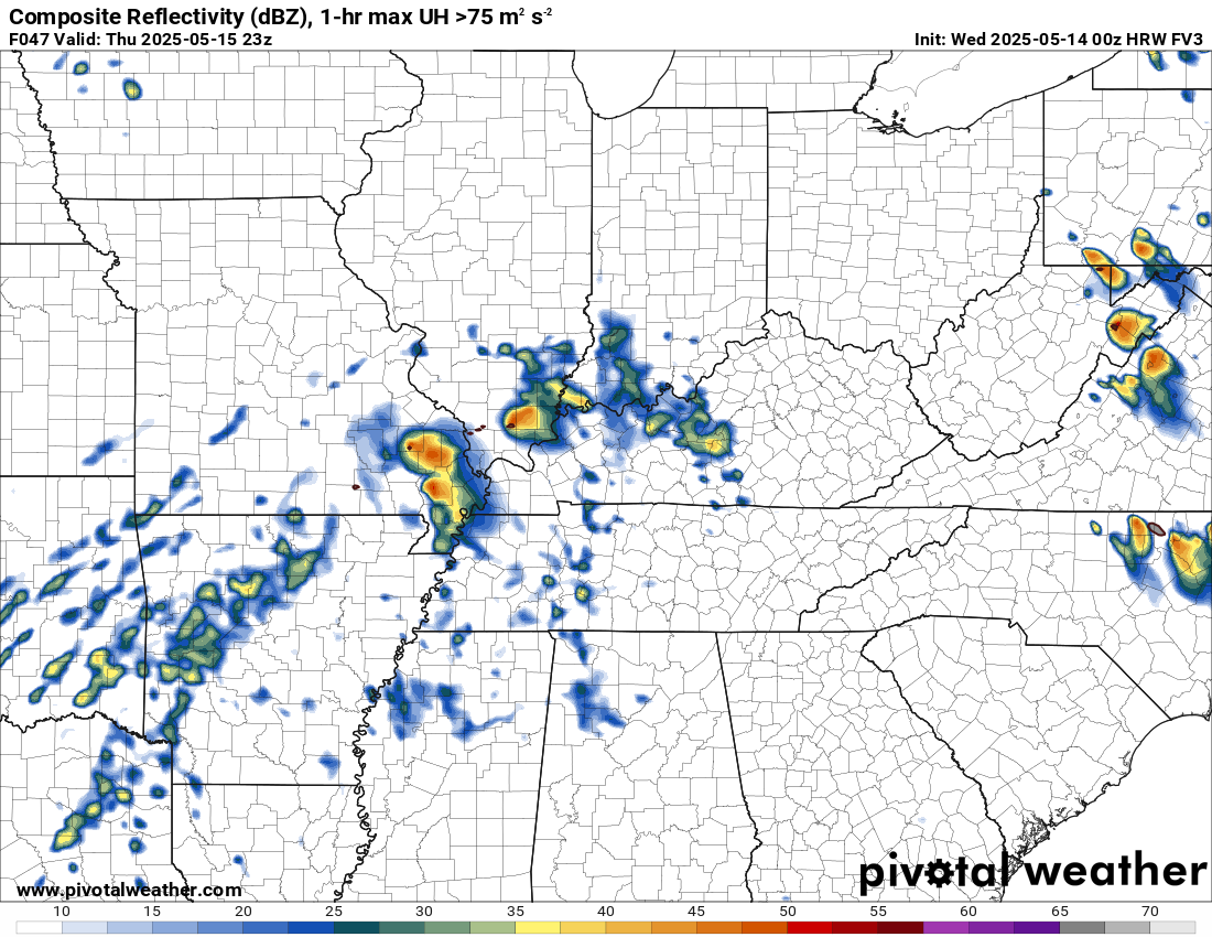
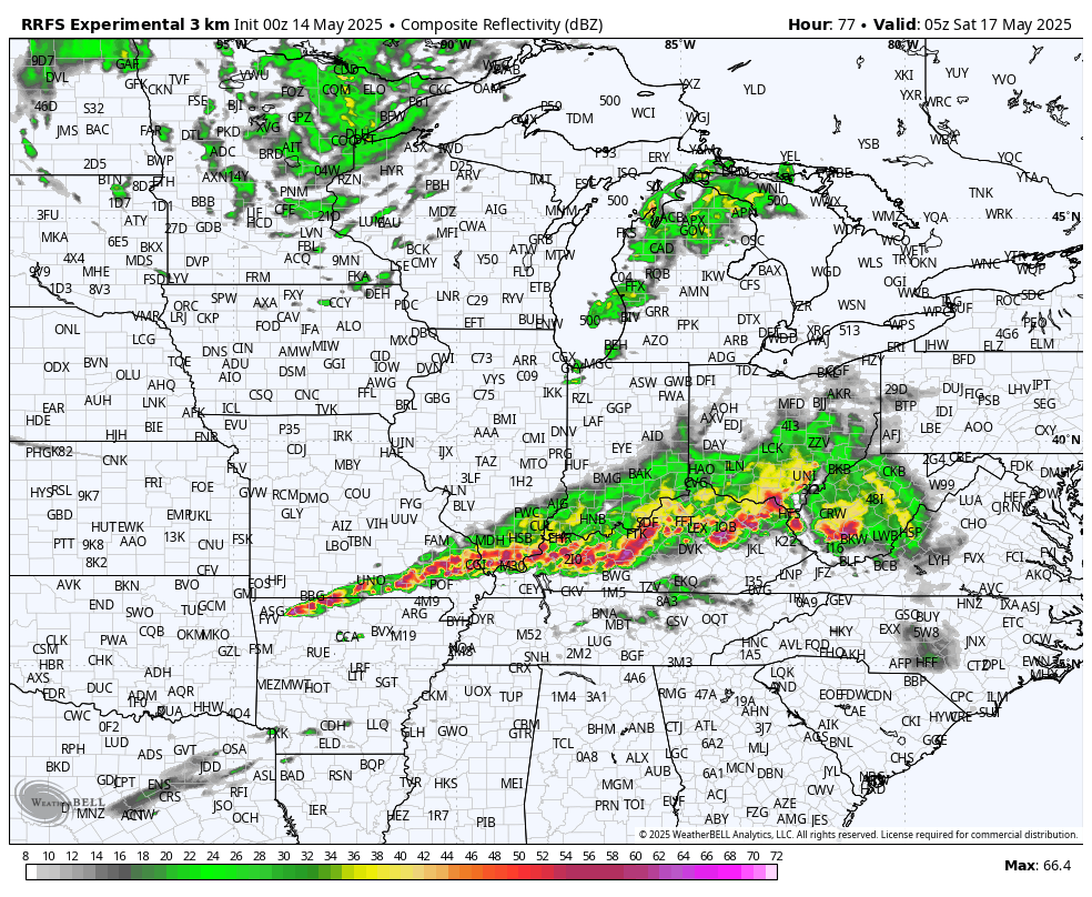
This is the HWF FV3 model. It does pop a few storms on Thursday afternoon.
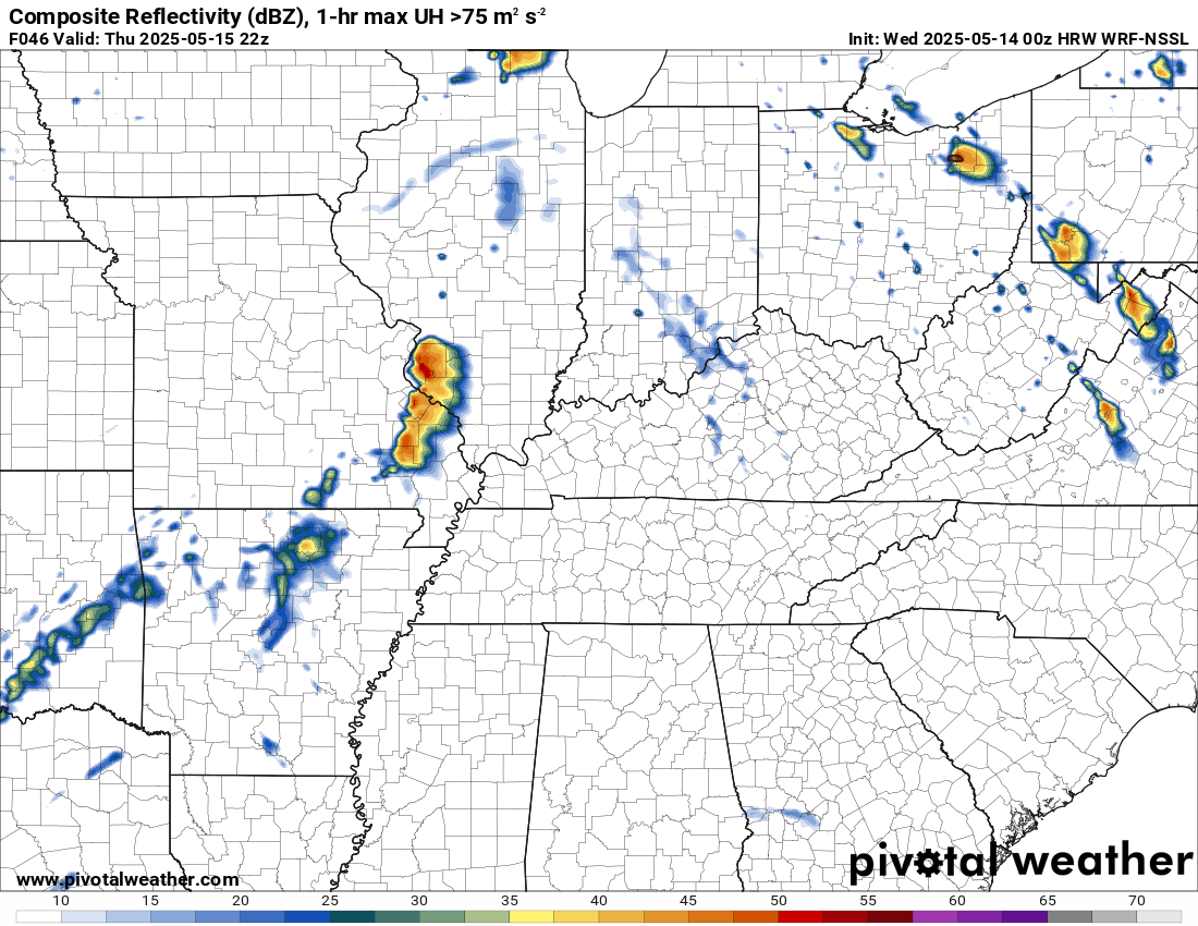
The WRF NSSL model. It also does pop a few storms.
NSSL MPAS model.
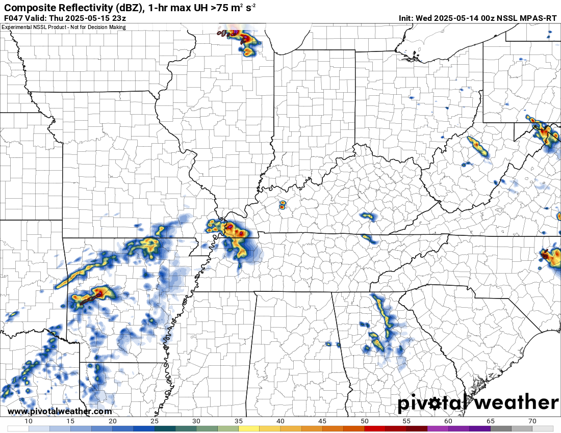
Other models remain dry. There is no model agreement on whether storms form on Thursday afternoon. This isn’t surprising with such a strong CAP.
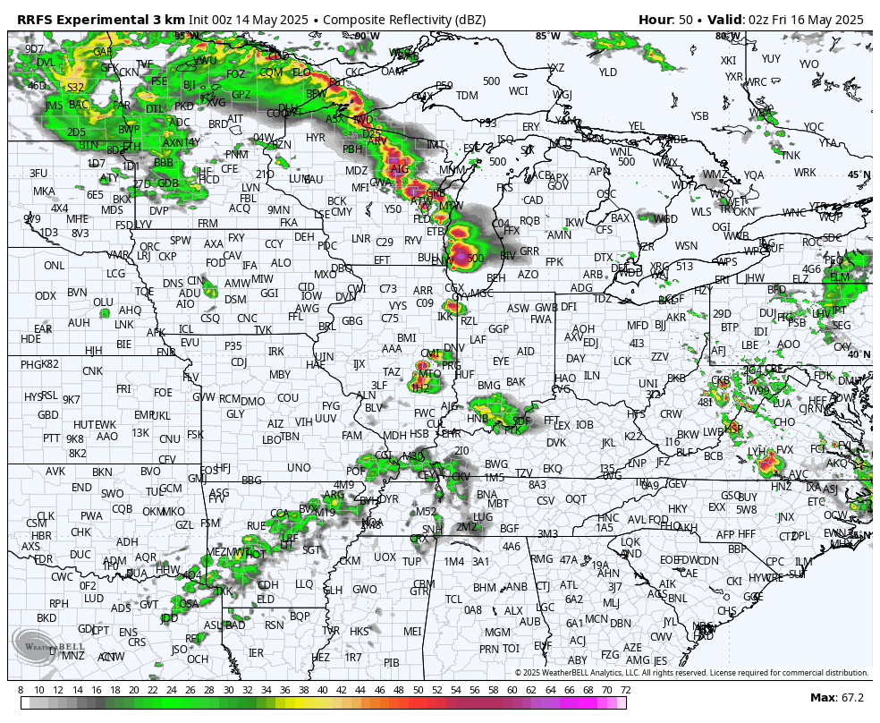
The chance of showers and thunderstorms could be a bit higher Thursday night from the Missouri Bootheel into western Kentucky and Tennessee. Most data shows some showers and thunderstorms forming as we move deeper into the night. By then, some of the stronger severe weather parameters will have diminished. So, perhaps that activity would remain below severe levels. I will monitor it.
This model shows those showers and storms. Notice the heavier activity to our north.
.
FRIDAY’S THUNDERSTORM CHANCES
Thunderstorm chances will increase on Friday. Some thunderstorms could also be severe, mainly during the afternoon and overnight hours. A couple of rounds of storms will be possible.
There could be a few storms Friday morning over mainly the Bootheel into Kentucky/Tennessee.
Then, another round or two during the afternoon into the overnight hours.
The CAP on Friday won’t be as strong. Lift will be stronger on Friday, as well.
We are at a level two (slight) risk of severe weather on Friday.
I can’t rule out our region being upgraded to a level three severe weather risk.
.
Friday’s CAPE numbers. Plenty of energy for thunderstorms to tap into.
.
Let’s look at Friday. Confidence is higher that storms will form on Friday and Friday night.
This is just one model. It won’t be exact, but you can take the general idea from it. Storms are likely by Friday afternoon and night.
This model shows severe thunderstorms around 3 PM on Friday across portions of Missouri and Illinois.
These storms would be moving towards the east.
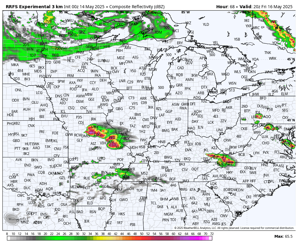
This next graphic is for late Friday afternoon and evening. This particular model shows severe thunderstorms in our area.
Eventually, a line forms during the late afternoon and evening hours.
.
Monitor your app notifications.
The chance of showers and thunderstorms will be lower on Saturday and Saturday night.
Scattered showers and thunderstorms return to the forecast Sunday, Monday, and Tuesday.
The cold front should move across the region on Tuesday and Tuesday night. That will bring an end to the thunderstorm chances.
.

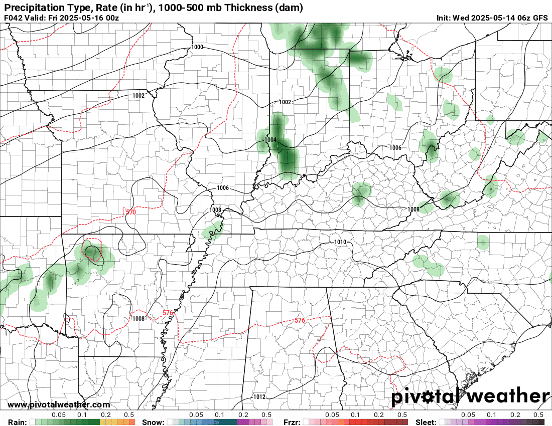
The timestamp (upper left) is in Zulu. 12z=7 am. 18z=1 pm. 00z=7 pm.
Double-click the animation to enlarge it.
EC model.
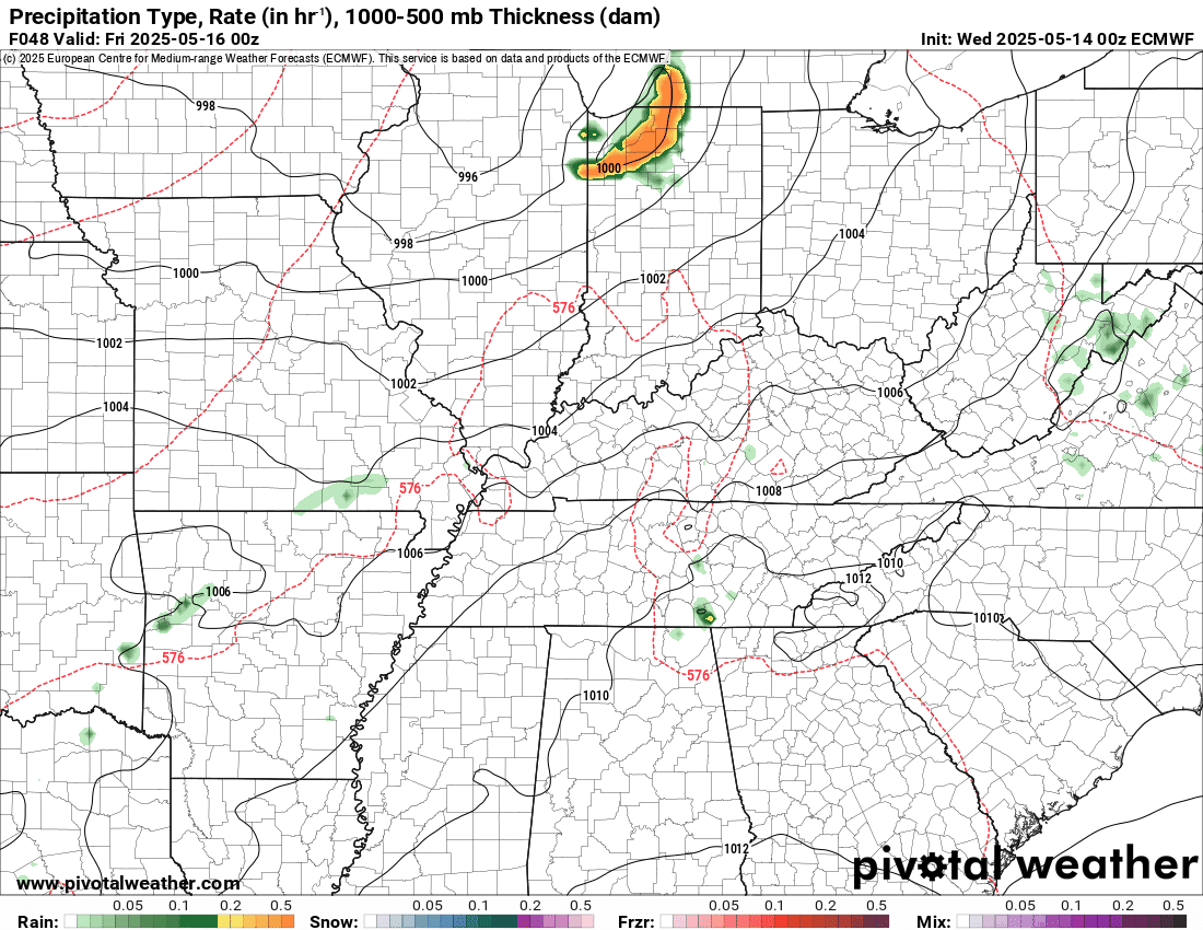
.
Here is the GFS model for Thursday through Friday night.
.
.
.
Click here if you would like to return to the top of the page.
.Average high temperatures for this time of the year are around 73 degrees.
Average low temperatures for this time of the year are around 52 degrees.
Average precipitation during this time period ranges from 1.00″ to 1.40″
Six to Ten Day Outlook.
Blue is below average. Red is above average. The no color zone represents equal chances.
Average highs for this time of the year are in the lower 60s. Average lows for this time of the year are in the lower 40s.

Green is above average precipitation. Yellow and brown favors below average precipitation. Average precipitation for this time of the year is around one inch per week.

.

Average low temperatures for this time of the year are around 55 degrees.
Average precipitation during this time period ranges from 1.20″ to 1.50″
.
Eight to Fourteen Day Outlook.
Blue is below average. Red is above average. The no color zone represents equal chances.

Green is above average precipitation. Yellow and brown favors below average precipitation. Average precipitation for this time of the year is around one inch per week.

.
.
.
We have a new service to complement your www.weathertalk.com subscription. This does NOTreplace www.weathertalk.com It is simply another tool for you to receive severe weather information.
.


.

Radars and Lightning Data
Interactive-city-view radars. Clickable watches and warnings.
https://wtalk.co/B3XHASFZ
Old legacy radar site (some of you like it better)
https://weatherobservatory.com/weather-radar.htm
If the radar is not updating then try another one. If a radar does not appear to be refreshing then hit Ctrl F5. You may also try restarting your browser.
Backup radar site in case the above one is not working.
https://weathertalk.com/morani
Regional Radar
https://imagery.weathertalk.com/prx/RadarLoop.mp4
** NEW ** Zoom radar with chaser tracking abilities!
ZoomRadar
If the radar is not working, then email me: Email me at beaudodson@usawx.com
.
We do have some sponsors! Check them out.
Roof damage from recent storms? Link – Click here
INTEGRITY ROOFING AND EXTERIORS!
⛈️ Roof or gutter damage from recent storms? Today’s weather is sponsored by Integrity Roofing. Check out their website at this link https://www.ourintegritymatters.com/

![]()
![]()
![]()
Make sure you have three to five ways of receiving your severe weather information.
Weather Talk is one of those ways! Now, I have another product for you and your family.

.
Want to add more products to your Beau Dodson Weather App?
Receive daily videos, weather blog updates on normal weather days and severe weather and winter storm days, your county by county weather forecast, and more!
Here is how to do add those additional products to your app notification settings!
Here is a video on how to update your Beau Dodson Weather payment.
The app is for subscribers. Subscribe at www.weathertalk.com/welcome then go to your app store and search for WeatherTalk
Subscribers, PLEASE USE THE APP. ATT and Verizon are not reliable during severe weather. They are delaying text messages.
The app is under WeatherTalk in the app store.

Apple users click here

Android users click here
.
Radars and Lightning Data
Interactive-city-view radars. Clickable watches and warnings.
https://wtalk.co/B3XHASFZ
Old legacy radar site (some of you like it better)
https://weatherobservatory.com/weather-radar.htm
If the radar is not updating then try another one. If a radar does not appear to be refreshing then hit Ctrl F5. You may also try restarting your browser.
Backup radar site in case the above one is not working.
https://weathertalk.com/morani
Regional Radar
https://imagery.weathertalk.com/prx/RadarLoop.mp4
** NEW ** Zoom radar with chaser tracking abilities!
ZoomRadar
Lightning Data (zoom in and out of your local area)
https://wtalk.co/WJ3SN5UZ
Not working? Email me at beaudodson@usawx.com
National map of weather watches and warnings. Click here.
Storm Prediction Center. Click here.
Weather Prediction Center. Click here.
.

Live lightning data: Click here.
Real time lightning data (another one) https://map.blitzortung.org/#5.02/37.95/-86.99
Our new Zoom radar with storm chases
.
.

Interactive GOES R satellite. Track clouds. Click here.
GOES 16 slider tool. Click here.
College of DuPage satellites. Click here
.

Here are the latest local river stage forecast numbers Click Here.
Here are the latest lake stage forecast numbers for Kentucky Lake and Lake Barkley Click Here.
.
.
Find Beau on Facebook! Click the banner.


 .
.