

.
I have some question-and-answer threads over on the Facebook page. Link to those threads CLICK HERE
Or email me at beaudodsonweather@gmail.com
.

🌪️ Seven-Day Tornado Outlook ⛈️
May 8th through May 14th
Current risk: Currently, we do not have tornadoes in the forecast.
I am monitoring the long range (around the 15th onward).
Current confidence level: High confidence in the current forecast.
Comment:
.

Seven-Day Hazardous Weather Outlook
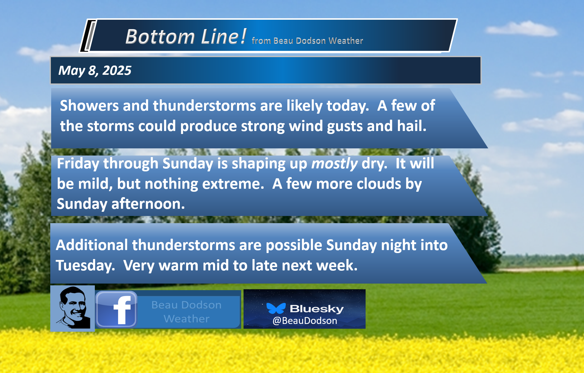
1. Is lightning in the forecast? SCATTERED. Scattered lightning is possible today and tonight. Another chance Sunday night into Monday. A slight chance on Tuesday and Wednesday. I will monitor next Thursday and Friday.
2. Are severe thunderstorms in the forecast? POSSIBLE. A few storms could produce high winds and hail this afternoon and evening (Thursday). I will monitor next Monday. I am monitoring next Thursday, Friday, and Saturday.
The Storm Prediction Center has portions of our region in a level one (marginal) risk for severe weather later today. The dark green zone is the marginal risk. Light green is where sub-severe storms are possible.
This is a low-end risk for a few reports of wind and hail.

3. Is flash flooding in the forecast? NO.
4. Will non-thunderstorm winds top 40 mph? NO.
5. Will temperatures rise above 90 degrees? NO.
6. Will the heat index rise above 100 degrees? INLIKELY. I will monitor late next week.
.
A quick forecast glance. Your 48-hour forecast Graphics


.

.

Radars and Lightning Data
Interactive-city-view radars. Clickable watches and warnings.
https://wtalk.co/B3XHASFZ
Regional Radar
https://imagery.weathertalk.com/prx/RadarLoop.mp4
** NEW ** Zoom radar with chaser tracking abilities!
ZoomRadar
Lightning Data (zoom in and out of your local area)
https://wtalk.co/WJ3SN5UZ
.


Forecast discussion.
- Mostly mild temperatures into next week. It may become hot by the middle/end of next week. Muggy, as well.
- Scattered showers and thunderstorms today and tonight.
- Nicer weather tomorrow and Saturday.
- I am monitoring shower and thunderstorm chances late Sunday night through Monday night. Then, again towards the middle/end of next week.
- A marginal risk of severe storms this afternoon and evening. Isolated damaging wind and hail are the primary concern.
- Watching the long-range severe weather forecast.
.

.
Good morning, everyone.
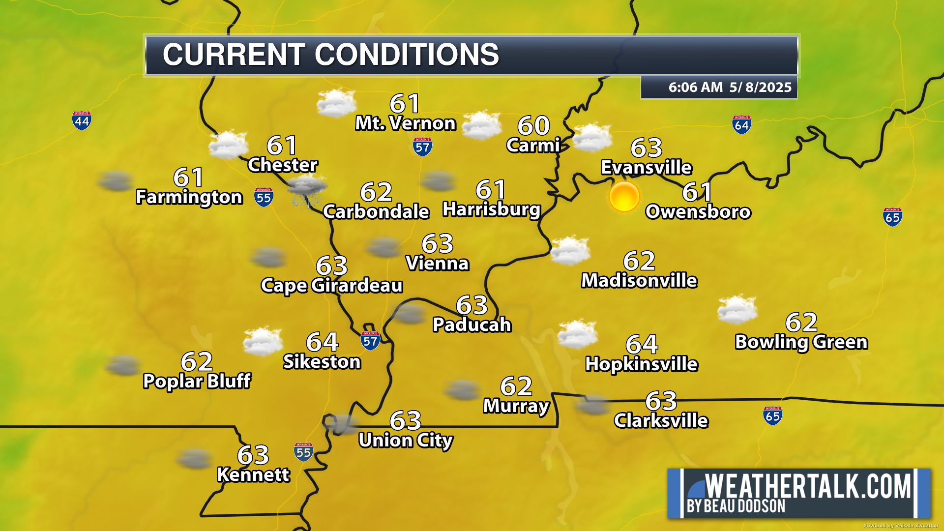
We are waking up to mild temperatures area-wide. Some patchy fog, as well. A few showers and storms.
.
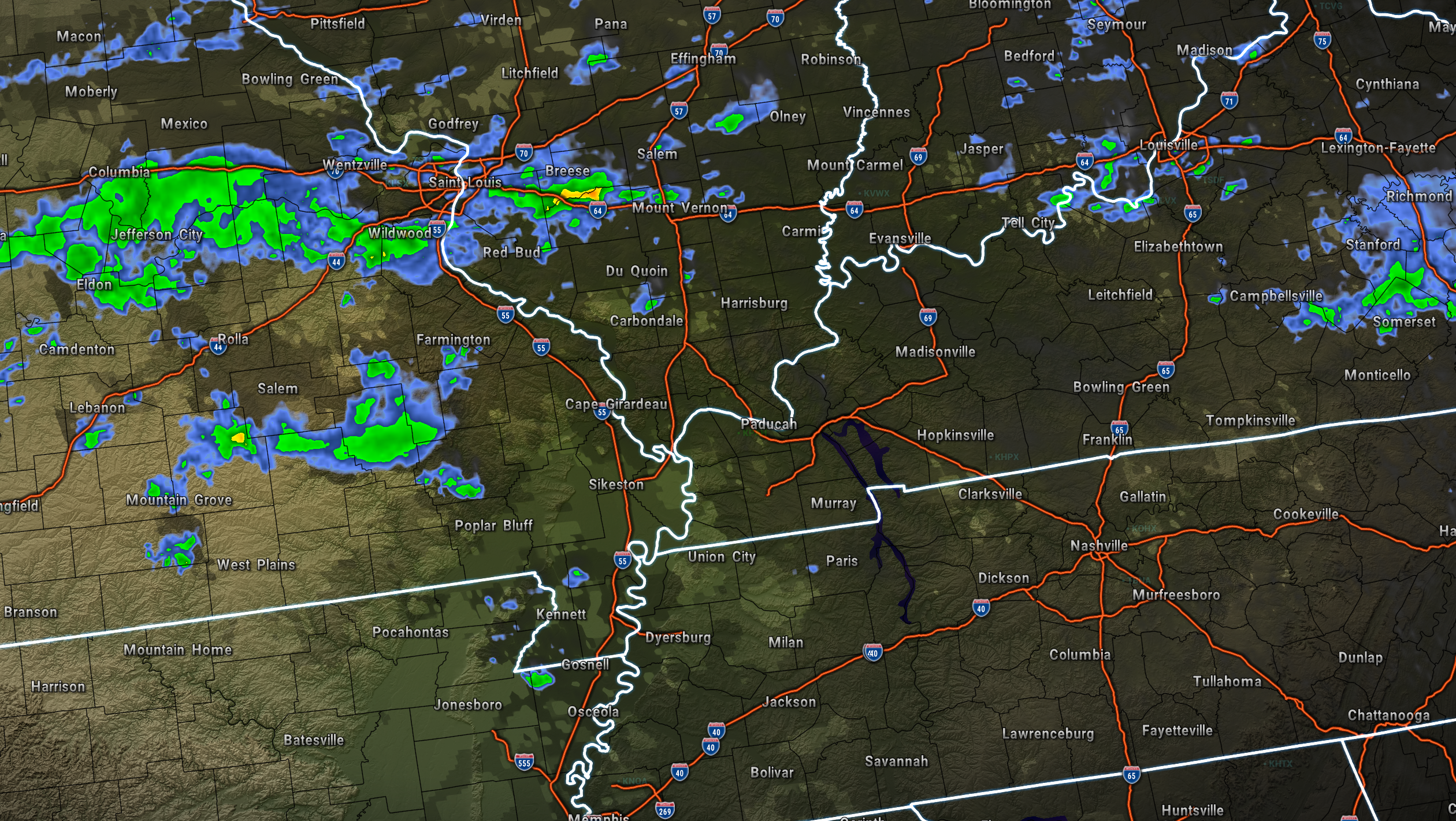
Radar showed a few showers and thunderstorms across mainly southeast Missouri and southern Illinois (esp north).
6:20 AM radar (see the live radar links at the bottom of the page)
.
The weather will be unsettled today. We already have a few showers and thunderstorms on radar. I expect quite a few more to develop by late morning and afternoon.
An upper-level disturbance will be pushing across the region. This will cause lift. That equals showers and thunderstorms.
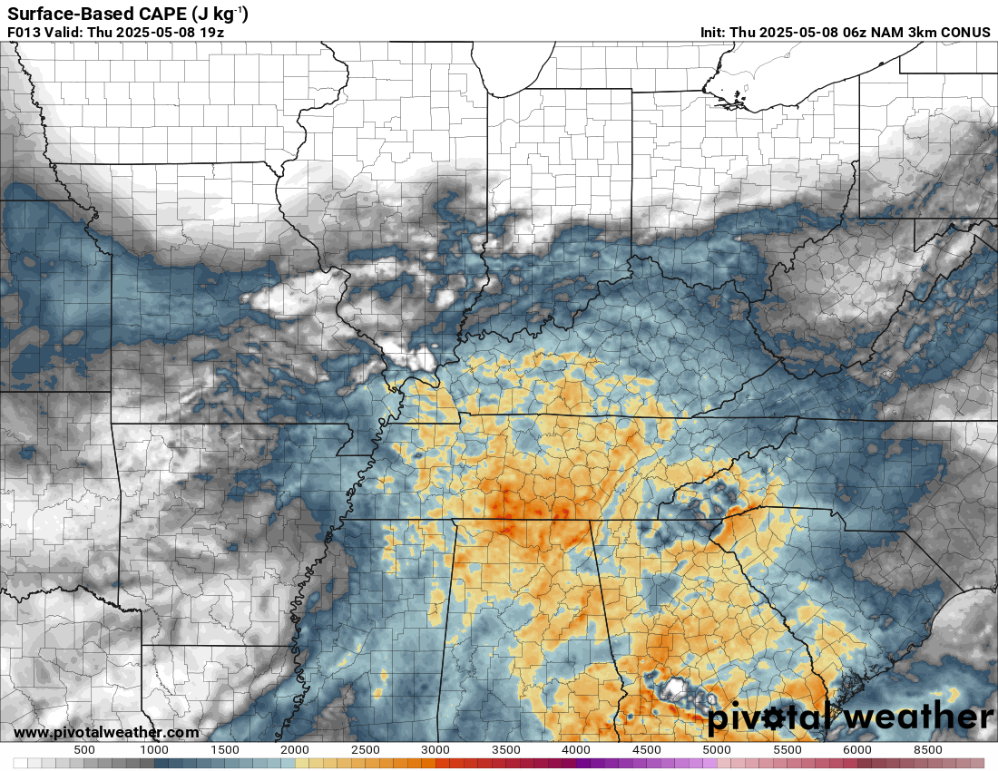
There will be some CAPE to work with. CAPE is energy that thunderstorms tap into.
You can see that here. Those orange colors are decent CAPE numbers. Wind shear will be low today. Wind shear is another ingredient for severe thunderstorms.
Thus, a marginal risk of a few storms producing high winds and hail.
.
As mentioned above, the Storm Prediction Center has a low-level one risk across portions of the region (the dark green zone).
This is not a significant severe weather outbreak/event. It is a low-end risk that a couple of storms will produce strong winds/downburst winds and quarter-sized hail. Lightning, of course.
Here is the severe weather outlook for today. The time frame of most concern is primarily 12 pm to 7 pm.
.
Friday and Saturday should deliver nicer weather. Rain chances have diminished. That is good news. It will be mild, as well.
I also lowered Sunday’s rain probabilities. More good news.
Let’s hope we finally have a nice weekend! It has been a while.
Yet another system will push into the region by Sunday night and Monday of next week. This will bring additional showers and thunderstorms.
Peak thunderstorm chances will likely be on Monday and Monday night.
A bit early to know if severe weather will be a concern. For now, if severe weather becomes a concern, it appears it would be a low-level risk on Monday.
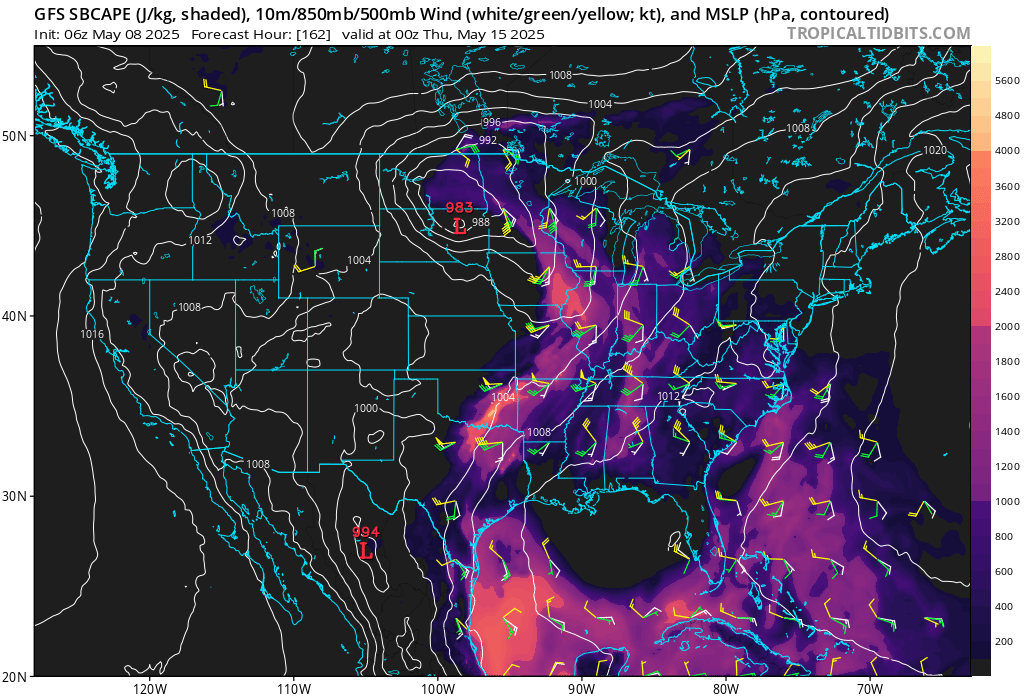
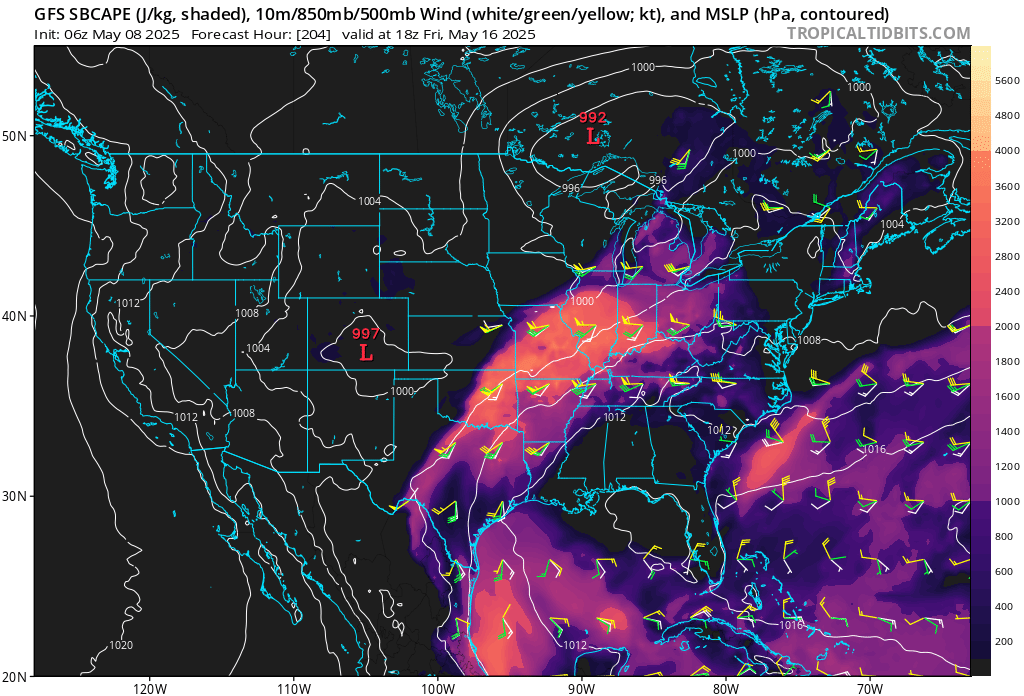
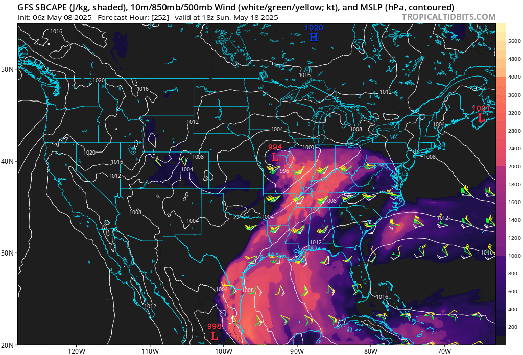
I continue to watch the 14th through 20th time frame. Data has been showing higher instability levels during that time frame.
Typically, May is our peak tornado season. So severe weather would not be a surprise. I will be monitoring trends.
You can see that instability on the GFS model.
This is CAPE. CAPE is energy for thunderstorms to tap into.
Here are the latest graphics from that particular model.
May 14th and 15th. Unstable air over our region.
May 16th. Quite unstable.
May 18th instability. A cold front is shown on the GFS model with severe thunderstorms.
.
This could be a multi-day period that we will need to monitor. It is still beyond day seven. Thus, confidence in exact details is low.
Monitor updated forecasts as we move deeper into next week.
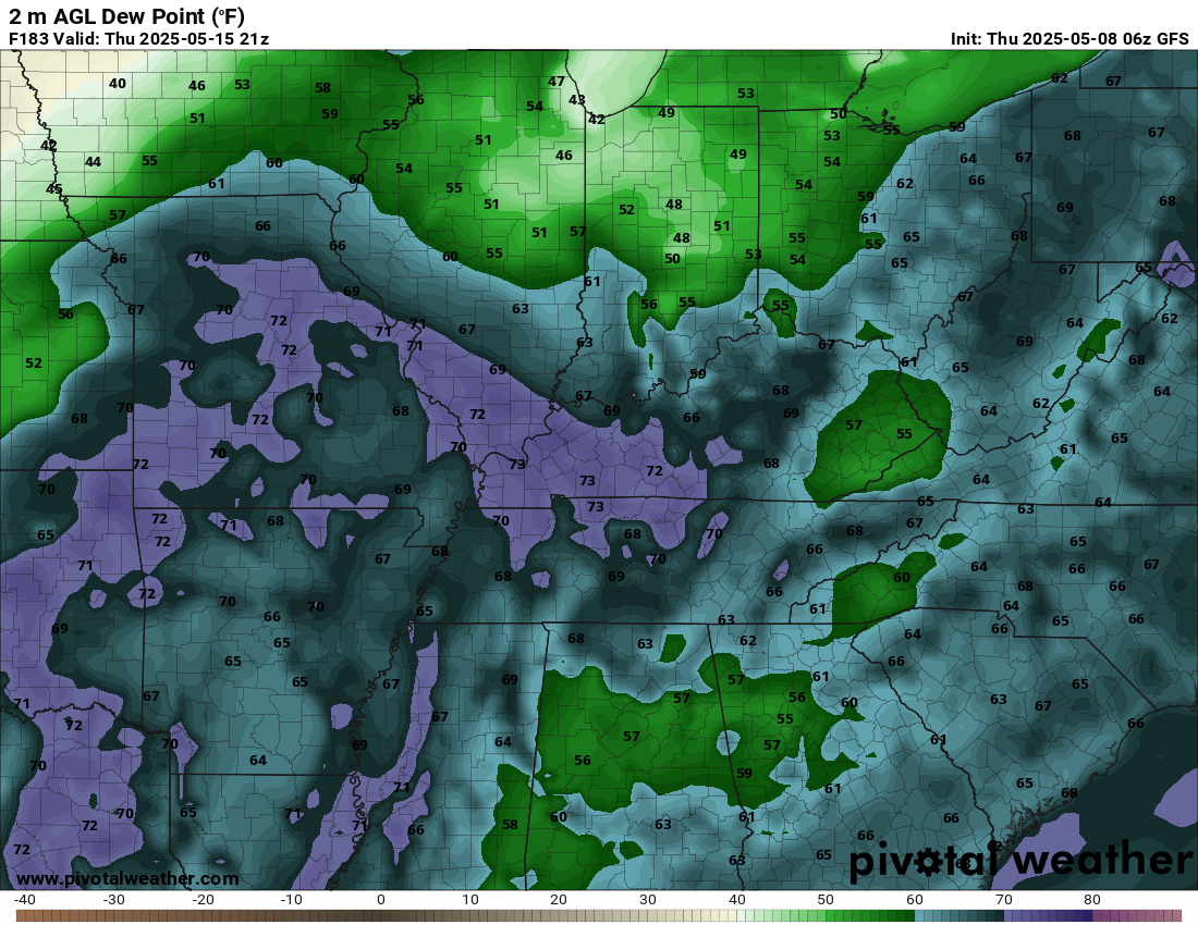
It will also become very warm. Towards the middle/end of next week I am forecasting widespread 80s with heat index values reaching above 90 degrees!
Muggy, as well.
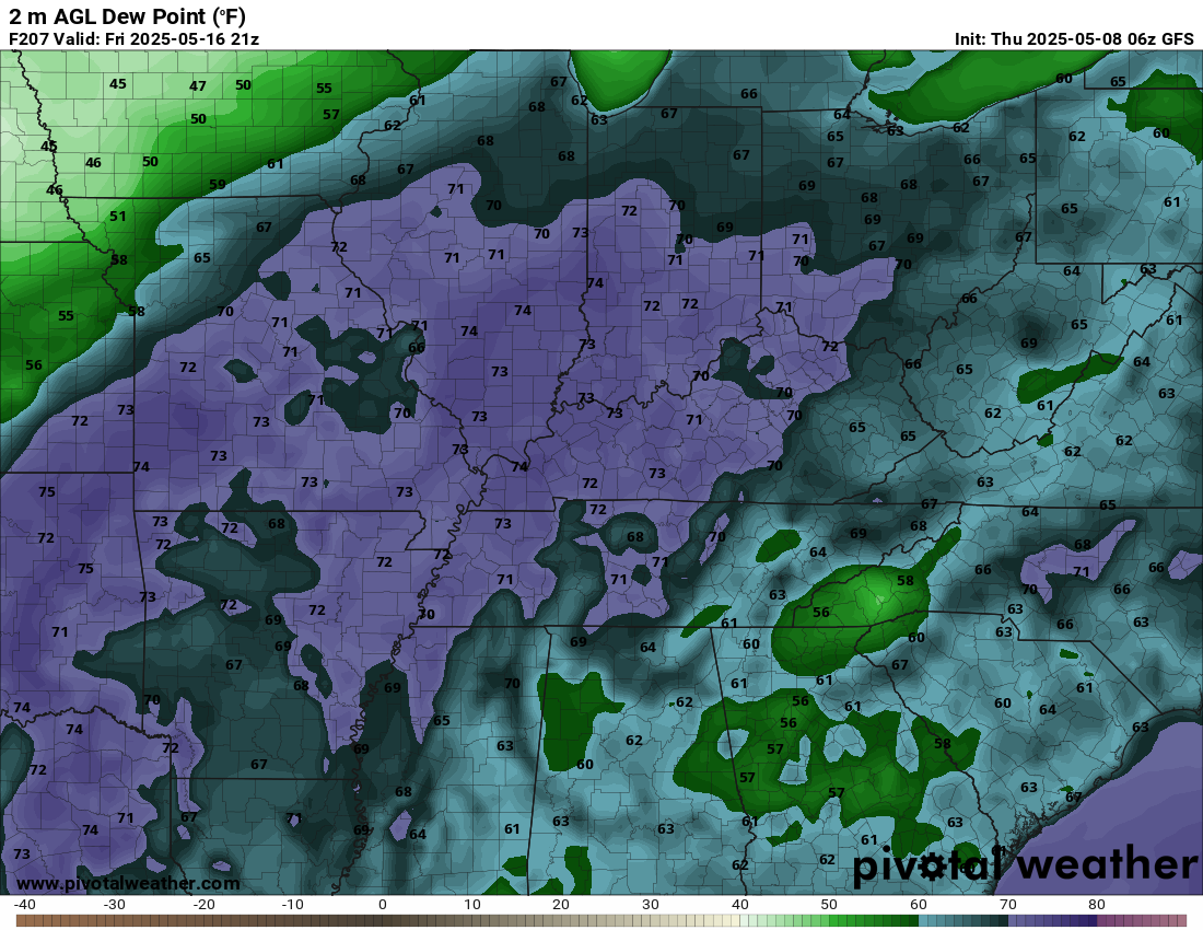
Dew points may pop above 70 degrees. That is muggy air. Humid.
Here is the Thursday afternoon dew point forecast (next week). Muggy.
Double-click to enlarge.
.
More muggy air next Friday afternoon, as well. This would be unstable air. Thunderstorms could be an issue.
.
If the GFS is right, then heat index values could pop into the 90s late next week.
Here is what it shows for next Friday afternoon (heat index values – what the air feels like).
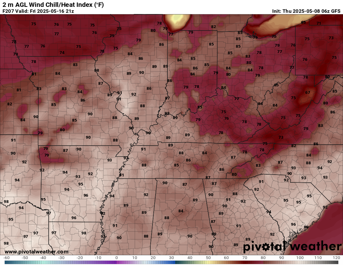
Lots to monitor. I will stay on top of it.
.

The timestamp (upper left) is in Zulu. 12z=7 am. 18z=1 pm. 00z=7 pm.
Double-click the animation to enlarge it.
NAM model.
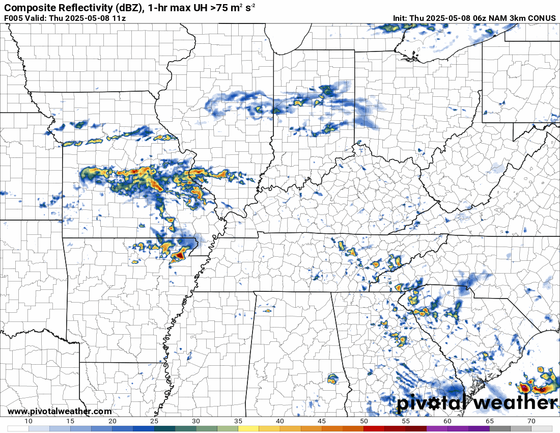
.
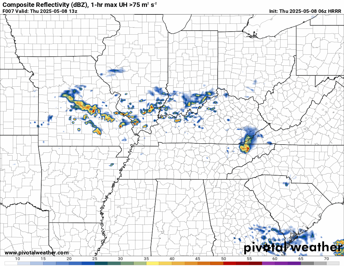
Here is the Hrrr model.
.
.
.
Click here if you would like to return to the top of the page.
.Average high temperatures for this time of the year are around 73 degrees.
Average low temperatures for this time of the year are around 52 degrees.
Average precipitation during this time period ranges from 1.00″ to 1.40″
Six to Ten Day Outlook.
Blue is below average. Red is above average. The no color zone represents equal chances.
Average highs for this time of the year are in the lower 60s. Average lows for this time of the year are in the lower 40s.

Green is above average precipitation. Yellow and brown favors below average precipitation. Average precipitation for this time of the year is around one inch per week.

.

Average low temperatures for this time of the year are around 55 degrees.
Average precipitation during this time period ranges from 1.20″ to 1.50″
.
Eight to Fourteen Day Outlook.
Blue is below average. Red is above average. The no color zone represents equal chances.

Green is above average precipitation. Yellow and brown favors below average precipitation. Average precipitation for this time of the year is around one inch per week.

.
.
.
We have a new service to complement your www.weathertalk.com subscription. This does NOT replace www.weathertalk.com It is simply another tool for you to receive severe weather information.
.


.
Radars and Lightning Data
Interactive-city-view radars. Clickable watches and warnings.
https://wtalk.co/B3XHASFZ
Old legacy radar site (some of you like it better)
https://weatherobservatory.com/weather-radar.htm
If the radar is not updating then try another one. If a radar does not appear to be refreshing then hit Ctrl F5. You may also try restarting your browser.
Backup radar site in case the above one is not working.
https://weathertalk.com/morani
Regional Radar
https://imagery.weathertalk.com/prx/RadarLoop.mp4
** NEW ** Zoom radar with chaser tracking abilities!
ZoomRadar
If the radar is not working, then email me: Email me at beaudodson@usawx.com
.
We do have some sponsors! Check them out.
Roof damage from recent storms? Link – Click here
INTEGRITY ROOFING AND EXTERIORS!
⛈️ Roof or gutter damage from recent storms? Today’s weather is sponsored by Integrity Roofing. Check out their website at this link https://www.ourintegritymatters.com/

![]()
![]()
![]()
Make sure you have three to five ways of receiving your severe weather information.
Weather Talk is one of those ways! Now, I have another product for you and your family.

.
Want to add more products to your Beau Dodson Weather App?
Receive daily videos, weather blog updates on normal weather days and severe weather and winter storm days, your county by county weather forecast, and more!
Here is how to do add those additional products to your app notification settings!
Here is a video on how to update your Beau Dodson Weather payment.
The app is for subscribers. Subscribe at www.weathertalk.com/welcome then go to your app store and search for WeatherTalk
Subscribers, PLEASE USE THE APP. ATT and Verizon are not reliable during severe weather. They are delaying text messages.
The app is under WeatherTalk in the app store.

Apple users click here

Android users click here
.
Radars and Lightning Data
Interactive-city-view radars. Clickable watches and warnings.
https://wtalk.co/B3XHASFZ
Old legacy radar site (some of you like it better)
https://weatherobservatory.com/weather-radar.htm
If the radar is not updating then try another one. If a radar does not appear to be refreshing then hit Ctrl F5. You may also try restarting your browser.
Backup radar site in case the above one is not working.
https://weathertalk.com/morani
Regional Radar
https://imagery.weathertalk.com/prx/RadarLoop.mp4
** NEW ** Zoom radar with chaser tracking abilities!
ZoomRadar
Lightning Data (zoom in and out of your local area)
https://wtalk.co/WJ3SN5UZ
Not working? Email me at beaudodson@usawx.com
National map of weather watches and warnings. Click here.
Storm Prediction Center. Click here.
Weather Prediction Center. Click here.
.

Live lightning data: Click here.
Real time lightning data (another one) https://map.blitzortung.org/#5.02/37.95/-86.99
Our new Zoom radar with storm chases
.
.

Interactive GOES R satellite. Track clouds. Click here.
GOES 16 slider tool. Click here.
College of DuPage satellites. Click here
.

Here are the latest local river stage forecast numbers Click Here.
Here are the latest lake stage forecast numbers for Kentucky Lake and Lake Barkley Click Here.
.
.
Find Beau on Facebook! Click the banner.


 .
.