

.
I have some question-and-answer threads over on the Facebook page. Link to those threads CLICK HERE
Or email me at beaudodsonweather@gmail.com
.

🌪️ Seven-Day Tornado Outlook ⛈️
May 1st through May 7th
Current risk: The risk of a tornado remains low.
Current confidence level: High confidence in the forecast.
Comment: The risk of tornadoes will remain low. There is a small risk of severe weather today over Kentucky. There is a small risk of severe weather in the region on Friday. Overall, the risk of a tornado is very small.
.

Seven-Day Hazardous Weather Outlook
1. Is lightning in the forecast? YES. We will have a chance of lightning today through Friday night. A few storms may linger into Saturday.
2. Are severe thunderstorms in the forecast? POSSIBLE. A few storms could be intense today into Friday afternoon. The primary concern will be an isolated report of damaging wind and nickel-sized hail. The tornado risk remains very low.
3. Is flash flooding in the forecast? LOW RISK. Locally heavy rain is possible today into Friday night. Overall, the risk of flash flooding is small/low. An isolated concern could arise if a few storms train over the same county.
4. Will non-thunderstorm winds top 40 mph? NO.
5. Will temperatures rise above 90 degrees? NO.
6. Will the heat index rise above 100 degrees? NO.
.
A quick forecast glance. Your 48-hour forecast Graphics


.

.


Forecast discussion.
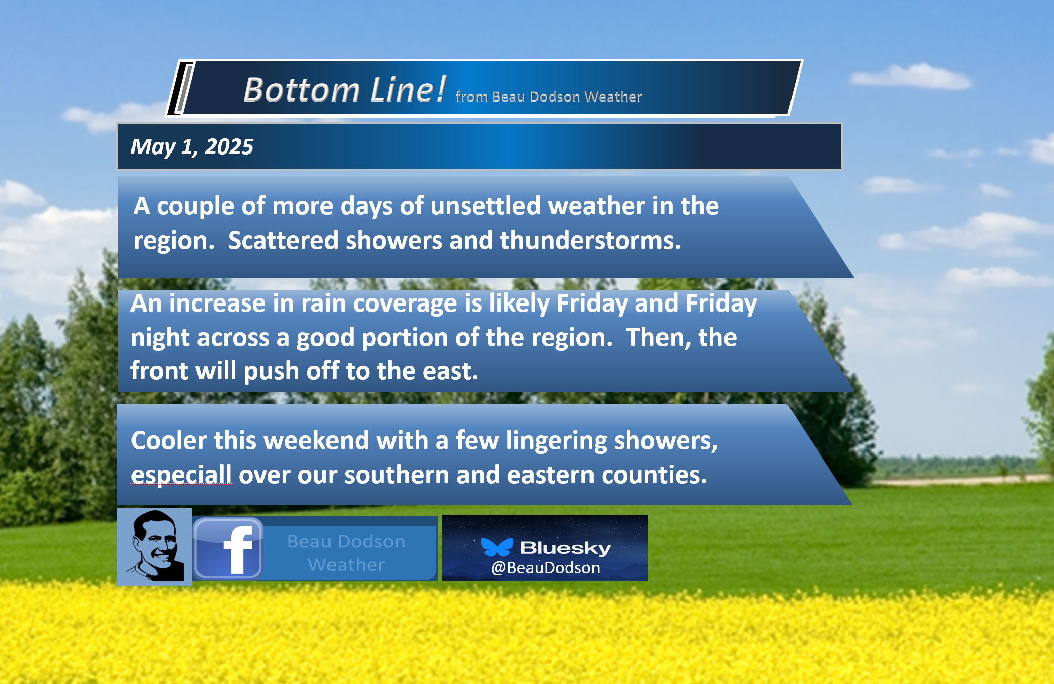
- Mild again today and tomorrow.
- A few showers and thunderstorms today and tonight. The chances have decreased a bit.
- Shower and thunderstorm chances increase a bit on Friday and Friday night.
- A few lingering showers on Saturday. Cooler Saturday and Sunday.
.

.
It has certainly been a difficult week of forecasting. The primary uncertainty each day has centered on rain probabilities. How high and how low to place the percent number.
I knew it would rain each day, but trying to put a % number on it has been difficult.
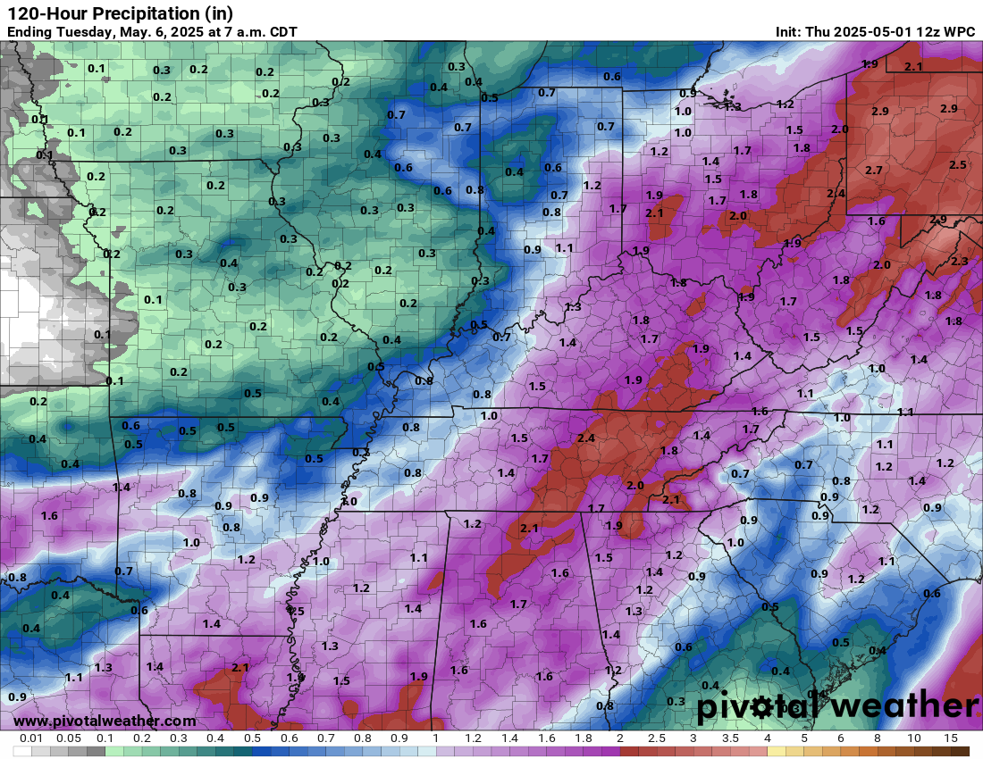
Most of the region experienced showers and thunderstorms over the last few days. Some locations have received 1 to 3 inches of rain. Some places have received less than 0.10″ of rain.
The next 48 hours will bring more of the same.
I lowered today’s rain probabilities. There will be precipitation on radar today, but many areas may end up dry or mostly dry.
Twenty-four hours ago, today looked like it was going to be quite wet.
Last night’s storms stabilized the atmosphere. I only expect widely scattered showers and thunderstorms today and tonight.
Then, I expect rain coverage to increase tomorrow and tomorrow night.
A few of the thunderstorms could be intense over our eastern counties today and tonight. Then, across a bit more of the area on Friday.
Overall, the threat of severe weather will remain minimal.
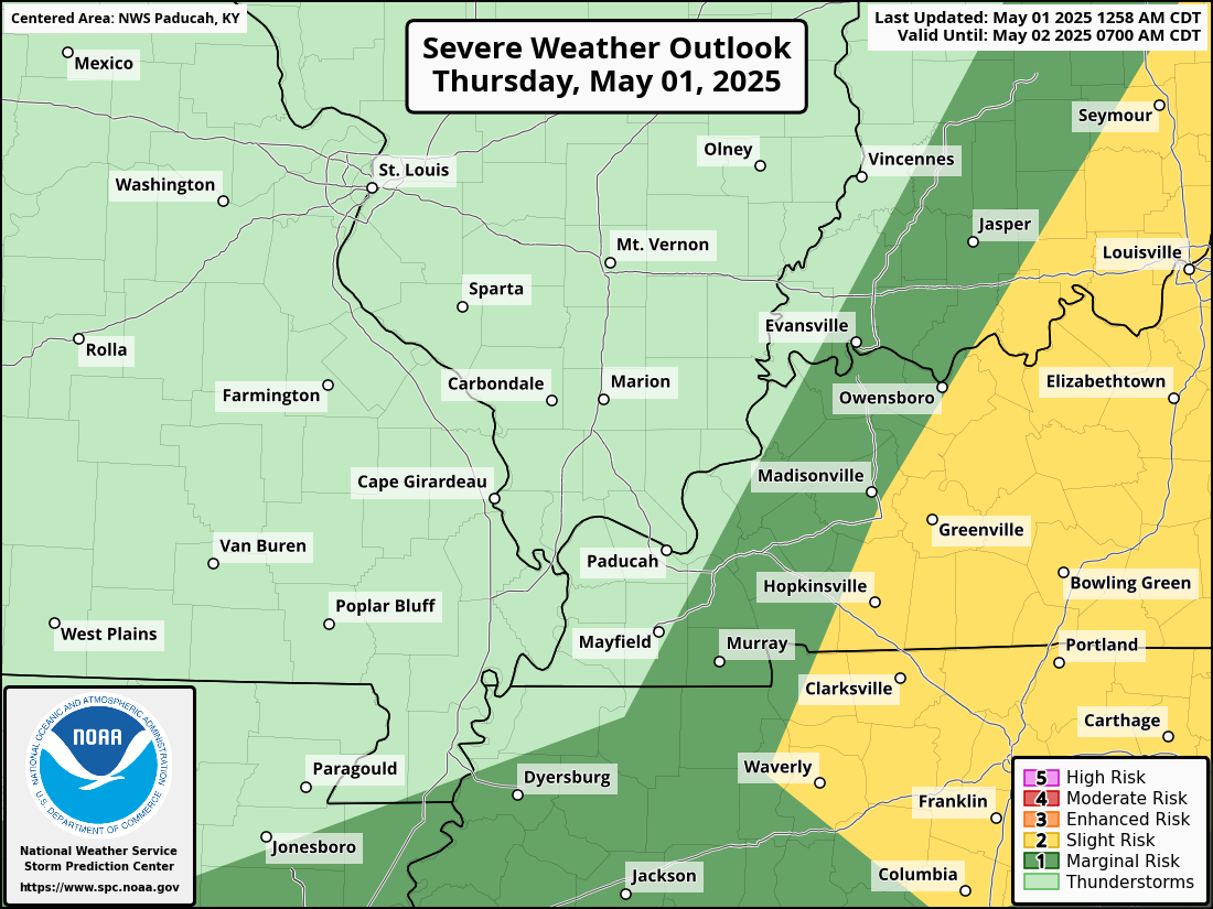
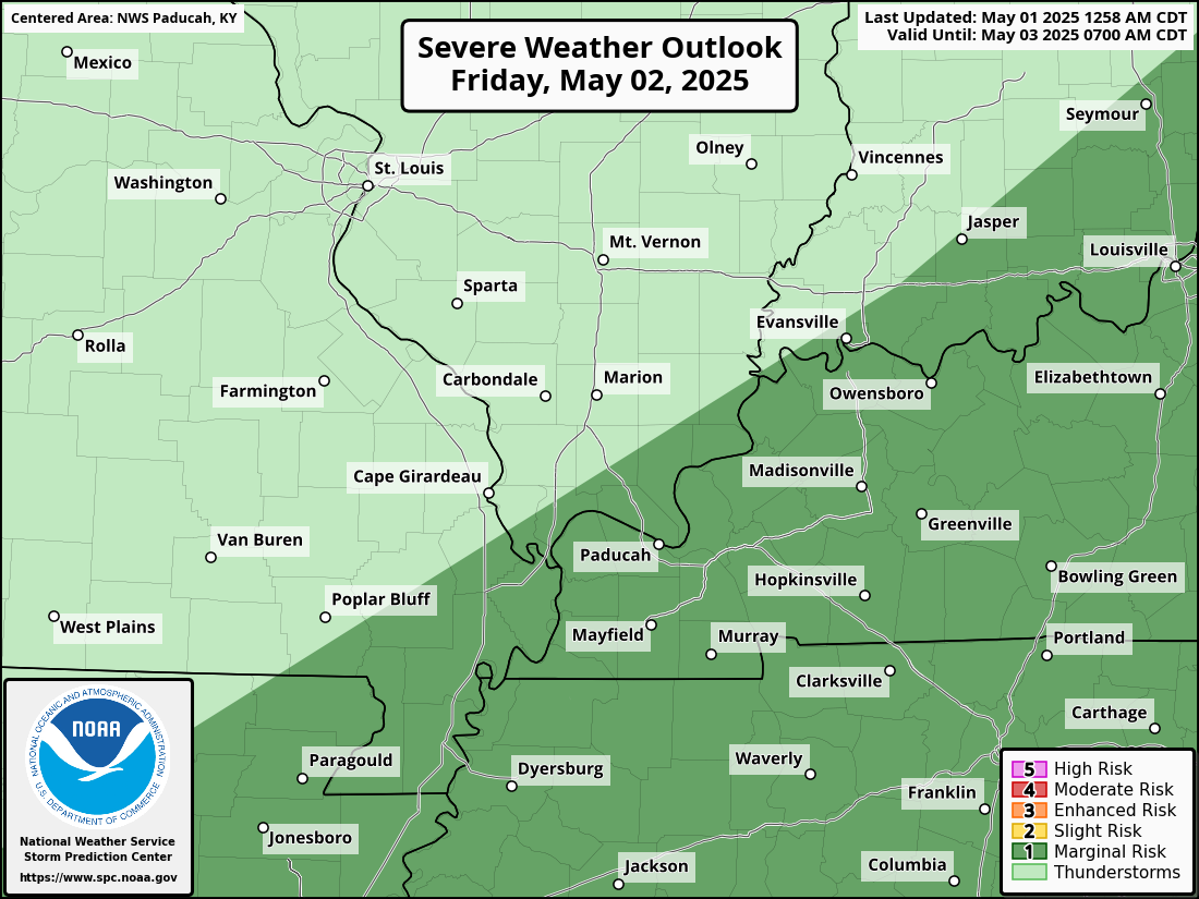
Today’s severe weather outlook. Light green is where storms are possible, but below severe levels. Dark green is a level one threat zone. The lowest threat. Yellow is a level two (slight) risk.
Today’s outlook
Tomorrow’s outlook
.
Rain totals will vary greatly based on the placement of thunderstorms. Storms can always enhance rain totals.
.
A few showers may linger into Saturday and Saturday night. The chances will be a bit higher over Kentucky and Tennessee on Saturday.
Rain chances on Sunday will be low, but perhaps not zero over our eastern counties. Any rain would be light.
A big upper-level low will push into the region this weekend. That will bring cooler air.
You can see that upper-level low on this 500 MB vort max from the GFS model.
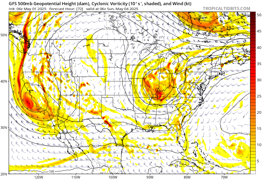
It will turn quite a bit cooler on Saturday and Sunday. Highs will mostly be in the 60s. Lows this weekend will be in the 40s and 50s. A bit of a chill in the air.
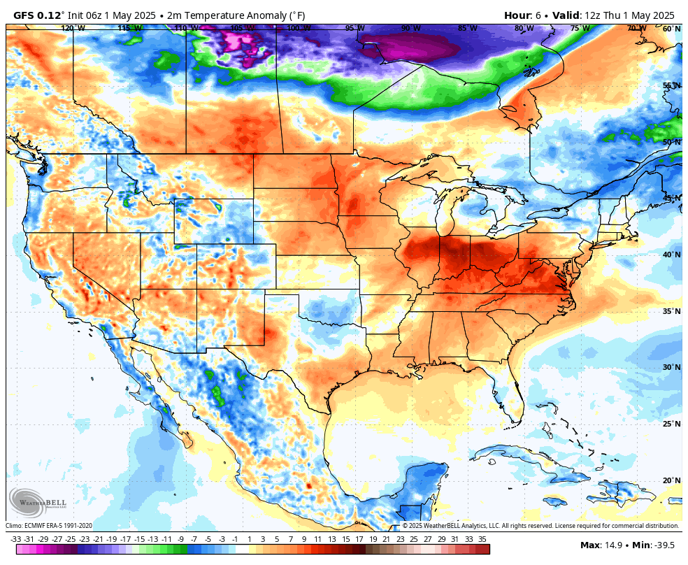
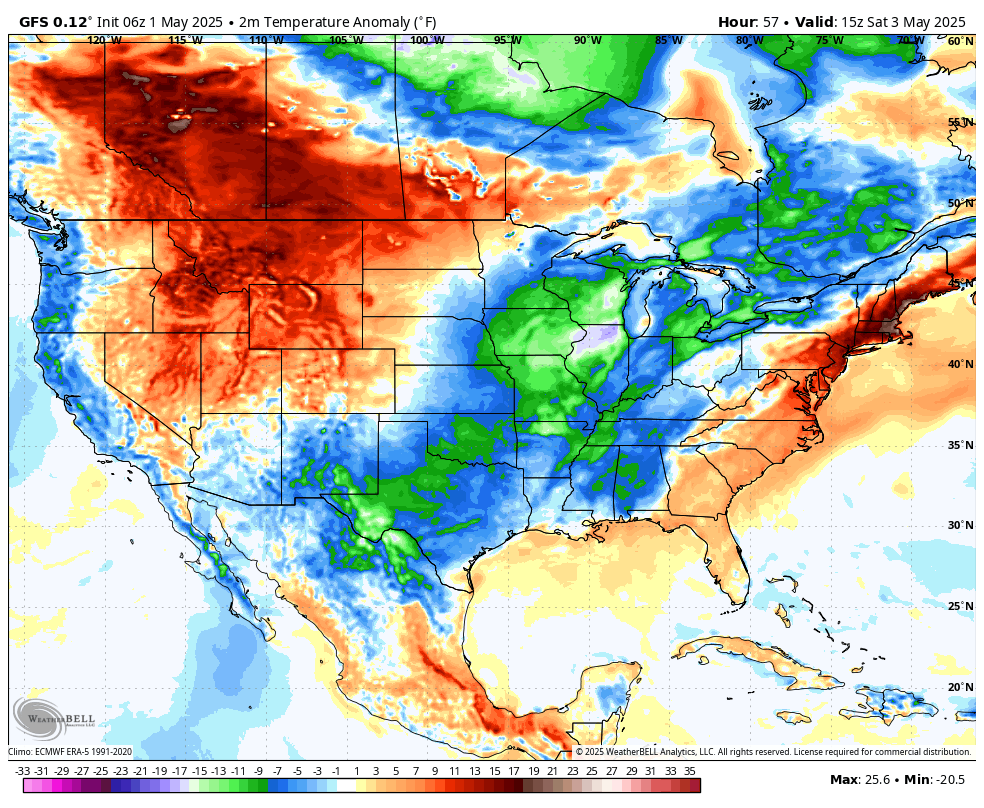
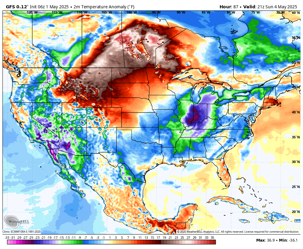
Check out these temperature anomaly maps. These maps show you how many degrees above or below average temperatures will be.
Above average today (orange and red).
Check out tomorrow into Monday. Blue, green, and purple colors. That represents below-average temperatures.
Sunday
Monday temperature anomaly map
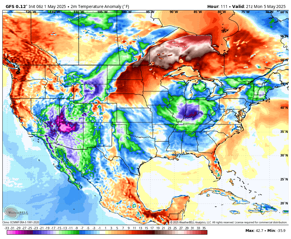
Peak tornado season is May. Any time we have cooler air in May, it is a good thing. It does help keep the tornadoes away.
I continue to worry about a severe drought this summer over portions of the central United States. Perhaps centered on Iowa.
The question may be our region. Will we slip into drought, or will we remain in the MCS train-zone? MCS’s are large summer thunderstorm clusters that ride the heat ridge. Up and over the drought zone. They can bring heavy rain and severe weather.
I am monitoring trends in the guidance.
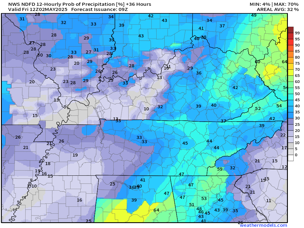
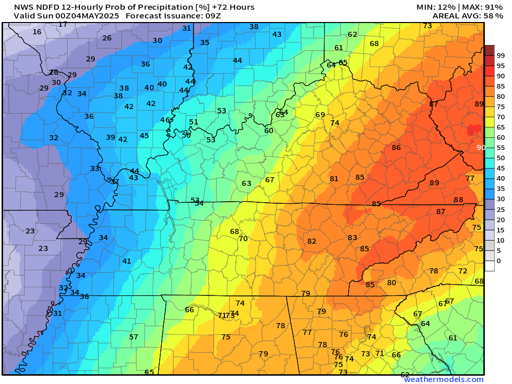
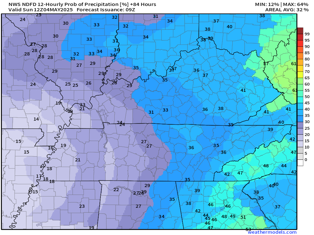
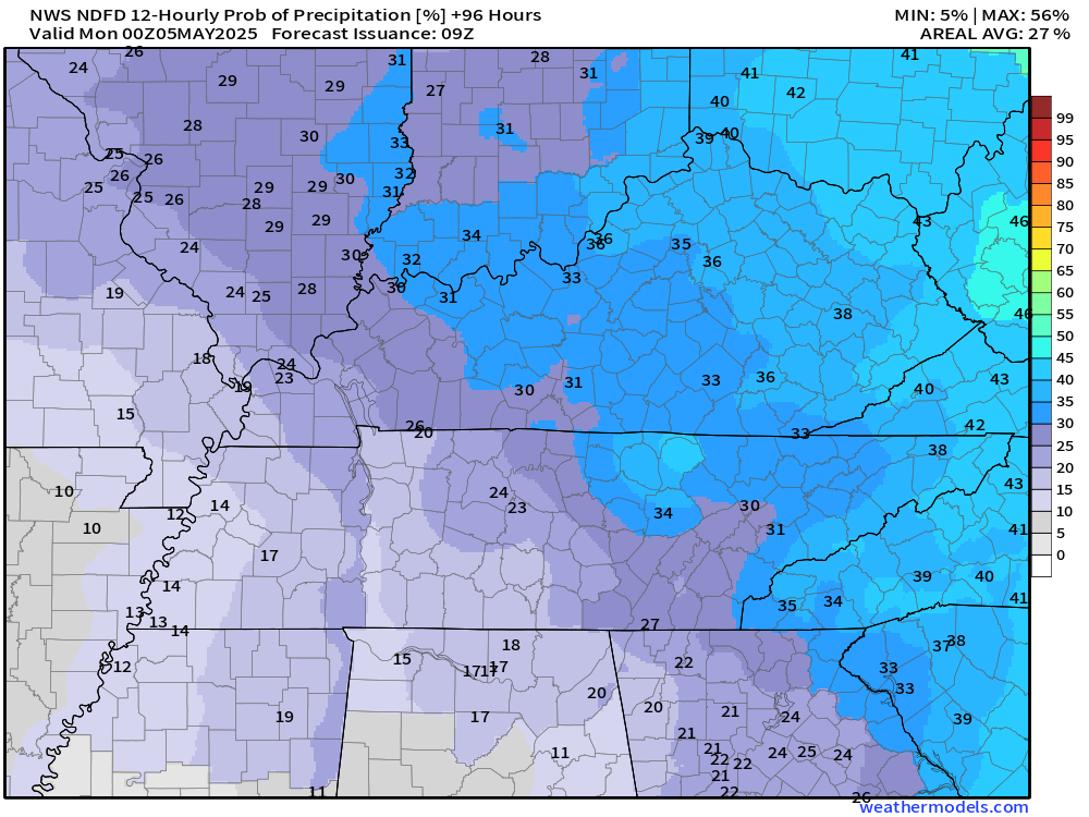
Let’s take a look at the latest rain probability maps for the next couple of days.
Double-click each image to enlarge it.
Today’s rain probabilities
You can expect 20 to 30% chances area-wide. Scattered thunderstorms will be possible.
.
Tonight’s rain probabilities
Similar tonight. Scattered showers and thunderstorms.
.
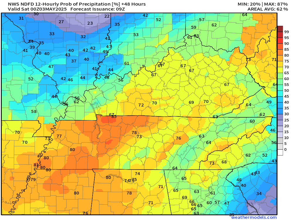
Friday’s rain probabilities
Chances on Friday may end up higher over far southeast Missouri, far southern Illinois, Kentucky, and Tenenssee.
.
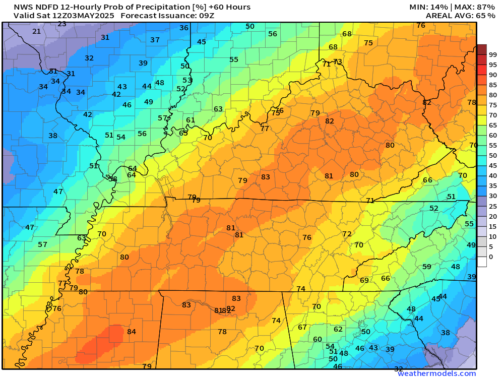
Friday night’s rain probabilities
.
Saturday’s rain probabilities
.
Saturday night’s rain probabilities
.
Sunday’s rain probabilities
.
A warming trend is expected to return around the middle of next week.
.
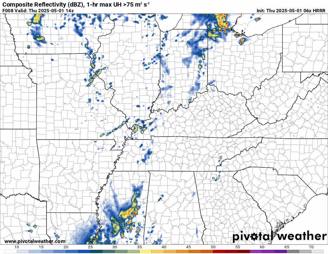
Let’s look at some future-cast radars.
.

The timestamp (upper left) is in Zulu. 12z=7 am. 18z=1 pm. 00z=7 pm.
Double-click the animation to enlarge it.
Hrrr model. This shows you the shower and thunderstorm activity today into tomorrow.
As you can see, periods of showers and thunderstorms.
.
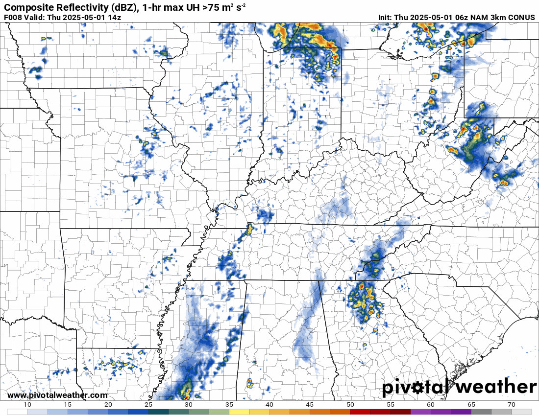
Here is the NAM model.
.
.
.
Click here if you would like to return to the top of the page.
.Average high temperatures for this time of the year are around 73 degrees.
Average low temperatures for this time of the year are around 52 degrees.
Average precipitation during this time period ranges from 1.00″ to 1.40″
Six to Ten Day Outlook.
Blue is below average. Red is above average. The no color zone represents equal chances.
Average highs for this time of the year are in the lower 60s. Average lows for this time of the year are in the lower 40s.

Green is above average precipitation. Yellow and brown favors below average precipitation. Average precipitation for this time of the year is around one inch per week.

.

Average low temperatures for this time of the year are around 55 degrees.
Average precipitation during this time period ranges from 1.20″ to 1.50″
.
Eight to Fourteen Day Outlook.
Blue is below average. Red is above average. The no color zone represents equal chances.

Green is above average precipitation. Yellow and brown favors below average precipitation. Average precipitation for this time of the year is around one inch per week.

.
.
.
We have a new service to complement your www.weathertalk.com subscription. This does NOT replace www.weathertalk.com It is simply another tool for you to receive severe weather information.
.


.

Radars and Lightning Data
Interactive-city-view radars. Clickable watches and warnings.
https://wtalk.co/B3XHASFZ
Old legacy radar site (some of you like it better)
https://weatherobservatory.com/weather-radar.htm
If the radar is not updating then try another one. If a radar does not appear to be refreshing then hit Ctrl F5. You may also try restarting your browser.
Backup radar site in case the above one is not working.
https://weathertalk.com/morani
Regional Radar
https://imagery.weathertalk.com/prx/RadarLoop.mp4
** NEW ** Zoom radar with chaser tracking abilities!
ZoomRadar
If the radar is not working, then email me: Email me at beaudodson@usawx.com
.
We do have some sponsors! Check them out.
Roof damage from recent storms? Link – Click here
INTEGRITY ROOFING AND EXTERIORS!
⛈️ Roof or gutter damage from recent storms? Today’s weather is sponsored by Integrity Roofing. Check out their website at this link https://www.ourintegritymatters.com/

![]()
![]()
![]()
Make sure you have three to five ways of receiving your severe weather information.
Weather Talk is one of those ways! Now, I have another product for you and your family.

.
Want to add more products to your Beau Dodson Weather App?
Receive daily videos, weather blog updates on normal weather days and severe weather and winter storm days, your county by county weather forecast, and more!
Here is how to do add those additional products to your app notification settings!
Here is a video on how to update your Beau Dodson Weather payment.
The app is for subscribers. Subscribe at www.weathertalk.com/welcome then go to your app store and search for WeatherTalk
Subscribers, PLEASE USE THE APP. ATT and Verizon are not reliable during severe weather. They are delaying text messages.
The app is under WeatherTalk in the app store.

Apple users click here

Android users click here
.
Radars and Lightning Data
Interactive-city-view radars. Clickable watches and warnings.
https://wtalk.co/B3XHASFZ
Old legacy radar site (some of you like it better)
https://weatherobservatory.com/weather-radar.htm
If the radar is not updating then try another one. If a radar does not appear to be refreshing then hit Ctrl F5. You may also try restarting your browser.
Backup radar site in case the above one is not working.
https://weathertalk.com/morani
Regional Radar
https://imagery.weathertalk.com/prx/RadarLoop.mp4
** NEW ** Zoom radar with chaser tracking abilities!
ZoomRadar
Lightning Data (zoom in and out of your local area)
https://wtalk.co/WJ3SN5UZ
Not working? Email me at beaudodson@usawx.com
National map of weather watches and warnings. Click here.
Storm Prediction Center. Click here.
Weather Prediction Center. Click here.
.

Live lightning data: Click here.
Real time lightning data (another one) https://map.blitzortung.org/#5.02/37.95/-86.99
Our new Zoom radar with storm chases
.
.

Interactive GOES R satellite. Track clouds. Click here.
GOES 16 slider tool. Click here.
College of DuPage satellites. Click here
.

Here are the latest local river stage forecast numbers Click Here.
Here are the latest lake stage forecast numbers for Kentucky Lake and Lake Barkley Click Here.
.
.
Find Beau on Facebook! Click the banner.


 .
.