

.
I have some question-and-answer threads over on the Facebook page. Link to those threads CLICK HERE
Or email me at beaudodsonweather@gmail.com
.

Severe weather update 10 AM
.
🌪️ Seven-Day Tornado Outlook ⛈️
April 29th through May 5th
Current risk: The risk of tornadoes is low.
Current confidence level: High confidence in the forecast.
Comment: The Storm Prediction Center has placed our region in a low-end risk of severe weather today through Thursday.
The primary concern will be damaging winds and quarter-sized hail. The tornado risk is low. The tornado risk is rarely zero when we have severe thunderstorms. Overall, however, the risk is low.
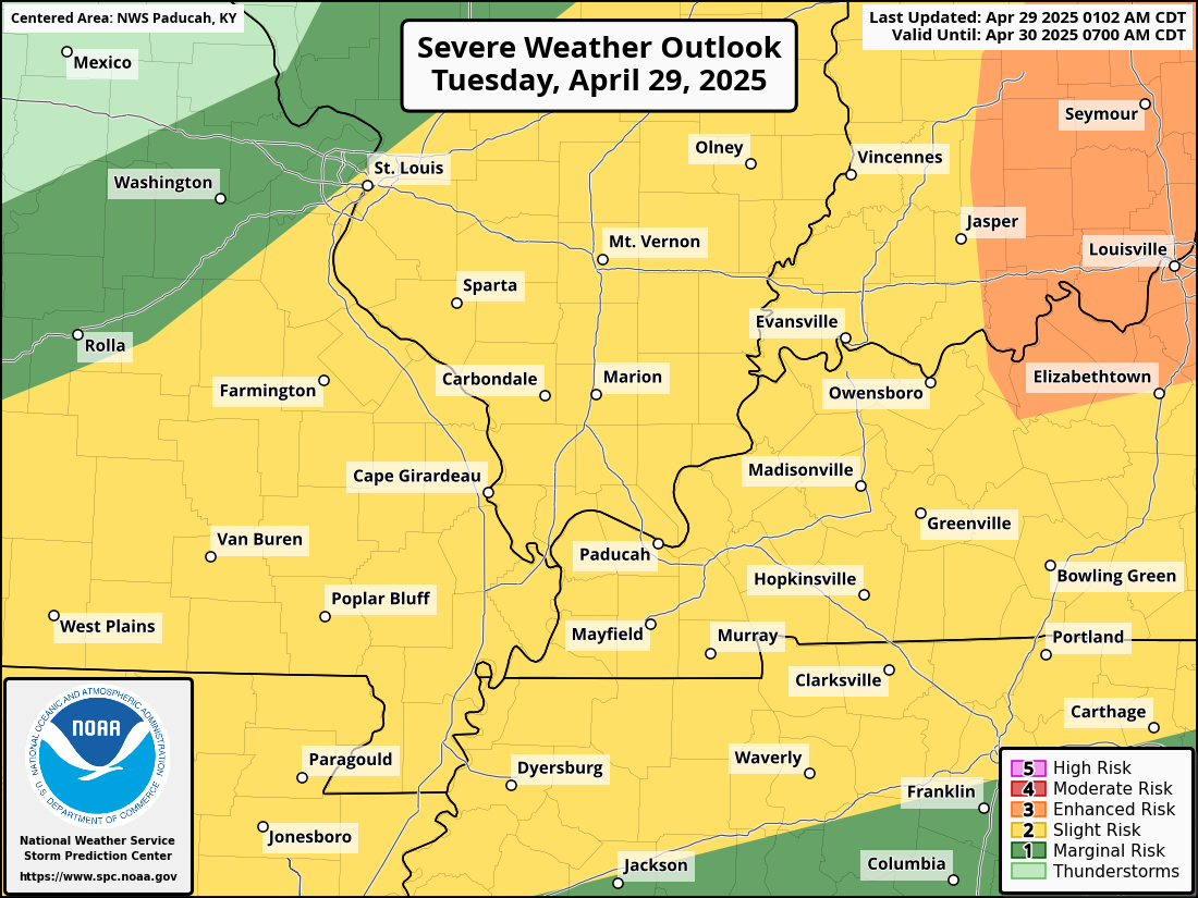
Here is today’s severe weather risk. Mainly this afternoon and evening.
Yellow is the level two out of five risk. Dark green is the level one out of five risk.
.
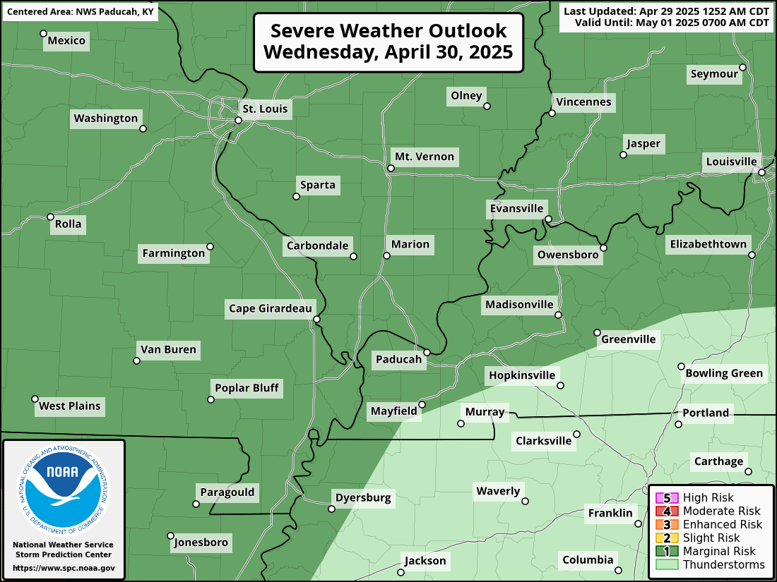
Here is Wednesday’s severe weather outlook
Dark green is a level one out of five for a severe weather risk. Light green indicates that storms are possible, but they should remain below severe levels.
One is the lowest level.
.
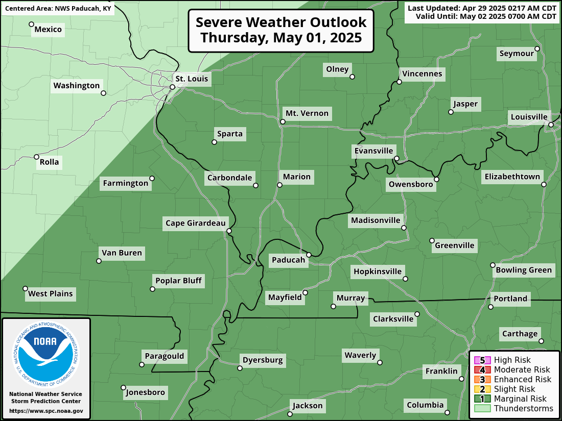
Here is Thursday’s severe weather outlook
.

Seven-Day Hazardous Weather Outlook
1. Is lightning in the forecast? YES. We will have a chance of lightning from today through Thursday night.
2. Are severe thunderstorms in the forecast? POSSIBLE. A few thunderstorms could become severe today and tonight. Another low risk on Wednesday and Thursday.
3. Is flash flooding in the forecast? LOW RISK. Locally heavy rain is possible today through Thursday evening. Widespread flash flooding is not anticipated. A few spots could have brief water issues if thunderstorms train over the same areas.
4. Will non-thunderstorm winds top 40 mph? NO.
5. Will temperatures rise above 90 degrees? NO.
6. Will the heat index rise above 100 degrees? NO.
.
A quick forecast glance. Your 48-hour forecast Graphics


.

.


Forecast discussion.
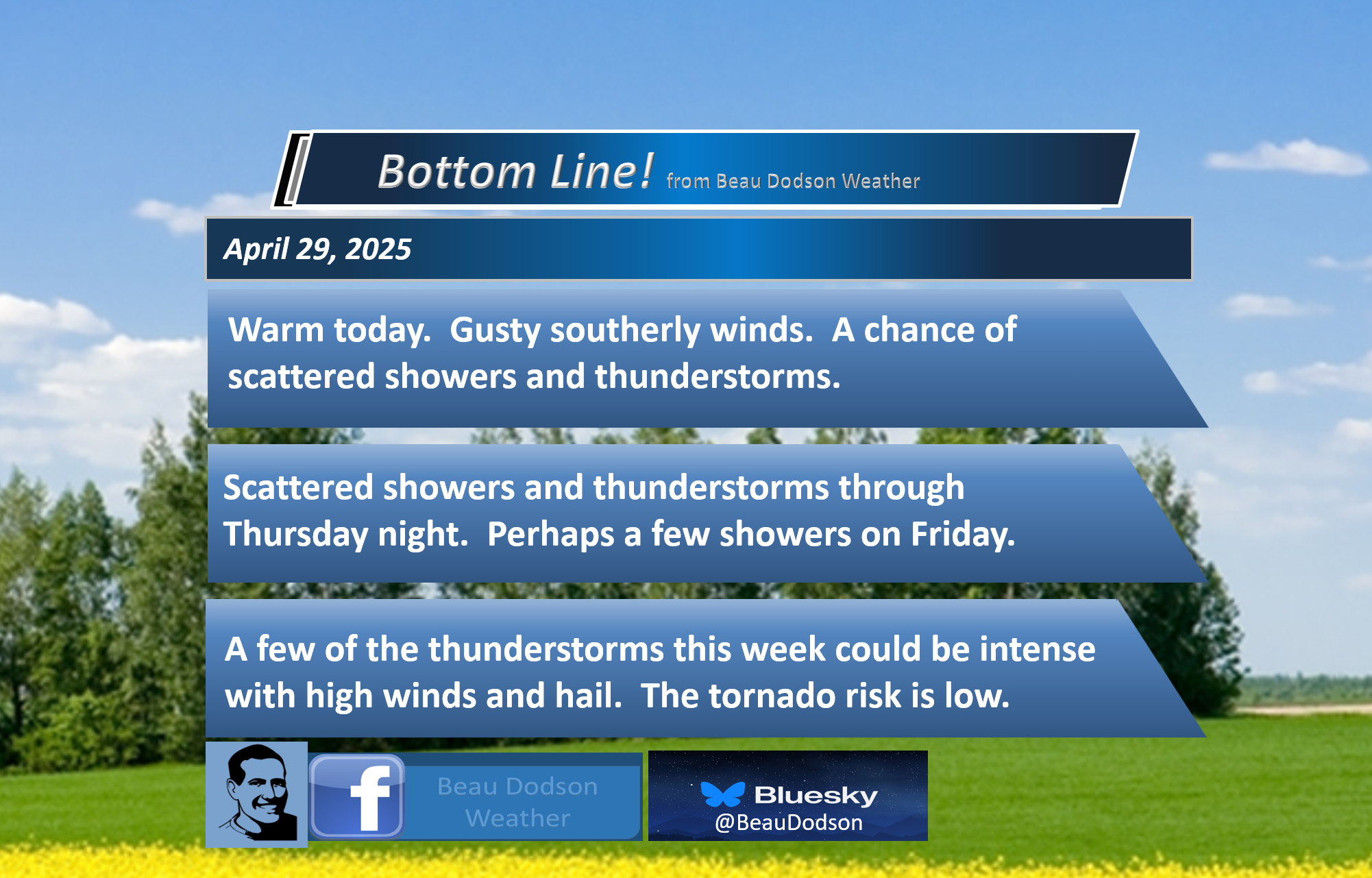
- Mild today. Gusty southerly winds.
- A chance of showers and thunderstorms today through Thursday night. A few of the thunderstorms could be intense with strong wind gusts and hail. A low-level severe weather risk today through Thursday evening.
- A few showers may continue into Friday.
- Dry and cool Saturday and Sunday. Overnight lows in the 40s and 50s. Highs in the 60s and 70s.
- Calm early next week.
.

.
Good morning, everyone
We are waking up to clouds. Mild temperatures, as well.
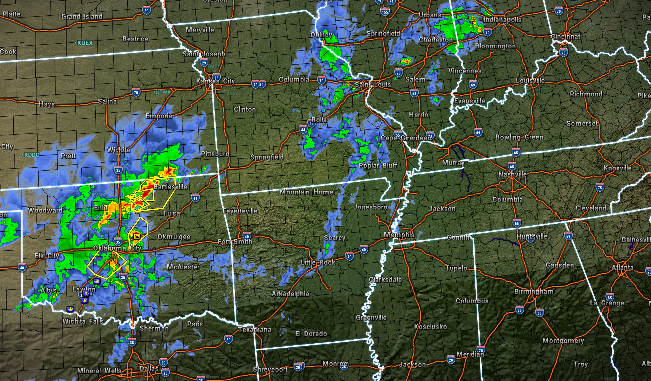
Radar at 6 am showed a few showers over southeast Missouri and southern Illinois.
A larger complex of thunderstorms was forming over eastern Oklahoma. This will push into our region later today and tonight.
This is what radar looked like at 6:10 AM. You can see that complex well to our west across southern Kansas and Oklahoma.
.
We will have some instability today. And, some weak wind shear, as well. Dew points are in the 60s.
Those are ingredients for at least a low-end severe weather risk.
The Storm Prediction Center has outlined our region in a slight risk for severe thunderstorms. The primary concern will be damaging winds and quarter-sized hail. The tornado risk is low, but never zero. Any time we have severe thunderstorms, there’s a chance of a brief tornado.
Overall, the risk of tornadoes is low.
The primary time frame of concern (for severe weather) will be this afternoon and evening.
On Wednesday, the warm front will lift northward through our region. That places us in the warm sector of the storm system. Additional scattered thunderstorms are likely. A few could be intense.
Then, on Thursday, the cold front will return to our region. This will bring an increase in shower and thunderstorm activity Wednesday night into Thursday evening.
The cold front will push through the region Thursday night and Friday.
Once the cold front pushes through the region, the chance of rain will taper. Becoming more scattered.
Saturday through Monday appears dry. Cool mornings. Mild afternoons. No significant weather concerns.
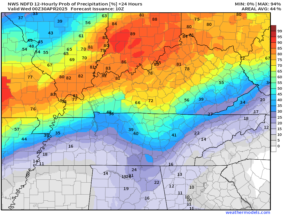
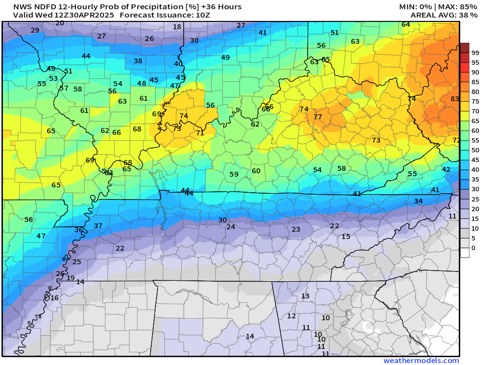
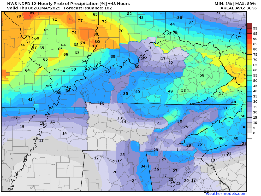
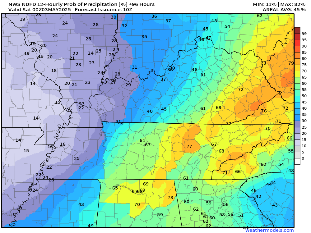
Let me show you the rain probabilities through Friday. This shows you the % chance of showers and thunderstorms. As you can see, it moves around a bit.
Double-click each image to enlarge it.
Today’s rain probabilities
Tonight’s rain probabilities
Wednesday’s rain probabilities
Wednesday night’s rain probabilities
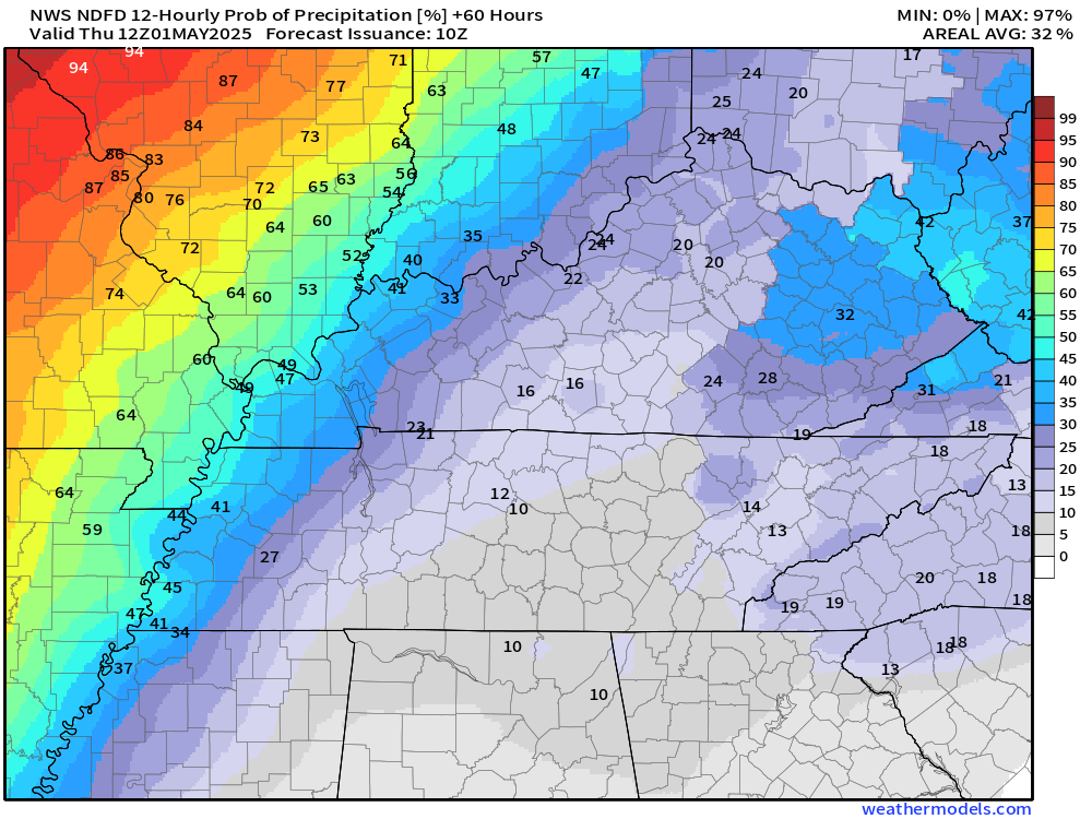
Thursday’s rain probabilities
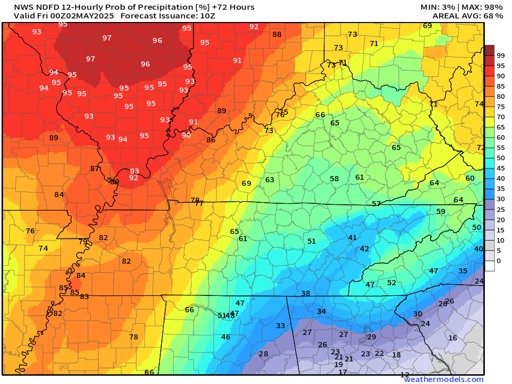
Thursday night’s rain probabilities
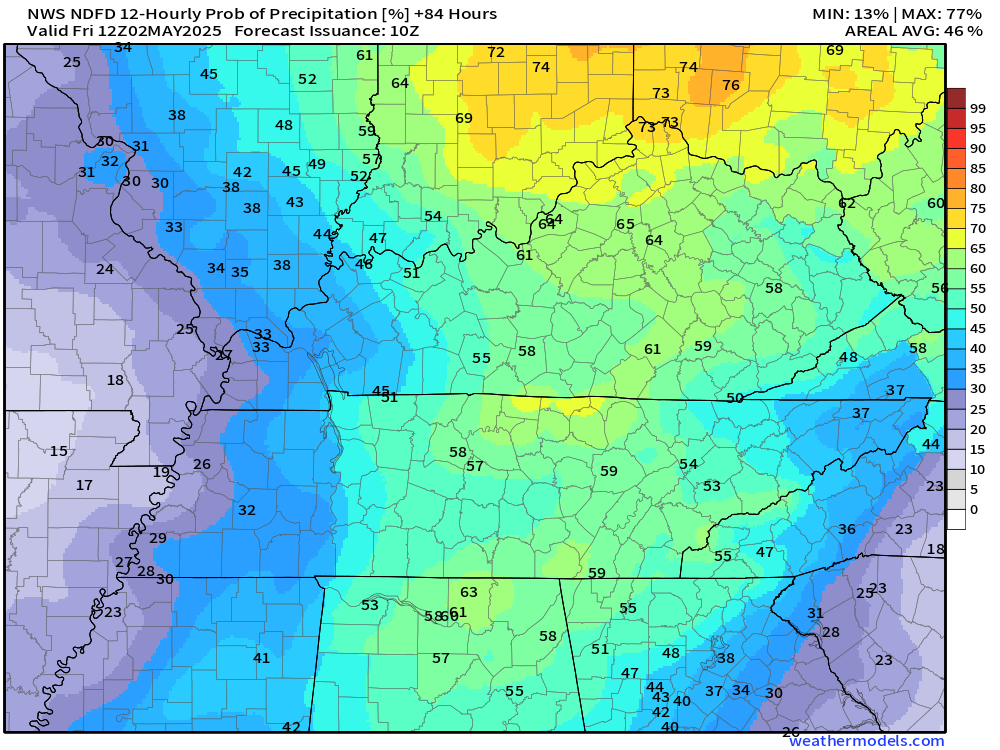
Friday’s rain probabilities
Let’s look at some future-cast radars.
.

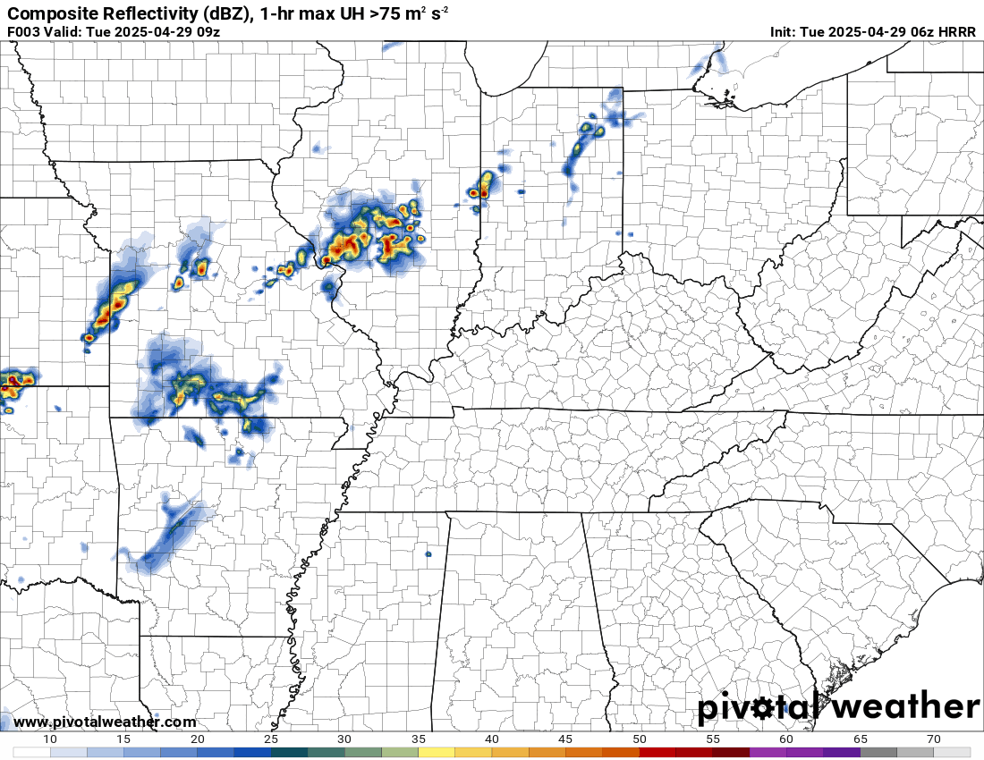
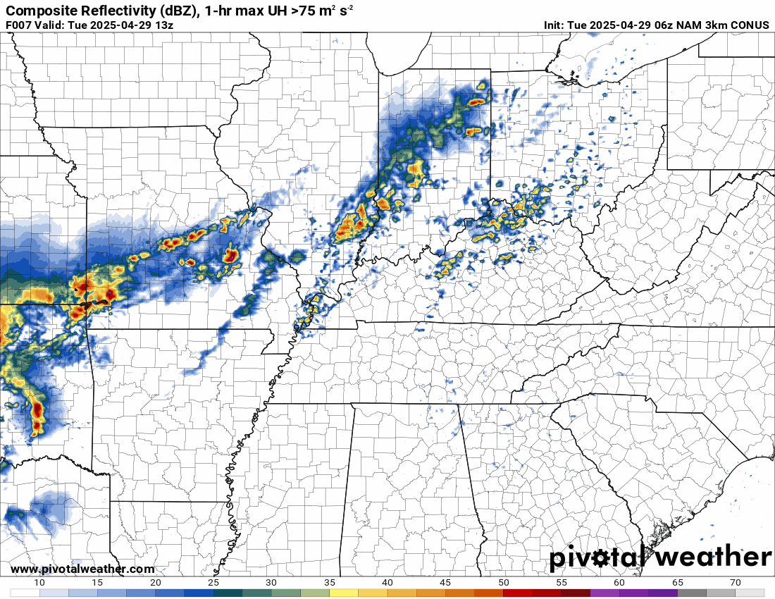
The timestamp (upper left) is in Zulu. 12z=7 am. 18z=1 pm. 00z=7 pm.
Double-click the animation to enlarge it.
Hrrr model. This shows you the shower and thunderstorm activity today into tomorrow.
As you can see, periods of showers and thunderstorms.
.
Here is the NAM model.
.
.
.
Click here if you would like to return to the top of the page.
.Average high temperatures for this time of the year are around 72 degrees.
Average low temperatures for this time of the year are around 50 degrees.
Average precipitation during this time period ranges from 1.00″ to 1.40″
Six to Ten Day Outlook.
Blue is below average. Red is above average. The no color zone represents equal chances.
Average highs for this time of the year are in the lower 60s. Average lows for this time of the year are in the lower 40s.

Green is above average precipitation. Yellow and brown favors below average precipitation. Average precipitation for this time of the year is around one inch per week.

.

Average low temperatures for this time of the year are around 54 degrees.
Average precipitation during this time period ranges from 1.20″ to 1.50″
.
Eight to Fourteen Day Outlook.
Blue is below average. Red is above average. The no color zone represents equal chances.

Green is above average precipitation. Yellow and brown favors below average precipitation. Average precipitation for this time of the year is around one inch per week.

.
.
.
We have a new service to complement your www.weathertalk.com subscription. This does NOT replace www.weathertalk.com It is simply another tool for you to receive severe weather information.
.


.

Radars and Lightning Data
Interactive-city-view radars. Clickable watches and warnings.
https://wtalk.co/B3XHASFZ
Old legacy radar site (some of you like it better)
https://weatherobservatory.com/weather-radar.htm
If the radar is not updating then try another one. If a radar does not appear to be refreshing then hit Ctrl F5. You may also try restarting your browser.
Backup radar site in case the above one is not working.
https://weathertalk.com/morani
Regional Radar
https://imagery.weathertalk.com/prx/RadarLoop.mp4
** NEW ** Zoom radar with chaser tracking abilities!
ZoomRadar
If the radar is not working, then email me: Email me at beaudodson@usawx.com
.
We do have some sponsors! Check them out.
Roof damage from recent storms? Link – Click here
INTEGRITY ROOFING AND EXTERIORS!
⛈️ Roof or gutter damage from recent storms? Today’s weather is sponsored by Integrity Roofing. Check out their website at this link https://www.ourintegritymatters.com/

![]()
![]()
![]()
Make sure you have three to five ways of receiving your severe weather information.
Weather Talk is one of those ways! Now, I have another product for you and your family.

.
Want to add more products to your Beau Dodson Weather App?
Receive daily videos, weather blog updates on normal weather days and severe weather and winter storm days, your county by county weather forecast, and more!
Here is how to do add those additional products to your app notification settings!
Here is a video on how to update your Beau Dodson Weather payment.
The app is for subscribers. Subscribe at www.weathertalk.com/welcome then go to your app store and search for WeatherTalk
Subscribers, PLEASE USE THE APP. ATT and Verizon are not reliable during severe weather. They are delaying text messages.
The app is under WeatherTalk in the app store.

Apple users click here

Android users click here
.
Radars and Lightning Data
Interactive-city-view radars. Clickable watches and warnings.
https://wtalk.co/B3XHASFZ
Old legacy radar site (some of you like it better)
https://weatherobservatory.com/weather-radar.htm
If the radar is not updating then try another one. If a radar does not appear to be refreshing then hit Ctrl F5. You may also try restarting your browser.
Backup radar site in case the above one is not working.
https://weathertalk.com/morani
Regional Radar
https://imagery.weathertalk.com/prx/RadarLoop.mp4
** NEW ** Zoom radar with chaser tracking abilities!
ZoomRadar
Lightning Data (zoom in and out of your local area)
https://wtalk.co/WJ3SN5UZ
Not working? Email me at beaudodson@usawx.com
National map of weather watches and warnings. Click here.
Storm Prediction Center. Click here.
Weather Prediction Center. Click here.
.

Live lightning data: Click here.
Real time lightning data (another one) https://map.blitzortung.org/#5.02/37.95/-86.99
Our new Zoom radar with storm chases
.
.

Interactive GOES R satellite. Track clouds. Click here.
GOES 16 slider tool. Click here.
College of DuPage satellites. Click here
.

Here are the latest local river stage forecast numbers Click Here.
Here are the latest lake stage forecast numbers for Kentucky Lake and Lake Barkley Click Here.
.
.
Find Beau on Facebook! Click the banner.


 .
.