It will be cooler today. Lingering clouds will make it feel even cooler, at times.
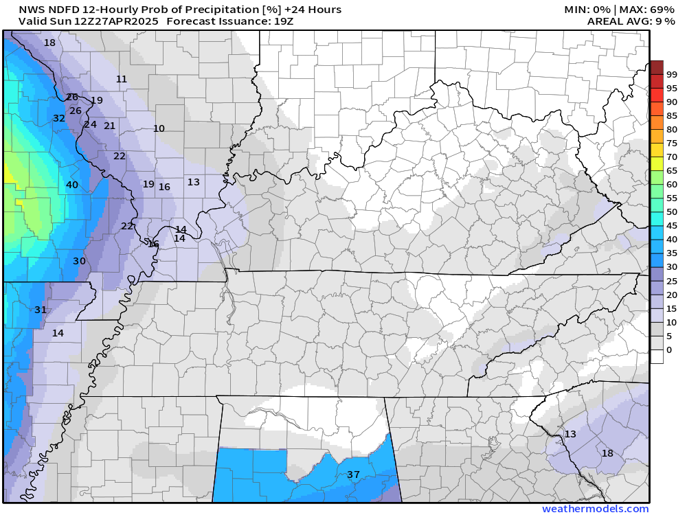
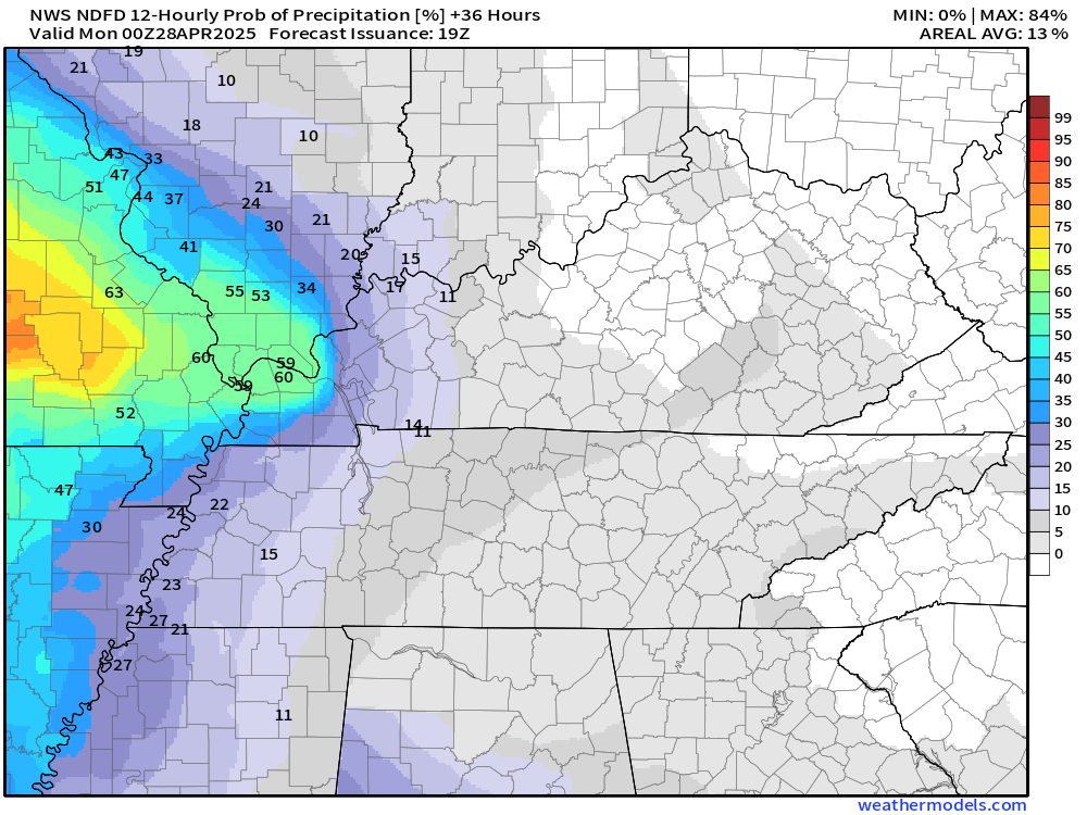
I did increase shower and thunderstorm chances for late tonight into Sunday afternoon. The peak chances will be across southeast Missouri and southwest Illinois.
Here is a graphic showing you Sunday’s thunderstorm chances/probabilities.
Tonight
Tomorrow
.
It will be warm on Monday and Tuesday. Highs well into the 80s!
A cold front will bring a chance of showers and thunderstorms back to the region on Tuesday afternoon and night. A few of those storms could be intense. Monitor updates.
The front will stall in or near our region on Wednesday and Thursday. That will bring additional chances of thunderstorms from Wednesday into at least Thursday night, perhaps into Friday.
Some of the thunderstorms on Thursday could be intense. Monitor updates.
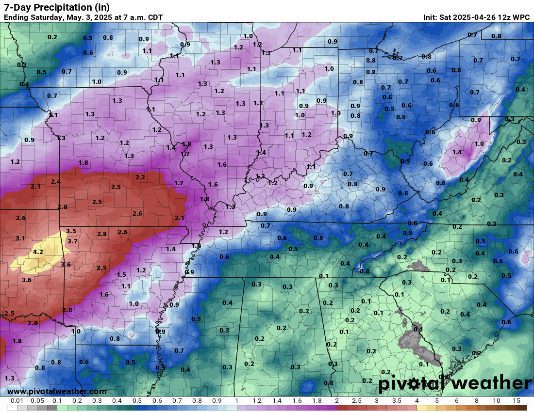
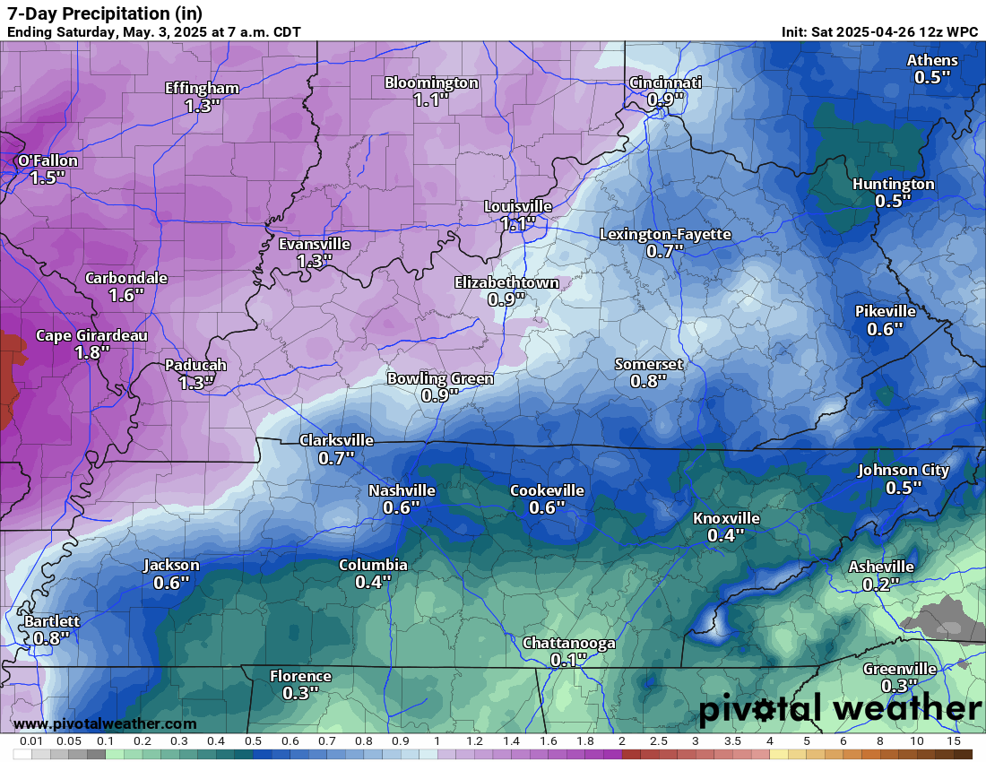
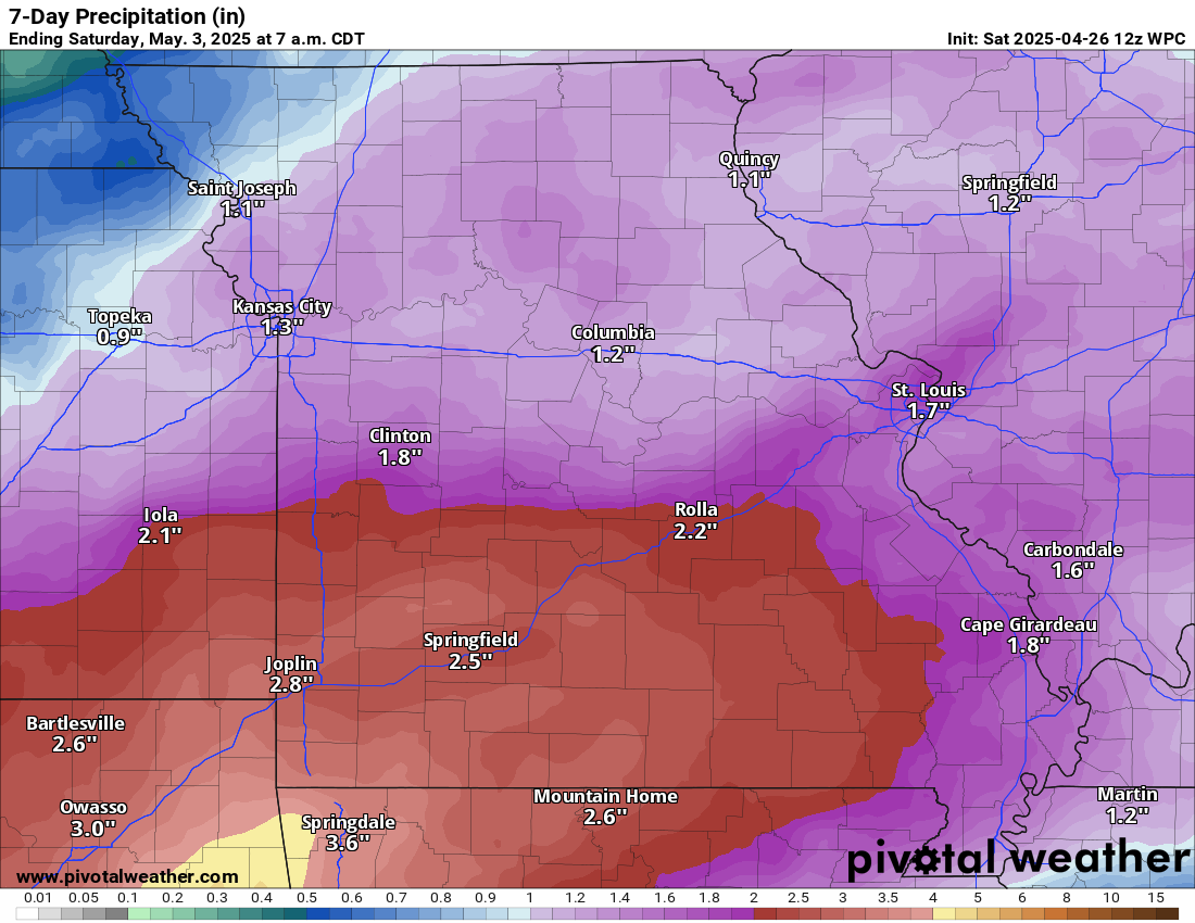
Rainfall totals between now and next Friday will vary depending on the placement of thunderstorms. AS always, thunderstorms can enhance rain totals.
Double click on the image to enlarge it.