
.

.
I have some question-and-answer threads over on the Facebook page. Link to those threads CLICK HERE
Or email me at beaudodsonweather@gmail.com
.

Seven-Day Tornado Outlook
Tornado activity is not anticipated.
.

Seven-Day Hazardous Weather Outlook
1. Is lightning in the forecast? POSSIBLE. Wednesday afternoon and evening. Mainly over KY/TN.
2. Are severe thunderstorms in the forecast? NO.
3. Is flash flooding in the forecast? NO. There is ongoing river flooding in some counties.
4. Will non-thunderstorm winds top 40 mph? NO.
5. Will temperatures drop below 10 degrees? NO.
6. Will the wind chill dip below 0 degrees? NO.
7. Is measurable snow and/or sleet in the forecast? NO.
8. Is freezing rain/ice in the forecast? NO.
.
A quick forecast glance. Your 48-hour forecast Graphics


.

.


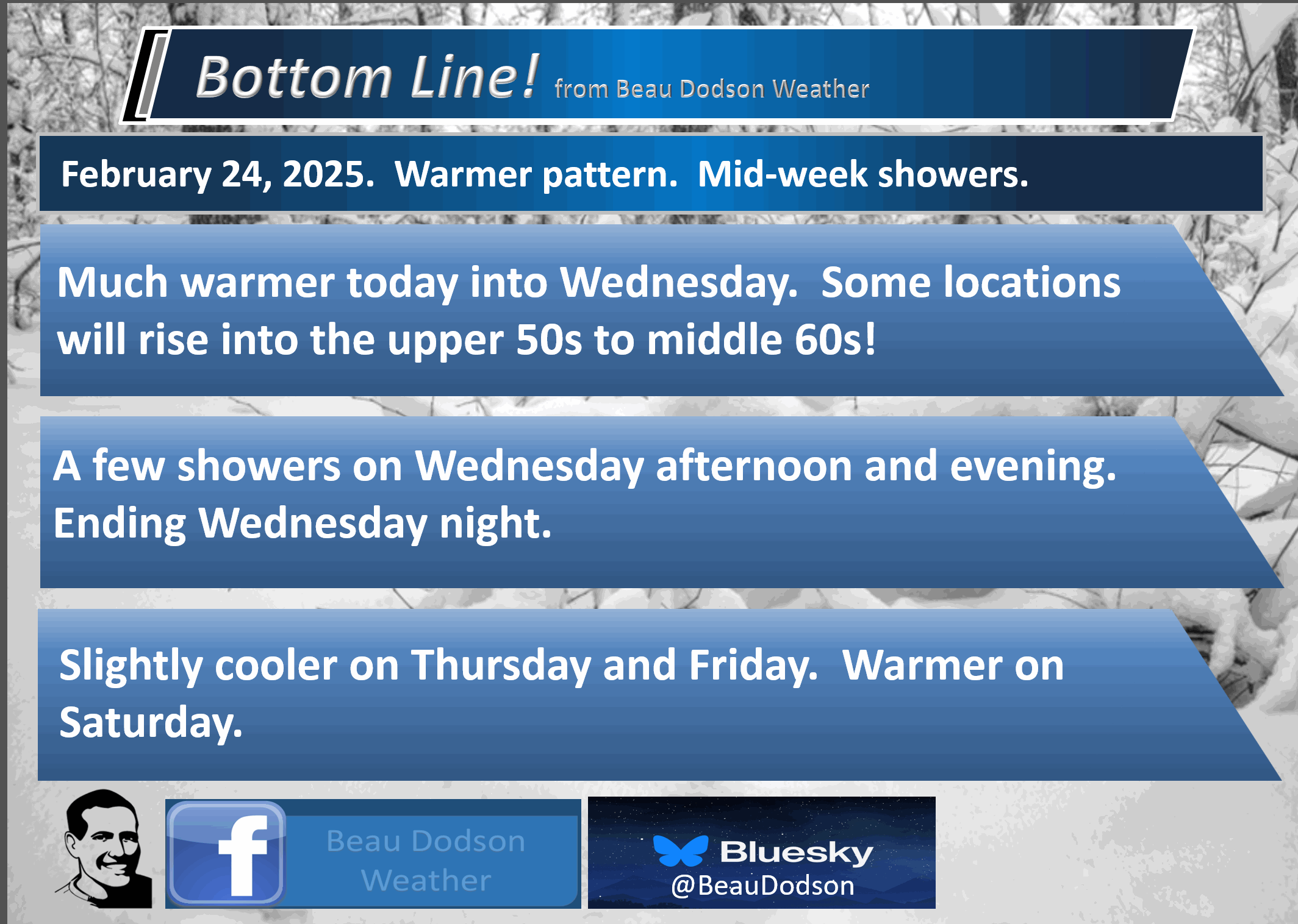
Forecast discussion.
- Warmer today into Wednesday. Some locations will hit sixty degrees!
- There is a chance of a few showers on Wednesday/Wednesday night. A band of showers. Light rainfall totals. 0.00″ to 0.25″.
- River flooding continues in some counties. It will take some time for the rivers to recede.
- Decent weather Thursday into Sunday.
- Watching early March for several systems.
.
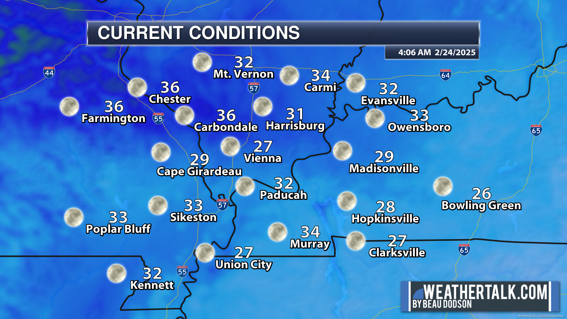
It is still chilly this morning, but nothing like recent days. No single digits. No teens! We will take it.
Our warming trend continues today and will be with us into Wednesday. A bit cooler Thursday. A bit warmer from Friday into Sunday.
The good news is that I am not forecasting any extreme weather swings this week. I think we can all be thankful for that.
It has been quite the weather ride over the past two weeks. We have earned a break.
.

I have no significant weather concerns over the coming days.
There could be some patchy fog this morning. So far, not much has developed. Hopefully, it stays that way.
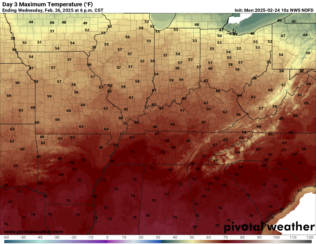
The great news is that temperatures will warm a bit today and quite a bit tomorrow and Wednesday.
The warmest day now appears to be Wednesday (ahead of a cold front). Today and tomorrow will feel pretty good, as well.
Widespread fifties today. Widespread fifties and a few sixties tomorrow. Widespread sixties on Wednesday!
.
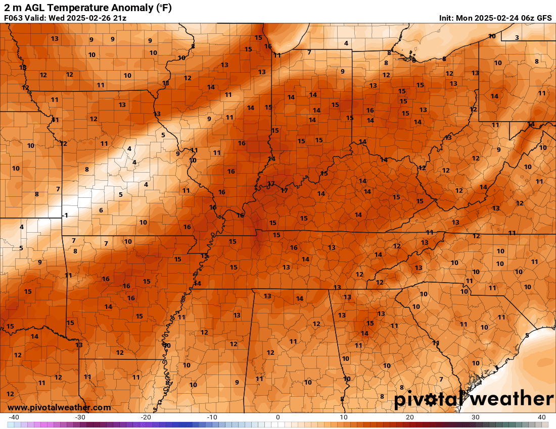
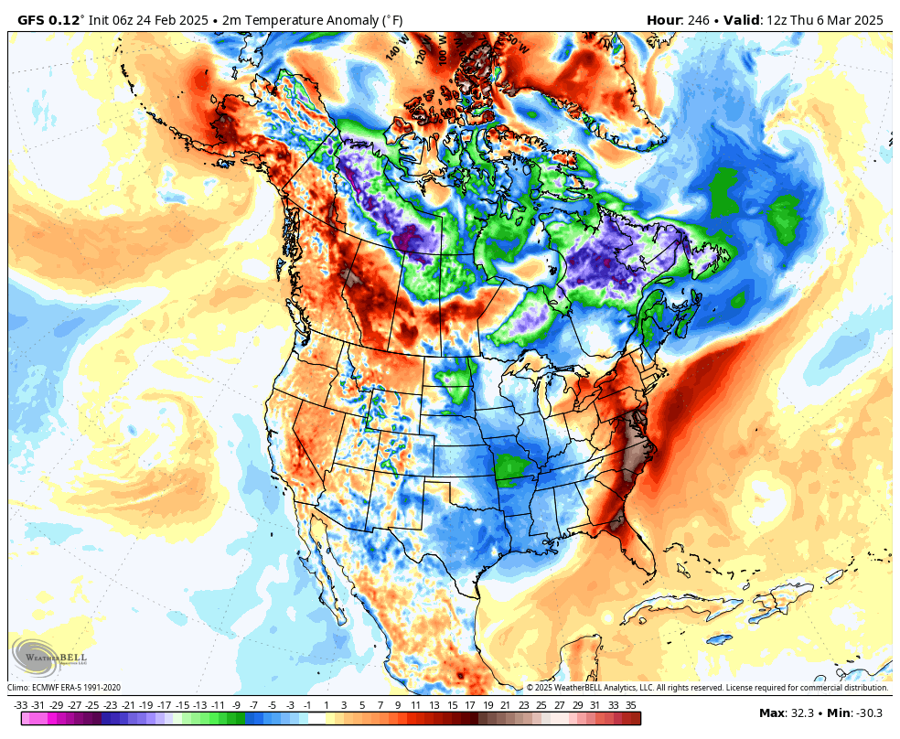
Let’s look at the Wednesday temperature anomaly map.
This map shows you how many degrees above average temperatures will be. This is quite a change from a week ago!
.
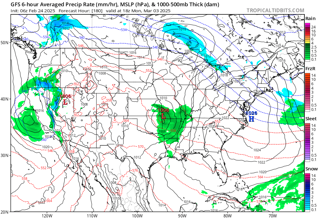
A few showers and a rumble of thunder will be possible on Wednesday afternoon and evening. The thunder is a bit more likely over Kentucky and Tennessee. No severe thunderstorms, thankfully.
See the future-cast radars below the Weather Call information (scroll down).
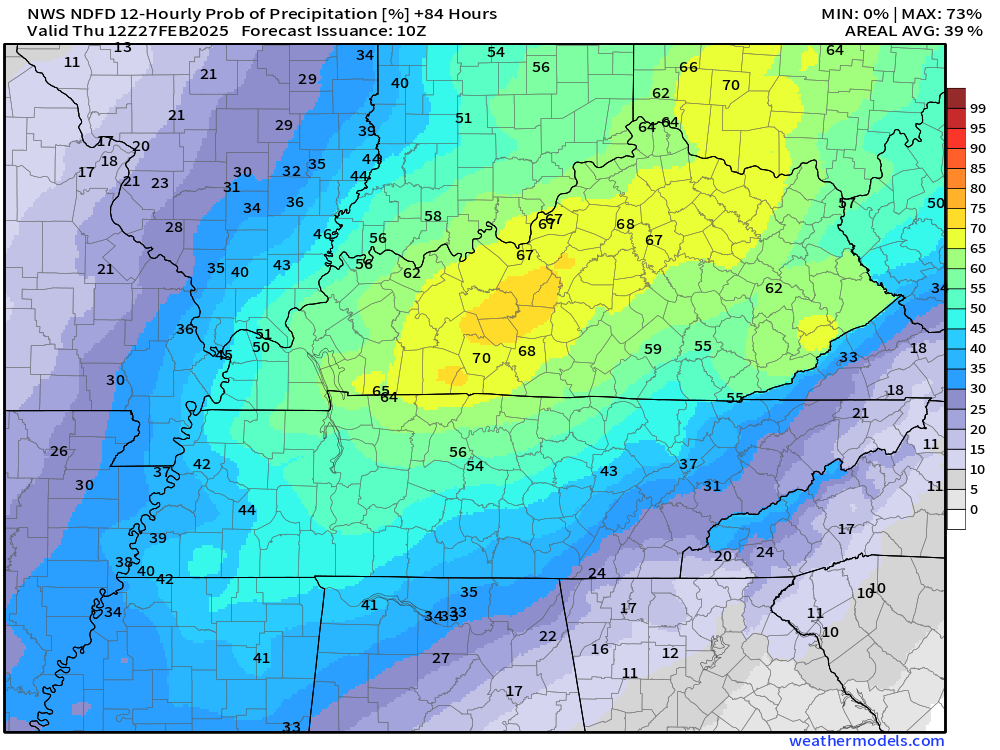
Let’s look at those precipitation probabilities.
Notice our western counties have lower rain chances vs central and east.
Wednesday, 6 am to 6 pm (mostly pm chances).
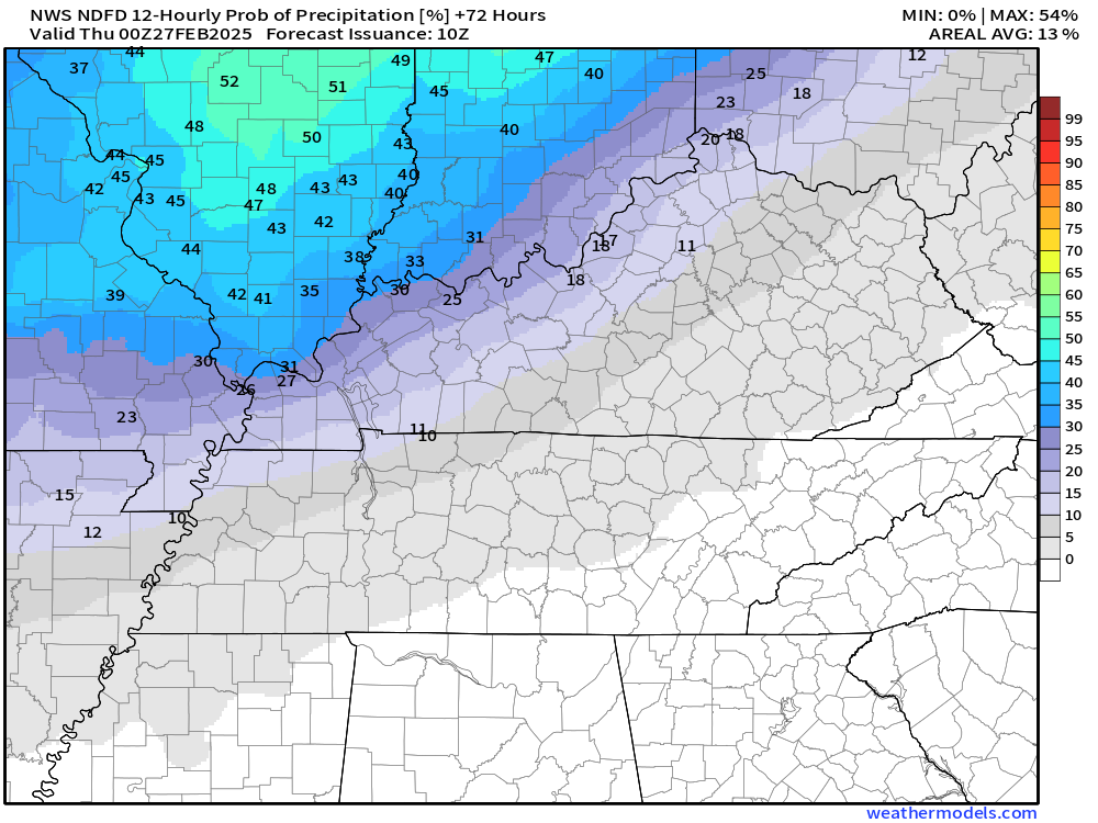
Wednesday evening and overnight rain probabilities. Peak chances will be around 60%.
A quick-moving band of showers.
.
This is not a big precipitation event.
Rainfall totals will be on the light side. Some locations could end up dry.
Here is the latest rainfall forecast for that rain event.
Not much.
You may double-click on the images to enlarge them.
Notice the Poplar Bluff area has trace amounts. A bit more as you travel farther east.
.
I am watching a couple of cold shots in March. After that, we should slide into spring!
There are some crazy maps floating around about the polar vortex returning in March. Most of the model guidance does not show that. Yes, they show some cold spurts of weather, but not single digits or below zero. I will monitor it, of course.
Here is the GEFS temperature anomaly map for March 5th. It has above-average temperatures.
Those warm colors equal above-average temperatures.
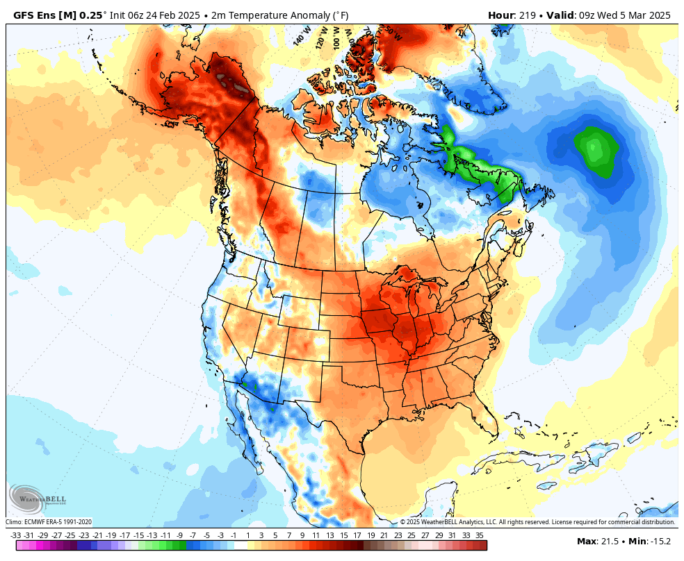
Perhaps a little cooler behind that cold front.
This is the temperature anomaly map for March 6th. Other data shows near-normal to above-normal temperatures during that same time frame.
.
There are several signals for a mild to warm end of March (second half of March). Active, as well. Several systems to track during March.
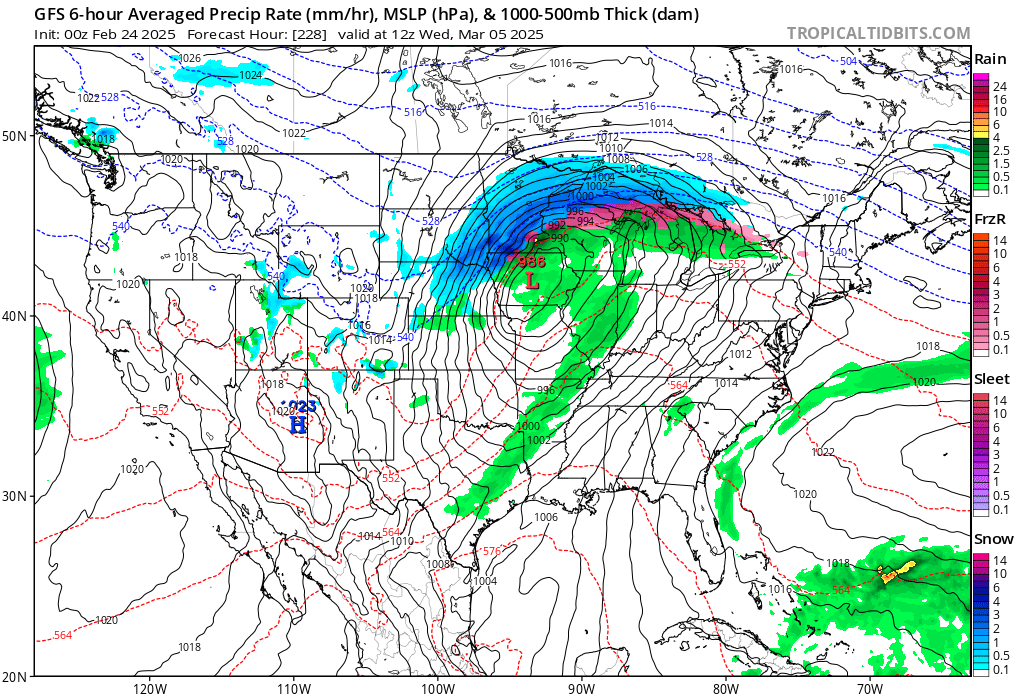
I am watching several precipitation events during the first ten days of March. Right now, they look wet, not white.
Guidance shows rain showers with a chance of embedded thunderstorms.
It is that time of the year. Monitor updates.
The GFS model shows rain showers around the 3rd or 4th of March and another system a few days later.
.
Another system March 5th and 6th. Plenty of time to monitor these systems.
.
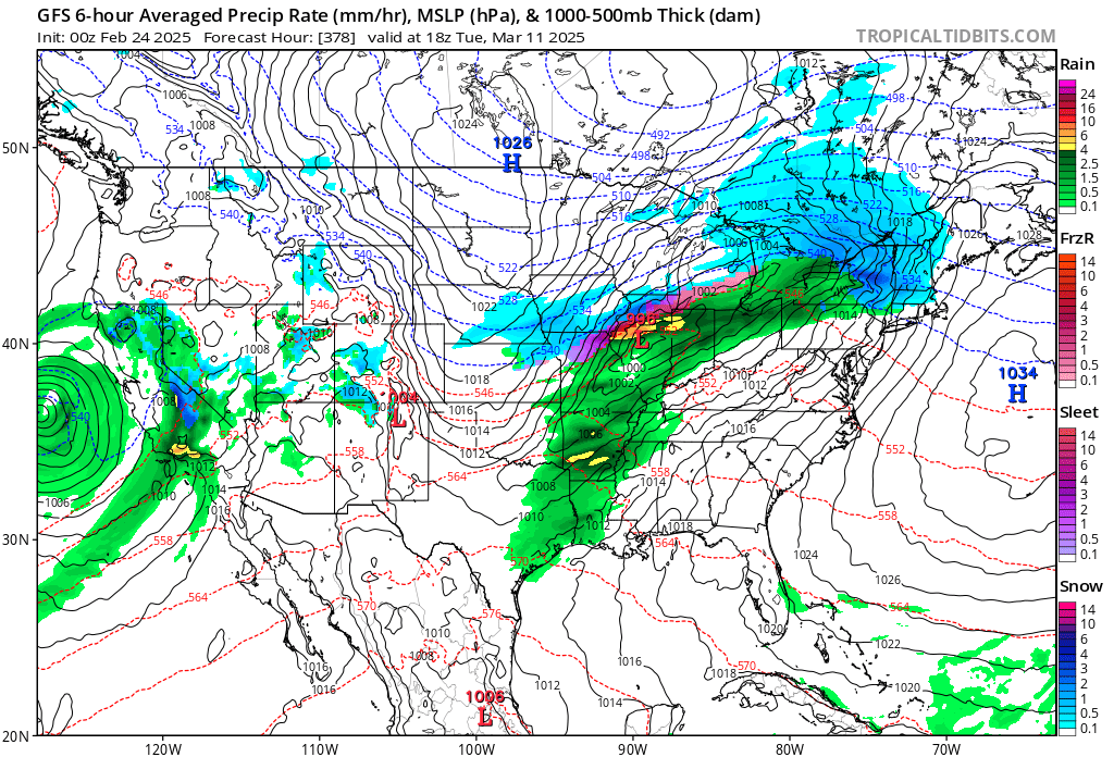
The severe weather analogs are showing some spikes of concern for areas to our south with these early to mid-March systems. For now, I am watching trends. Whether we have to deal with severe storms is unknown.
This graphic is for March 9th into the 16th. I will keep a close eye on it.
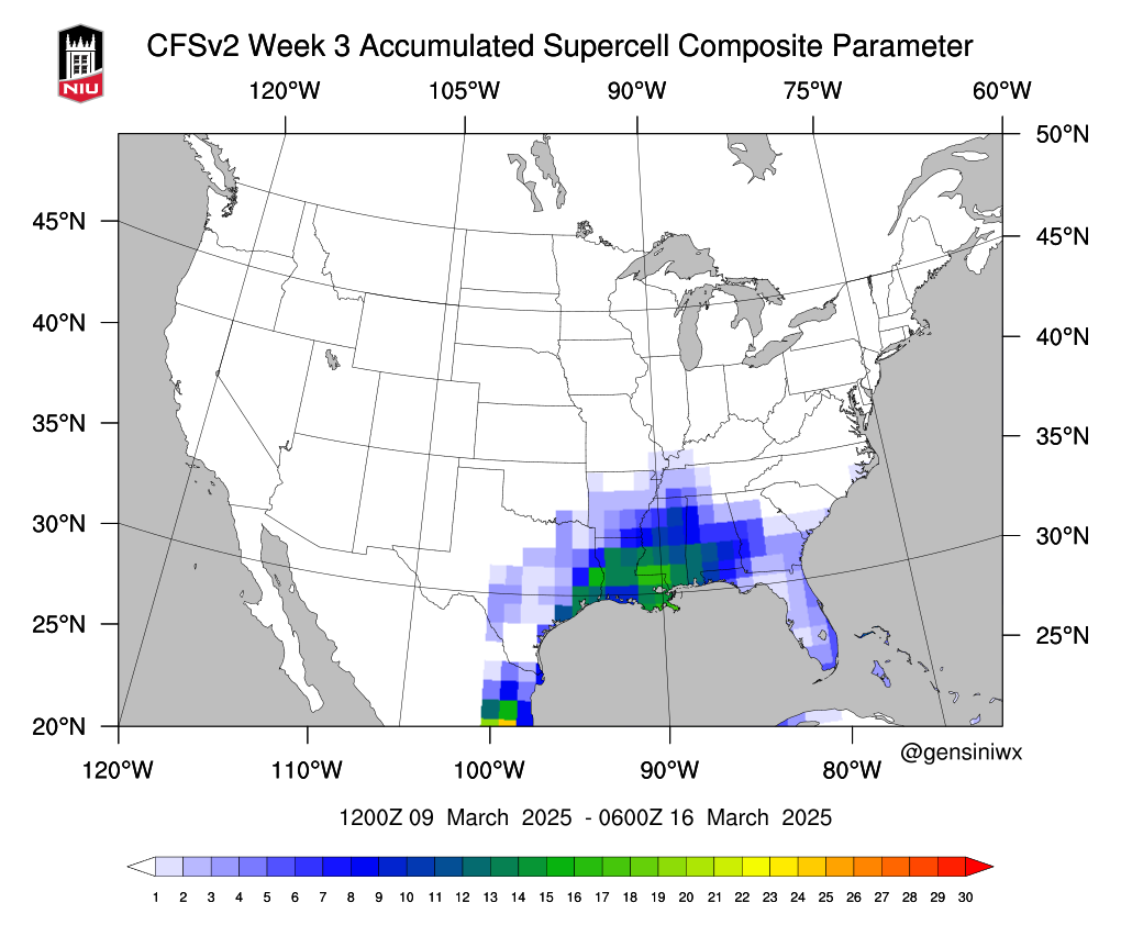
At some point, severe weather will become a concern. It always does during the spring months.
Make sure you have multiple ways of receiving your severe weather alerts.
.
.
.

What radar might look like.
Here is the NAM future-cast radar. You can see those scattered showers on Wednesday afternoon and evening.
Double-click the animation to enlarge it.
The timestamp (upper left) is in Zulu. 12z=6 am. 18z=12 pm. 00z=6 pm.
The NAM model shows the mid-week system.

.

Radars and Lightning Data
Interactive-city-view radars. Clickable watches and warnings.
https://wtalk.co/B3XHASFZ
Old legacy radar site (some of you like it better)
https://weatherobservatory.com/weather-radar.htm
If the radar is not updating then try another one. If a radar does not appear to be refreshing then hit Ctrl F5. You may also try restarting your browser.
Backup radar site in case the above one is not working.
https://weathertalk.com/morani
Regional Radar
https://imagery.weathertalk.com/prx/RadarLoop.mp4
** NEW ** Zoom radar with chaser tracking abilities!
ZoomRadar
If the radar is not working, then email me: Email me at beaudodson@usawx.com
.
We do have some sponsors! Check them out.
Connected and Protected.
They Specialize in Audio, Video, Networking, Security, Cameras, Electrical, New Construction, Remodels, and retrofitting Jobs. Experience the future of smart living and unmatched security with Connected & Protected Solutions today.
Link – Click here

.
Roof damage from recent storms? Link – Click here
INTEGRITY ROOFING AND EXTERIORS!
⛈️ Roof or gutter damage from recent storms? Today’s weather is sponsored by Integrity Roofing. Check out their website at this link https://www.ourintegritymatters.com/

![]()
![]()

.
Click here if you would like to return to the top of the page.
.Average high temperatures for this time of the year are around 50 degrees.
Average low temperatures for this time of the year are around 30 degrees.
Average precipitation during this time period ranges from 0.90″ to 1.20″
Six to Ten Day Outlook.
Blue is below average. Red is above average. The no color zone represents equal chances.
Average highs for this time of the year are in the lower 60s. Average lows for this time of the year are in the lower 40s.

Green is above average precipitation. Yellow and brown favors below average precipitation. Average precipitation for this time of the year is around one inch per week.

.

Average low temperatures for this time of the year are around 31degrees.
Average precipitation during this time period ranges from 0.90″ to 1.20″
.
Eight to Fourteen Day Outlook.
Blue is below average. Red is above average. The no color zone represents equal chances.

Green is above average precipitation. Yellow and brown favors below average precipitation. Average precipitation for this time of the year is around one inch per week.

.
![]()
Make sure you have three to five ways of receiving your severe weather information.
Weather Talk is one of those ways! Now, I have another product for you and your family.

.
.
https://weathercallservices.com/beau-dodson-weather


Want to add more products to your Beau Dodson Weather App?
Receive daily videos, weather blog updates on normal weather days and severe weather and winter storm days, your county by county weather forecast, and more!
Here is how to do add those additional products to your app notification settings!
Here is a video on how to update your Beau Dodson Weather payment.
The app is for subscribers. Subscribe at www.weathertalk.com/welcome then go to your app store and search for WeatherTalk
Subscribers, PLEASE USE THE APP. ATT and Verizon are not reliable during severe weather. They are delaying text messages.
The app is under WeatherTalk in the app store.

Apple users click here

Android users click here
.
Radars and Lightning Data
Interactive-city-view radars. Clickable watches and warnings.
https://wtalk.co/B3XHASFZ
Old legacy radar site (some of you like it better)
https://weatherobservatory.com/weather-radar.htm
If the radar is not updating then try another one. If a radar does not appear to be refreshing then hit Ctrl F5. You may also try restarting your browser.
Backup radar site in case the above one is not working.
https://weathertalk.com/morani
Regional Radar
https://imagery.weathertalk.com/prx/RadarLoop.mp4
** NEW ** Zoom radar with chaser tracking abilities!
ZoomRadar
Lightning Data (zoom in and out of your local area)
https://wtalk.co/WJ3SN5UZ
Not working? Email me at beaudodson@usawx.com
National map of weather watches and warnings. Click here.
Storm Prediction Center. Click here.
Weather Prediction Center. Click here.
.

Live lightning data: Click here.
Real time lightning data (another one) https://map.blitzortung.org/#5.02/37.95/-86.99
Our new Zoom radar with storm chases
.
.

Interactive GOES R satellite. Track clouds. Click here.
GOES 16 slider tool. Click here.
College of DuPage satellites. Click here
.

Here are the latest local river stage forecast numbers Click Here.
Here are the latest lake stage forecast numbers for Kentucky Lake and Lake Barkley Click Here.
.
.
Find Beau on Facebook! Click the banner.


 .
.