
.

.
I have some question-and-answer threads over on the Facebook page. Link to those threads CLICK HERE
Or email me at beaudodsonweather@gmail.com
.

Seven-Day Hazardous Weather Outlook
1. Is lightning in the forecast? NO.
2. Are severe thunderstorms in the forecast? NO.
3. Is flash flooding in the forecast? NO. There is ongoing river flooding in some counties.
4. Will non-thunderstorm winds top 40 mph? NO.
5. Will temperatures drop below 10 degrees? NO.
6. Will the wind chill dip below 0 degrees? NO.
7. Is measurable snow and/or sleet in the forecast? NO.
8. Is freezing rain/ice in the forecast? NO.
.
A quick forecast glance. Your 48-hour forecast Graphics


.

.


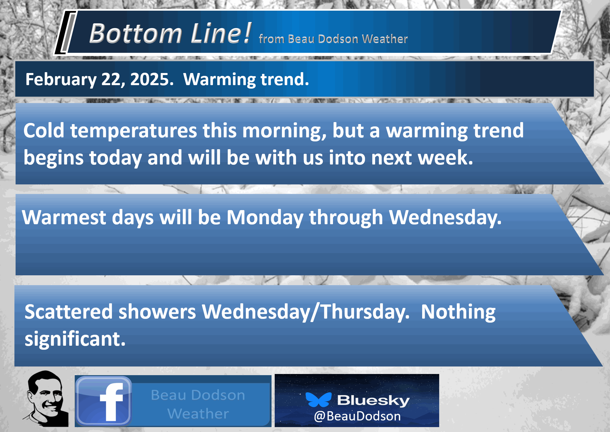
Forecast discussion. Active weather.
- Cold this morning, but a warming trend begins today.
- Much warmer tomorrow into next week!
- Flooding continues in some areas. Avoid flooded roadways.
.
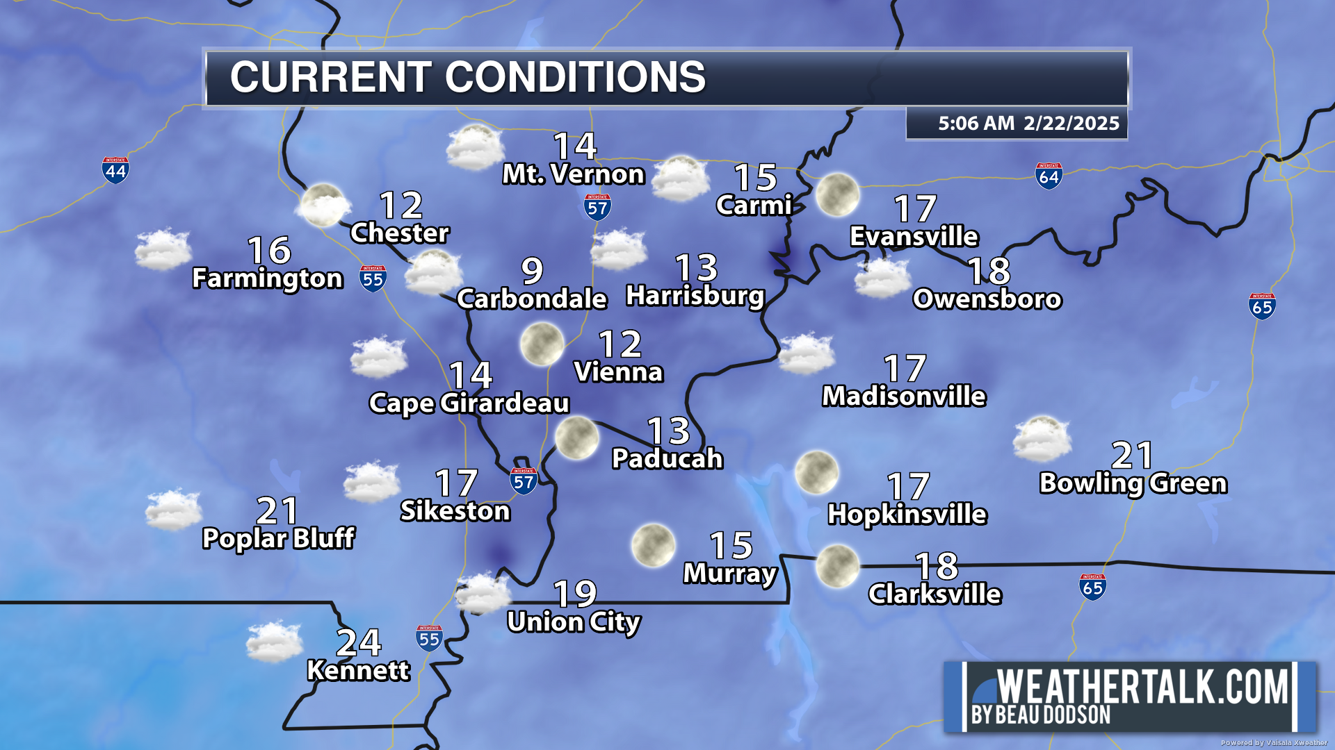
We are waking up to chilly temperatures.
5 AM Temperatures. Not as cold as yesterday. I guess that is the good news?
.

There are no significant weather concerns over the coming days.
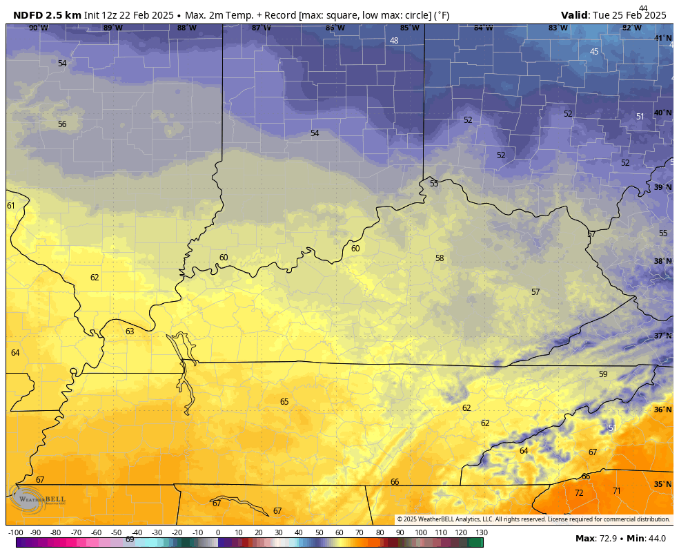
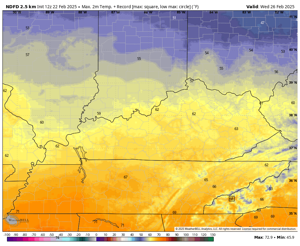
The great news is that temperatures will warm a bit today and quite a bit tomorrow into the middle of next week.
In fact, some locations could hit 60 degrees on Tuesday and Wednesday. Wouldn’t that be great?
Tuesday high temperatures

.
Wednesday high temperatures

.
A few showers will also be possible on Wednesday and Thursday. However, we are not forecasting heavy rain or severe weather. Some more good news!
I included showers in the forecast for Thursday, but it’s possible the rain will end by Wednesday night. This is not a big event.
Rainfall totals will be on the light side.
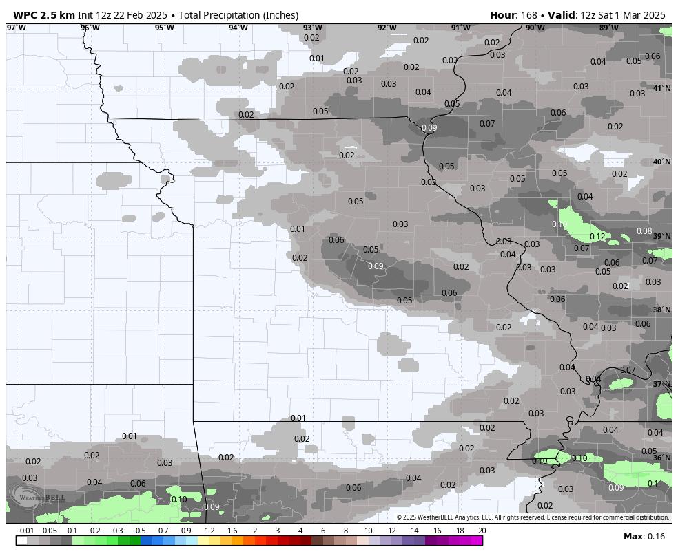
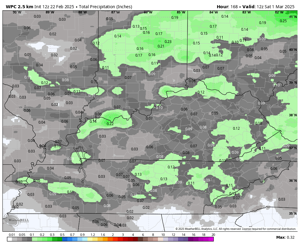
Here is the current seven-day rainfall forecast.
Not much.
You may double-click on these images to enlarge them.
.
.
I am watching some cold shots in March. After that, we should slide into spring!
Check out these two maps.
This is the temperature anomaly map for Tuesday. Lots of warm colors. Above average temperatures.
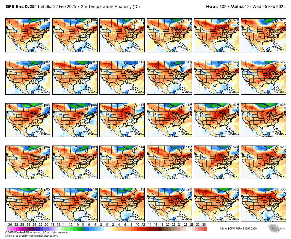
.
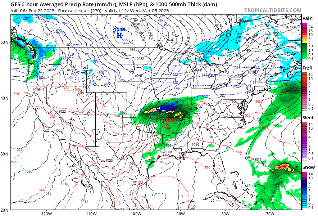
The GFS for March 7th looks cold. A lot of blue colors. So, let’s watch early March for some additional chilly air.
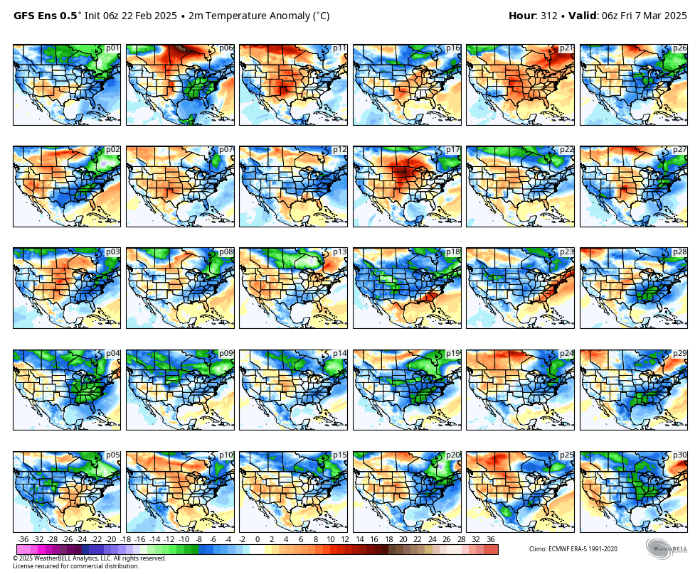
.
I am watching two or three precipitation events during the first ten days of March. It is too early to know if snow or severe weather will be a concern.
It is that time of the year. Monitor updates.
The GFS model does show rain showers around the 3rd of March. Another system a few days later.
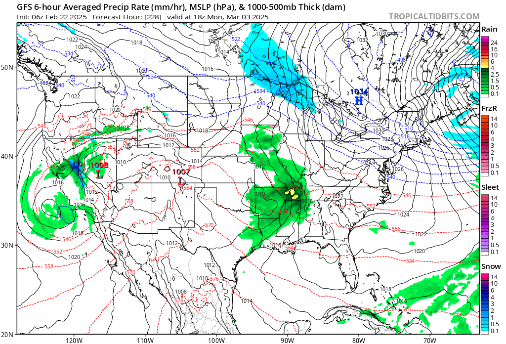
March 5th and 5th. Plenty of time to monitor these systems. Too early to know impacts.
.

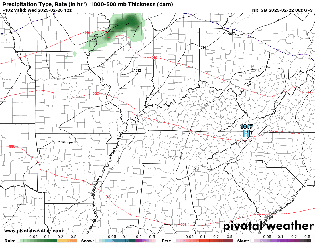
What radar might look like.
Here is the GFS future-cast radar. You can see those scattered showers on Wednesday.
Double-click the animation to enlarge it.
The timestamp (upper left) is in Zulu. 12z=6 am. 18z=12 pm. 00z=6 pm.
I am watching a bigger system around the first week of March. Too soon for details.
The GFS shows the mid-week system.
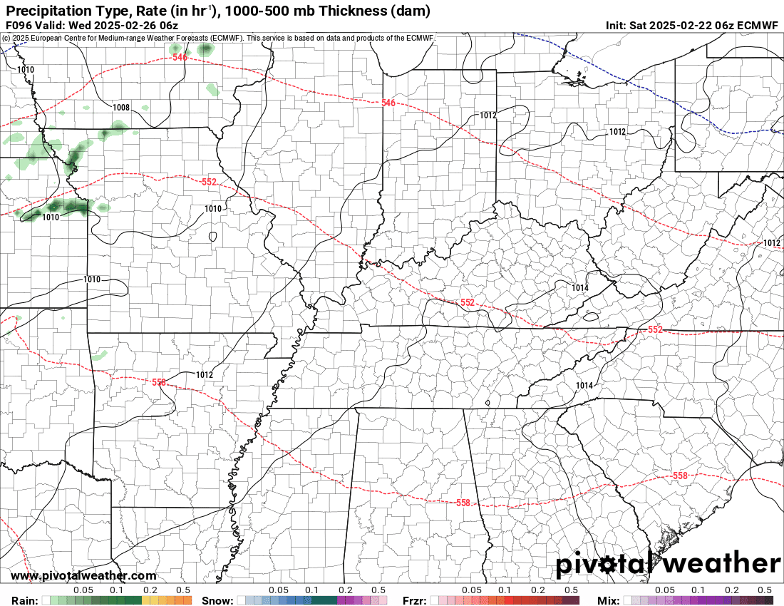
And the EC model shows a similar outcome. A band of quick-moving showers.
.
.

Radars and Lightning Data
Interactive-city-view radars. Clickable watches and warnings.
https://wtalk.co/B3XHASFZ
Old legacy radar site (some of you like it better)
https://weatherobservatory.com/weather-radar.htm
If the radar is not updating then try another one. If a radar does not appear to be refreshing then hit Ctrl F5. You may also try restarting your browser.
Backup radar site in case the above one is not working.
https://weathertalk.com/morani
Regional Radar
https://imagery.weathertalk.com/prx/RadarLoop.mp4
** NEW ** Zoom radar with chaser tracking abilities!
ZoomRadar
If the radar is not working, then email me: Email me at beaudodson@usawx.com
.
We do have some sponsors! Check them out.
Connected and Protected.
They Specialize in Audio, Video, Networking, Security, Cameras, Electrical, New Construction, Remodels, and retrofitting Jobs. Experience the future of smart living and unmatched security with Connected & Protected Solutions today.
Link – Click here

.
Roof damage from recent storms? Link – Click here
INTEGRITY ROOFING AND EXTERIORS!
⛈️ Roof or gutter damage from recent storms? Today’s weather is sponsored by Integrity Roofing. Check out their website at this link https://www.ourintegritymatters.com/

![]()
![]()

.
Click here if you would like to return to the top of the page.
.Average high temperatures for this time of the year are around 50 degrees.
Average low temperatures for this time of the year are around 30 degrees.
Average precipitation during this time period ranges from 0.90″ to 1.20″
Six to Ten Day Outlook.
Blue is below average. Red is above average. The no color zone represents equal chances.
Average highs for this time of the year are in the lower 60s. Average lows for this time of the year are in the lower 40s.

Green is above average precipitation. Yellow and brown favors below average precipitation. Average precipitation for this time of the year is around one inch per week.

.

Average low temperatures for this time of the year are around 31degrees.
Average precipitation during this time period ranges from 0.90″ to 1.20″
.
Eight to Fourteen Day Outlook.
Blue is below average. Red is above average. The no color zone represents equal chances.

Green is above average precipitation. Yellow and brown favors below average precipitation. Average precipitation for this time of the year is around one inch per week.

.
![]()
Make sure you have three to five ways of receiving your severe weather information.
Weather Talk is one of those ways! Now, I have another product for you and your family.

.
.
https://weathercallservices.com/beau-dodson-weather


Want to add more products to your Beau Dodson Weather App?
Receive daily videos, weather blog updates on normal weather days and severe weather and winter storm days, your county by county weather forecast, and more!
Here is how to do add those additional products to your app notification settings!
Here is a video on how to update your Beau Dodson Weather payment.
The app is for subscribers. Subscribe at www.weathertalk.com/welcome then go to your app store and search for WeatherTalk
Subscribers, PLEASE USE THE APP. ATT and Verizon are not reliable during severe weather. They are delaying text messages.
The app is under WeatherTalk in the app store.

Apple users click here

Android users click here
.
Radars and Lightning Data
Interactive-city-view radars. Clickable watches and warnings.
https://wtalk.co/B3XHASFZ
Old legacy radar site (some of you like it better)
https://weatherobservatory.com/weather-radar.htm
If the radar is not updating then try another one. If a radar does not appear to be refreshing then hit Ctrl F5. You may also try restarting your browser.
Backup radar site in case the above one is not working.
https://weathertalk.com/morani
Regional Radar
https://imagery.weathertalk.com/prx/RadarLoop.mp4
** NEW ** Zoom radar with chaser tracking abilities!
ZoomRadar
Lightning Data (zoom in and out of your local area)
https://wtalk.co/WJ3SN5UZ
Not working? Email me at beaudodson@usawx.com
National map of weather watches and warnings. Click here.
Storm Prediction Center. Click here.
Weather Prediction Center. Click here.
.

Live lightning data: Click here.
Real time lightning data (another one) https://map.blitzortung.org/#5.02/37.95/-86.99
Our new Zoom radar with storm chases
.
.

Interactive GOES R satellite. Track clouds. Click here.
GOES 16 slider tool. Click here.
College of DuPage satellites. Click here
.

Here are the latest local river stage forecast numbers Click Here.
Here are the latest lake stage forecast numbers for Kentucky Lake and Lake Barkley Click Here.
.
.
Find Beau on Facebook! Click the banner.


 .
.