
.

I have some question and answer threads over on the Facebook page. Link to those threads CLICK HERE
Or email me at beaudodsonweather@gmail.com —> send me your rainfall totals and flood reports.
.
5 PM
Some updated graphics from the NWS
.
Double click images to enlarge them.
.
3:30 PM Update
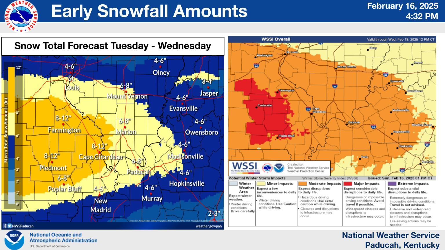
Paducah has their first call maps out. It looks pretty close to what I put out this morning.
Here was my morning snowfall forecast update
2 PM UPDATE
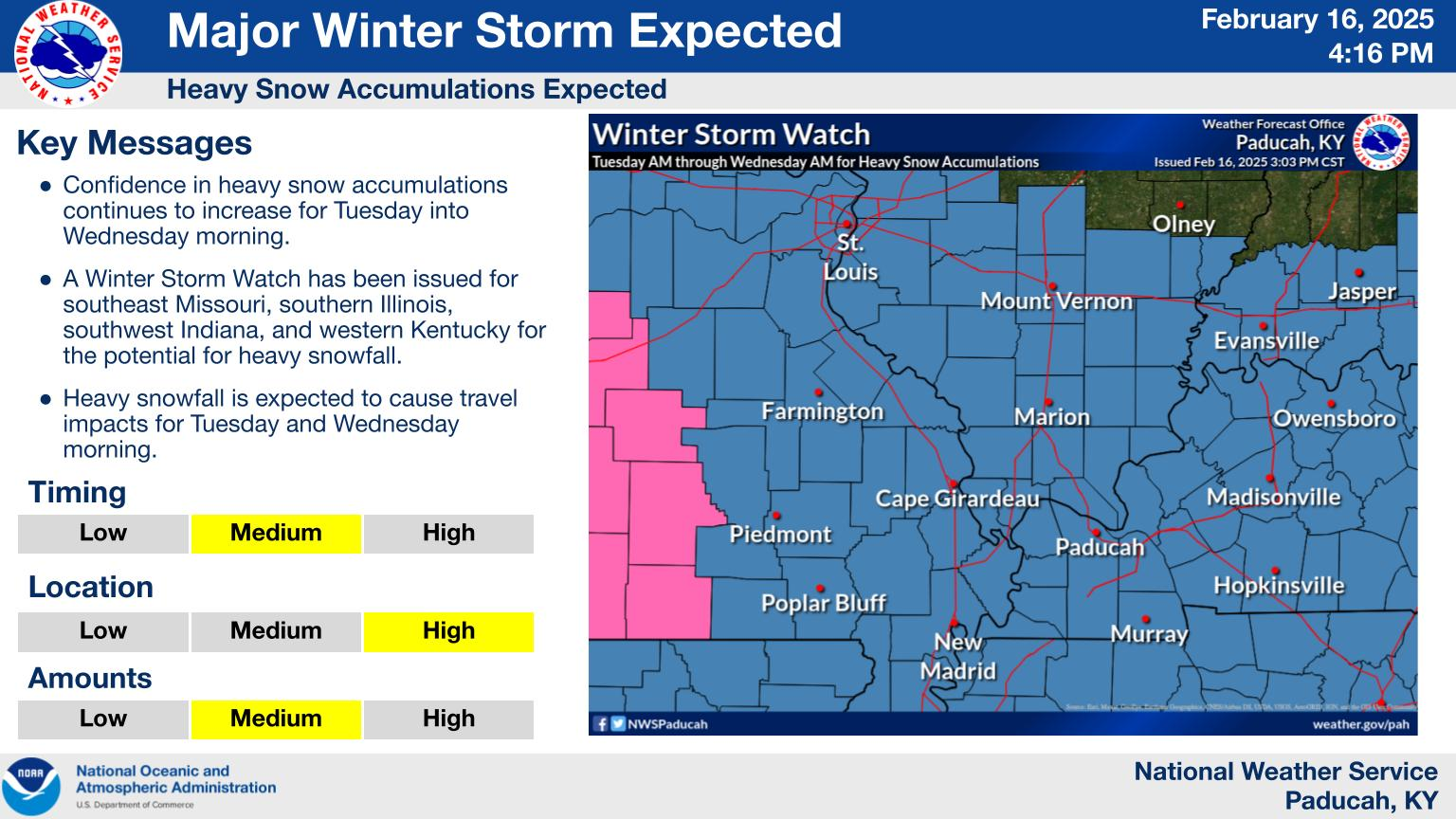
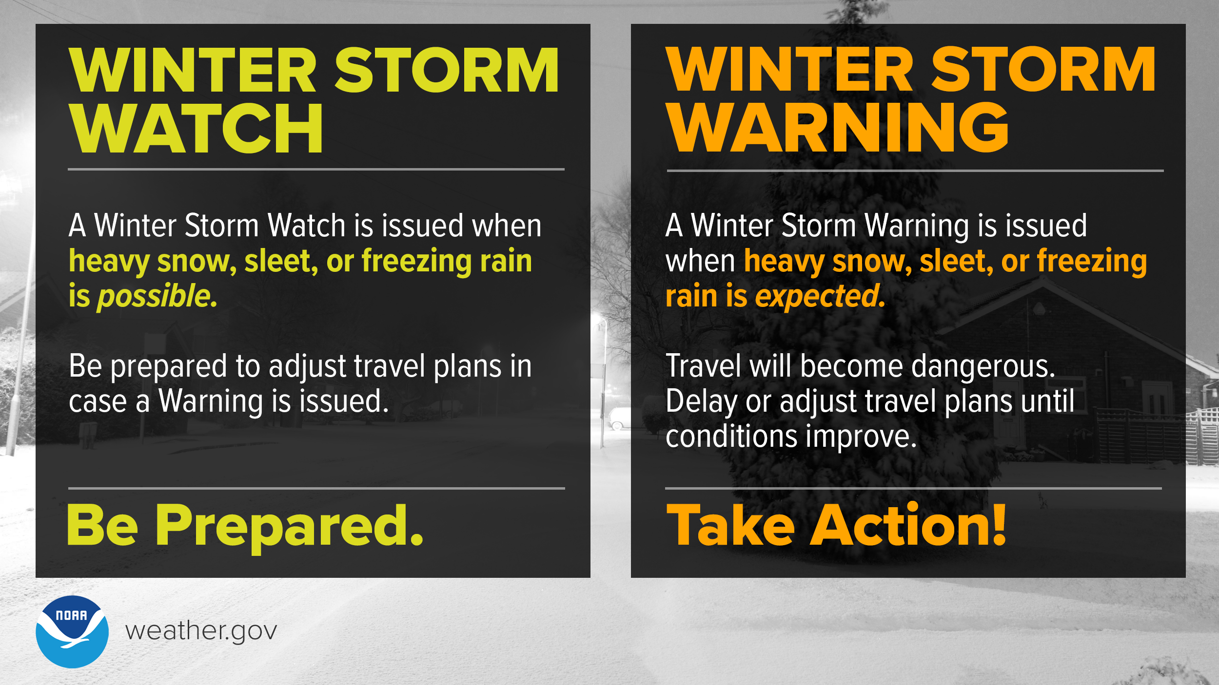
A winter storm watch blankets the entire region from TUE AM into WED AM. The bulk of the snow will fall TUE PM/WED AM.
Some updated graphics.
This is melted precip (which equals a widespread 4 to 8 inches of snow. Locally higher likely, esp in SE MO.
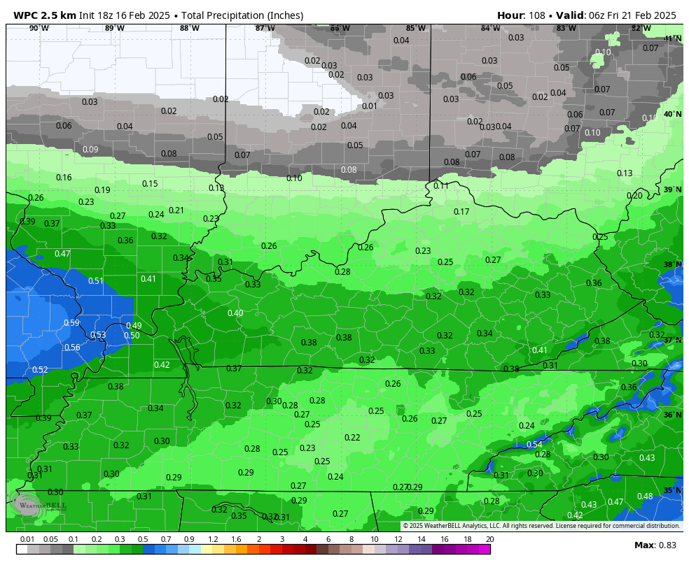
.

Those blue colors in southeast Missouri could end up being more like 6 to 12 inches. Can not rule that out.
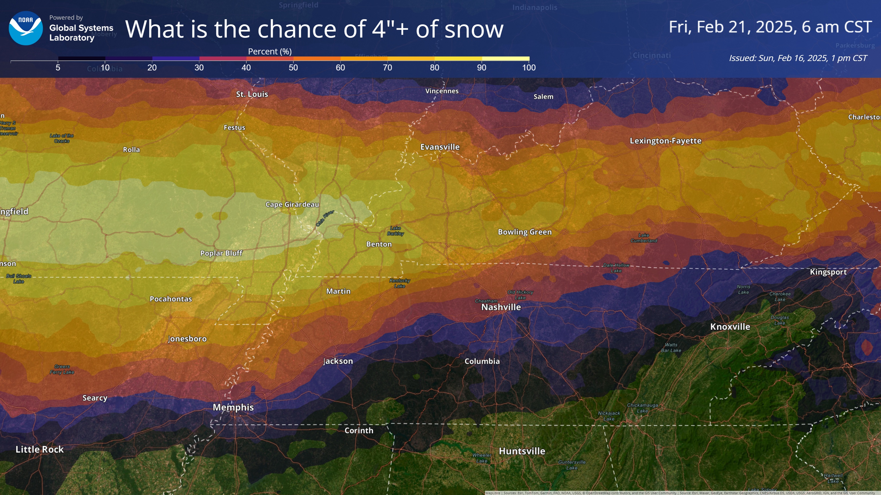
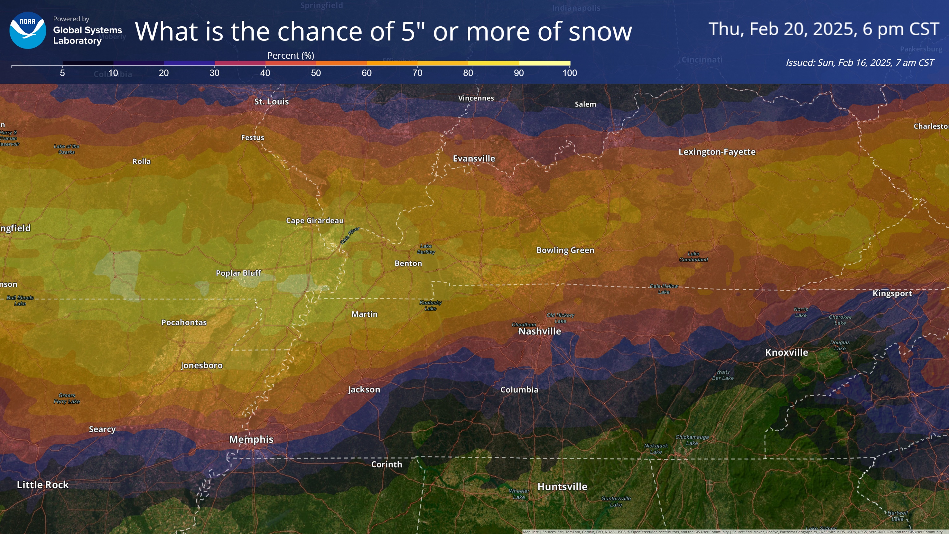
What is the chance of four or more inches of snow?
Double click image to enlarge it
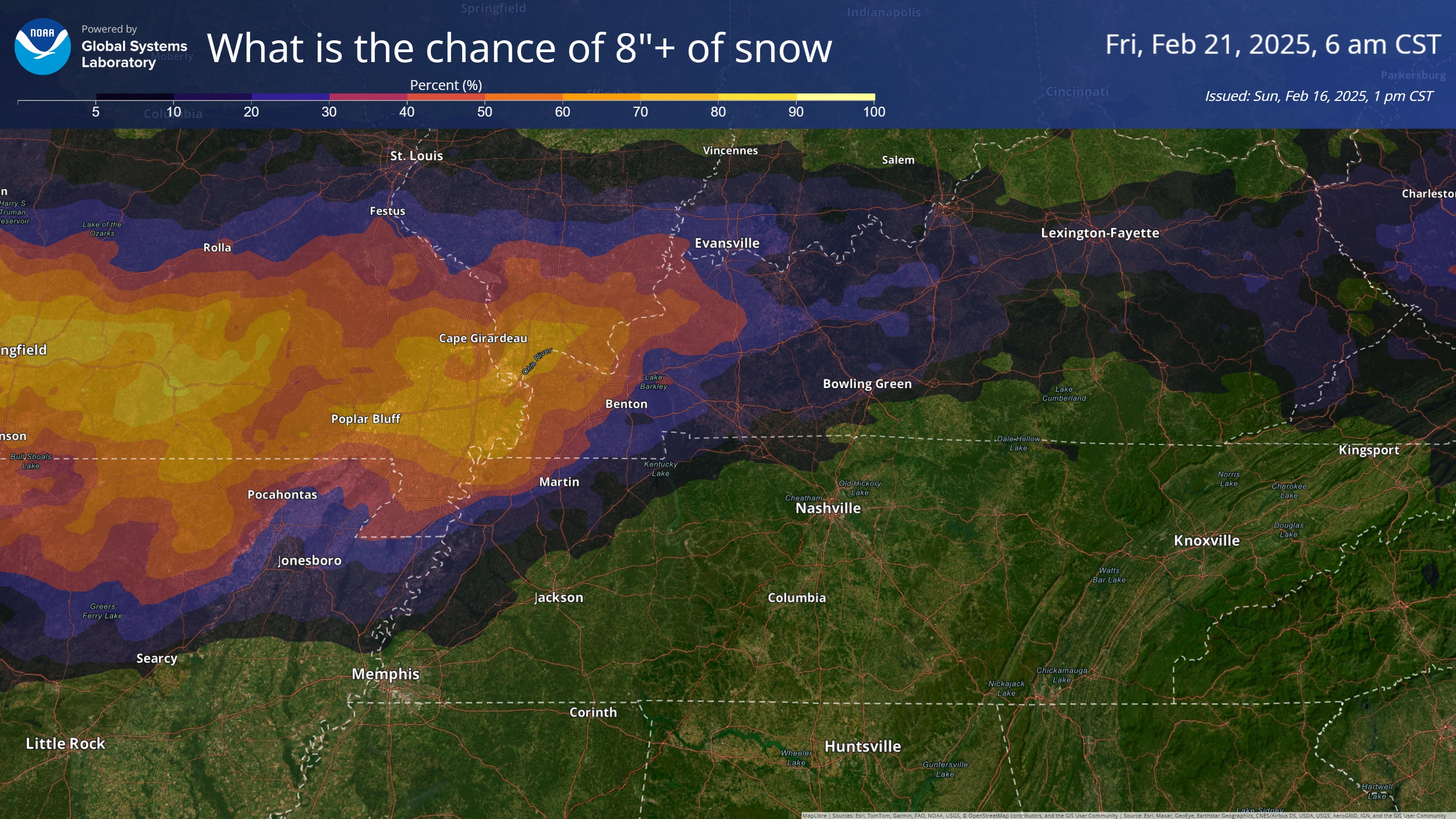
What is the chance of eight or more inches of snow?
..
Video Update From the St Louis, NWS. Paducah may put out a video later.
.
A quick forecast glance. Your 48-hour forecast Graphics


.
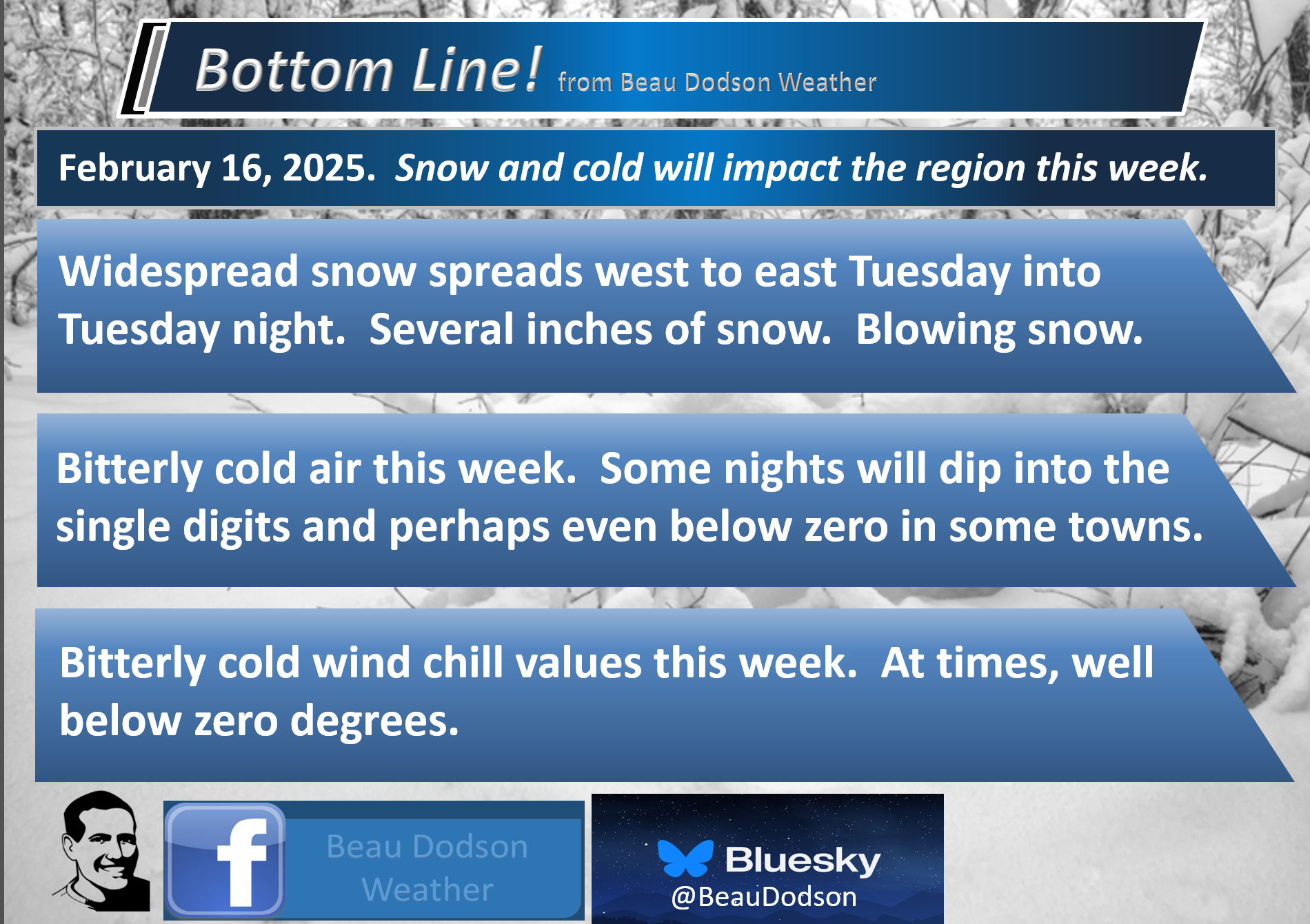
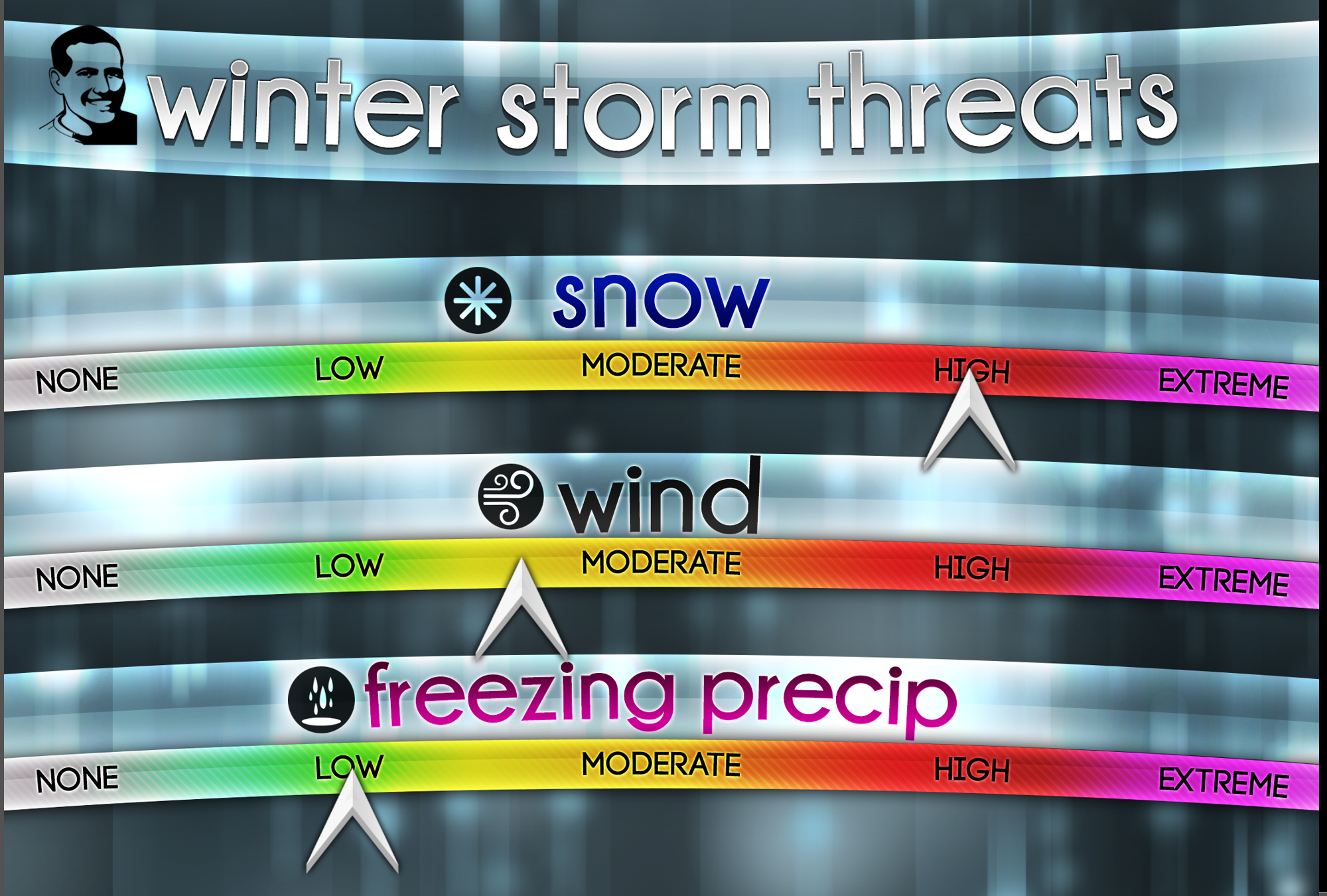
Bottom Line Up Front. An active weather pattern into next week.
- A major winter storm will bring widespread snow (locally heavy) to the region Tuesday into Wednesday. Peak snow chances will be Tuesday afternoon into Wednesday morning. Significant travel impacts are anticipated. Blowing and drifting snow likely.
- Bitterly cold temperatures this week. Bitterly cold wind chill values.
- The NWS will issue winter storm watches later today for the Tuesday/Wednesday event.
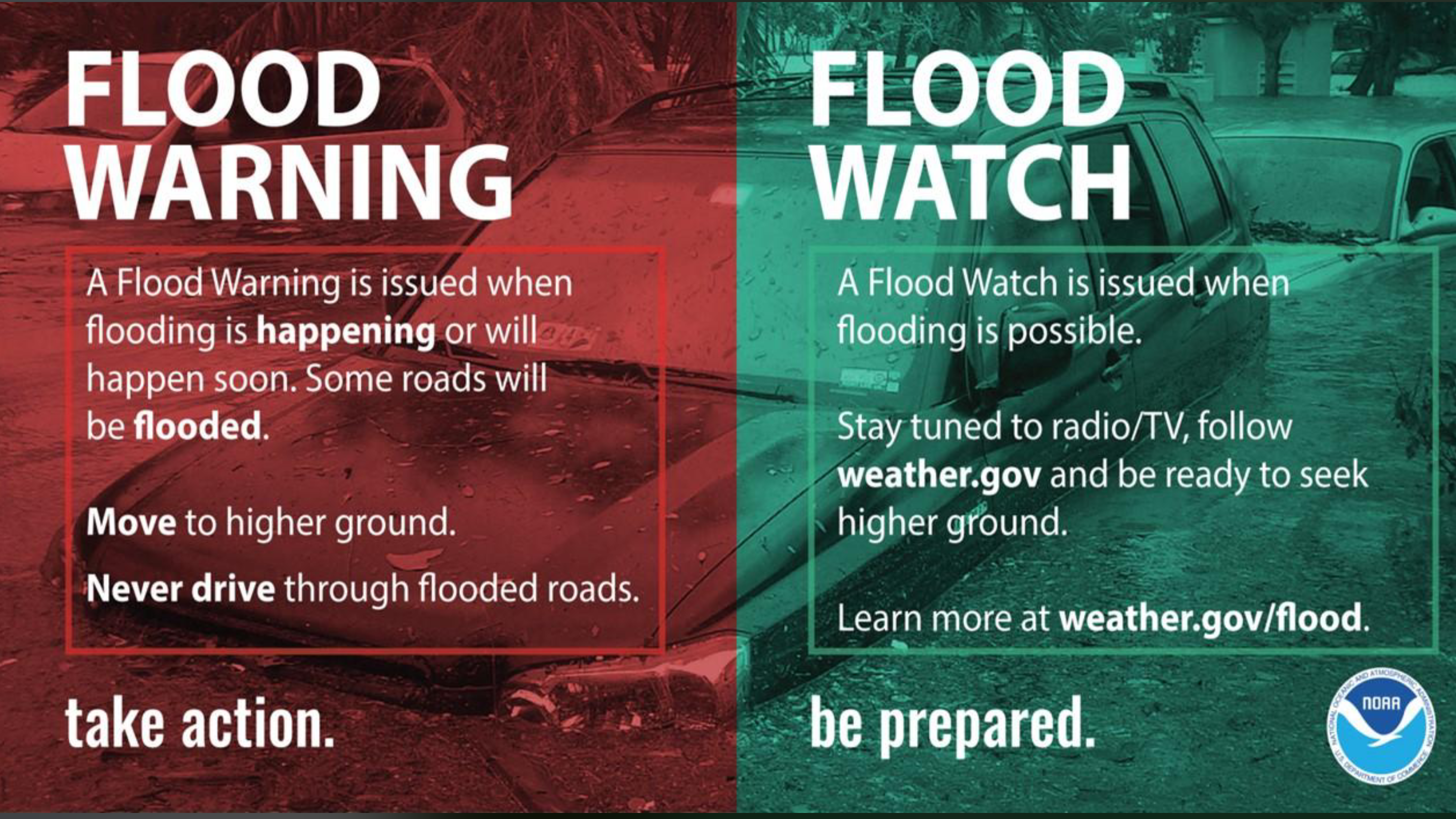
- Flooding continues in many areas. Avoid flooded roadways
![]()
.
Bottom Line Up Front
Winter storm to bring widespread snow to the region. Bitterly cold temperatures.
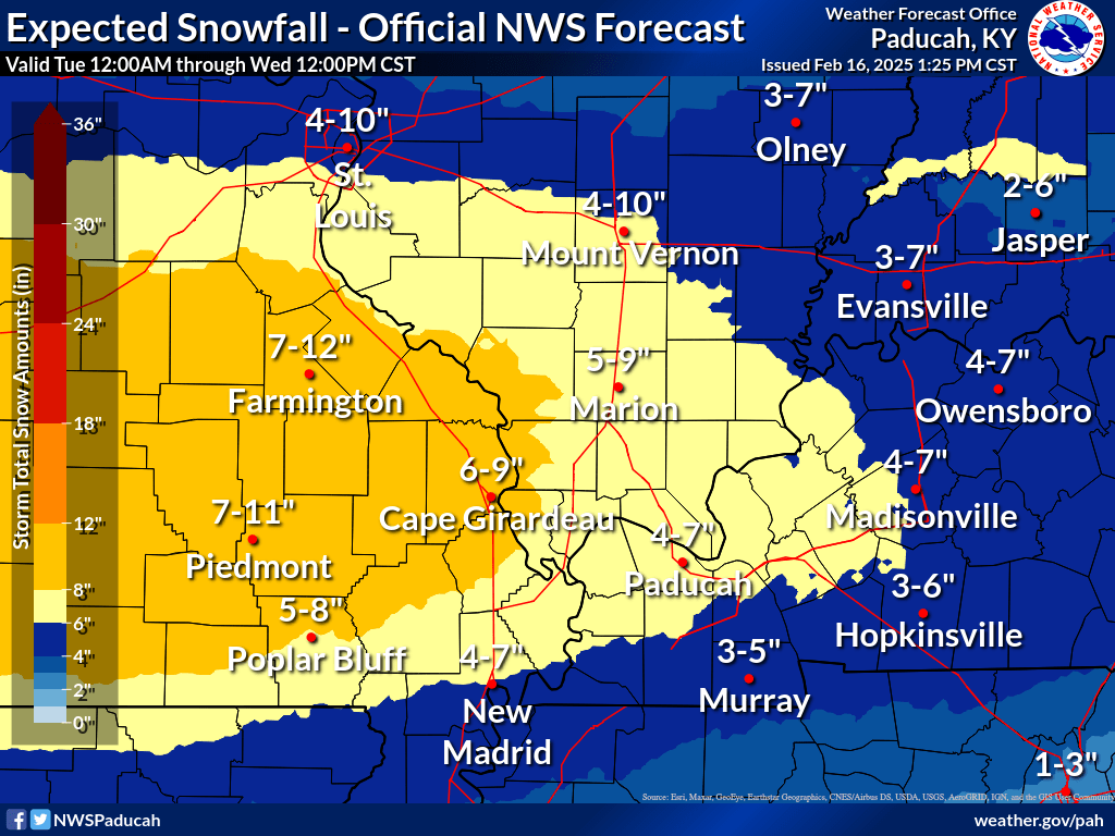
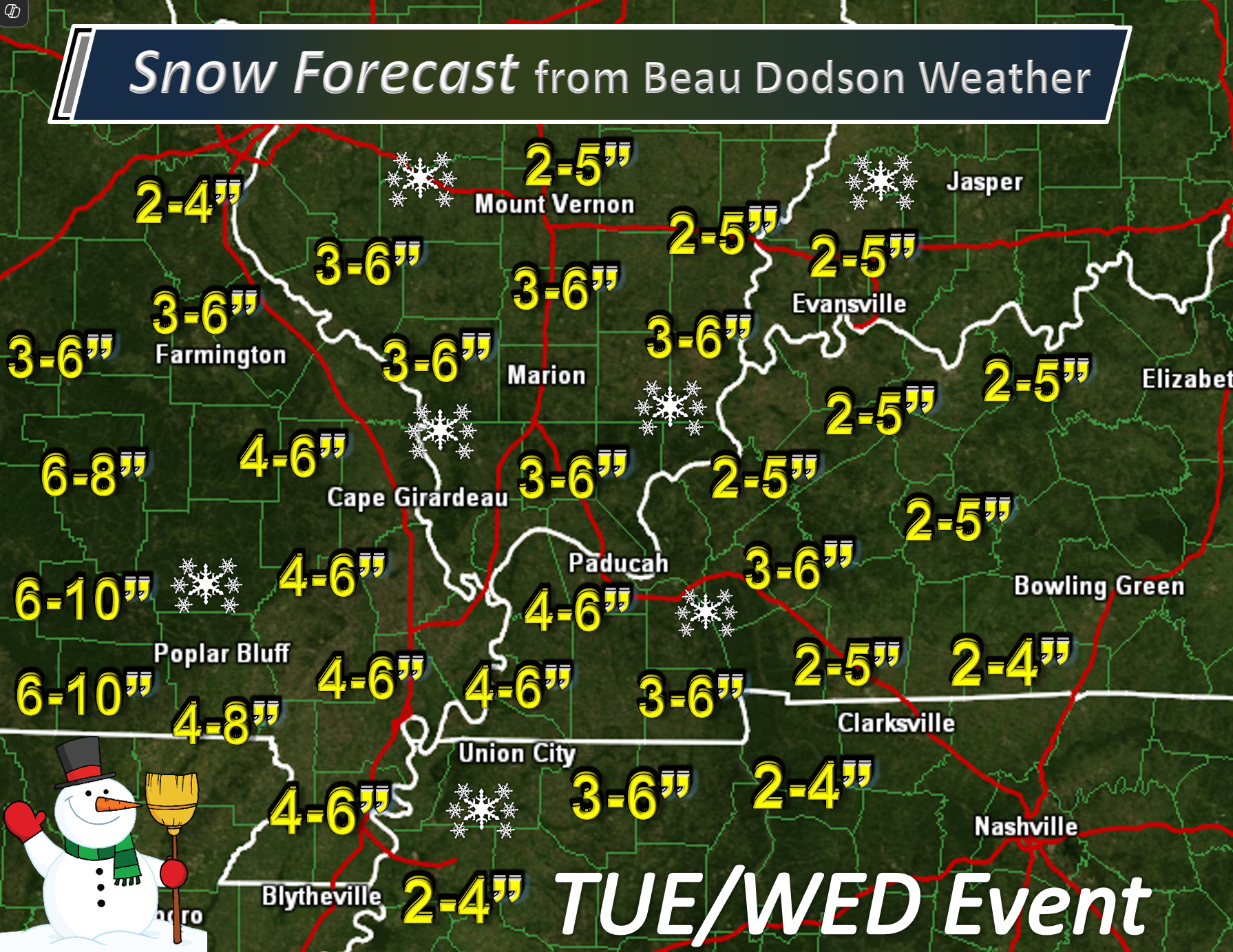
This is my first call snowfall map.
Adjustments are likely, keep that in mind. The system is still a few days away
.
.
Tuesday and Wednesday Snow Potential
.
Double click this image to enlarge it. It’s a little hard to read.
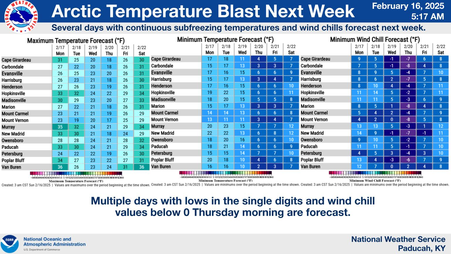
These are temperatures and wind chill values for the week ahead.

.
Double click the image to enlarge it.

.
Future-cast Radars.
What radar might look like with our winter storm threat Tuesday and Wednesday.
Here is the GFS future-cast radar.
Double click the animation to enlarge it.
The time stamp (upper left) is in zulu. 12z=6 am. 18z=12 pm. 00z=6 pm.
.
.
Snow Potential Is Increasing Next Tuesday and Wednesday
.
A winter storm will bring widespread snow, wind, and cold to the region this week. If you have travel plans Tuesday and Wednesday, then there could be impacts. Especially as we move through Tuesday afternoon and night.
I am still working on the exact timing. I can’t rule out some snow showers Monday night/Tuesday morning, But, chances ramp up later on Tuesday into Tuesday night. That is when the heaviest snow will fall.
The NWS will issue winter storm watches later today for the Tuesday/Wednesday event.
.
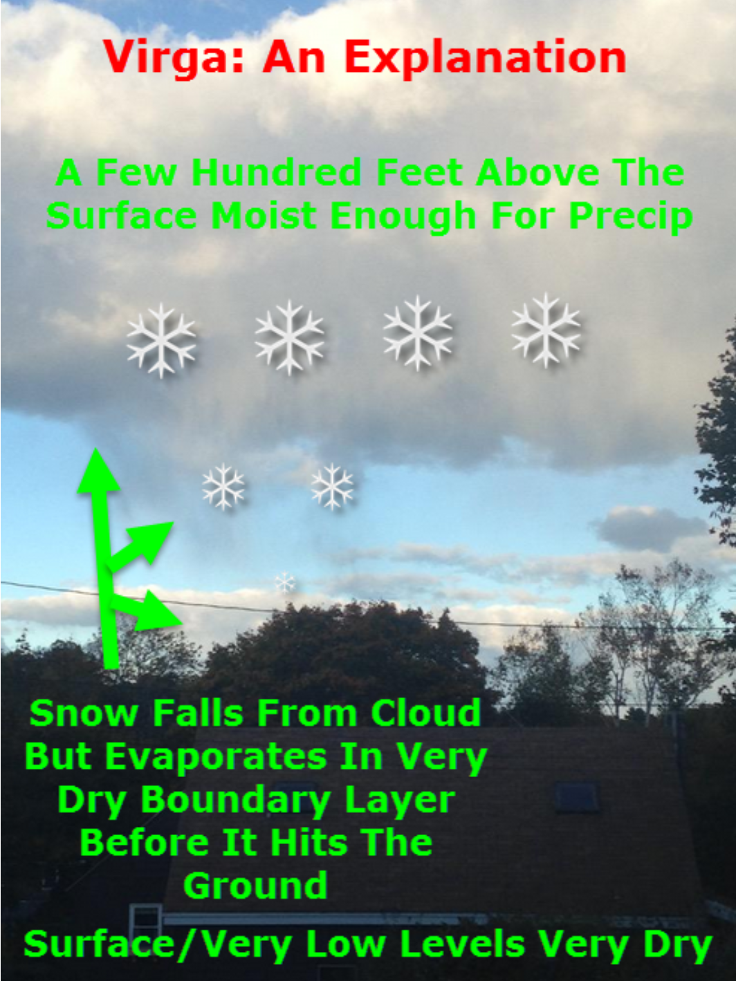
There is some dry air aloft at the beginning of this event. This will cause virga. The radar may look like it is snowing at your house, but it is evaporating before reaching the ground. In some winter storms, this can last for a few hours. I will need to monitor that portion of the forecast.
With time, the snow moistens up the atmosphere and the flakes reach the ground.
.
Chances are near certain for a widespread snow event.
Typically, snow ratios are 10:1. That means 0.25″ of liquid equals 2.5″ of snow. We might be looking at 15:1 or higher snow rations. A dry fluffy snow. That could increase snow totals.
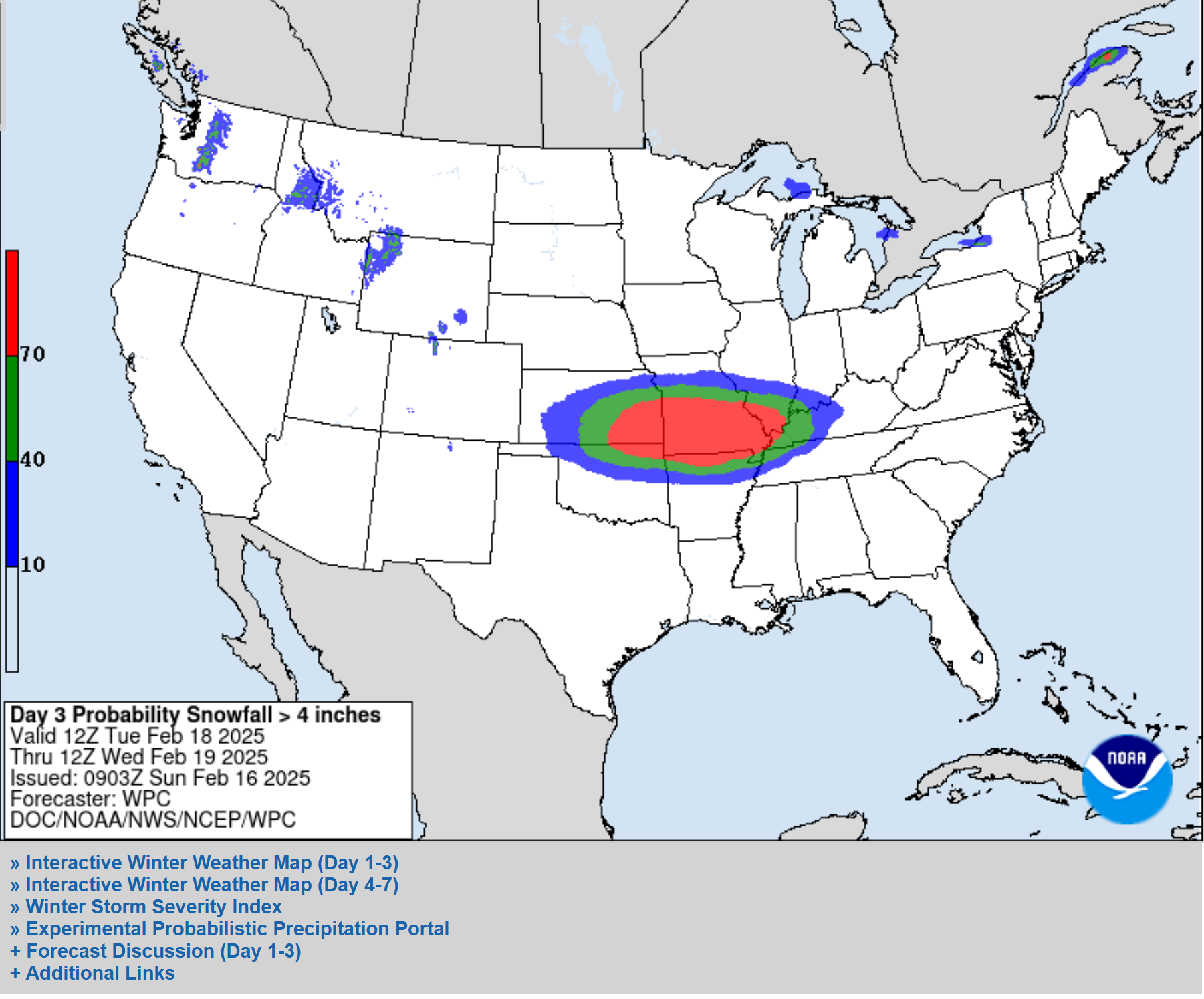
Here is what the WPC/NOAA posted for snow accumulation probabilities for Tuesday and Wednesday.
What is the probability of 4″ or more of snow? High probabilities.
.
Let’s look at some data.
What is the probability of 4 to 6+ inches of snow? Very high probabilities.
.
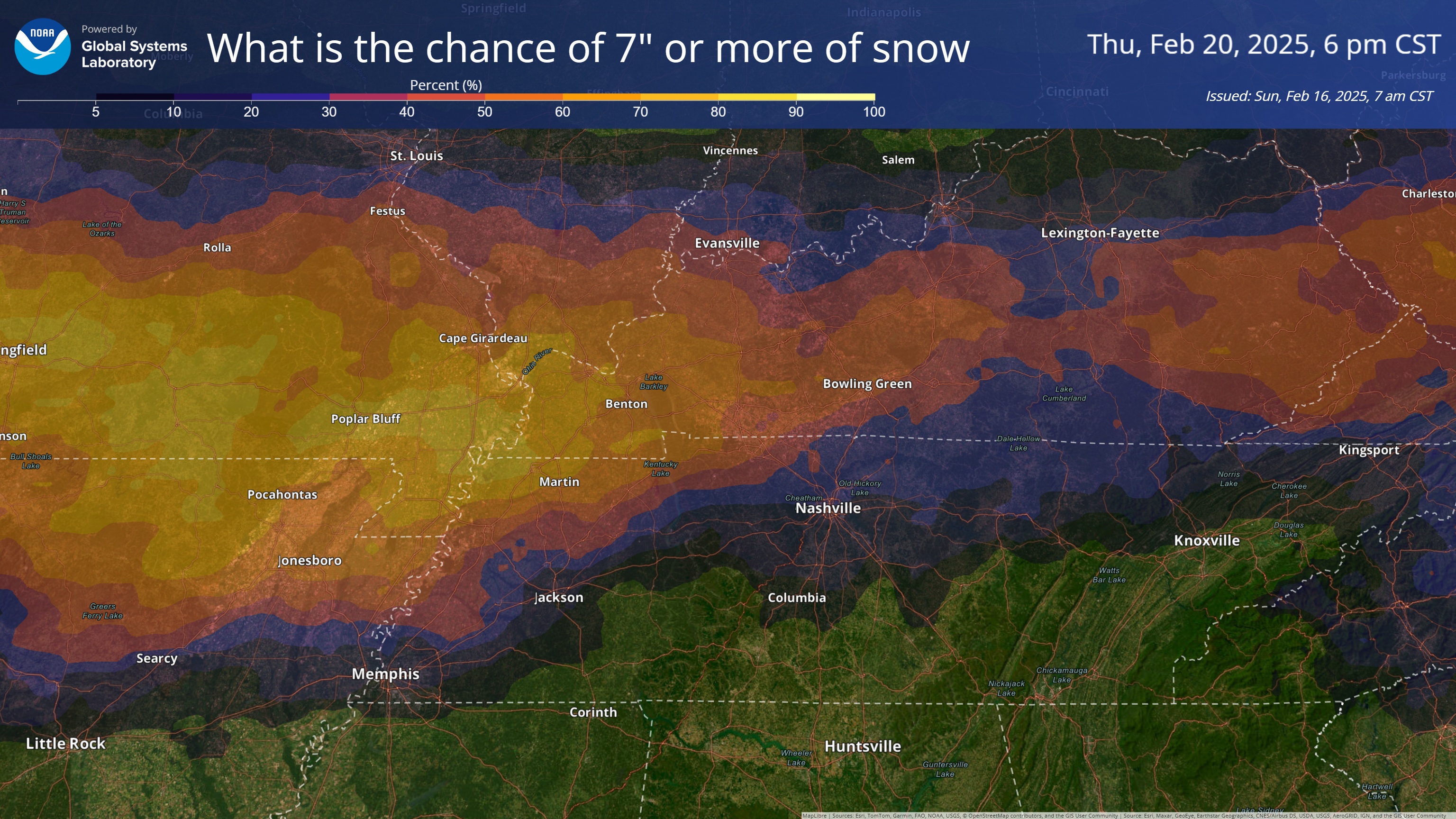
What is the chance of seven or more inches of snow?
.
This is the GFS model. Each frame is one run of the model. I am looking for trends in the guidance.
The trend has been for the heaviest snow to fall across southern Missouri into our region.
This is the probability of four or more inches of snow. Notice it keeps increasing the chances.
.

.
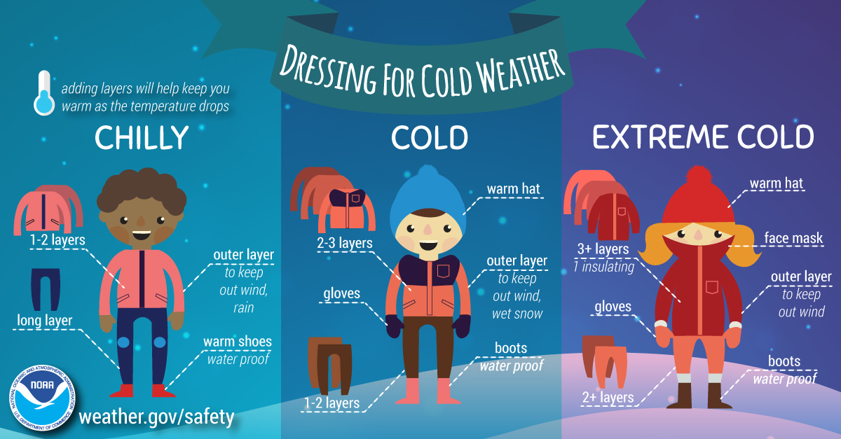
Bitterly cold air filters into the region Sunday into this weekend Some locations will stay below freezing for five days. It will feel like winter.
This will likely be the coldest air of the winter season, thus far.
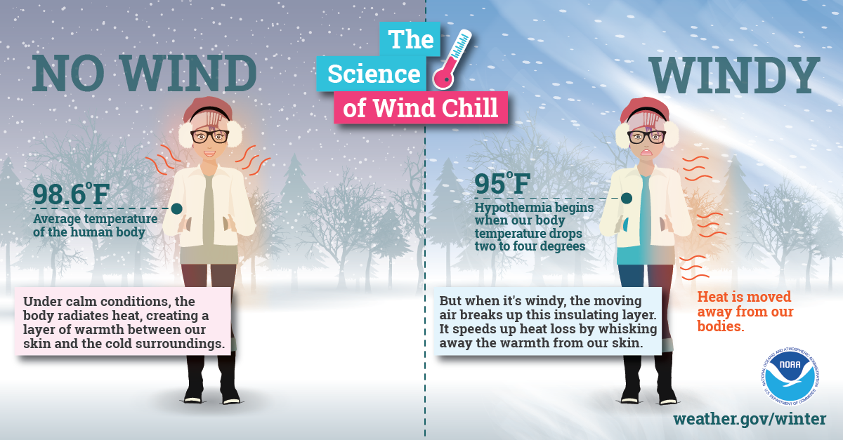
Wind chill temperatures will be even colder. Well below zero, at times. Harsh winter weather.
Remember, the body responds to wind chill. The wind chill is more important than the actual temperatures. Frostbite is a real concern with this upcoming winter event.
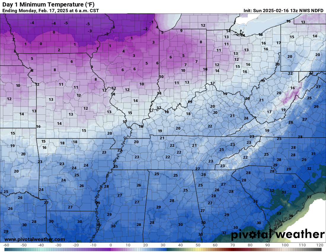
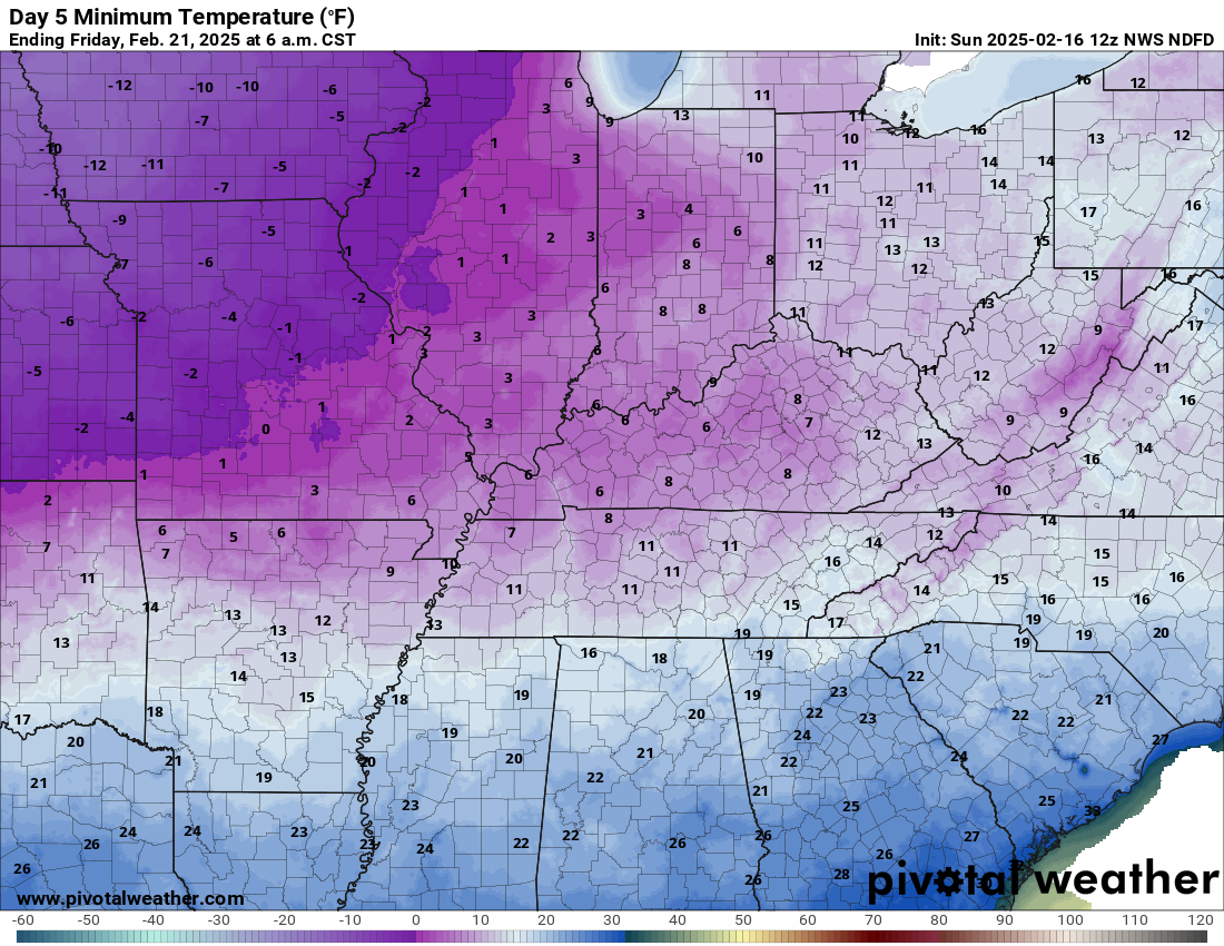
Check out these lows.
Monday morning lows
Double click images to enlarge them.
.
Tuesday morning lows
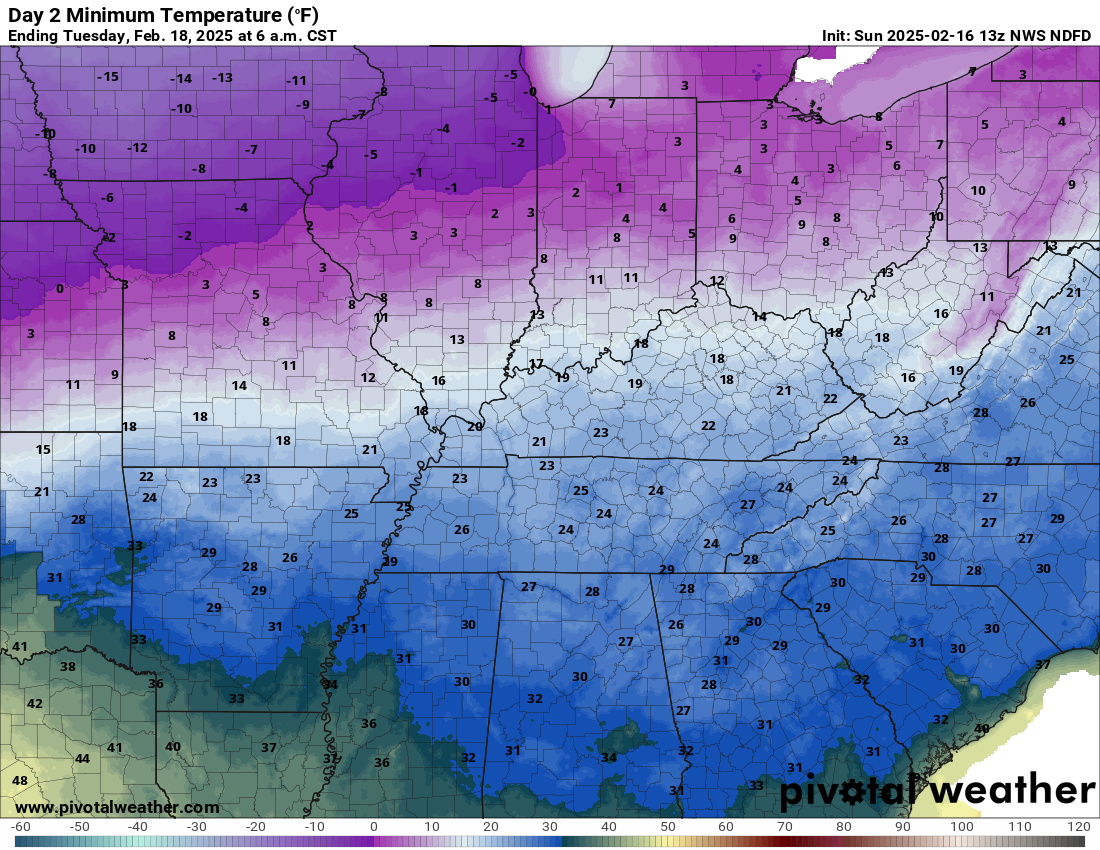
.
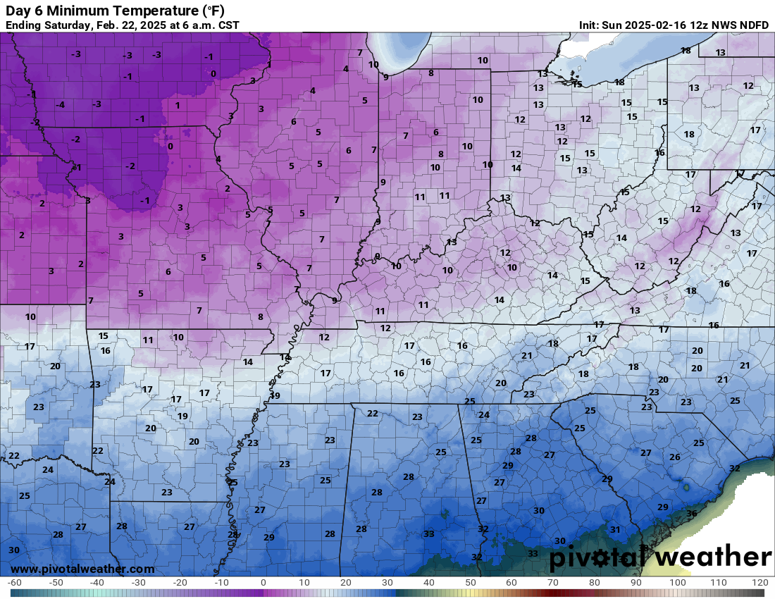
Wednesday morning lows
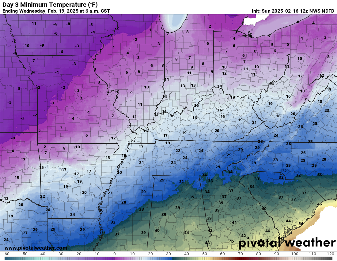
.
Thursday morning lows
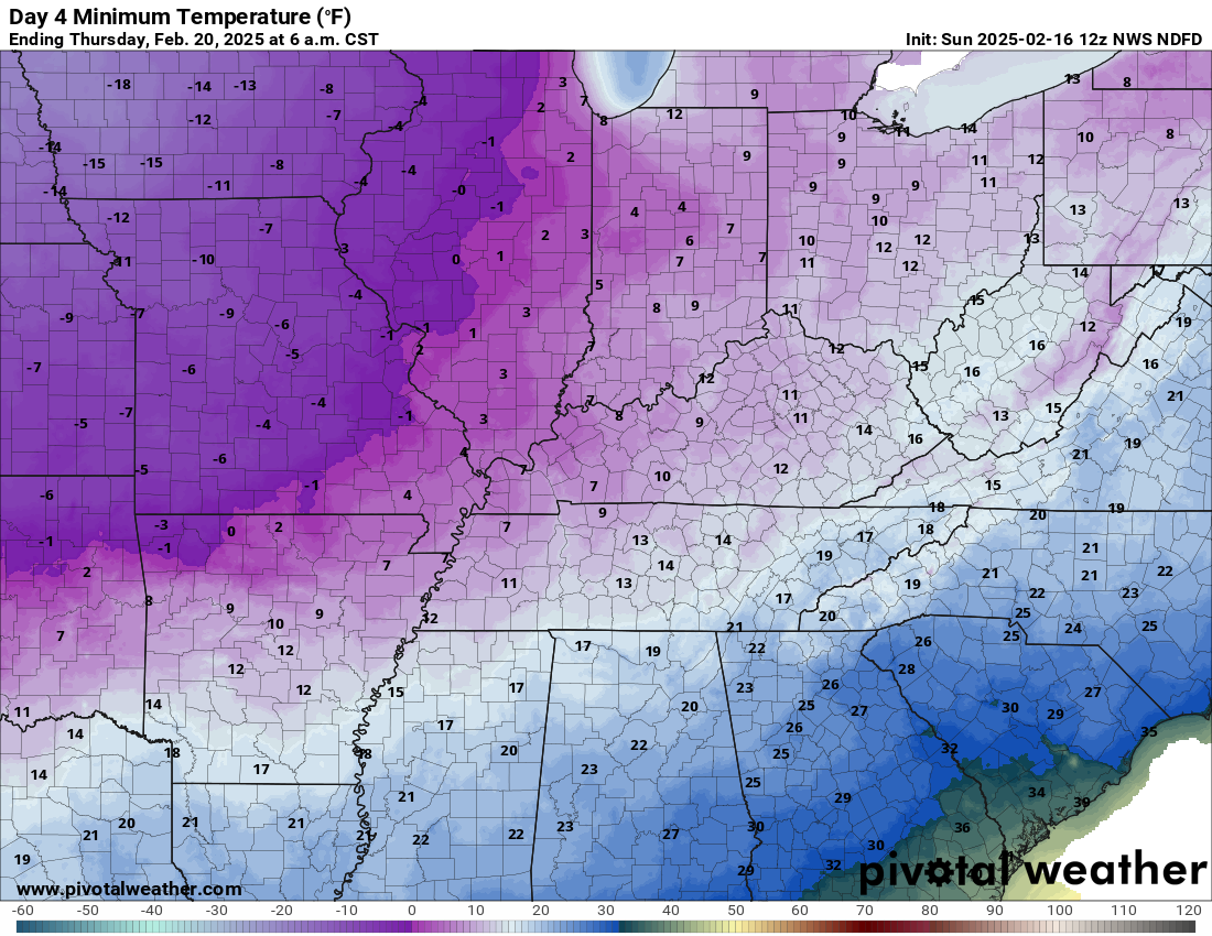
.
Friday morning lows
.
We do have some sponsors! Check them out.
Connected and Protected.
They Specialize in Audio, Video, Networking, Security, Cameras, Electrical, New Construction, Remodels, and retrofitting Jobs. Experience the future of smart living and unmatched security with Connected & Protected Solutions today.
Link – Click here

.
Roof damage from recent storms? Link – Click here
INTEGRITY ROOFING AND EXTERIORS!
⛈️ Roof or gutter damage from recent storms? Today’s weather is sponsored by Integrity Roofing. Check out their website at this link https://www.ourintegritymatters.com/

![]()
![]()

.
Click here if you would like to return to the top of the page.
.Average high temperatures for this time of the year are around 46 degrees.
Average low temperatures for this time of the year are around 29 degrees.
Average precipitation during this time period ranges from 0.90″ to 1.20″
Six to Ten Day Outlook.
Blue is below average. Red is above average. The no color zone represents equal chances.
Average highs for this time of the year are in the lower 60s. Average lows for this time of the year are in the lower 40s.

Green is above average precipitation. Yellow and brown favors below average precipitation. Average precipitation for this time of the year is around one inch per week.

.

Average low temperatures for this time of the year are around 29 degrees.
Average precipitation during this time period ranges from 0.90″ to 1.20″
.
Eight to Fourteen Day Outlook.
Blue is below average. Red is above average. The no color zone represents equal chances.

Green is above average precipitation. Yellow and brown favors below average precipitation. Average precipitation for this time of the year is around one inch per week.

.
![]()
Make sure you have three to five ways of receiving your severe weather information.
Weather Talk is one of those ways! Now, I have another product for you and your family.

.
.
https://weathercallservices.com/beau-dodson-weather


Want to add more products to your Beau Dodson Weather App?
Receive daily videos, weather blog updates on normal weather days and severe weather and winter storm days, your county by county weather forecast, and more!
Here is how to do add those additional products to your app notification settings!
Here is a video on how to update your Beau Dodson Weather payment.
The app is for subscribers. Subscribe at www.weathertalk.com/welcome then go to your app store and search for WeatherTalk
Subscribers, PLEASE USE THE APP. ATT and Verizon are not reliable during severe weather. They are delaying text messages.
The app is under WeatherTalk in the app store.

Apple users click here

Android users click here
.

Radars and Lightning Data
Interactive-city-view radars. Clickable watches and warnings.
https://wtalk.co/B3XHASFZ
Old legacy radar site (some of you like it better)
https://weatherobservatory.com/weather-radar.htm
If the radar is not updating then try another one. If a radar does not appear to be refreshing then hit Ctrl F5. You may also try restarting your browser.
Backup radar site in case the above one is not working.
https://weathertalk.com/morani
Regional Radar
https://imagery.weathertalk.com/prx/RadarLoop.mp4
** NEW ** Zoom radar with chaser tracking abilities!
ZoomRadar
Lightning Data (zoom in and out of your local area)
https://wtalk.co/WJ3SN5UZ
Not working? Email me at beaudodson@usawx.com
National map of weather watches and warnings. Click here.
Storm Prediction Center. Click here.
Weather Prediction Center. Click here.
.

Live lightning data: Click here.
Real time lightning data (another one) https://map.blitzortung.org/#5.02/37.95/-86.99
Our new Zoom radar with storm chases
.
.

Interactive GOES R satellite. Track clouds. Click here.
GOES 16 slider tool. Click here.
College of DuPage satellites. Click here
.

Here are the latest local river stage forecast numbers Click Here.
Here are the latest lake stage forecast numbers for Kentucky Lake and Lake Barkley Click Here.
.
.
Find Beau on Facebook! Click the banner.


 .
.