
.
Good morning, everyone.
Welcome to Sunday! I hope you had a nice Saturday!

I am experimenting with simplifying the daily blog. Send me comments at beaudodsonweather@gmail.com
.
Here is my latest seven day video update
.
.
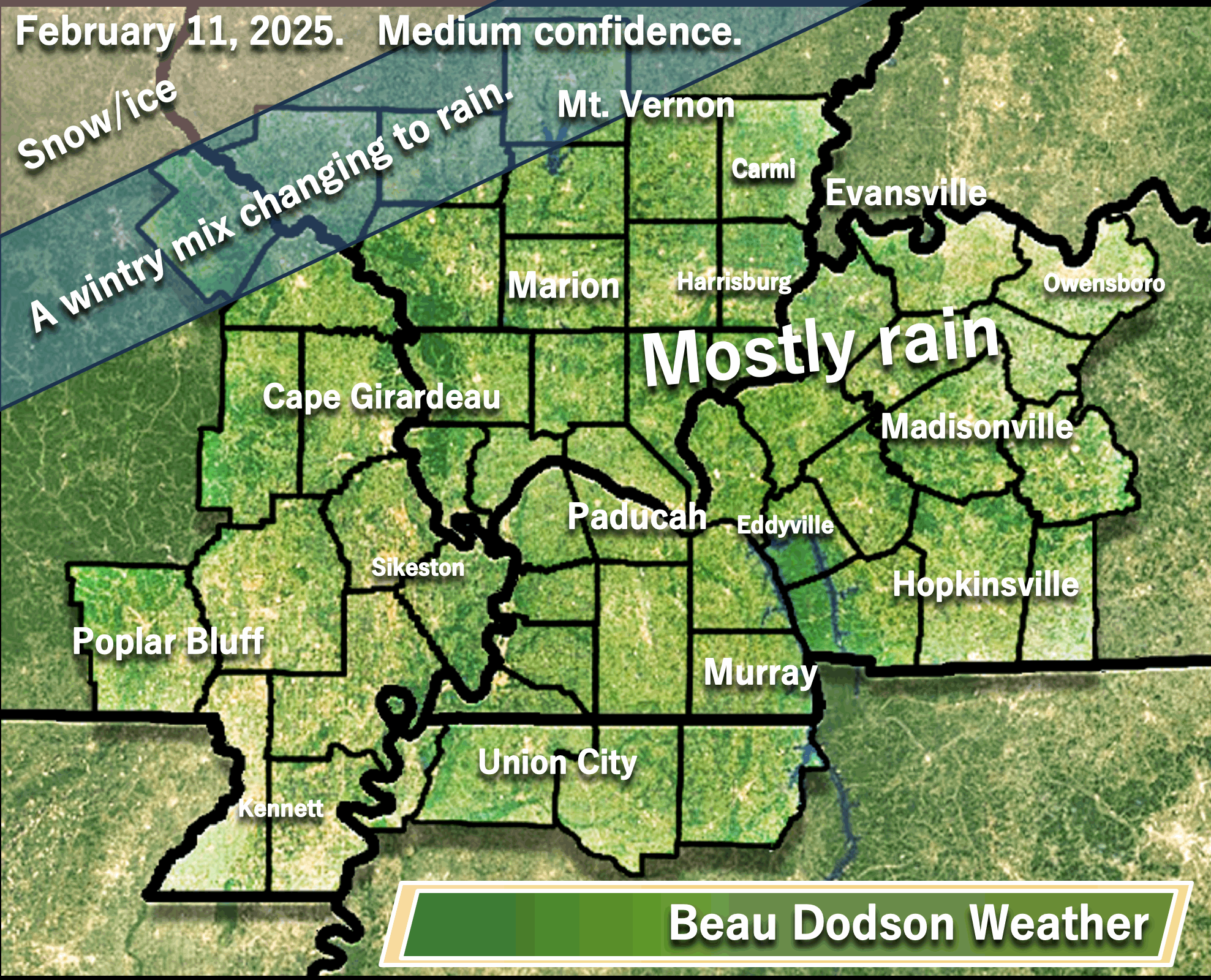
A quick forecast glance. Your 48-hour forecast Graphics


.
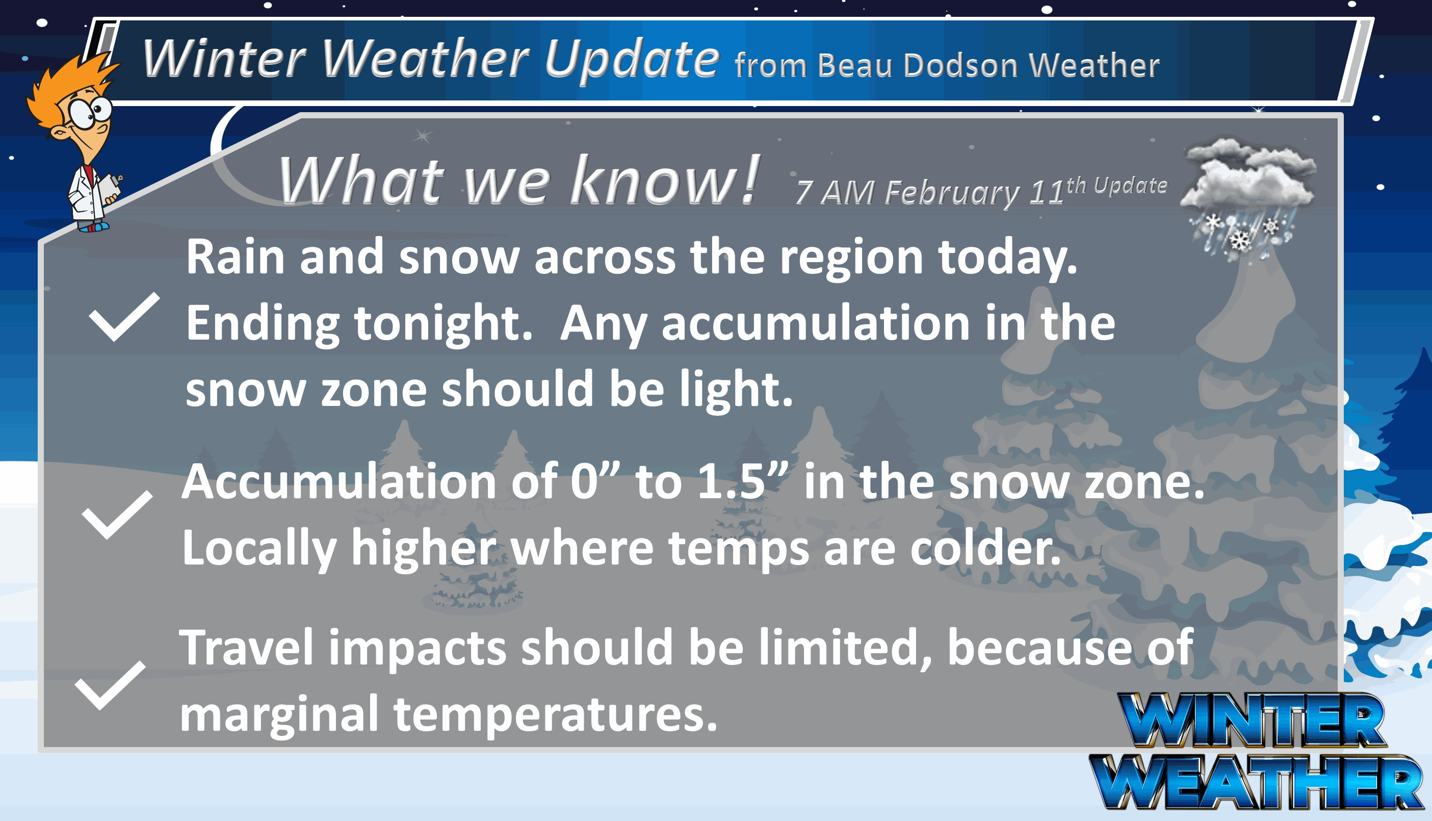
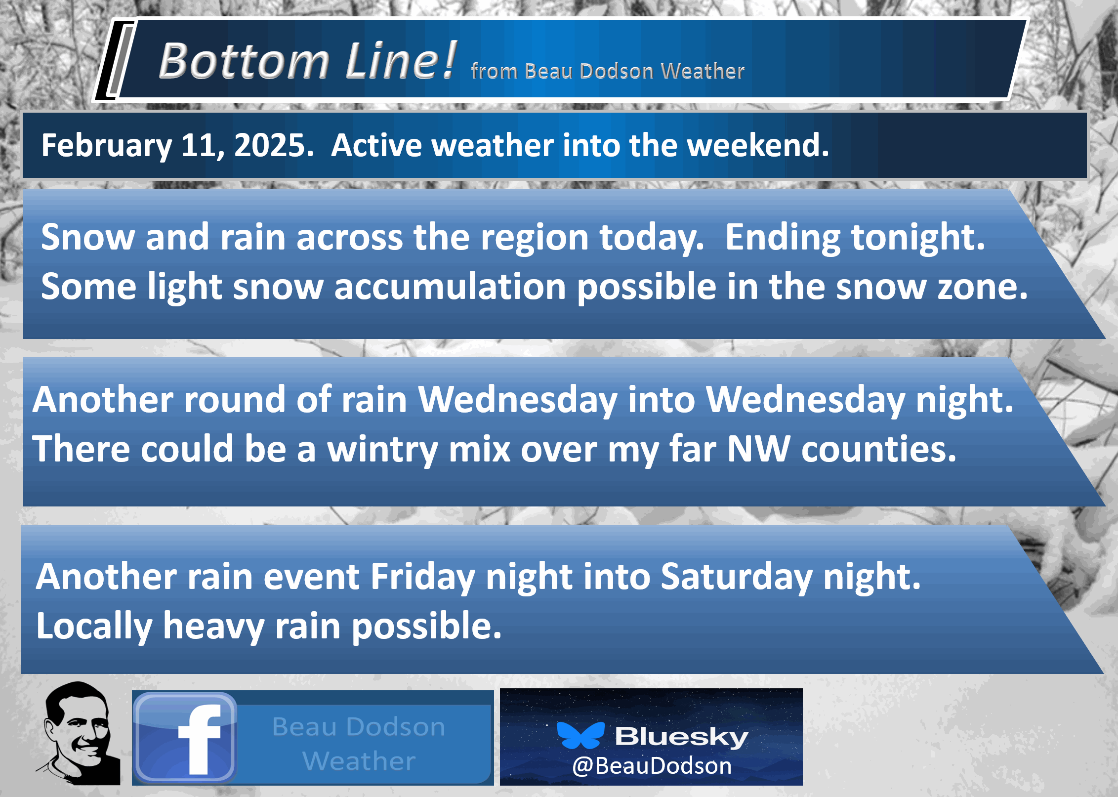
Bottom Line Up Front. An active weather pattern into the weekend.
- Wet today. Much of the region will have plain old rain. Some areas will have wet snow with marginal temperatures for accumulation.
- A few remaining rain or snow showers tonight.
- Widespread rain returns Wednesday/Wednesday night. Our far northwest and northern counties could begin as a mix (see graphics below). Precipitation could end as a wintry mix across more of the region. Colder Wednesday night. I will watch Wednesday night for a flash freeze (if temperatures fall into the teens and twenties before surfaces dry).
- Dry Thursday into Friday morning.
- Rain returns Friday night into Saturday night! For now, this looks to be mostly a rain event. Moderate to heavy rain possible.
.

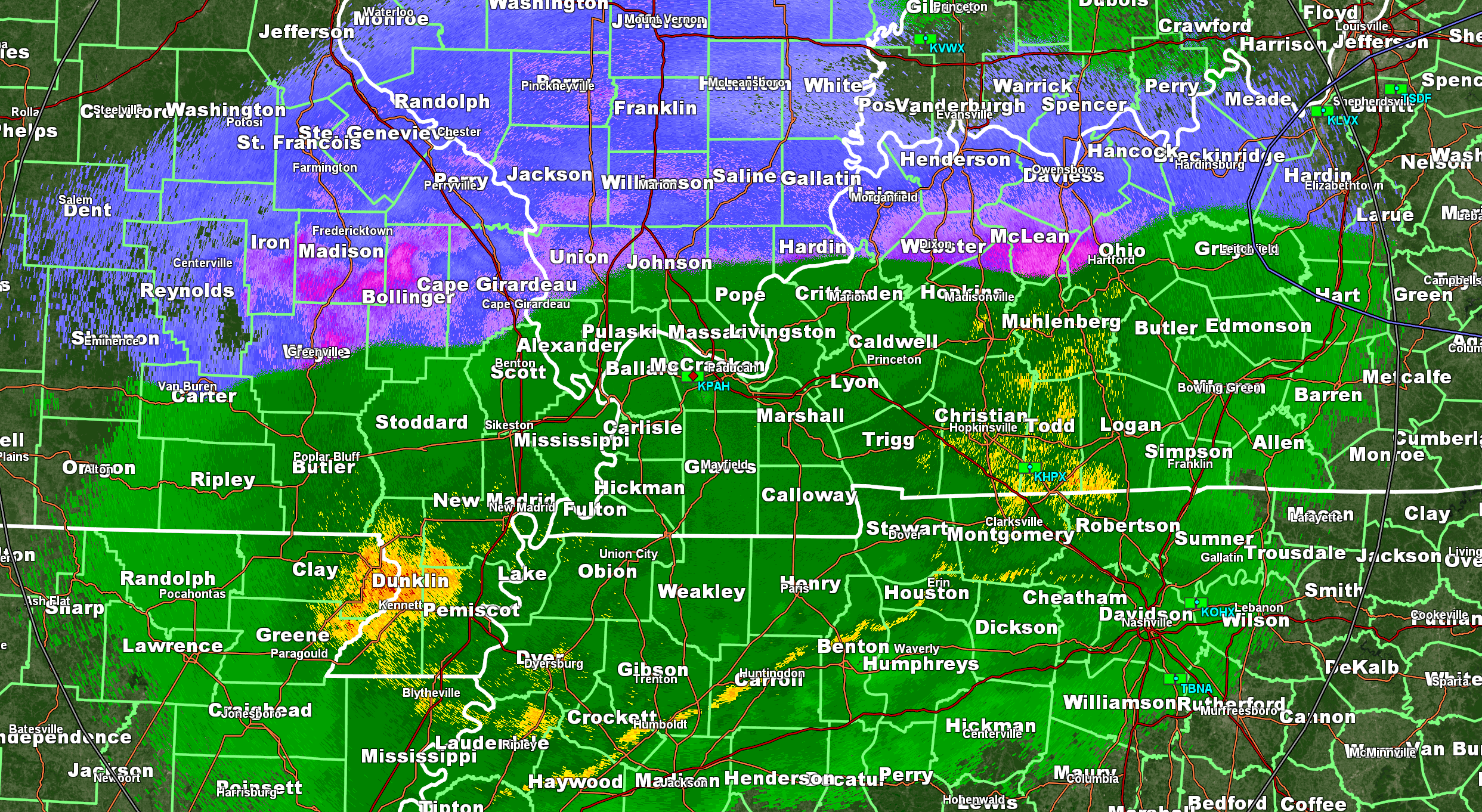
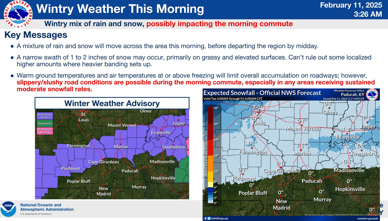
This morning’s radars show widespread snow and rain across the region.

Here Are Your Beau Dodson Weather Radars
Don’t forget the local city-view radars have a winterize button. Click that button to see precipitation type.
Interactive-city-view radars. Clickable watches and warnings.
https://wtalk.co/B3XHASFZ
Old legacy radar site (some of you like it better)
https://weatherobservatory.com/weather-radar.htm
Here was the 5:15 AM radar shot. Green is rain. Pink is moderate snow. Blue is snow.
A sharp line between the two. The placement of the snow is about where we expected. Within a few miles.
.
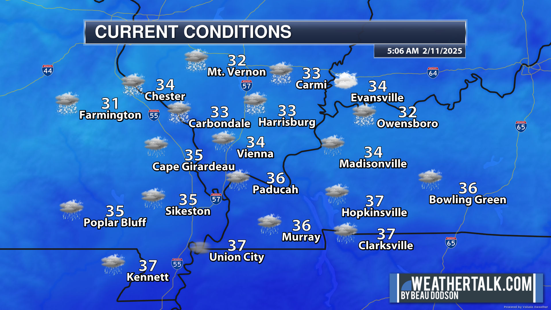
Temperatures are marginal for accumulation. Here were the 5 am temperatures. Many areas were above freezing.
.
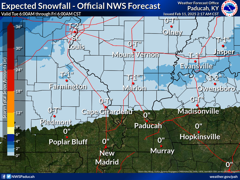
Here are the current snow totals forecast for today.
Again, temperatures will be marginal for this event. That would mean treated roads would remain mostly wet. Watch elevated surfaces and untreated roadways.
My going forecast has been zero to an inch or so with locally higher totals possible. The higher totals would mean the heavier snow would need to overcome the warm temperatures and warm ground conditions.
Here are the expected snowfall totals. This graphic is from the NWS.
.
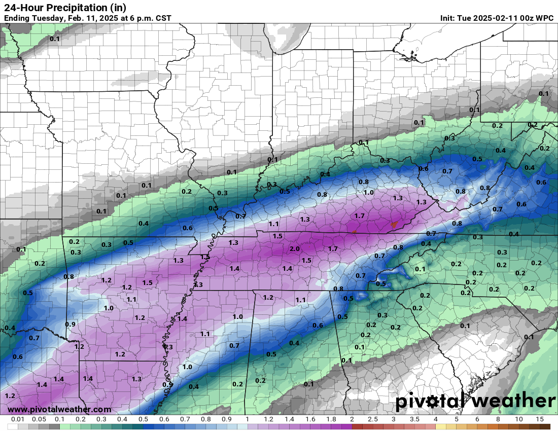
Here are the precipitation (melted) totals through tonight. A decent amount of rain, for some.
.
Advisory graphic. Double click this image to enlarge it. This is from the NWS.
The advisory expires at noon.
.
You can see the winter weather advisory in purple. That will expire at noon.
Road impacts will be limited, because temperatures are near or above freezing in many areas. Northwest Kentucky is a bit colder and they have the highest chance of receiving a bit more snow.
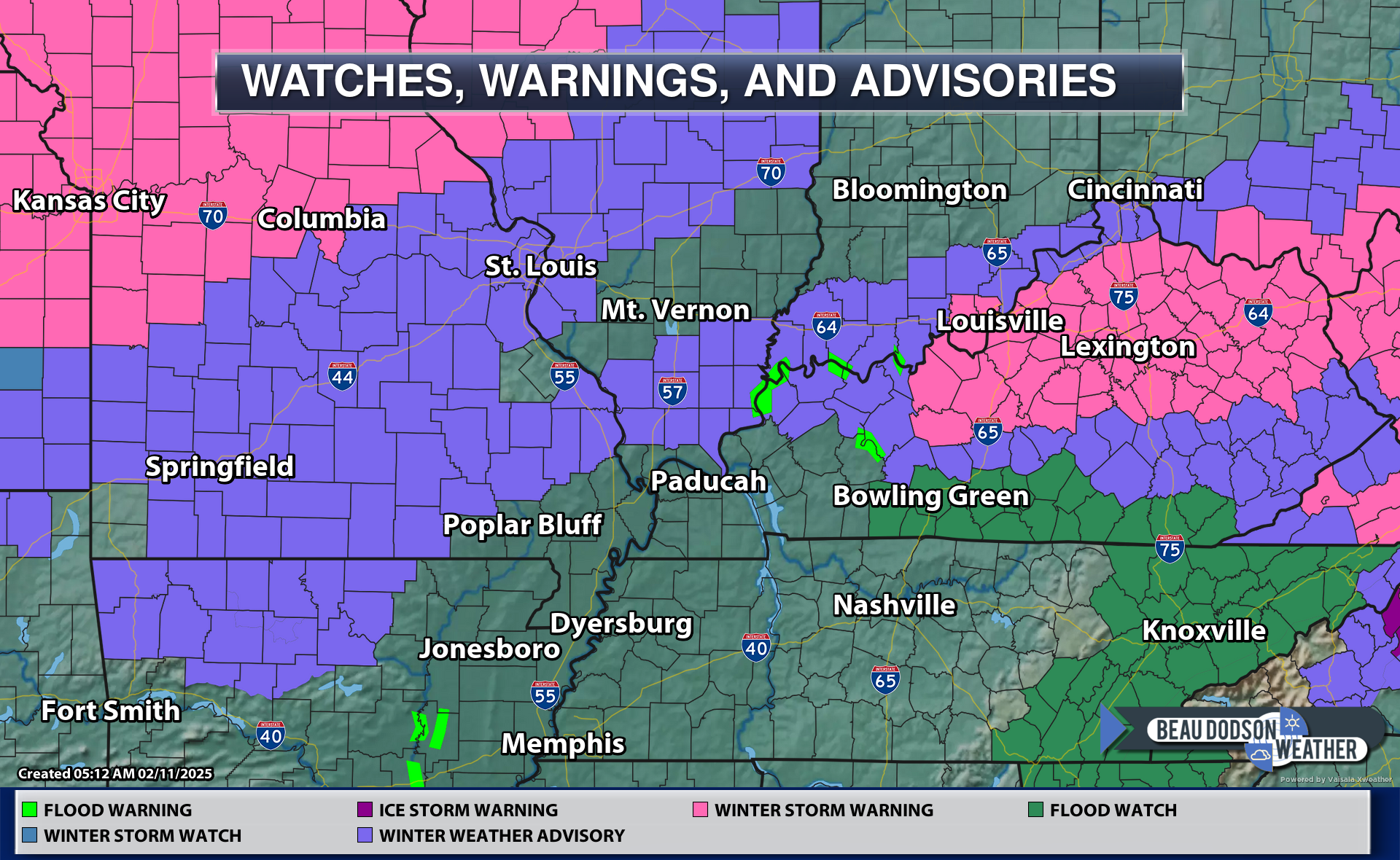
The winter storm warnings and winter weather advisories to our northwest are for a second system that arrives on Wednesday.
.

.
An active weather pattern today into the weekend. Multiple rounds of precipitation.
Another precipitation event arrives Wednesday and Wednesday night. Followed by yet another rain event Friday night and Saturday.
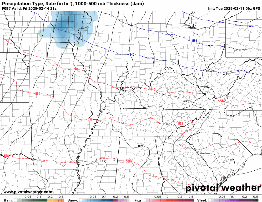
After a brief lull in precipitation tonight, we will see yet more precipitation arrive on Wednesday and Wednesday night. This could begin as a wintry mix of freezing rain and sleet across portions of southeast Missouri and southern Illinois. Ice accumulations would be light ranging from a trace to perhaps 0.10″.
The rest of the region will experience plain old rain.
Here is where the Wednesday event could begin as a mix. Then, it will change to rain. I will keep an eye on it.
.
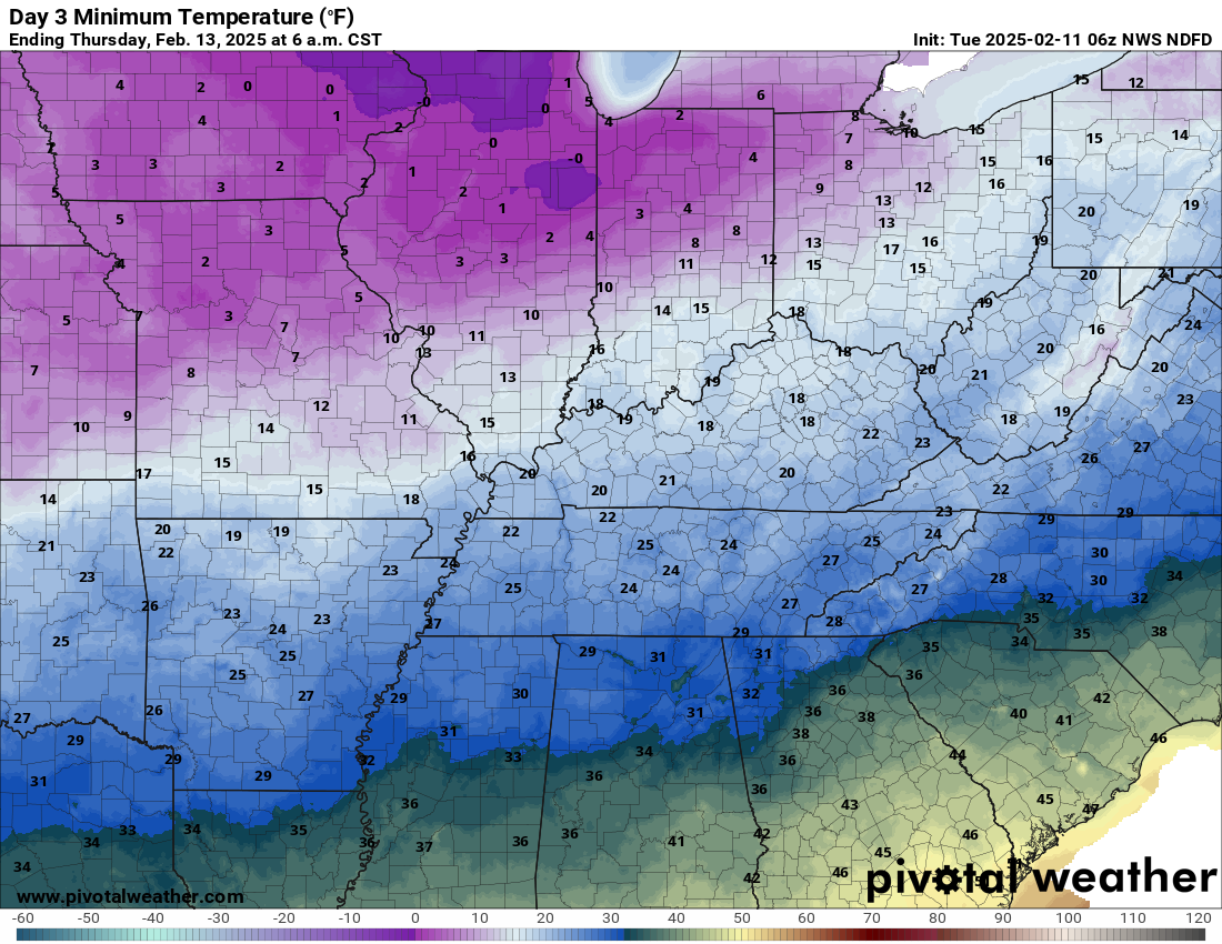
We will also need to watch temperatures Wednesday night as they rapidly fall below freezing. Perhaps a flash freeze in some areas and/or rain ending as a brief mix.
A flash freeze occurs when rain has fallen and temperatures fall so fast that wet surfaces can become icy.
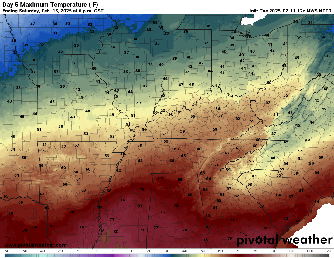
Check out the Thursday morning low temperatures. Brrrr.
Double click image to enlarge it.
.
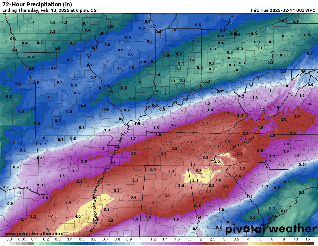
Here are the rainfall (and melted precipitation) totals from today through Thursday morning. This covers both events (today into Wednesday night).
.
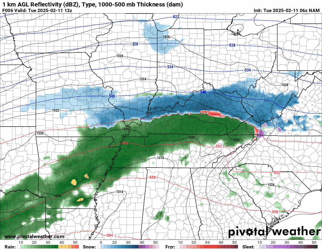
Future-cast Radars. What radar might look like with these events.
Here is the future-cast radar for today into Wednesday night. Two systems back to back.
Blue is snow. Red is ice. Green and yellow represent rain.
The time stamp is in zulu. 12z=6 am. 18z=12 pm. 00z=6 pm.
.
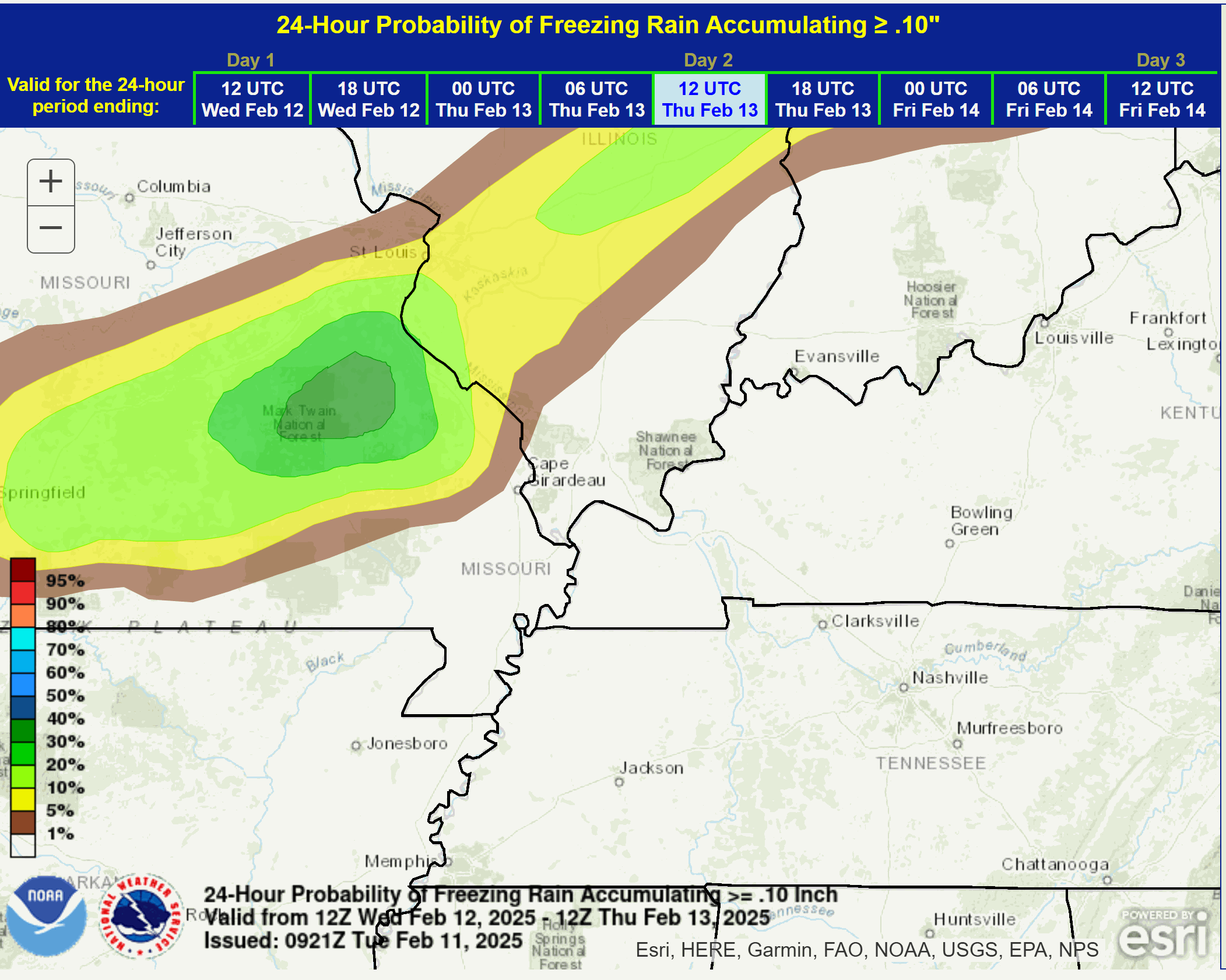
Here is the probability of 0.10″ of freezing rain with the Wednesday system.
I will monitor southeast Missouri and portions of southern Illinois. With time, it would change to rain.
.
Yet another rain event Friday night into Saturday night.
We will have a brief lull in precipitation on Thursday into Friday morning. Then, another rain event rapidly moves in Friday night into Saturday night. Ending Saturday night.
There could even be a rumble of thunder on Saturday!
It will be chilly Friday night and there could be some snow or sleet pellets mixed in with the rain, but it will eventually change to plain old rain.
Temperatures will be warmer on Saturday.
Check out Saturday’s high temperatures. Double click the image to enlarge it.
Portions of the region will rise into the fifties.
.
Rain ends Saturday night. It could end as a light mix with temperatures falling into the twenties.
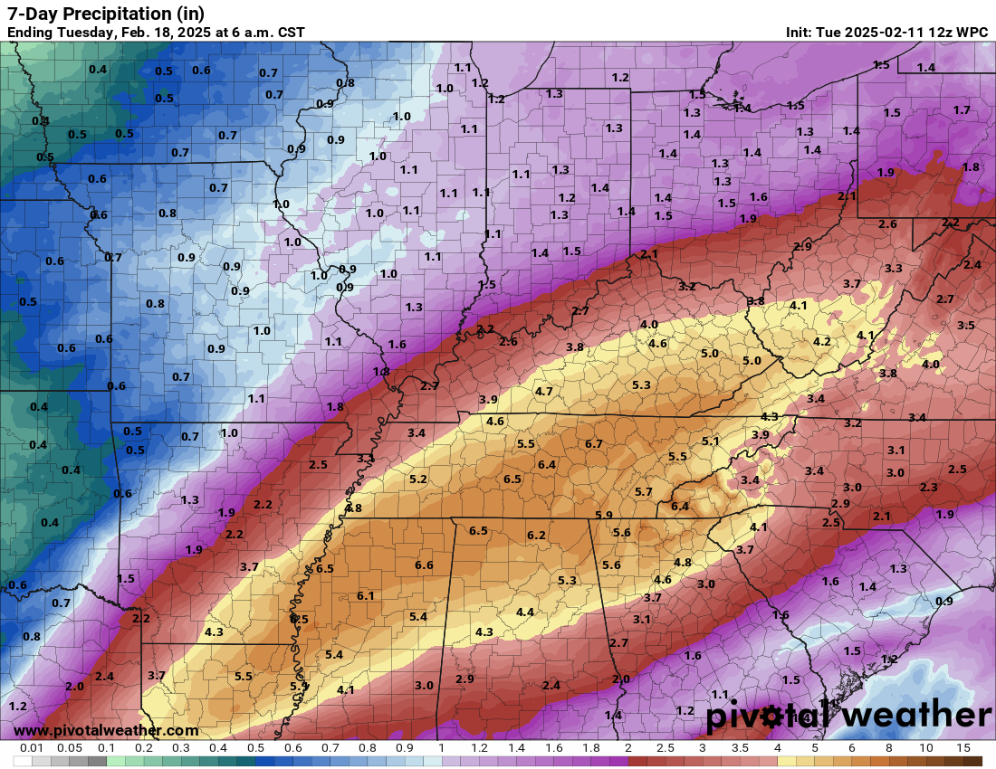
Let’s look at seven day rainfall totals. This captures all three events. Today through Saturday.
That is a considerable of rain across the Ohio and Tennessee Valley!
Flooding Concerns?
River flooding will become an issue over the coming days. We already have some river flood warnings in the region.
There could also be some overland field flooding, ditches flooded, sharp rises on streams, and nuisance flooding of commonly flooded roadways. Especially with the mid-week and late-week system.
We will need to monitor rain totals, especially over Kentucky and Tennessee. Unsure if we will need a flood watch, but the NWS is monitoring it.
.
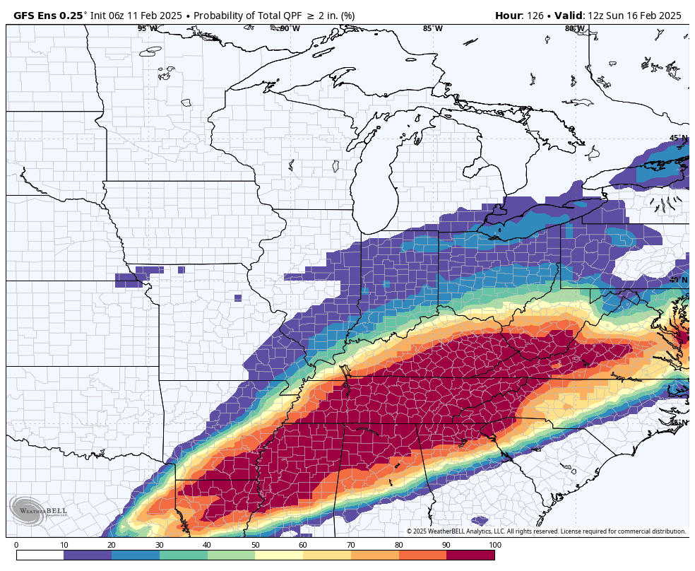
Here is the GEFS ensembles.
What is the probability of receiving two or more inches of rain between now and Sunday? a decent chance as you travel south southeast in the region.
.
Future-cast Radars.
What radar might look like with the Friday and Saturday event.
Here is the GFS model future-cast radar for the Friday and Saturday event.
The time-stamp is located in the upper left portion of the animation.
Blue is snow. Pink is ice. Green and yellow represent plain old rain.
Double click on animations to enlarge them.
Time stamp is in Zulu. 00z=6 pm. 06z=12 am. 12z=6 am. 18z=12 pm.
.
The latest eight to fourteen day temperature outlook looks chilly. Blue represents below average temperatures.
We will just have to see if precipitation accompanies these colder temperatures.

.
We have a few sponsors that are helping cover new technology costs! Check them out.
Heating problems?
One Hour Heating and Air – Click Here

Connected and Protected.
They Specialize in Audio, Video, Networking, Security, Cameras, Electrical, New Construction, Remodels, and retrofitting Jobs. Experience the future of smart living and unmatched security with Connected & Protected Solutions today.
Link – Click here

Roof damage from recent storms? Link – Click here

![]()
![]()

.
Click here if you would like to return to the top of the page.
.Average high temperatures for this time of the year are around 46 degrees.
Average low temperatures for this time of the year are around 29 degrees.
Average precipitation during this time period ranges from 0.90″ to 1.20″
Six to Ten Day Outlook.
Blue is below average. Red is above average. The no color zone represents equal chances.
Average highs for this time of the year are in the lower 60s. Average lows for this time of the year are in the lower 40s.

Green is above average precipitation. Yellow and brown favors below average precipitation. Average precipitation for this time of the year is around one inch per week.

.

Average low temperatures for this time of the year are around 29 degrees.
Average precipitation during this time period ranges from 0.90″ to 1.20″
.
Eight to Fourteen Day Outlook.
Blue is below average. Red is above average. The no color zone represents equal chances.
Green is above average precipitation. Yellow and brown favors below average precipitation. Average precipitation for this time of the year is around one inch per week.

.
![]()
Make sure you have three to five ways of receiving your severe weather information.
Weather Talk is one of those ways! Now, I have another product for you and your family.

.
.
https://weathercallservices.com/beau-dodson-weather


Want to add more products to your Beau Dodson Weather App?
Receive daily videos, weather blog updates on normal weather days and severe weather and winter storm days, your county by county weather forecast, and more!
Here is how to do add those additional products to your app notification settings!
Here is a video on how to update your Beau Dodson Weather payment.
The app is for subscribers. Subscribe at www.weathertalk.com/welcome then go to your app store and search for WeatherTalk
Subscribers, PLEASE USE THE APP. ATT and Verizon are not reliable during severe weather. They are delaying text messages.
The app is under WeatherTalk in the app store.

Apple users click here

Android users click here
.
Radars and Lightning Data
Interactive-city-view radars. Clickable watches and warnings.
https://wtalk.co/B3XHASFZ
Old legacy radar site (some of you like it better)
https://weatherobservatory.com/weather-radar.htm
If the radar is not updating then try another one. If a radar does not appear to be refreshing then hit Ctrl F5. You may also try restarting your browser.
Backup radar site in case the above one is not working.
https://weathertalk.com/morani
Regional Radar
https://imagery.weathertalk.com/prx/RadarLoop.mp4
** NEW ** Zoom radar with chaser tracking abilities!
ZoomRadar
Lightning Data (zoom in and out of your local area)
https://wtalk.co/WJ3SN5UZ
Not working? Email me at beaudodson@usawx.com
National map of weather watches and warnings. Click here.
Storm Prediction Center. Click here.
Weather Prediction Center. Click here.
.

Live lightning data: Click here.
Real time lightning data (another one) https://map.blitzortung.org/#5.02/37.95/-86.99
Our new Zoom radar with storm chases
.
.

Interactive GOES R satellite. Track clouds. Click here.
GOES 16 slider tool. Click here.
College of DuPage satellites. Click here
.

Here are the latest local river stage forecast numbers Click Here.
Here are the latest lake stage forecast numbers for Kentucky Lake and Lake Barkley Click Here.
.
.
Find Beau on Facebook! Click the banner.


 .
.