We have a few sponsors that are helping cover new technology costs! Check them out.
Heating problems?
One Hour Heating and Air – Click Here

Connected and Protected.
They Specialize in Audio, Video, Networking, Security, Cameras, Electrical, New Construction, Remodels, and retrofitting Jobs. Experience the future of smart living and unmatched security with Connected & Protected Solutions today.
Link – Click here

Roof damage from recent storms? Link – Click here


.
Seven Day Hazardous Weather Outlook
1. Is lightning in the forecast? MONITOR. I am monitoring Tuesday night into Thursday.
2. Are severe thunderstorms in the forecast? MONITOR. Monitoring Wednesday and Thursday.
3. Is flash flooding in the forecast? MONITOR. Locally heavy rain is possible Wednesday and Thursday. At this time, confidence in rainfall totals remains low. The ground is saturated. If locally heavy rain does develop, then there could be some issues.
4. Will non-thunderstorm winds top 40 mph? NO.
6. Will the wind chill dip below 10 degrees? NOT AT THIS TIME.
7. Is measurable snow and/or sleet in the forecast? NOT AT THIS TIME.
8. Is freezing rain in the forecast? NOT AT THIS TIME.
.

Notes:
THE FORECAST WILL TO VARY FROM LOCATION TO LOCATION.
Scroll down to see your local forecast details.
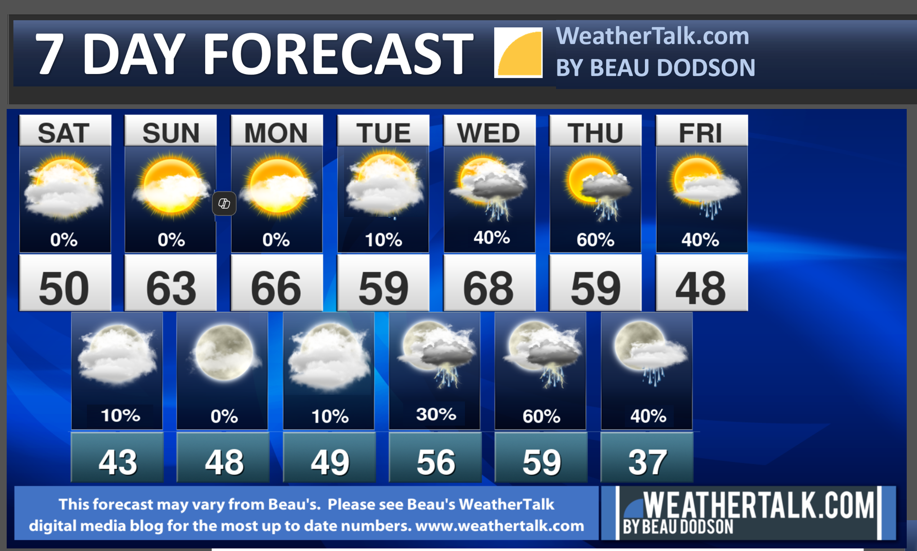
Seven-day forecast for southeast Missouri, southern Illinois, western Kentucky, and western Tennessee.
This is a BLEND for the region. Scroll further down to see the region by region forecast.
.
A quick glance. 48-hour forecast Graphics


Do you have any suggestions or comments? Email me at beaudodson@usawx.com
.
Weather Highlights and Forecast Discussion
-
- Cool today. Warmer tomorrow.
- Mild week ahead of us, overall.
- Monitoring precipitation chances Tuesday night into Thursday. Monitoring precipitation chances Friday into Sunday. A couple of systems to watch.
- Watching a cold shot of air late next week, as well. A bit of a roller-coaster with temps.
.
Beau’s Forecast Discussion
Good morning, everyone. Welcome to February!
Some of you picked up some pea size hail yesterday. We talked about that being a possibility. There was even a clap or two of thunder.
A cold pocket of air aloft combined with some showers and thunderstorms to help produce that pea size hail. A few spots had enough pea size hail to dust the ground.
January was certainly cold. How cold was it?
Let’s look at the anomalies. How many degrees above or below average were temperatures? Anything about three degrees is quite impressive (because we are talking about 31 day averages).
Average high and low temperature for January
Double click images to enlarge them
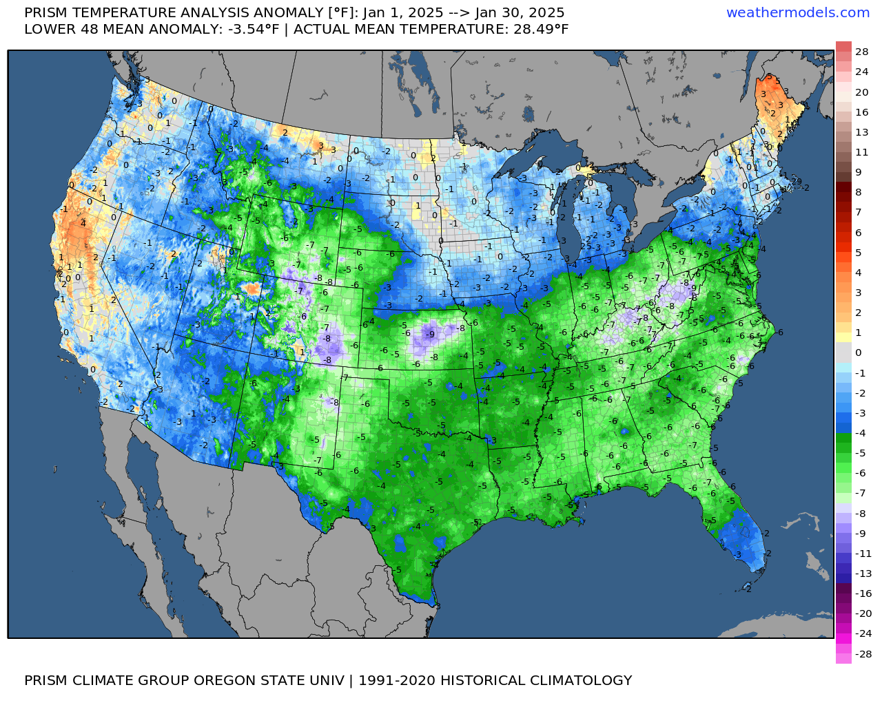
Average high temperature
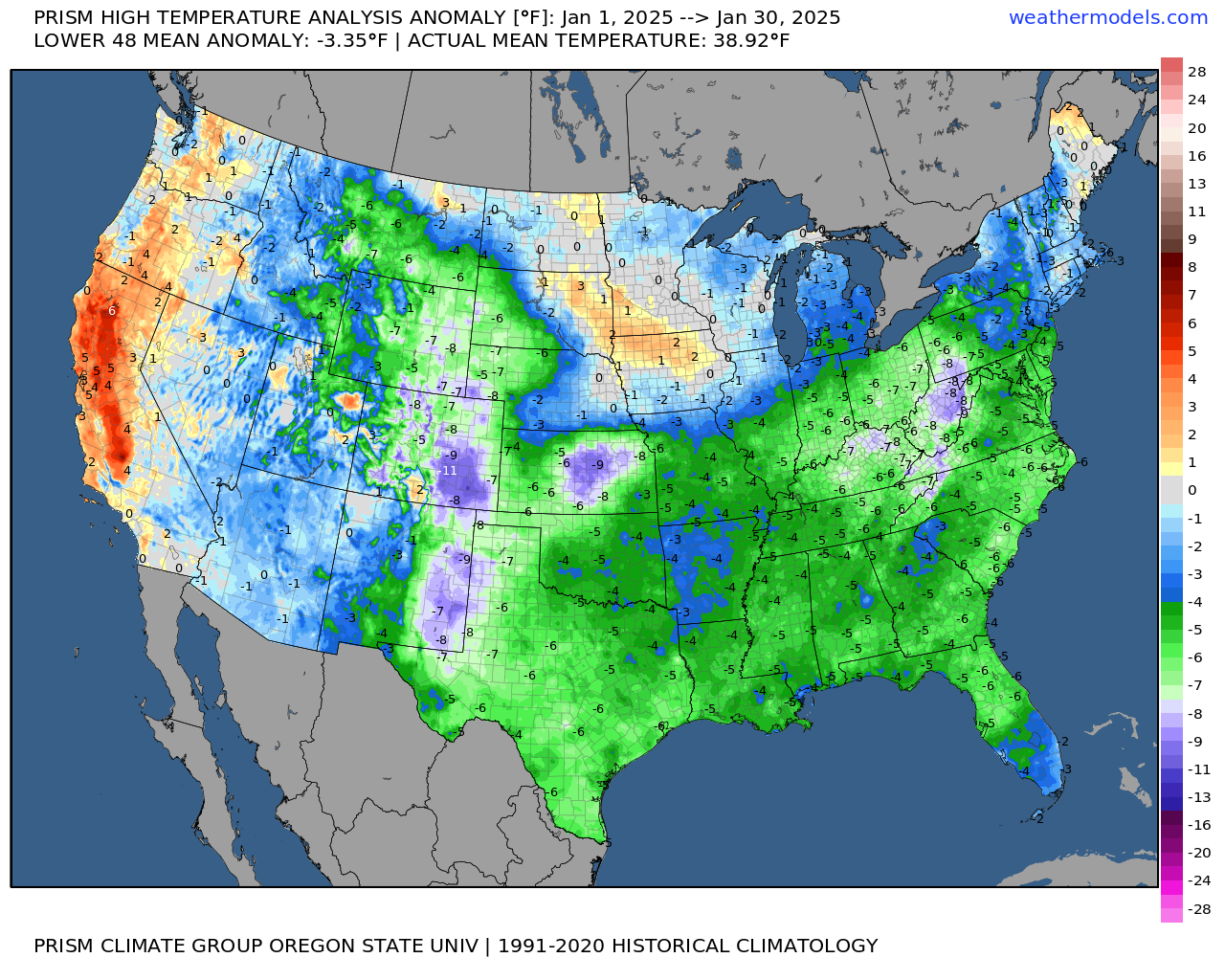
Average low temperature

Those are some chilly numbers! Nationwide, as well!
Today will be cool, but nothing to write home about. A fairly typical February day.
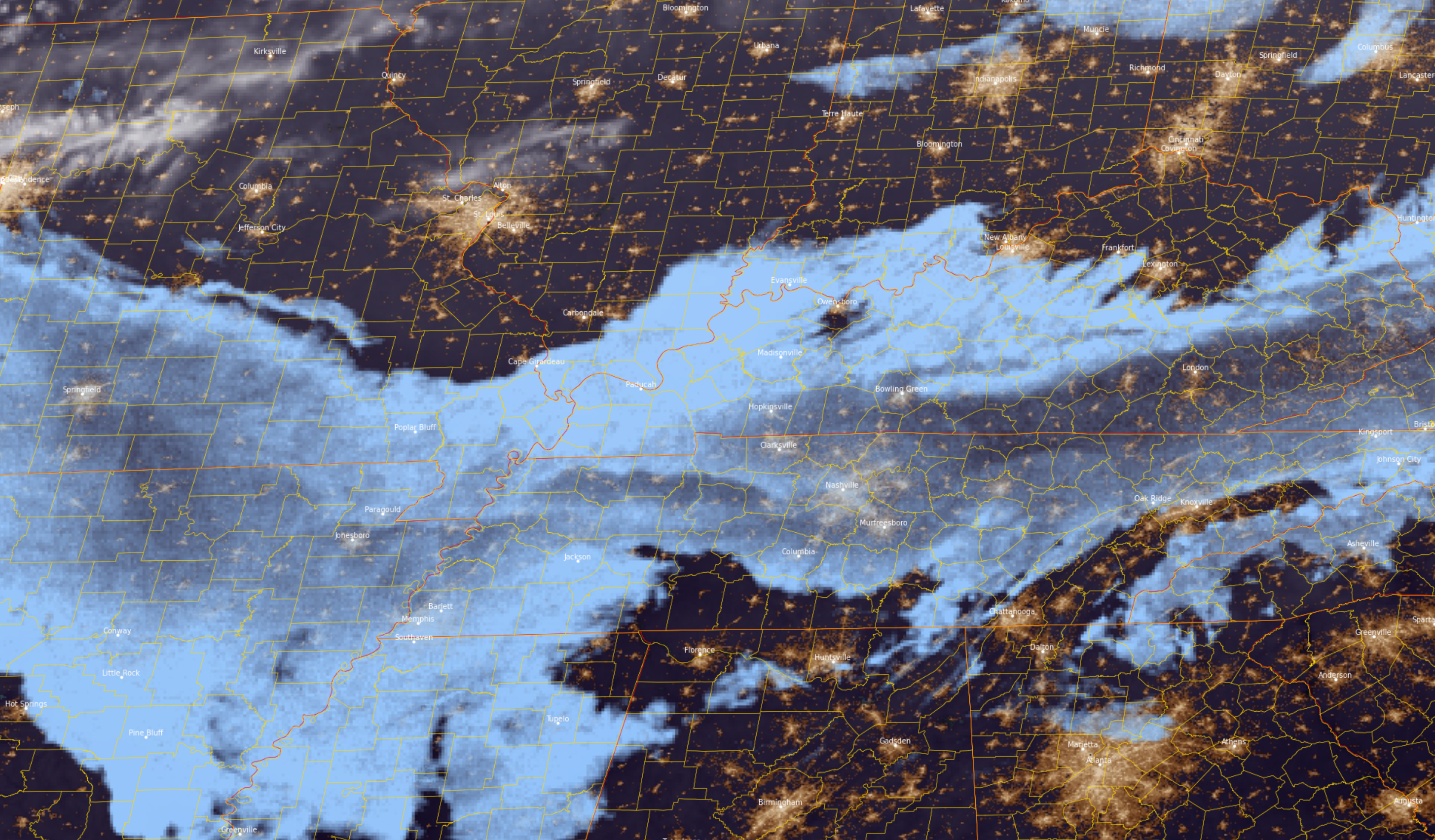
Clouds may be tough to scour out over our southern counties. Morning satellite shows those clouds.
Northern counties have a better chance of sunshine today.
We will just have to see about our southern counties.
Some patchy drizzle and fog will be possible tonight. Mainly over our far northern counties.
The great news is that tomorrow will be warmer. Monday will be warm, as well.
Tuesday will be a bit cooler behind a weak cold front.
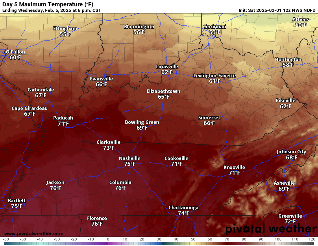
Warming begins Tuesday night and Wednesday. As a matter of fact, Wednesday could be the warmest day of the week.
I can’t rule out some 70s. We may have to deal with some clouds and showers/thunderstorms, as well. We will have to see how that impacts temperatures.
Double click images to enlarge them
We will have on and off chances of showers and thunderstorms from Tuesday night through Sunday.
Too soon to know if severe weather will be a concern. There will be a strong CAP. That could limit the severe threat. We will have to closely monitor it.
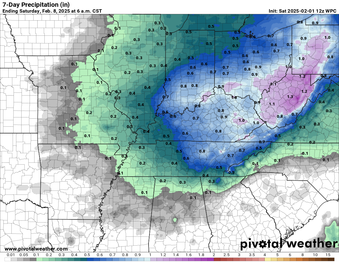
Here is the current rainfall forecast. There could be adjustments in this forecast. We will need to watch trends in the guidance.
Some data shows heavier totals. Medium confidence in rain totals Tuesday night through Thursday night.
Double click the image to enlarge it.
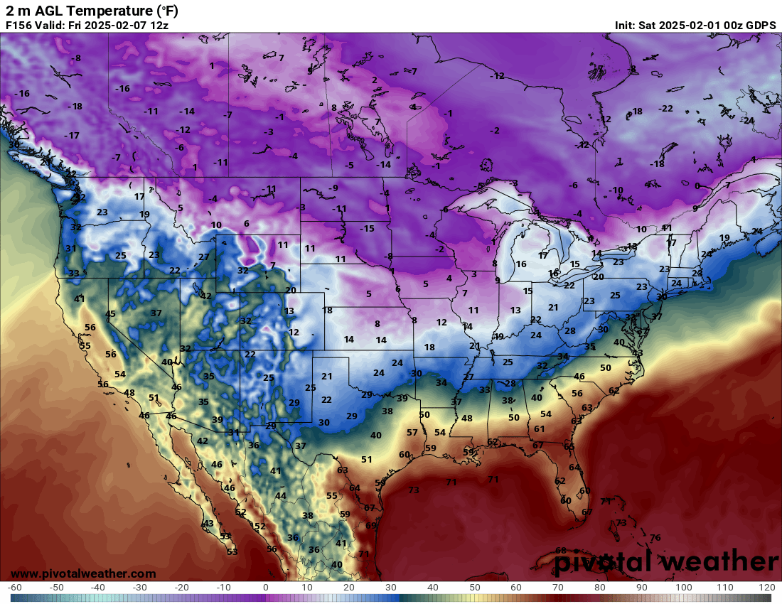
The Canadian model shows a sharp cold snap late next week. That would be behind the cold front. Data is mixed on just how cold it will be. I will be monitoring that push of colder air.
Double click images to enlarge them
This is an active pattern and changeable forecasts are likely. You will want to check back for updated forecast numbers.
We will be keeping a close eye on the Arctic air to the north.
You can see this on the Sunday, February 9th temperature forecast. Cold to the north. Warm to the south.
We are in the battle zone between cold and warm air. That usually means precipitation.
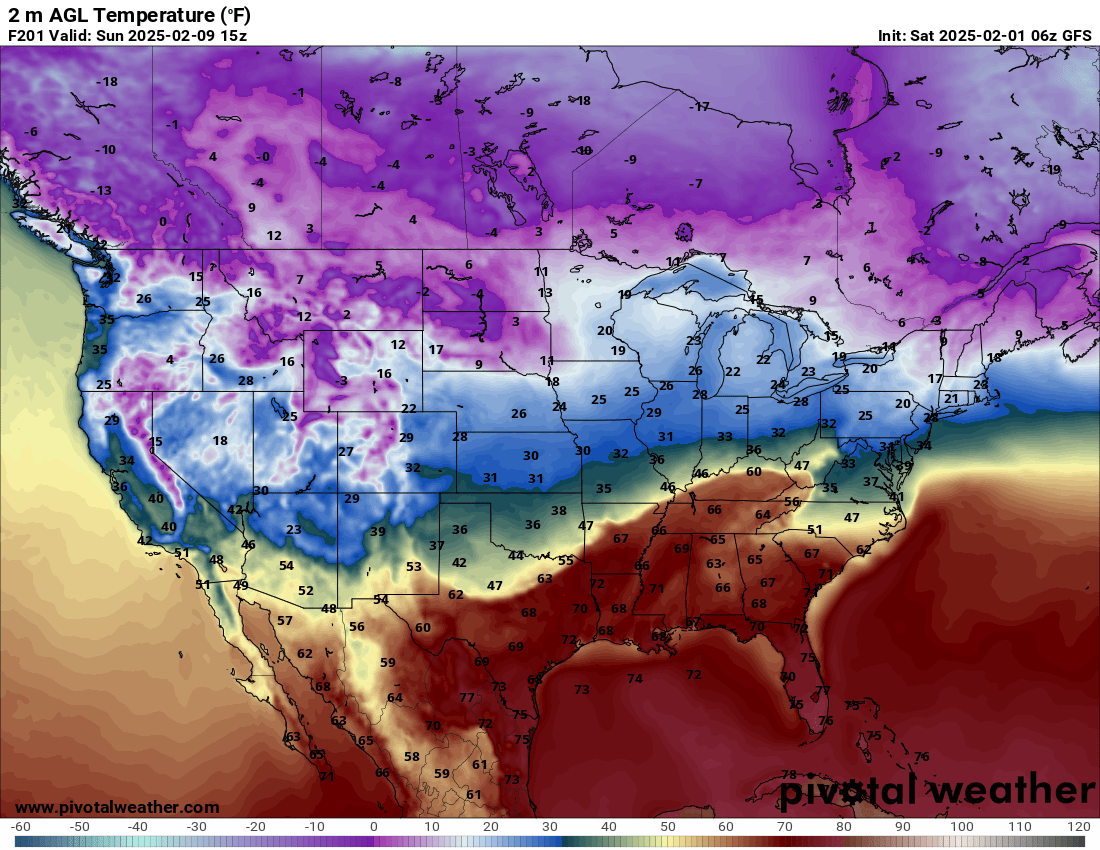
That boundary will likely fluctuate north and south each day.
Whether we have snow and ice will be highly dependent on the placement of that frontal boundary.
We do have some winter storm possibilities.
The long range GFS model shows that potential. The EC model shows it, as well.
We take these graphics with a grain of salt. I am just showing you the general idea as we move through the next few weeks.
It does look active. The question will be placement of the frontal boundary. Highly uncertain this far out.
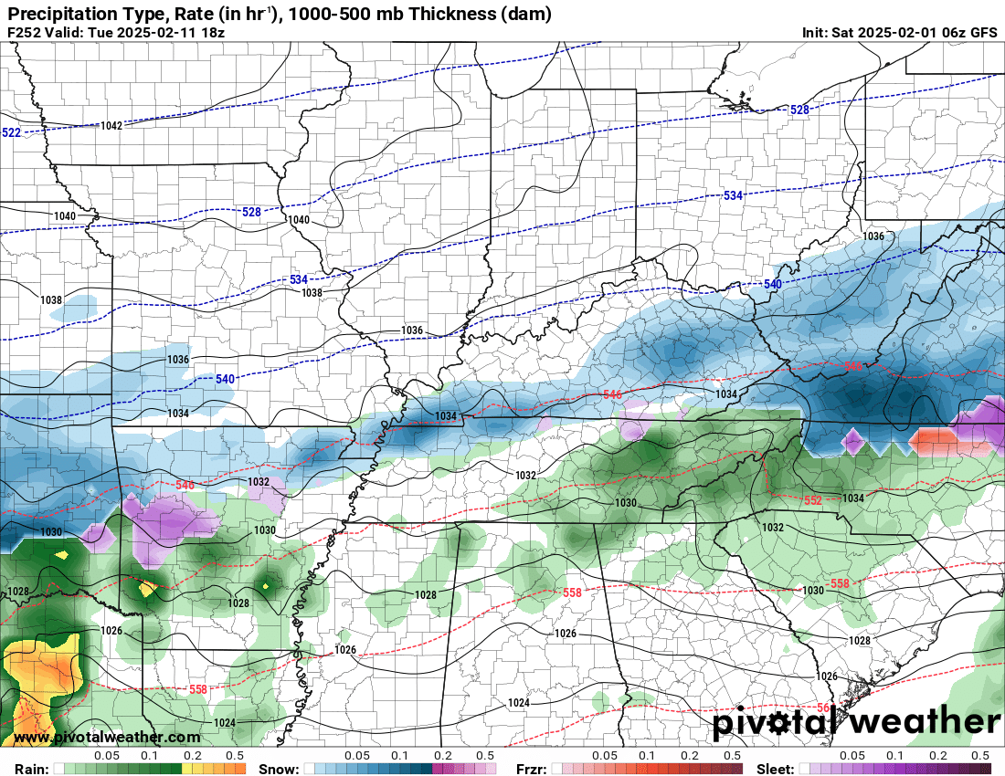
February 11th
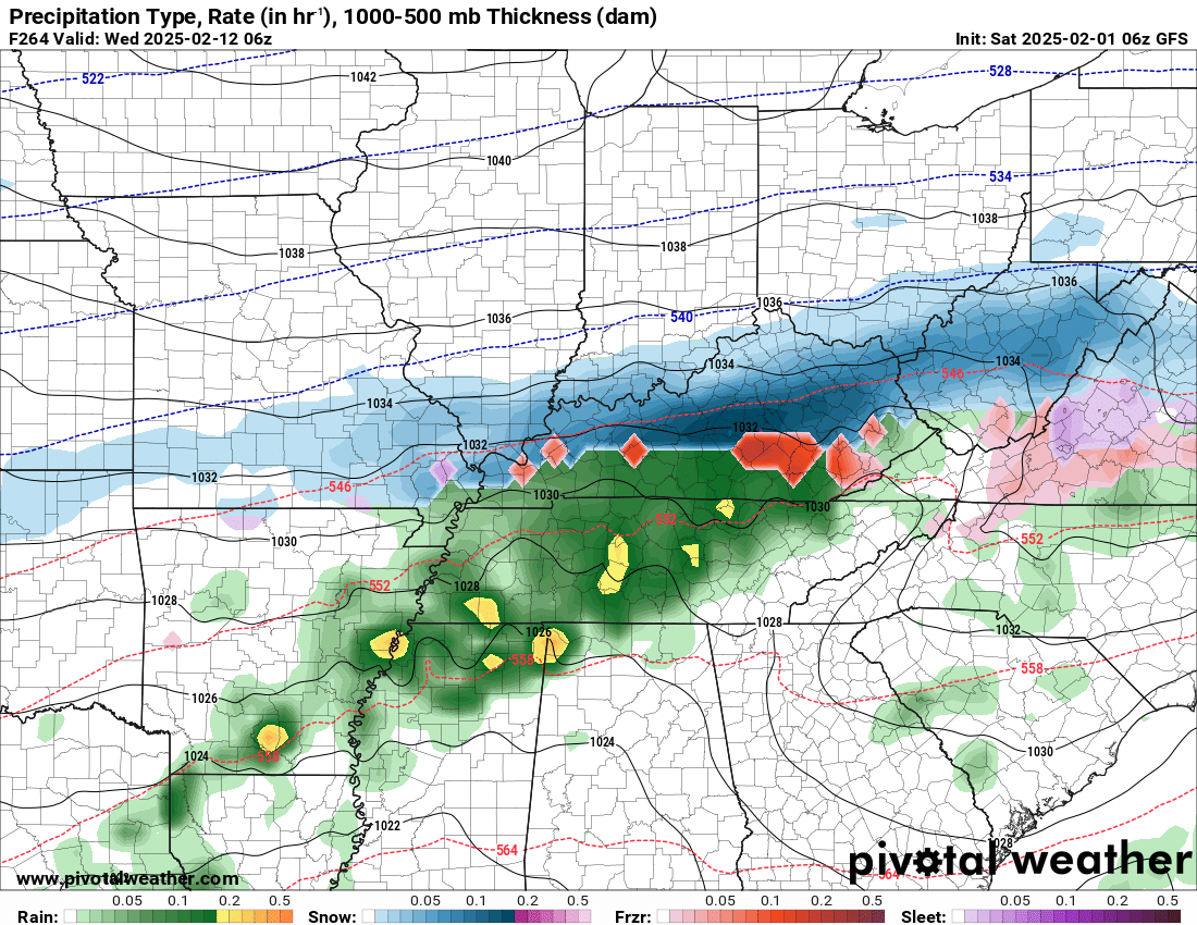
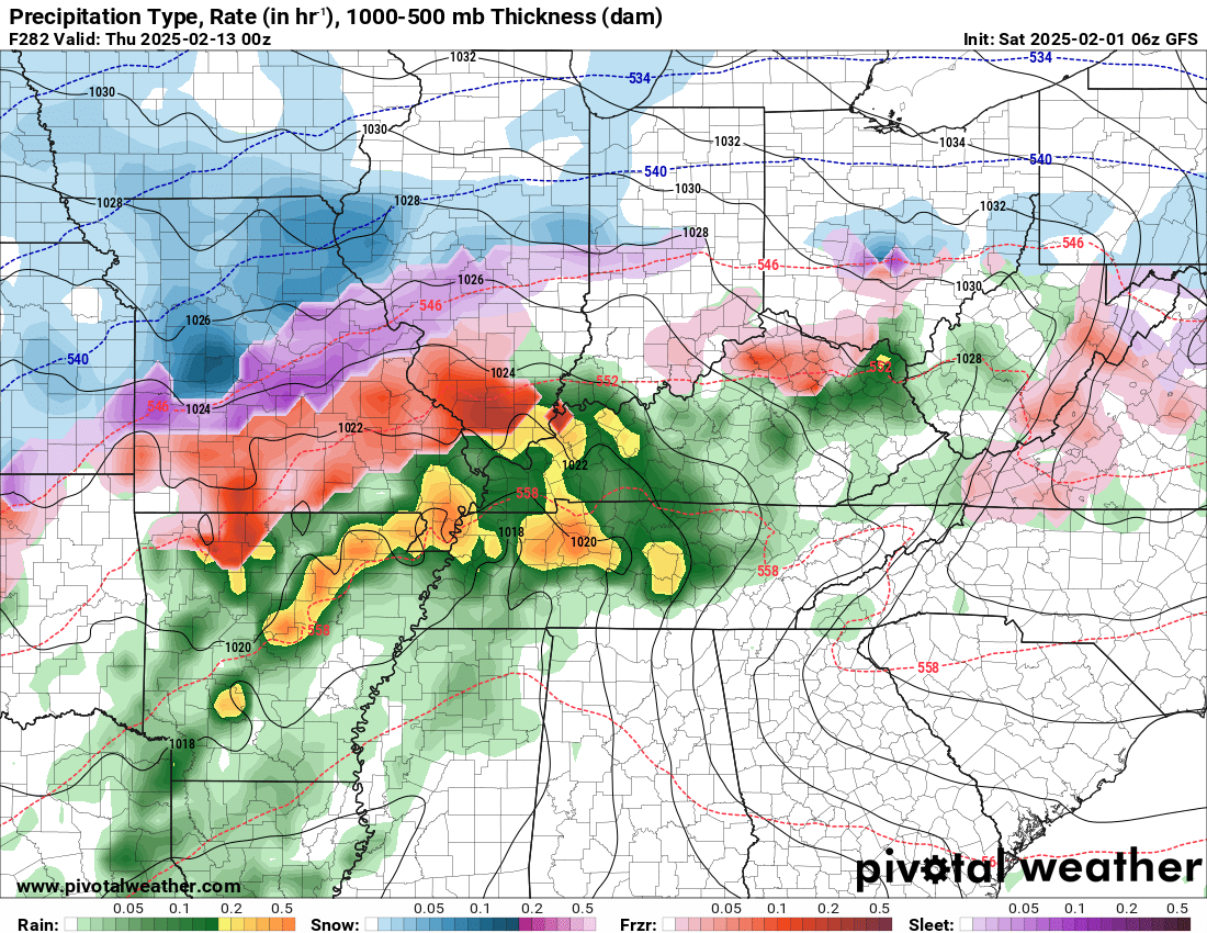
Blue is snow. Purple is sleet. Red is freezing rain. Green is rain. Yellow/orange represents heavier rain.
February 12th
February 13th
February 16th
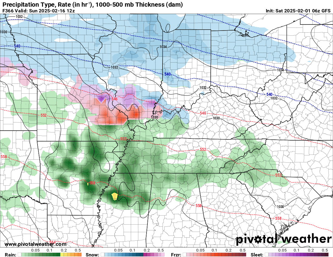
All I take from those maps is that the pattern is active.

.
Click here if you would like to return to the top of the page.
.Average high temperatures for this time of the year are around 48 degrees.
Average low temperatures for this time of the year are around 26 degrees.
Average precipitation during this time period ranges from 0.90″ to 1.20″
Six to Ten Day Outlook.
Blue is below average. Red is above average. The no color zone represents equal chances.
Average highs for this time of the year are in the lower 60s. Average lows for this time of the year are in the lower 40s.

Green is above average precipitation. Yellow and brown favors below average precipitation. Average precipitation for this time of the year is around one inch per week.

.

Average low temperatures for this time of the year are around 27 degrees.
Average precipitation during this time period ranges from 0.90″ to 1.20″
.
Eight to Fourteen Day Outlook.
Blue is below average. Red is above average. The no color zone represents equal chances.

Green is above average precipitation. Yellow and brown favors below average precipitation. Average precipitation for this time of the year is around one inch per week.

.
![]()
Make sure you have three to five ways of receiving your severe weather information.
Weather Talk is one of those ways! Now, I have another product for you and your family.

.
.
https://weathercallservices.com/beau-dodson-weather


Want to add more products to your Beau Dodson Weather App?
Receive daily videos, weather blog updates on normal weather days and severe weather and winter storm days, your county by county weather forecast, and more!
Here is how to do add those additional products to your app notification settings!
Here is a video on how to update your Beau Dodson Weather payment.
The app is for subscribers. Subscribe at www.weathertalk.com/welcome then go to your app store and search for WeatherTalk
Subscribers, PLEASE USE THE APP. ATT and Verizon are not reliable during severe weather. They are delaying text messages.
The app is under WeatherTalk in the app store.

Apple users click here

Android users click here
.

Radars and Lightning Data
Interactive-city-view radars. Clickable watches and warnings.
https://wtalk.co/B3XHASFZ
Old legacy radar site (some of you like it better)
https://weatherobservatory.com/weather-radar.htm
If the radar is not updating then try another one. If a radar does not appear to be refreshing then hit Ctrl F5. You may also try restarting your browser.
Backup radar site in case the above one is not working.
https://weathertalk.com/morani
Regional Radar
https://imagery.weathertalk.com/prx/RadarLoop.mp4
** NEW ** Zoom radar with chaser tracking abilities!
ZoomRadar
Lightning Data (zoom in and out of your local area)
https://wtalk.co/WJ3SN5UZ
Not working? Email me at beaudodson@usawx.com
National map of weather watches and warnings. Click here.
Storm Prediction Center. Click here.
Weather Prediction Center. Click here.
.

Live lightning data: Click here.
Real time lightning data (another one) https://map.blitzortung.org/#5.02/37.95/-86.99
Our new Zoom radar with storm chases
.
.

Interactive GOES R satellite. Track clouds. Click here.
GOES 16 slider tool. Click here.
College of DuPage satellites. Click here
.

Here are the latest local river stage forecast numbers Click Here.
Here are the latest lake stage forecast numbers for Kentucky Lake and Lake Barkley Click Here.
.
.
Find Beau on Facebook! Click the banner.


 .
.