September 22, 2024
11:45 AM Update
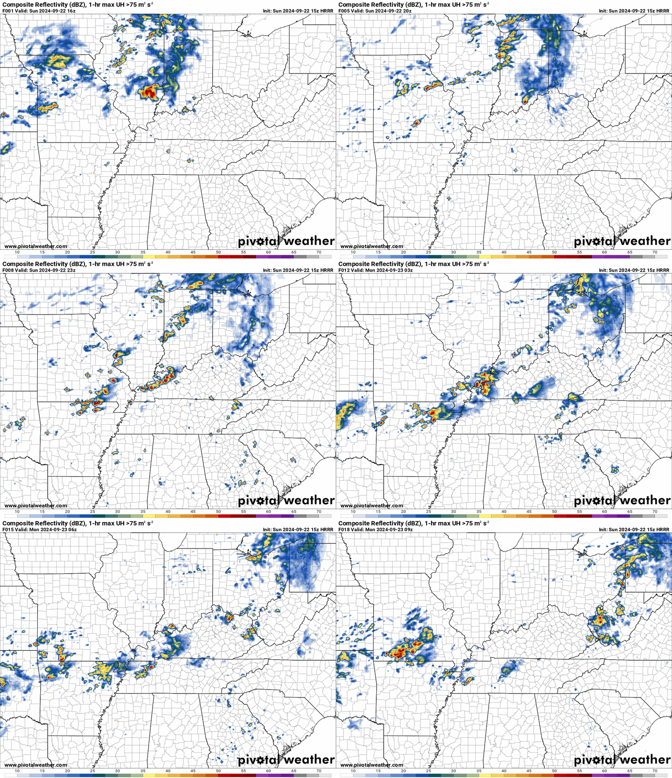
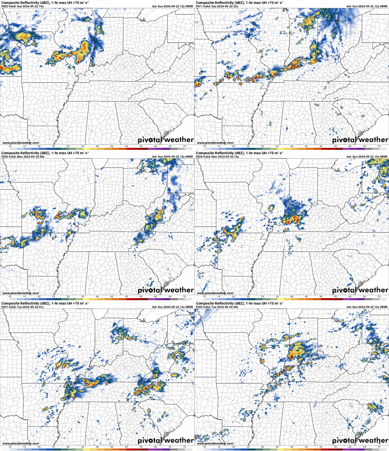
Here is the latest Hrrr model. This shows you what radar could look like this afternoon into tonight. Some of the storms could be locally intense.
Time stamp is Zulu. 12z=7 am. 18z=1 pm. 00z=7 pm. 06z=1 am.
Double click animation to enlarge it.

Seven Day Outlook
A look at today’s weather map and the week ahead.
Good morning, everyone! I hope you are having a nice weekend.
WELCOME TO AUTUMN 2024!
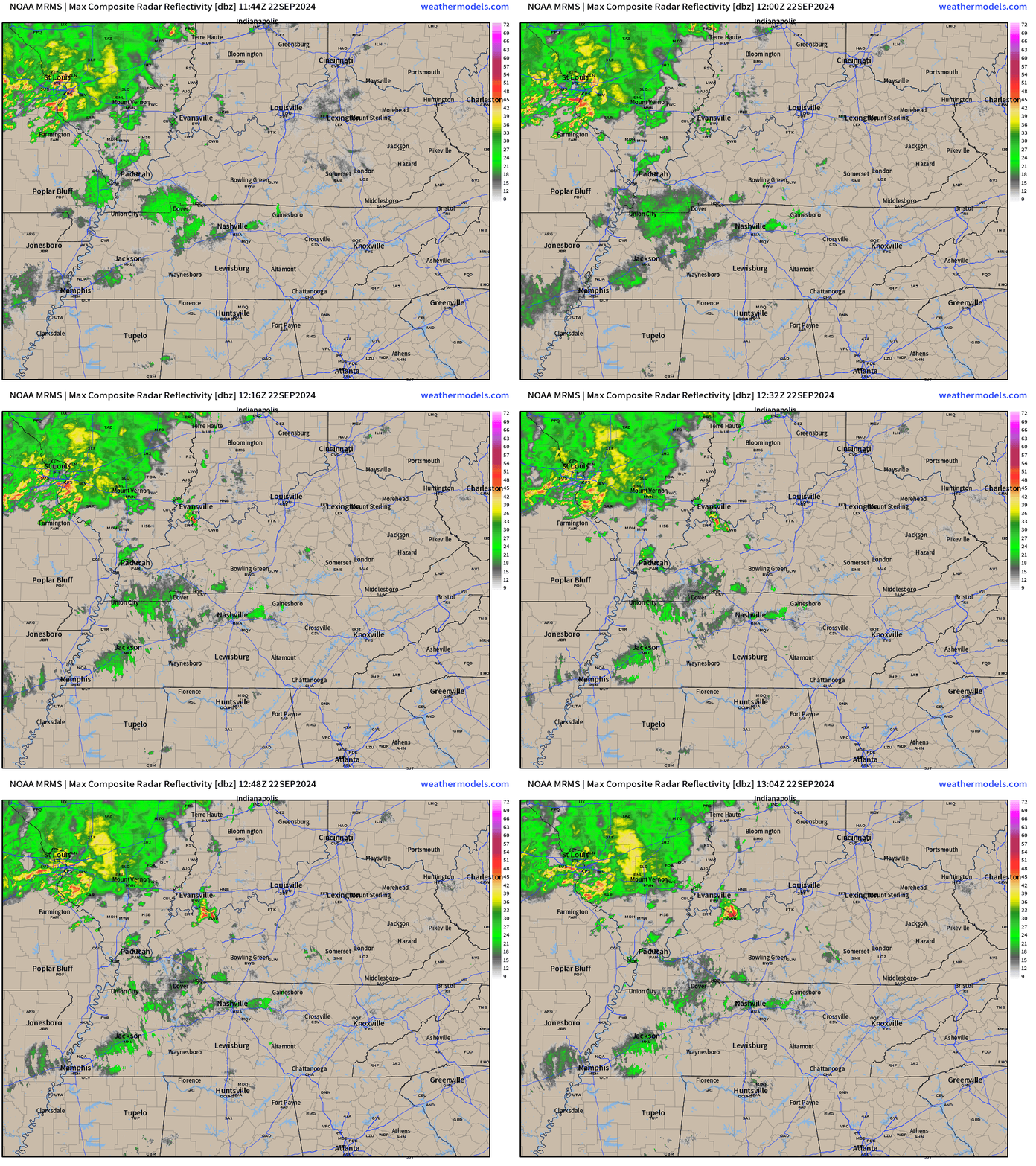
We are waking up to a mix of sun and clouds. Showers and thunderstorms are moving across our northern counties.
You can see that on this 8:15 AM radar animation (see live radar links below).
That will be the theme over the next few days. On and off shower and thunderstorm chances. Some of the storms could be locally intense with damaging wind and nickel size hail. Heavy downpours and lightning, as well. A few severe thunderstorm warnings will be possible. I will send out app messages if necessary.
Let’s look at the Hrrr model. This is future-cast radar. What radar might look like today into tomorrow night. Numerous showers and thunderstorms will be possible along the incoming cold front.
You can see that here. Time stamp is in Zulu time. 12z=7 am. 18z=1 PM. 00z=7 pm. 06z=1 AM.
Double click the animation to enlarge it.
.
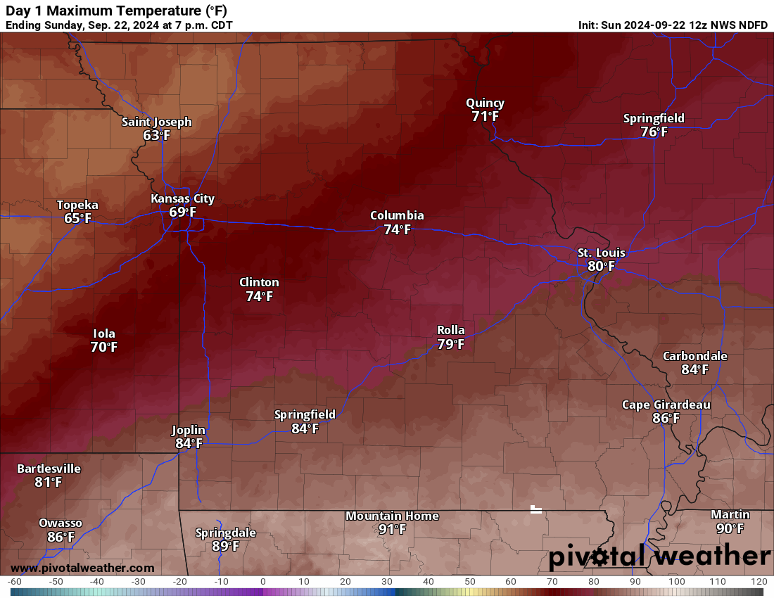
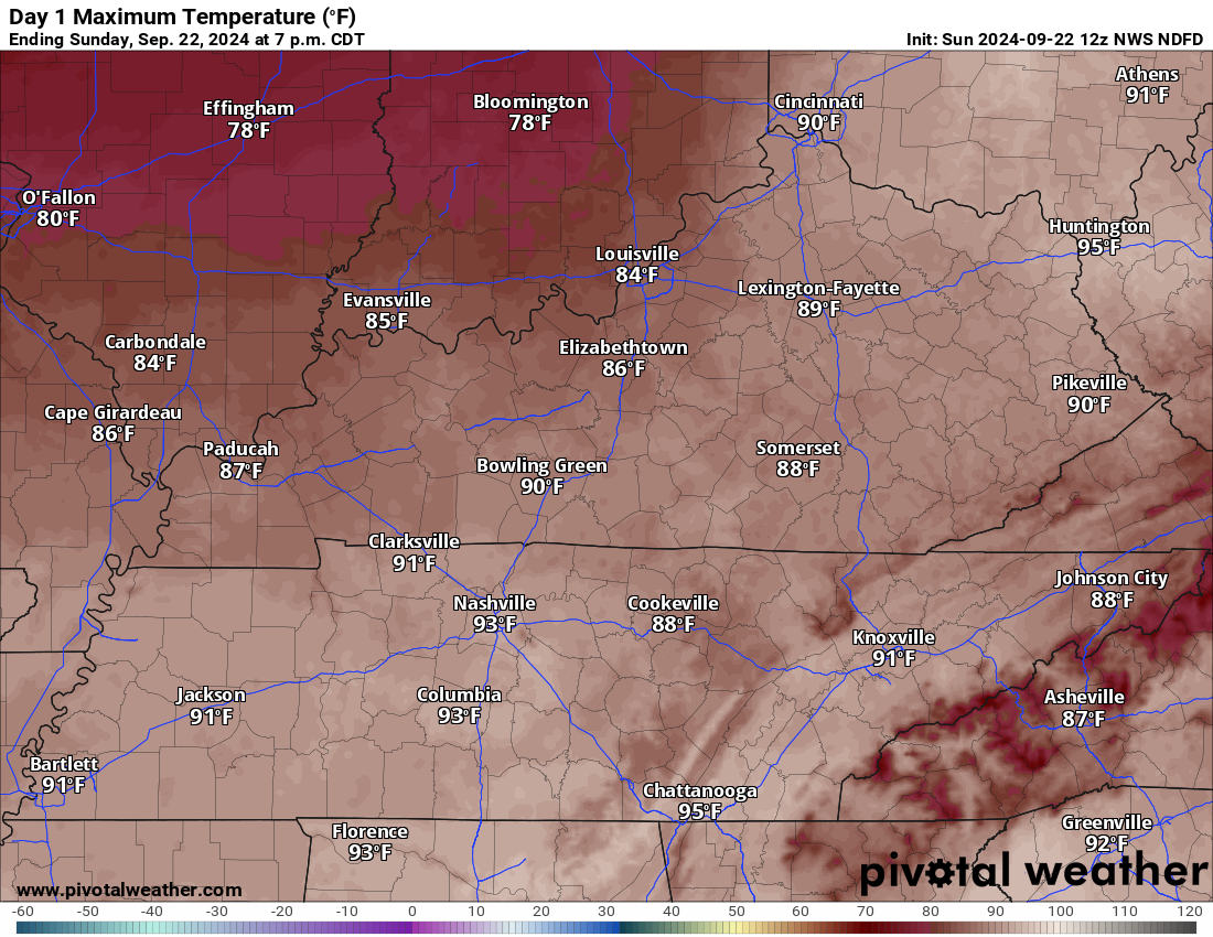
There will be a wide range of temperatures today. A bit cooler north (where clouds are thicker) and a bit warmer south (where there will be more sunshine). Above average temperatures area-wide.
Here is the high temperature forecast for today
Sunday high temperatures
.
A frontal boundary will slowly move through the region over the next few days. This will bring periods of showers and thunderstorms.
Peak chances will be during the afternoon and evening hours. With that said, scattered showers and storms will be possible at any given point of time.
Storms that form could produce locally heavy downpours, gusty winds, lightning, and even small hail. There is a low end severe weather risk over the next few days.
The Storm Prediction Center has outlined our region for a low end marginal risk of severe weather (the dark green zone). Light green is where sub-severe storms are possible. You can see that on this map. This is mainly for this afternoon and evening. A low chance of severe weather this morning and tonight.
We will have another risk Monday.

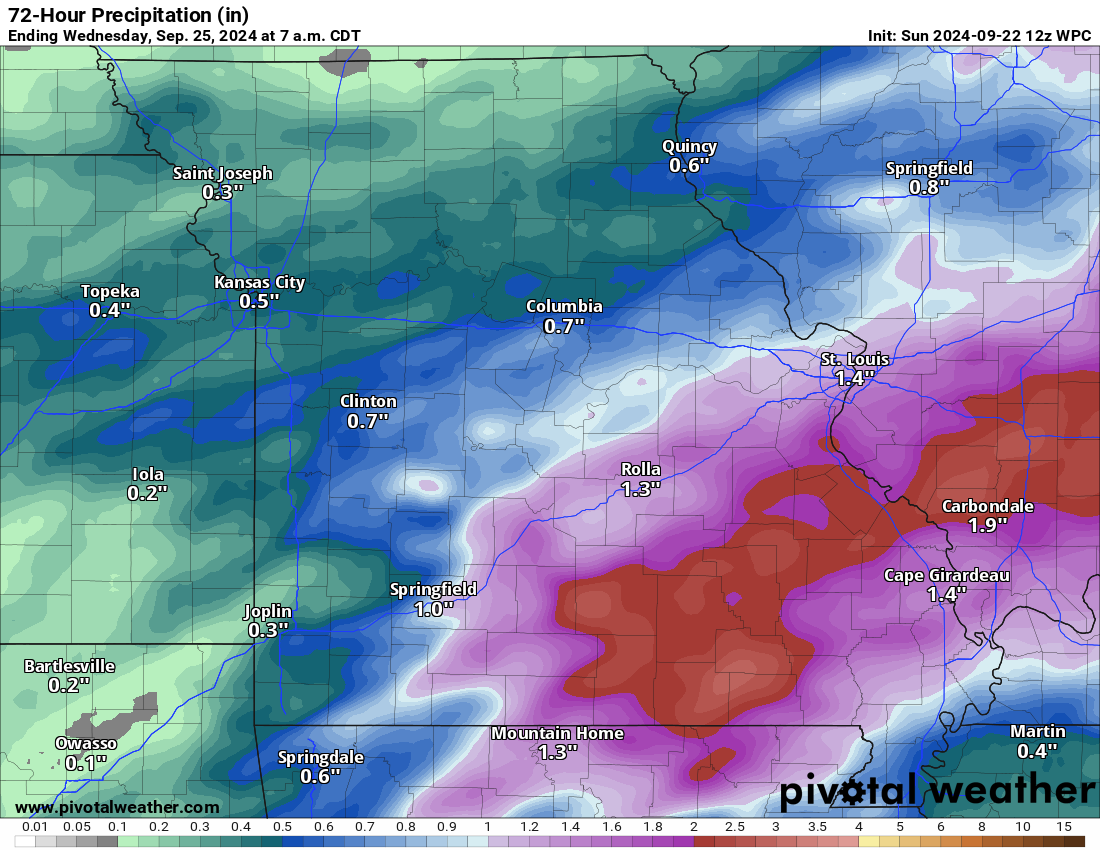
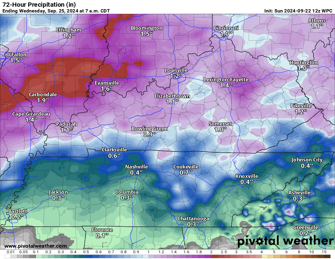
Rainfall totals will vary from county to county, but generally I am forecasting 0.75″ to 1.50″. Locally higher. This will occur today through Tuesday.
The highest totals will likely occur over our northern counties. Somewhat lower totals across the Bootheel and then east along the Kentucky/Tennessee border.
Here is the latest WPC/NOAA rainfall forecast. Take the general idea from this and not a specific amount.
Higher totals north. Somewhat lower far south.
Western view. Double click to enlarge.
Eastern view.
Again, those rainfall totals will occur over the next several days. Not all at once.
If you have outdoor plans, then monitor the Beau Dodson Weather Radars. You can find those links below.
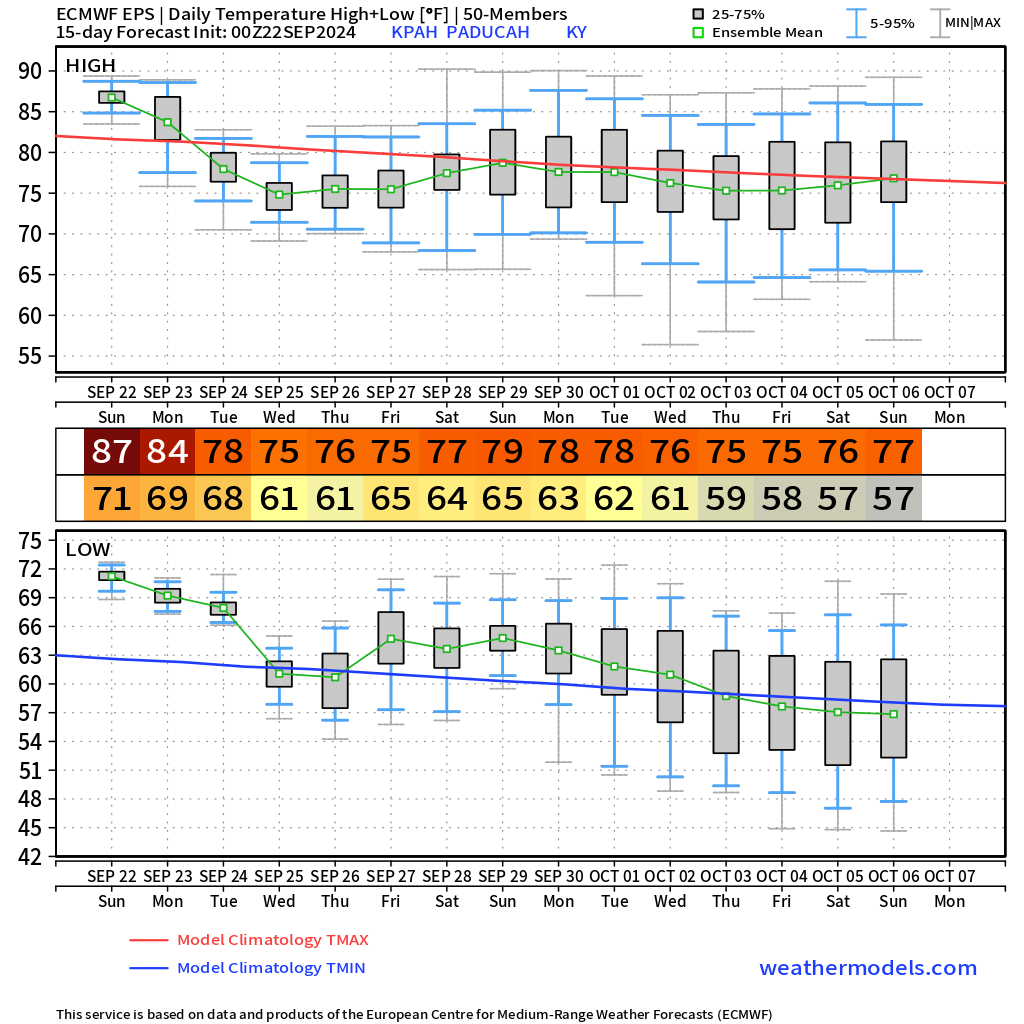
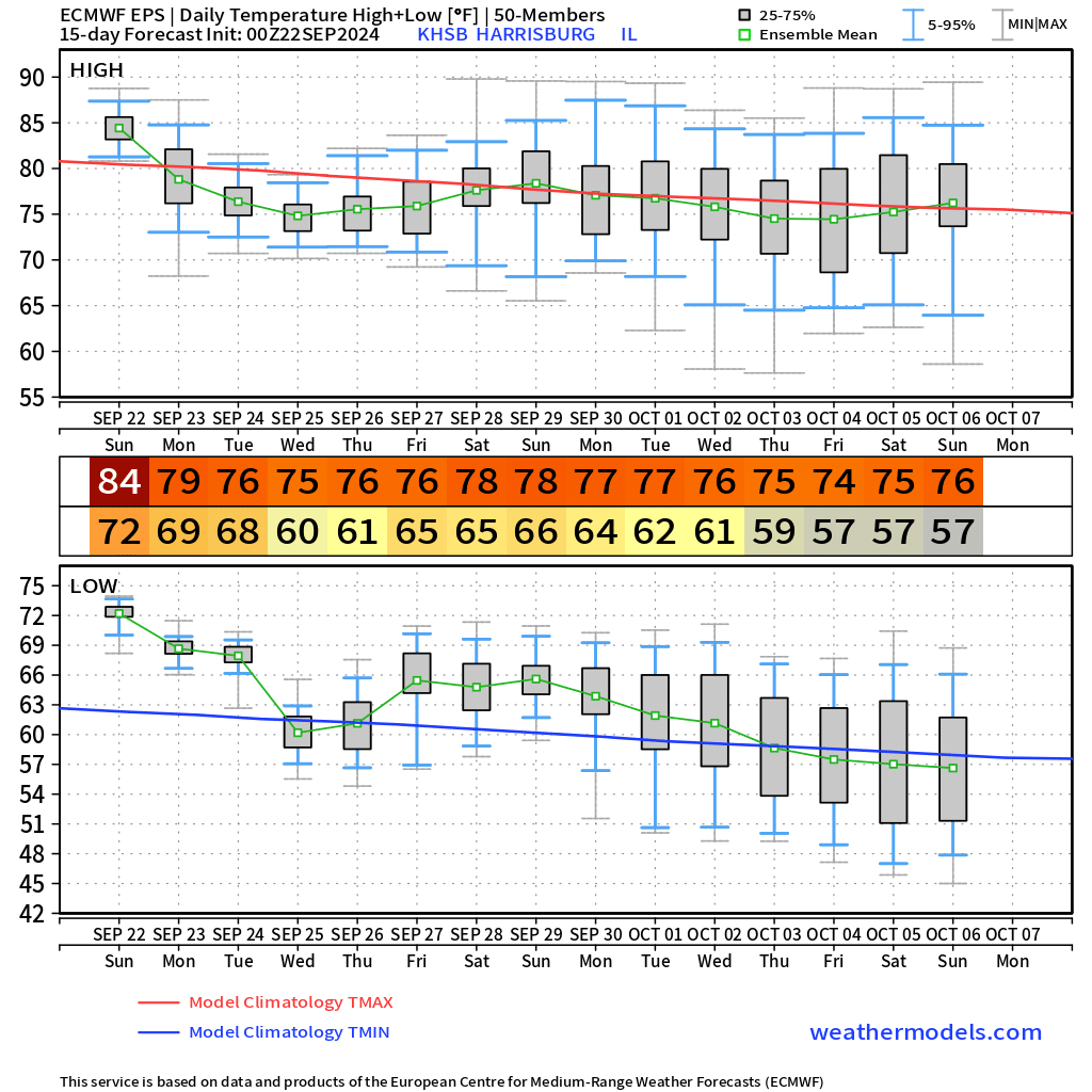
Temperatures will finally cool off as we move through the new work-week. Highs by Tuesday, Wednesday, and Thursday will only be in the 70s. Overnight lows will dip into the 50s and 60s. Much nicer temperatures. Seasonal temperatures.
The long range forecast shows a lot of 70s for highs. You can see that on this graphic. I chose three local cities. You can see the expected high and low temperatures below the date.
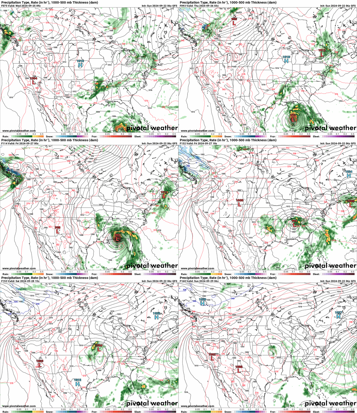
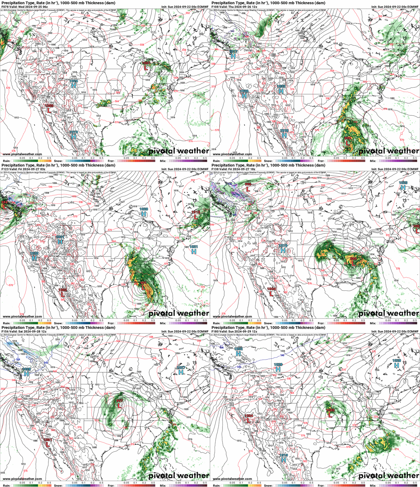
I continue to watch the tropics. The National Hurricane Center is expecting tropical development in the Gulf of Mexico this week.We will need to monitor the strength and track of the system. Will it bring our region some drought-busting rain? We will need to monitor it. Some of the guidance brings it into our region. Other guidance keeps the system farther south and east. It is too early to make a forecast on a system that has not formed.
Guidance is showing an upper level low forming over our region mid to late week. Models show that upper level low interacting with the tropical system. That would pull rain into our region.
For now, I have a 40% chance of rain as we move towards Thursday, Friday, and Saturday. That number may need adjusting if confidence increases that tropical moisture will pull into our region.
This is the GFS model. You can see the system develop in the Gulf of Mexico. It then moves north northeast and eventually north northwest.
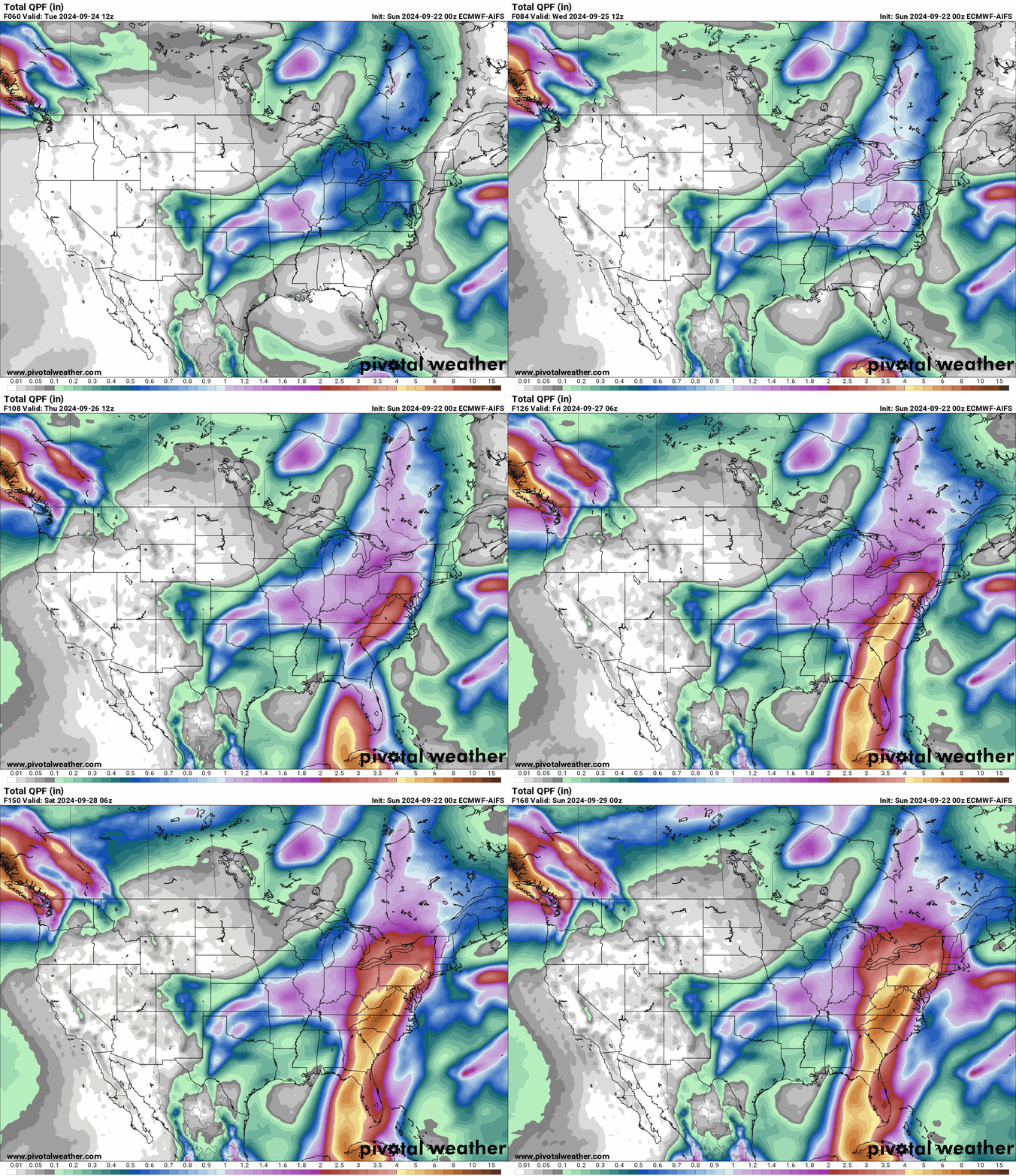
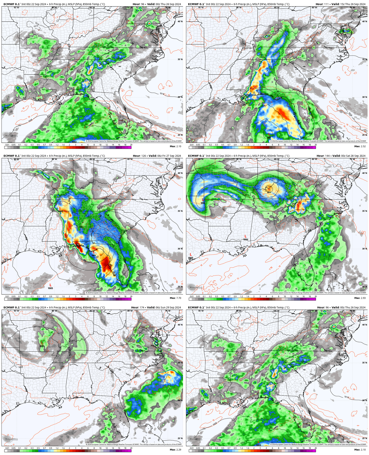
This is the EC model AI version. It is farther east. You can see the heavy rainfall along its track. Moving up the East Coast.
The EC model is pretty wild. It shows the upper level low and the hurricane interacting with each other over our region.
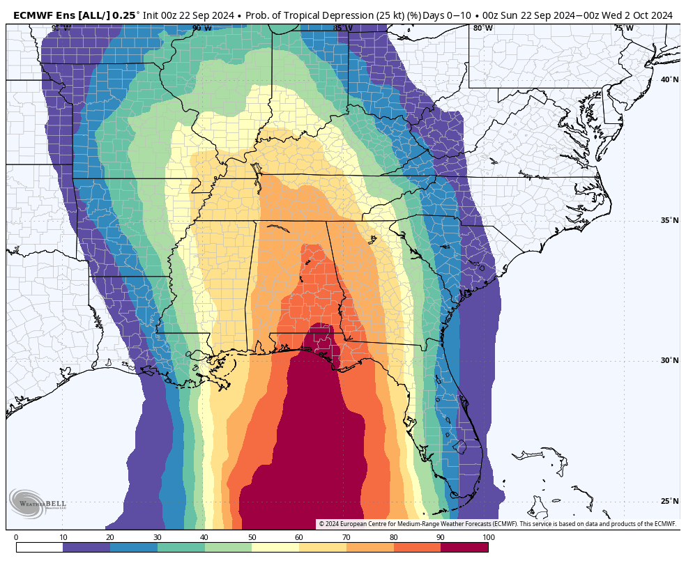
Let’s look at model ensembles. This is multiple model runs put together.
This shows you the highest probabilities for the track of the system. Notice the curve into our region. I will be monitoring this closely. The time-frame of concern will be the middle and end of this week.
Scroll to the bottom of the page for radars and more.
![]()
Current watches and warnings.

.
48-hour forecast Graphics


.

Radars and Lightning Data
Interactive-city-view radars. Clickable watches and warnings.
https://wtalk.co/B3XHASFZ
If the radar is not updating then try another one. If a radar does not appear to be refreshing then hit Ctrl F5. You may also try restarting your browser.
Backup radar site in case the above one is not working.
https://weathertalk.com/morani
Regional Radar
https://imagery.weathertalk.com/prx/RadarLoop.mp4
** NEW ** Zoom radar with chaser tracking abilities!
ZoomRadar
Lightning Data (zoom in and out of your local area)
https://wtalk.co/WJ3SN5UZ
Not working? Email me at beaudodson@usawx.com
National map of weather watches and warnings. Click here.
Storm Prediction Center. Click here.
Weather Prediction Center. Click here.
.

Live lightning data: Click here.
Real time lightning data (another one) https://map.blitzortung.org/#5.02/37.95/-86.99
Our new Zoom radar with storm chases
.
.

Interactive GOES R satellite. Track clouds. Click here.
GOES 16 slider tool. Click here.
College of DuPage satellites. Click here
Make sure you have three to five ways of receiving your severe weather information.
Weather Talk is one of those ways.
.
Find Beau on Facebook! Click the banner.







 .
.