
Good morning, everyone! I hope you are having a nice weekend.
Autumn is knocking! It will arrive tomorrow morning.
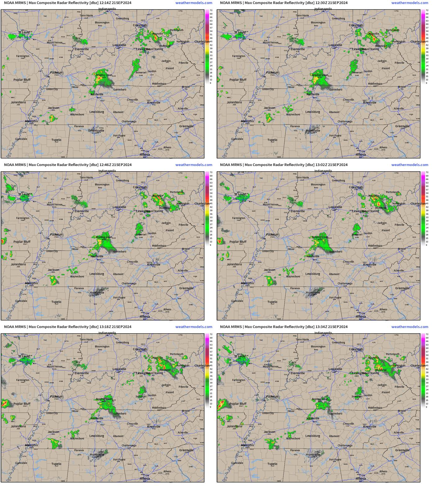
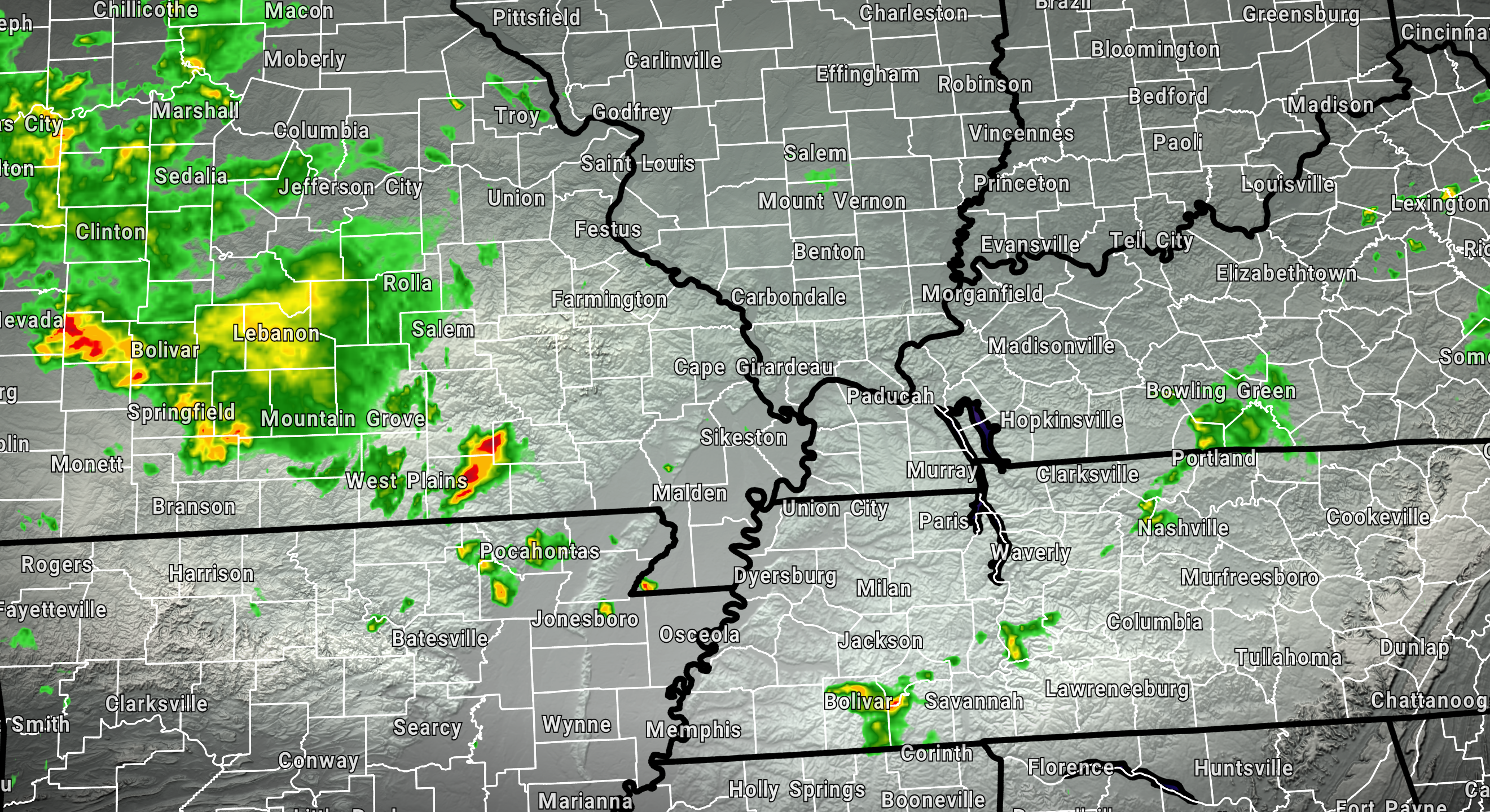
Here is what the National Weather Service Radar looked like at 8:40 AM. A few showers and storms.
Double click on images to enlarge them. See the live radars at the bottom of the page.
Today will not feel like autumn.
Today will be hot and humid with widespread 80s and 90s. WELL above seasonal averages. Typically, for this time of the year, temperatures would be in the lower 80s. Overnight lows would normally dip into the 50s!
I expect lows tonight to be in the upper 60s to around 70 degrees. Again, well above seasonal averages.
A frontal boundary and several disturbances will bring increasing chances of showers and thunderstorms to the region today through at least Tuesday.
Peak rain chances will arrive Sunday and Monday.
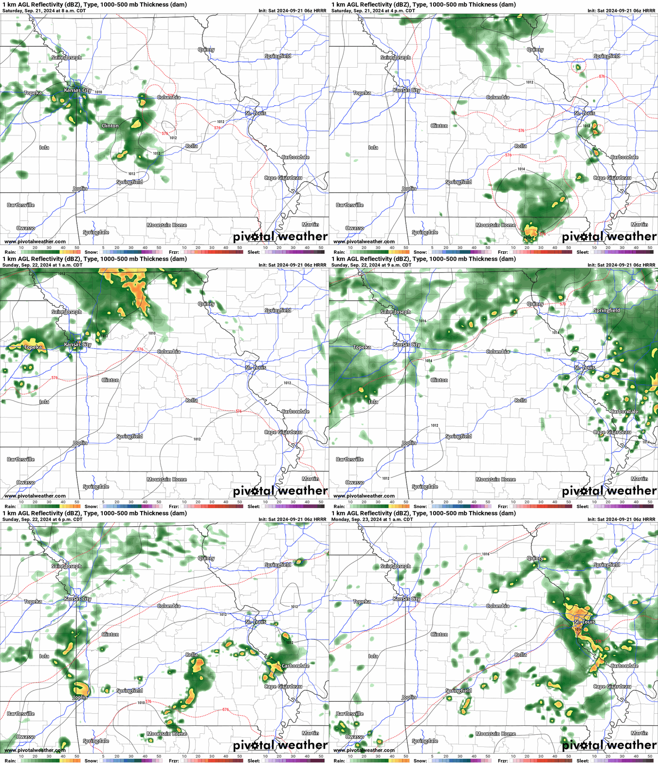
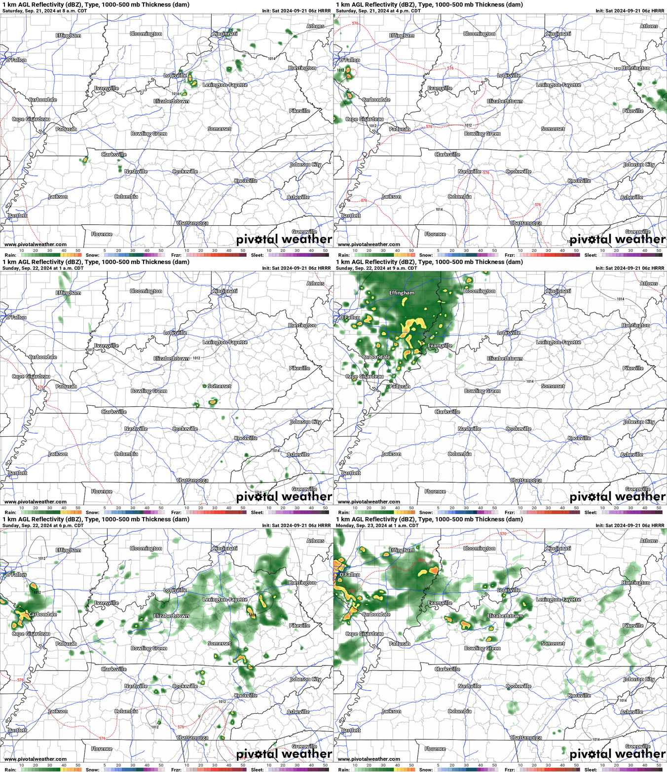
Let’s look at the Hrrr future-cast radar. This is a model. It won’t be exact, but you can take the general idea from it. Scattered showers and thunderstorms over the coming days. Much needed rainfall.
Western view. Double click to enlarge the animation.
Eastern view. Double click on the animation to enlarge it.
Storms that form could produce locally heavy downpours, gusty winds, lightning, and even small hail. There is a low end severe weather risk over the next few days.
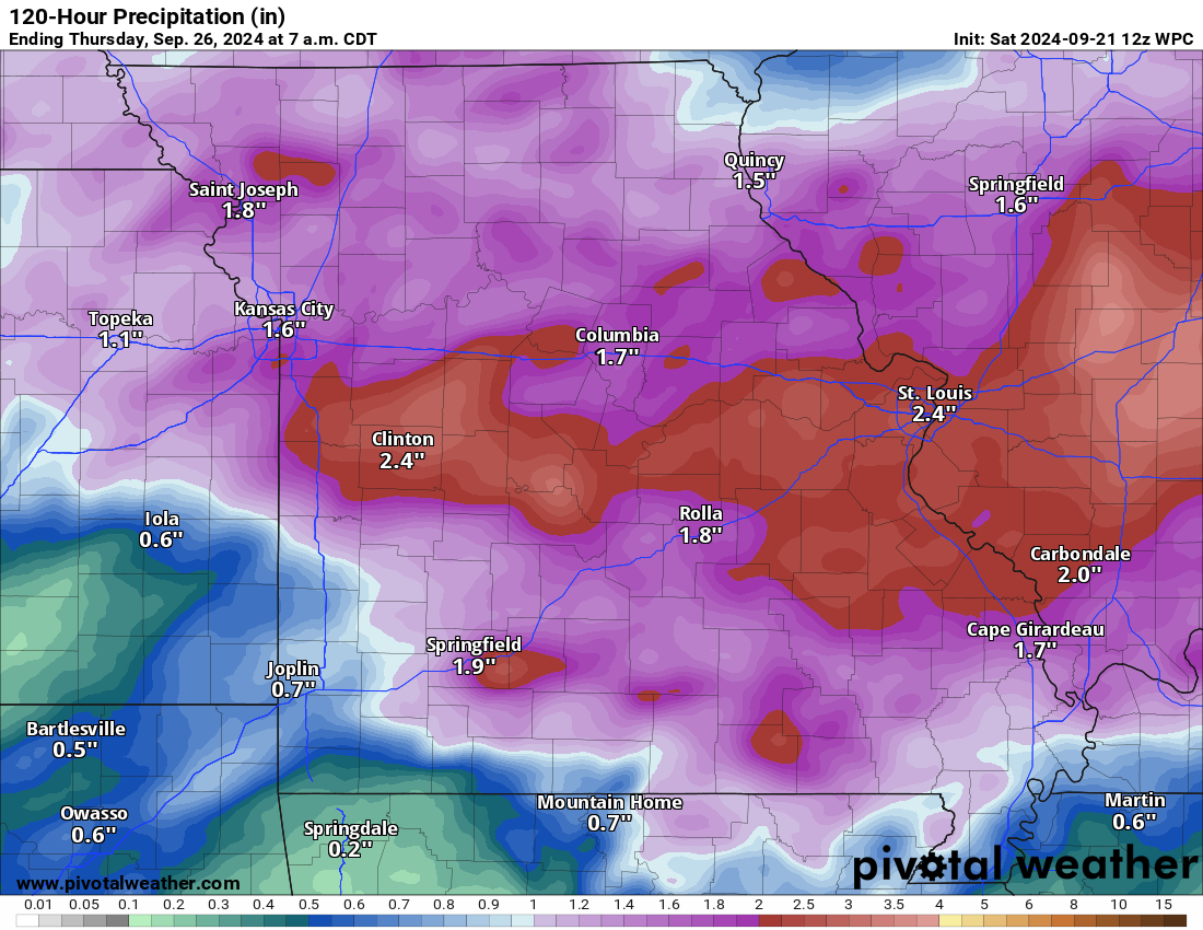
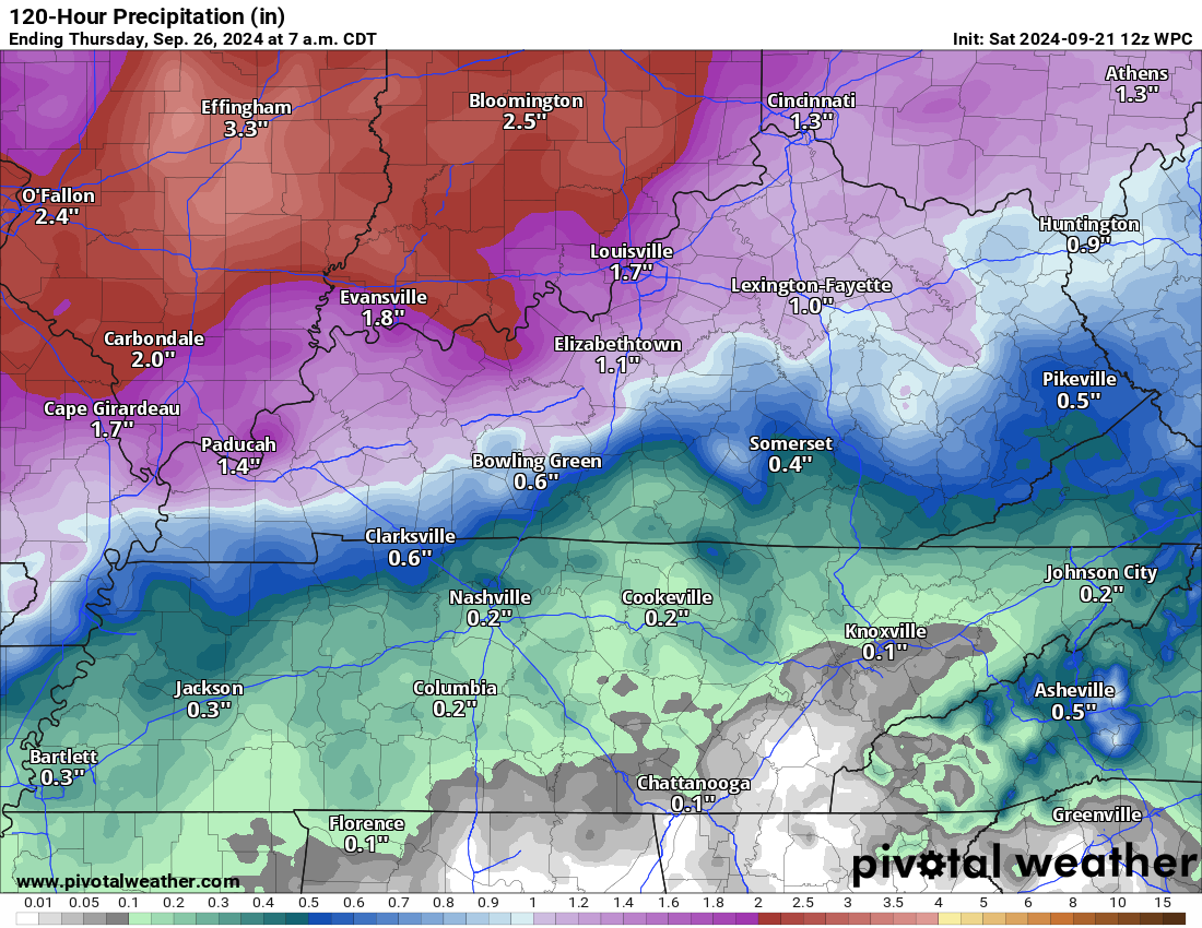
Rainfall totals will vary from county to county, but generally I am forecasting one to two inches. Locally higher. This will occur today through Tuesday.
The highest totals will likely occur over our northern counties. Somewhat lower totals across the Bootheel and then east along the Kentucky/Tennessee border.
Here is the latest WPC/NOAA rainfall forecast. Take the general idea from this and not a specific amount.
Higher totals north. Somewhat lower far south.
Western view. Double click to enlarge.
Eastern view.
Again, those rainfall totals will occur over the next several days. Not all at once.
If you have outdoor plans, then monitor the Beau Dodson Weather Radars. You can find those links below.
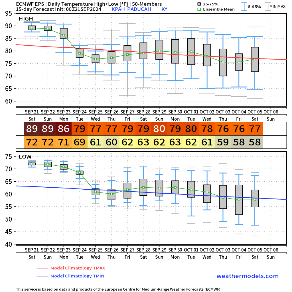
Temperatures will finally cool off as we move through the new work-week. Highs by Tuesday, Wednesday, and Thursday will only be in the 70s. Overnight lows will dip into the 50s and 60s. Much nicer weather.
The long range forecast shows a lot of 70s for highs. Youc an see that on this graphic. I chose Paducah as a center point.
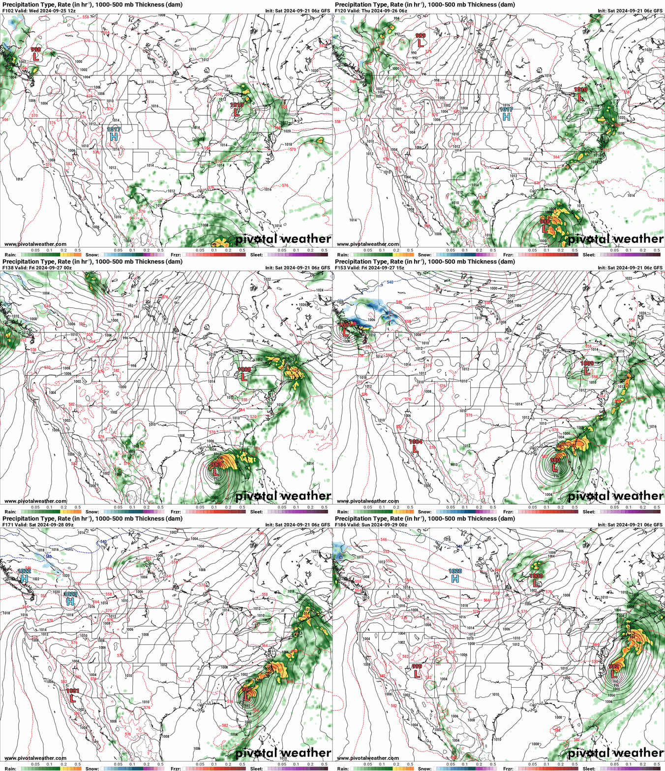
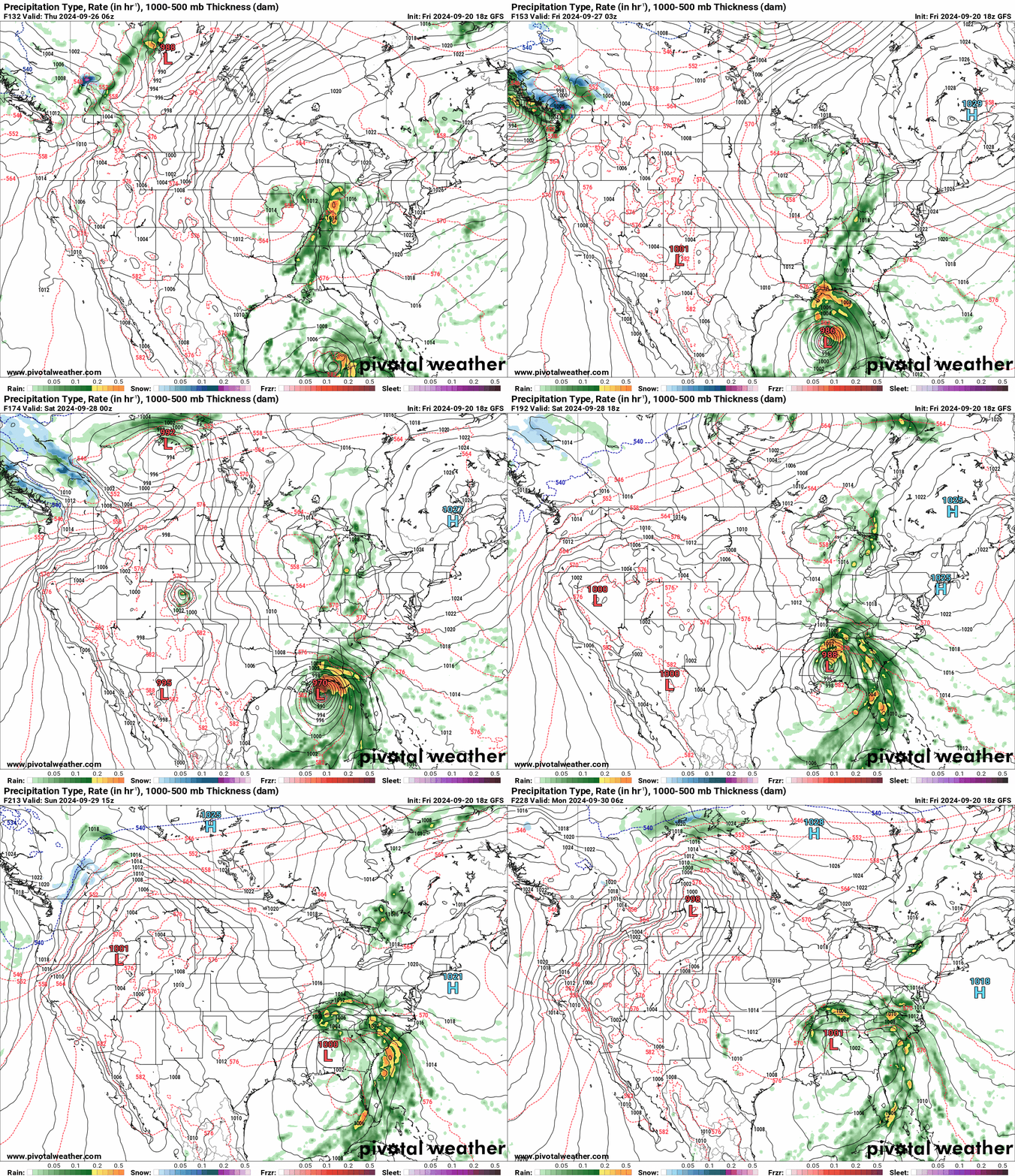
I continue to watch the tropics. The National Hurricane Center is expecting tropical development in the Gulf of Mexico this week. If a tropical storm or hurricane does form, then it could become intense. The Gulf of Mexico waters are very warm.
We will need to monitor the strength and track of the system. Will it bring our region some drought-busting rain? We will need to monitor it. Some of the guidance brings it into our region. Other guidance keeps the system farther south and east. It is too early to make a forecast on a system that has not formed.
This was the morning run of the GFS model. You can see the system develop in the Gulf of Mexico. The GFS model tracks it farther south and east. Double click the image to enlarge it.
Yesterday afternoon’s GFS run was farther west. So you can see the differences in the models. They will struggle with this system for several more days. I am monitoring trends. That is all we need to do for now.
If you have travel plans to the Gulf of Mexico, then monitor updated forecasts.
Stay tuned.
Scroll to the bottom of the page for
![]()
Current watches and warnings.

.
48-hour forecast Graphics


.

Radars and Lightning Data
Interactive-city-view radars. Clickable watches and warnings.
https://wtalk.co/B3XHASFZ
If the radar is not updating then try another one. If a radar does not appear to be refreshing then hit Ctrl F5. You may also try restarting your browser.
Backup radar site in case the above one is not working.
https://weathertalk.com/morani
Regional Radar
https://imagery.weathertalk.com/prx/RadarLoop.mp4
** NEW ** Zoom radar with chaser tracking abilities!
ZoomRadar
Lightning Data (zoom in and out of your local area)
https://wtalk.co/WJ3SN5UZ
Not working? Email me at beaudodson@usawx.com
National map of weather watches and warnings. Click here.
Storm Prediction Center. Click here.
Weather Prediction Center. Click here.
.

Live lightning data: Click here.
Real time lightning data (another one) https://map.blitzortung.org/#5.02/37.95/-86.99
Our new Zoom radar with storm chases
.
.

Interactive GOES R satellite. Track clouds. Click here.
GOES 16 slider tool. Click here.
College of DuPage satellites. Click here
Make sure you have three to five ways of receiving your severe weather information.
Weather Talk is one of those ways.
.
Find Beau on Facebook! Click the banner.






 .
.