Saturday Evening Update
6 pm
One severe thunderstorm moved through far western Kentucky earlier this evening. High wind and hail was reported with it.
There are a few showers and storms dotting radar, at this time. The storms are currently sub-severe.
I can’t rule out an isolated severe thunderstorm warning this evening.
Showers and thunderstorms will begin to wane after sunset. The risk of severe weather after midnight is small.
Storms this evening could still produce isolated high wind, penny size hail, and lightning. Brief downpours, as well
Most of the area will remain dry and muggy.
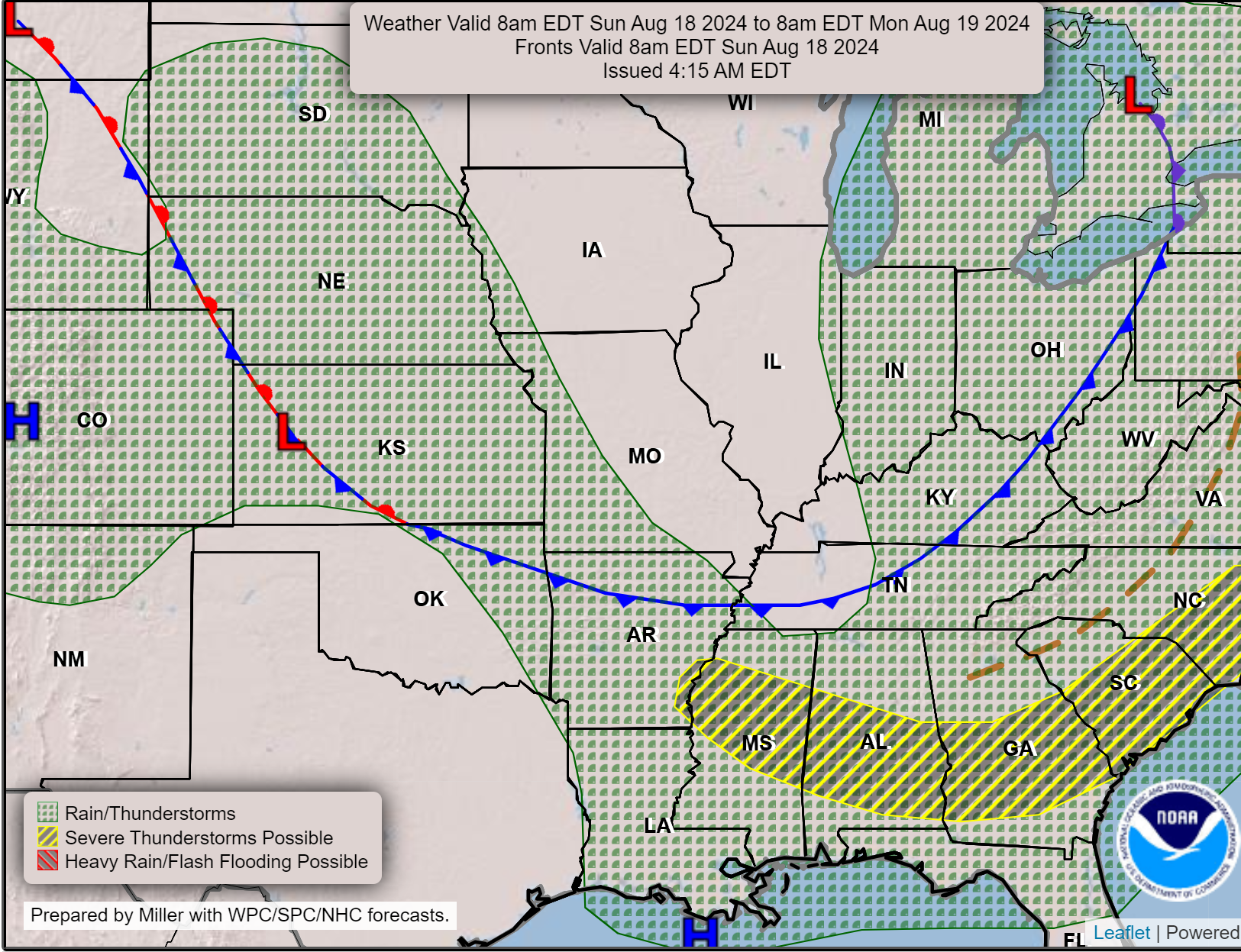
A cold front is now half-way through the area. This front will continue to push southward over the coming hours. Clearing our region overnight.
Tomorrow will be cooler and less muggy. A very nice week of weather ahead of us. A warming trend by Friday, Saturday, and Sunday. Nothing extreme.
Saturday Afternoon Update
3 PM
I continue to monitor the radar for a couple of showers and thunderstorms across western Kentucky and western Tennessee.
The chance of thunderstorms is lower as you travel north and west.
Overall, the severe weather threat remains fairly low but not zero.
If a few storms do form then they could produce damaging wind, heavy rain, and lightning. Small hail is possible, as well. The tornado threat remains negligible.
The Storm Prediction Center has outlined portions of the region for a risk of damaging wind. That would be the dark green zone on this map. Light green is where a few storms could develop, but below severe levels.
A severe thunderstorm is defined as a storm that produces 60 mph wind gusts or higher, quarter size hail or larger, and or a tornado. The tornado risk today is negligible.

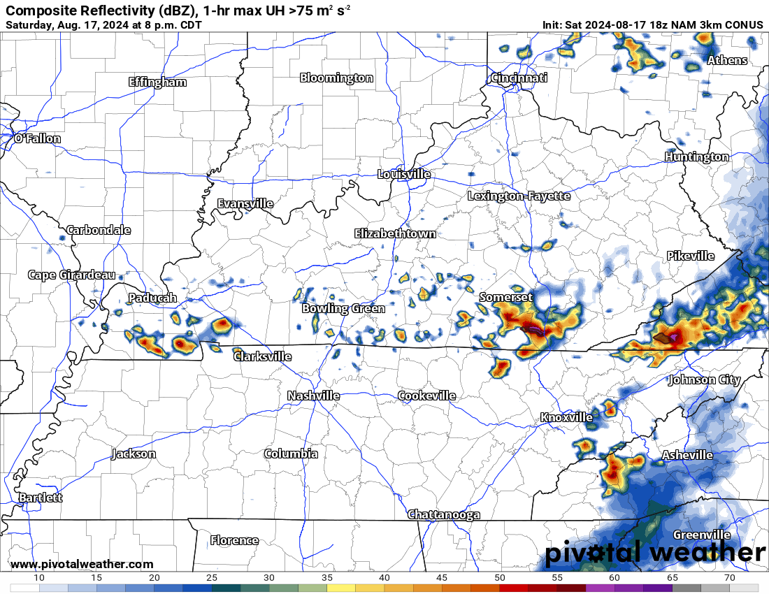
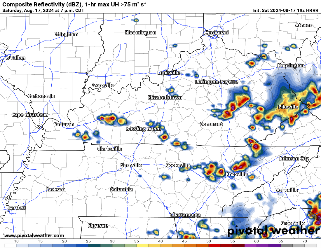
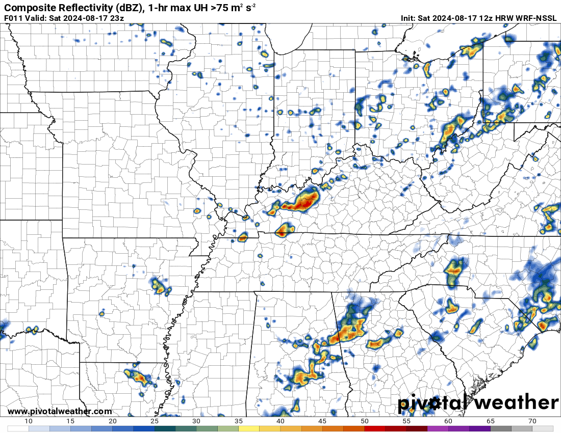
Models continue to show a couple of strong storms forming this evening.
These are just models and they are far from perfect. We take the general idea from them.
NAM model
Hrrr model
Saturday Late Morning Update
Well, we have one more hot day for the region. I am sure most of you are tired of the muggy weather.
The good news is that a cold front is advancing into the region from the north.
You can see the cold front on this weather map. It is moving southward. The blue line is the cold front.
Double click graphics and animations to enlarge them.
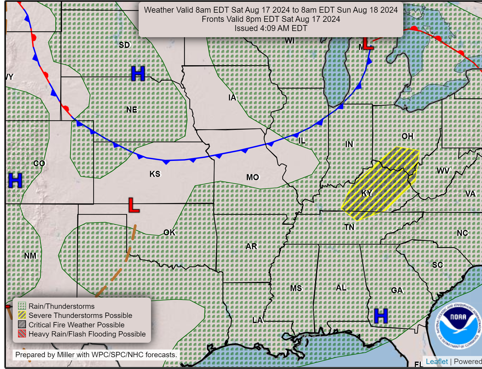
As you can see on this second graphic, the front will pass to our south by tomorrow morning. That will allow cooler and drier air to blanket our region. It will feel nicer tomorrow.
Currently, hot and humid air blankets our region. This will set the stage for scattered thunderstorms this afternoon. There remain questions about the coverage. I suspect a few storms will develop in the heat of the afternoon.
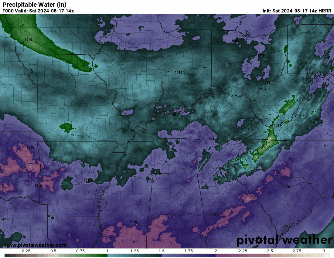
Here is the PWAT animation. PWAT is a measure of moisture in the atmosphere. Those purple areas are high PWAT values.
Plenty of moisture for storms to tap into. Although storm coverage will be limited, any storms that form could produce torrential downpours. Same as recent days. Frequent lightning, as well.
The rainfall probability map shows you where the chance of rain will be highest.
At any given location, there will be a 10% to 30% chance of thunderstorms. As you can see, the chance is a bit higher over Kentucky and Tennessee. The Missouri Bootheel, as well.
Remember, low probabilities do not mean that it won’t rain. It means the activity will be scattered and many areas will remain dry.

The Storm Prediction Center has outlined portions of the region for a risk of damaging wind. That would be the dark green zone on this map. Light green is where a few storms could develop, but below severe levels.
A severe thunderstorm is defined as a storm that produces 60 mph wind gusts or higher, quarter size hail or larger, and or a tornado. The tornado risk today is negligible.
Again, the primary concern will be a few reports of damaging wind or downburst winds. These wind gusts could bring down tree limbs and power lines. Storms will also produce heavy rain, small hail, and cloud to ground lightning.
If you are camping or have outdoor activities, then stay weather aware.
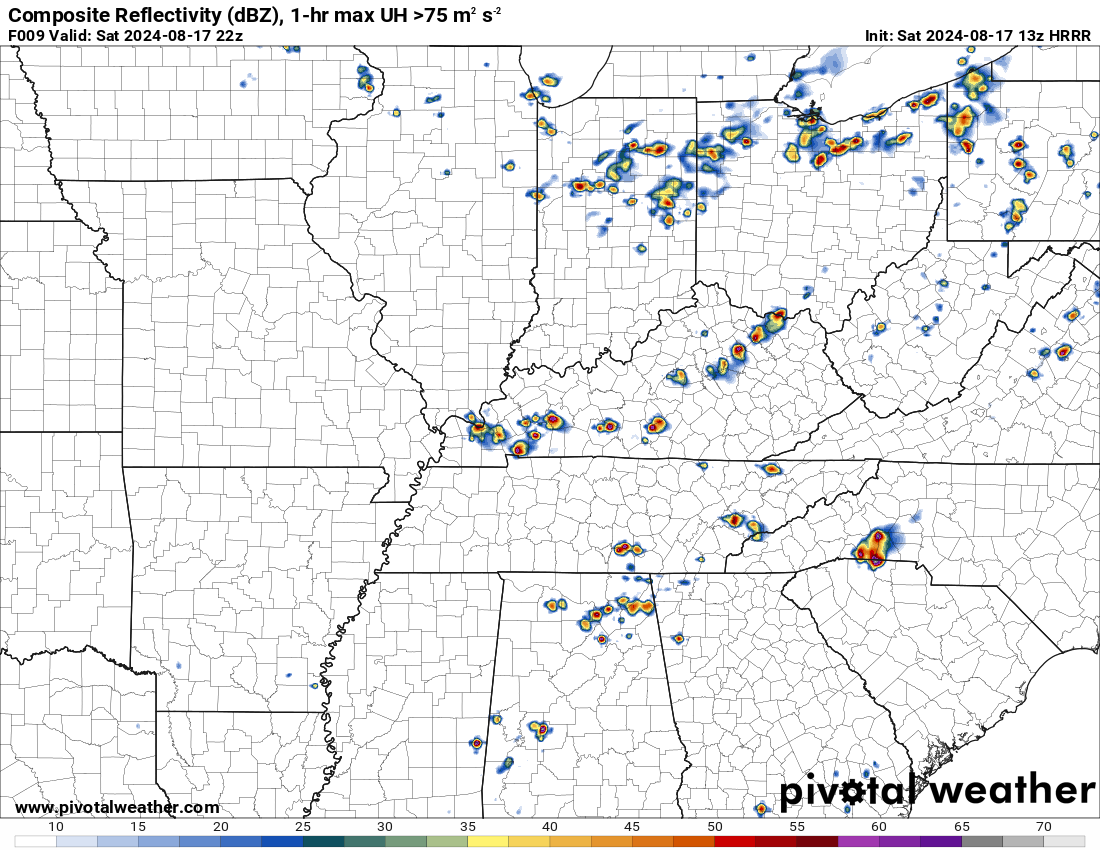
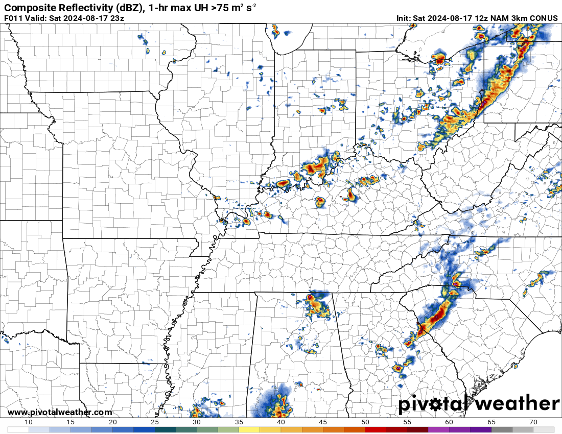
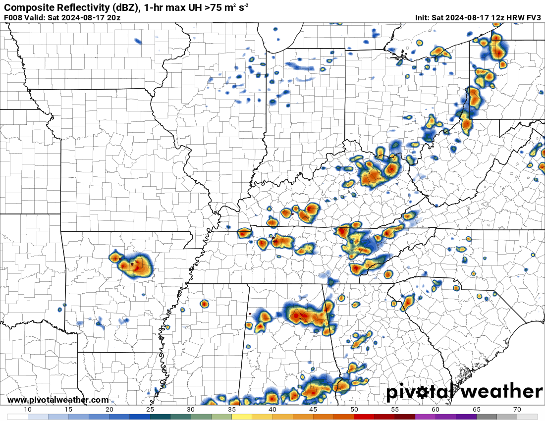
Let me show you some short-range high resolution models. These are four models. As you can see, each one develops a few thunderstorms.
And, once again, you can see that the models are centering the activity over Kentucky and Tennessee.
The time frame of concern will likely be 3 pm to 9 pm. Monitor your Beau Dodson www.weathertalk.com app for updates.
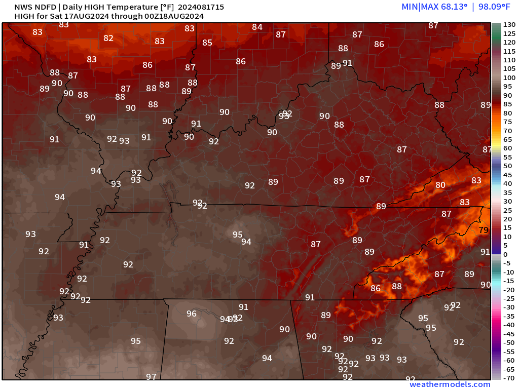
It will be hot today. Just one more day of heat! Cooler air is approaching behind the cold front.
Heat index values could top 100 degrees over the Bootheel, western Kentucky, and northwest Tennessee. That is where dew points will be a bit higher. That will lead to higher heat index values. Use care.
High temperature map for today.
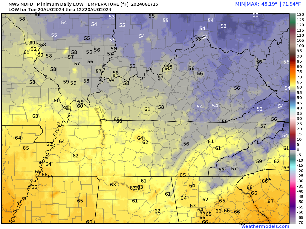
Highs Sunday through Friday will likely remain in the 70s and 80s. Overnight lows will dip into the 50s and 60s.
Tuesday morning lows
Wednesday lows
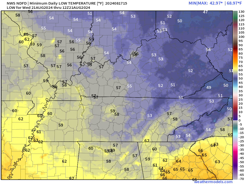
Wednesday lows
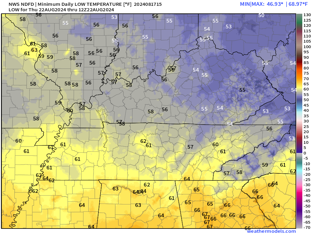
Nice!
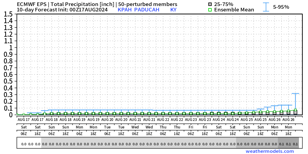
The bad news is the long range outlook is dry to very dry.
As a matter of fact, check out the EC ensemble models. This is through August 26th. It shows very little in the way of rainfall. Some of you need rain. Flash drought is developing in some areas. Flash drought is defined as a burst of dry weather that lingers for several weeks. Even though sub-level moisture may still be adequate, the top soil becomes very dry.
I am watching for another round of heat starting as early as next weekend into the following week. Quite a bit of data shows high temperatures returning to the 90s. Hopefully, they trend cooler.
September will be here soon. Meteorological autumn arrives September first.
The app is for subscribers. Subscribe at www.weathertalk.com/welcome then go to your app store and search for WeatherTalk
Subscribers, PLEASE USE THE APP. ATT and Verizon are not reliable during severe weather. They are delaying text messages.
The app is under WeatherTalk in the app store.

Apple users click here

Android users click here
.

Radars and Lightning Data
Interactive-city-view radars. Clickable watches and warnings.
https://wtalk.co/B3XHASFZ
If the radar is not updating then try another one. If a radar does not appear to be refreshing then hit Ctrl F5. You may also try restarting your browser.
Backup radar site in case the above one is not working.
https://weathertalk.com/morani
Regional Radar
https://imagery.weathertalk.com/prx/RadarLoop.mp4
** NEW ** Zoom radar with chaser tracking abilities!
ZoomRadar
Lightning Data (zoom in and out of your local area)
https://wtalk.co/WJ3SN5UZ
Not working? Email me at beaudodson@usawx.com
National map of weather watches and warnings. Click here.
Storm Prediction Center. Click here.
Weather Prediction Center. Click here.
.

Live lightning data: Click here.
Real time lightning data (another one) https://map.blitzortung.org/#5.02/37.95/-86.99
Our new Zoom radar with storm chases
.
.

Interactive GOES R satellite. Track clouds. Click here.
GOES 16 slider tool. Click here.
College of DuPage satellites. Click here
.

Here are the latest local river stage forecast numbers Click Here.
Here are the latest lake stage forecast numbers for Kentucky Lake and Lake Barkley Click Here.
.
.
Find Beau on Facebook! Click the banner.


 .
.